
Heritage railway stations · North West England
Manchester Oxford Road railway station
Also known as: Gorsaf reilffordd Oxford Road Manceinion
In or near Manchester.
Manchester Oxford Road railway station — a Grade II*-listed railway station in england-west-midlands, United Kingdom.

Thomas Nugent — CC BY-SA 2.0 via Wikimedia Commons licence

Plan your visit
- Typical visit
- 1 h–2 h
- Nearest railway station
- Manchester Oxford Road · 0.0 km
- Free entry
- Wheelchair accessible
Getting there & planning your visit
To visit Manchester Oxford Road railway station, you can use the postcode M1 6FU for sat-nav directions. Entry is free, and the station is wheelchair accessible. The nearest railway station is Manchester Oxford Road, located 0 km away.
About
Manchester Oxford Road railway station is a Grade II*-listed building in england-west-midlands, United Kingdom. Grade II* status is conferred by Historic England (or Cadw, Historic Environment Scotland or NIEA equivalents) on buildings of exceptional national interest. See the linked Wikipedia article for full historical and architectural details.
Photo gallery
See it from the streetimagery from 2022
Imagery © Mapillary contributors, CC BY-SA 4.0
Official information
Manchester Oxford Road railway station is a key transport hub in Manchester, providing access to various train services. The station features step-free access to platforms, lifts, and facilities such as toilets and baby changing areas.
From the Wikipedia article
Manchester Oxford Road is a railway station in Manchester, England, at the junction of Whitworth Street West and Oxford Street. It opened in 1849 and was rebuilt in 1960. It is the third busiest of the four stations in Manchester city centre. The station serves the southern part of Manchester city centre, the University of Manchester and Manchester Metropolitan University, on the line from Manchester Piccadilly westwards towards Warrington Central, Chester, Llandudno, Liverpool, Preston and Blackpool North. Eastbound trains continue beyond Piccadilly to Crewe, Leeds, Sheffield, Nottingham, Peterborough and Norwich. The station consists of four through platforms and one terminating bay platform. The station lies on a Grade II listed viaduct, which was built in 1839 as part of the Manchester, South Junction and Altrincham Railway. To reduce load on this viaduct, the station unusually utilises laminated wood structures as opposed to masonry, concrete, iron or steel. English Heritage describes it as a "building of outstanding architectural quality and technological interest; one of the most dramatic stations in England." It was Grade II listed in 1995. Architectural critic Nikolaus Pevsner described the station as "one of the most remarkable and unusual stations in the country". It has long been envisaged, since the Manchester Hub plan in 2009, that the station will be upgraded; in October 2016, a Transport and Works Act 1992 application was submitted to extend platforms at the station as part of the wider Manchester Piccadilly and Manchester Oxford Road Capacity Scheme. As of 2019, this application remains active but has not been approved by government. As a key transition node for both north–south and east–west transpennine routes, it is a recognised bottleneck and is the most delayed major station in the United Kingdom according to a Which? study in 2018 with over three quarters of services failing to depart on time during peak hours. In an attempt to obligate the…
Excerpt from Wikipedia under CC BY-SA 4.0. See the source article linked in Sources below.
Background
History
The station opened as Oxford Road on 20 July 1849 and was the headquarters of the Manchester, South Junction and Altrincham Railway (MSJAR) until 1904. The station was built on the site of 'Little Ireland', a slum "of a worse character than St Giles", in which about four thousand people had lived in "measureless filth and stench" (according to Friedrich Engels in The Condition of the Working Class in England) and of a gasworks which was relocated to the west. The station buildings, which were temporary wooden structures, were accessed by an inclined esplanade winding to the right from Gloucester Street (now Whitworth Street West) to reach their north front. There was a single platform on…
Architecture
The station had become dilapidated by the 1950s and, in connection with the electrification and modernisation programme of the Manchester to London Euston line in 1960, the old buildings were replaced by the current structure by architects William Robert Headley and Max Clendinning and structural engineer Hugh Tottenham. It was designed in a distinctive style in concrete and wood with curves bringing to mind the Sydney Opera House. The station is a grade II listed building. Pevsner calls it "One of the most interesting and innovative buildings of the period ... the most ambitious example in this country of timber conoid shell roofing" (p. 36) and "One of the most remarkable and unusual…
Sourced from Wikipedia under CC BY-SA 4.0.
- Coordinates
- 53.4739, -2.2422
- District
- Manchester
- Parish
- Manchester, unparished area
- Postcode
- M1 6FU
- Parliamentary constituency
- Manchester Central
- Nearest railway station
- Manchester Oxford Road — 0 km
- Official site
- www.nationalrail.co.uk
Sources
- wikidata: Q1859538 (CC0)
- wikipedia: Manchester Oxford Road railway station (CC BY-SA 4.0)
Other places nearby

Gorilla
Open-air theatres · 0.0 km
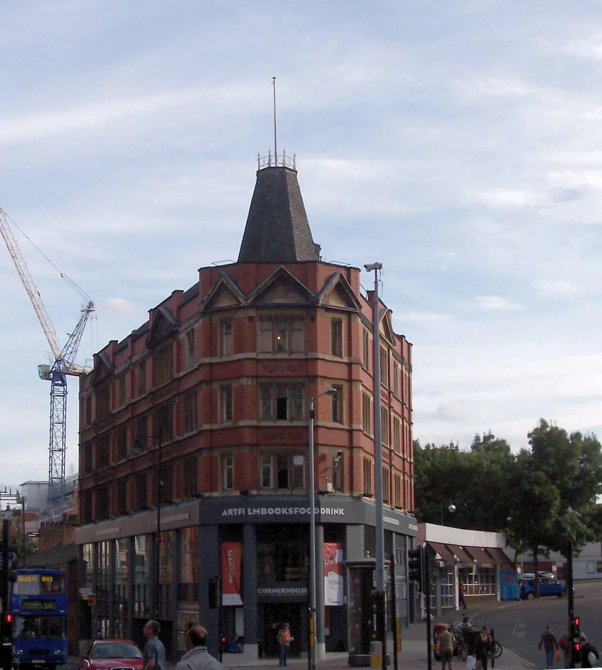
Cornerhouse
Galleries · 0.1 km

Grand Central Pub
Historic pubs · 0.1 km

Red Plaque: Little Ireland
Memorials & monuments · 0.1 km

V.I.P. Cinema
Theatres · 0.1 km
Unite Tower
Gardens · 0.1 km

Refuge Assurance Building
Gardens · 0.1 km

Palace Theatre, Manchester
Open-air theatres · 0.2 km
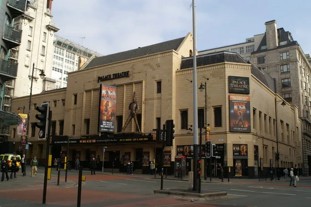
Palace Theatre
Theatres · 0.2 km

St. James's Hall
Open-air theatres · 0.2 km

International Anthony Burgess Foundation
Museums · 0.2 km

Maldron Hotel Manchester City Centre
Hotels · 0.2 km
Nearby
📷 5📷 3Galleries · North West England
Cornerhouse
Cornerhouse — former arts centre (gallery, cinemas) in Manchester, England.
📷 7Historic pubs · North West England
Grand Central Pub
Grand Central Pub in England North West, United Kingdom.
📷 3Memorials & monuments · North West England
Red Plaque: Little Ireland
Red Plaque: Little Ireland — a memorial in england-west-midlands, United Kingdom.
📷 5Theatres · North West England
V.I.P. Cinema
V.I.P. Cinema — a cinema heritage in england-west-midlands, United Kingdom.
📷 4Gardens · North West England
Unite Tower
Unite Tower — a garden in england-west-midlands, United Kingdom.
Where to eat & stay near Manchester Oxford Road railway station
Places to stay
📷 7Hotels · North West England
Maldron Hotel Manchester City Centre
Maldron Hotel Manchester City Centre — a hotel in england west midlands. 4-star. Brand: Maldron Hotels.
 📷 5
📷 5Hotels · North West England
Whitworth Locke, Civic Quarter
Whitworth Locke, Civic Quarter — a hotel in england west midlands. Brand: Locke.
 📷 7
📷 7Hotels · North West England
Midland Hotel
Midland Hotel — a hotel in england west midlands.
 📷 7
📷 7 📷 5
📷 5Hotels · North West England
Hilton Manchester Deansgate
Hilton Manchester Deansgate — a hotel in england west midlands.
 📷 5
📷 5Hotels · North West England
King Street Townhouse
King Street Townhouse — a hotel in england west midlands. 4-star. Brand: Eclectic Hotels.
Places to eat & drink
📷 7Historic pubs · North West England
Grand Central Pub
Grand Central Pub in England North West, United Kingdom.
 📷 5
📷 5Historic pubs · North West England
Peveril Of The Peak Public House
Peveril Of The Peak Public House in England North West, United Kingdom.
 📷 7
📷 7Historic pubs · North West England
Lass O Gowrie Public House
Lass O Gowrie Public House in England North West, United Kingdom.
 📷 5
📷 5Historic pubs · North West England
The Briton's Protection
The Briton's Protection in England North West, United Kingdom.
 📷 5
📷 5Historic pubs · North West England
Nos 74-78, and No 80 (The Grey Horse Public House) and Attached Railings, Portland Street
Nos 74-78, and No 80 (The Grey Horse Public House) and Attached Railings, Portland Street in England North West, United Kingdom.
 📷 5
📷 5Historic pubs · North West England
65-71, Princess Street
65-71, Princess Street in England North West, United Kingdom.
More places in this region
 📷 3
📷 3Heritage railway stations · North West England
Peel
Peel — Public artwork (statue) by William Calder Marshall.
 📷 5
📷 5Heritage railway stations · North West England
Wellington
Wellington — Public artwork (statue) by Matthew Noble.
 📷 5
📷 5Heritage railway stations · North West England
Manchester Liverpool Road railway station
Manchester Liverpool Road railway station — a Grade I-listed railway station in england-west-midlands, United Kingdom.
 📷 5
📷 5Heritage railway stations · North West England
Deansgate railway station
Deansgate railway station — a Grade II*-listed railway station in england-west-midlands, United Kingdom.
Frequently asked questions
- Where is Manchester Oxford Road railway station?
- Manchester Oxford Road railway station is in the West Midlands, United Kingdom (postcode M1 6FU), in the parish of Manchester, unparished area.
- What is Manchester Oxford Road railway station?
- Manchester Oxford Road railway station — a Grade II*-listed railway station in england-west-midlands, United Kingdom.
- How do I get to Manchester Oxford Road railway station?
- The nearest railway station is Manchester Oxford Road, about 0.0 km away. Drivers can use postcode M1 6FU.
- Who owns Manchester Oxford Road railway station?
- Manchester Oxford Road railway station is owned by Northern Trains.
- Is Manchester Oxford Road railway station a listed building?
- Manchester Oxford Road railway station is officially recognised as Grade II* listed.
- Is Manchester Oxford Road railway station free to visit?
- Yes, Manchester Oxford Road railway station is free to enter.
- How do I get to Manchester Oxford Road railway station?
- The nearest railway station is Manchester Oxford Road, about 0.0 km away. Drivers can navigate to postcode M1 6FU.