Natural landmarks · Scottish Lowlands
Maidenhead Bay
Maidenhead Bay — a natural feature in scotland lowlands.

Ann Cook — CC BY-SA 2.0 via Wikimedia Commons licence
Plan your visit
- Typical visit
- 1 h–2 h
About
Maidenhead Bay is a named natural feature in scotland lowlands, recorded in the GeoNames UK gazetteer. British landmarks of this type are typically marked on Ordnance Survey maps and recorded in the national gazetteer for cartographic and navigational reference. Coordinates and feature classification are sourced from the GeoNames open dataset.
Photo gallery
Place summary
Maidenhead Bay is a natural landmark located in the Scottish Lowlands. It is characterised by its scenic waterfront and diverse wildlife, making it a notable feature of the region's landscape. The bay offers opportunities for outdoor activities and nature observation, attracting visitors interested in the area's natural beauty.
AI-generated from the structured facts on this page (operator, designation, listing, era). Not a substitute for visiting.
- Coordinates
- 54.8482, -5.1312
Sources
- manual: geonames-11125856 (CC BY 4.0)
Other places nearby
Loading nearby places…
Nearby
 📷 5
📷 5Vineyards · Scottish Lowlands
Dunskey Golf Course
Dunskey Golf Course — a UK vineyard in scotland lowlands, producing English or Welsh wine from cool-climate grape varieties.
 📷 5
📷 5Towns & cities · Scottish Lowlands
Portpatrick
Portpatrick — village in Dumfries and Galloway, Scotland, UK.
 📷 5
📷 5Hotels · Scottish Lowlands
The Portpatrick
The Portpatrick — a hotel in scotland lowlands.
 📷 5
📷 5Villages · Scottish Lowlands
Enoch
Enoch — a village in scotland lowlands.
 📷 3
📷 3Harbours & ports · Scottish Lowlands
Inner Harbour, Portpatrick Harbour
Inner Harbour, Portpatrick Harbour — harbour within Portpatrick Harbour in Dumfries and Galloway, Scotland, UK.
 📷 3
📷 3Memorials & monuments · Scottish Lowlands
USAAF Douglas C-47A Skytrain 42-93038 Portpatrick Memorial
USAAF Douglas C-47A Skytrain 42-93038 Portpatrick Memorial — a memorial in scotland-lowlands, United Kingdom.
Where to eat & stay near Maidenhead Bay
Places to stay
📷 5Hotels · Scottish Lowlands
The Portpatrick
The Portpatrick — a hotel in scotland lowlands.
 📷 5
📷 5Campsites · Scottish Lowlands
Sunnymeade Caravan Park
Sunnymeade Caravan Park — a campsite in scotland lowlands.
 📷 5
📷 5Campsites · Scottish Lowlands
Galloway Point Holiday Park
Galloway Point Holiday Park — a campsite in scotland lowlands.
 📷 5
📷 5Campsites · Scottish Lowlands
Castle Bay Holiday & Residential Park
Castle Bay Holiday & Residential Park — a campsite in scotland lowlands.
 📷 5
📷 5Hotels · Scottish Lowlands
Knockinaam Lodge
Knockinaam Lodge — a hotel in scotland lowlands.
 📷 5
📷 5Campsites · Scottish Lowlands
Portpatrick Farm Holidays
Portpatrick Farm Holidays — a campsite in scotland lowlands.
More natural landmarks in this region
 Flagship📷 3
Natural landmarks · Scottish Lowlands
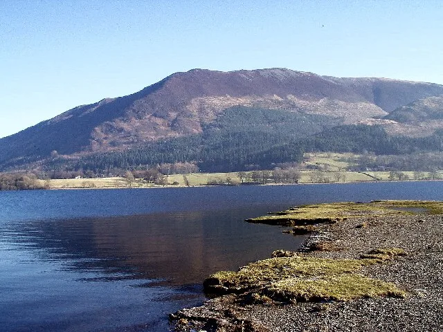
Bassenthwaite Lake
Bassenthwaite Lake — lake in Cumbria, England, UK.
 Flagship📷 3
Natural landmarks · Scottish Lowlands
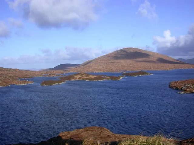
Loch Enoch
Loch Enoch — lake in Dumfries and Galloway, Scotland, UK.
 📷 5
📷 5Natural landmarks · Scottish Lowlands
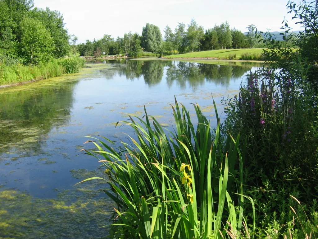
Annandale Water
Annandale Water — lake in Dumfries and Galloway, Scotland, UK.
 📷 3
📷 3Natural landmarks · Scottish Lowlands
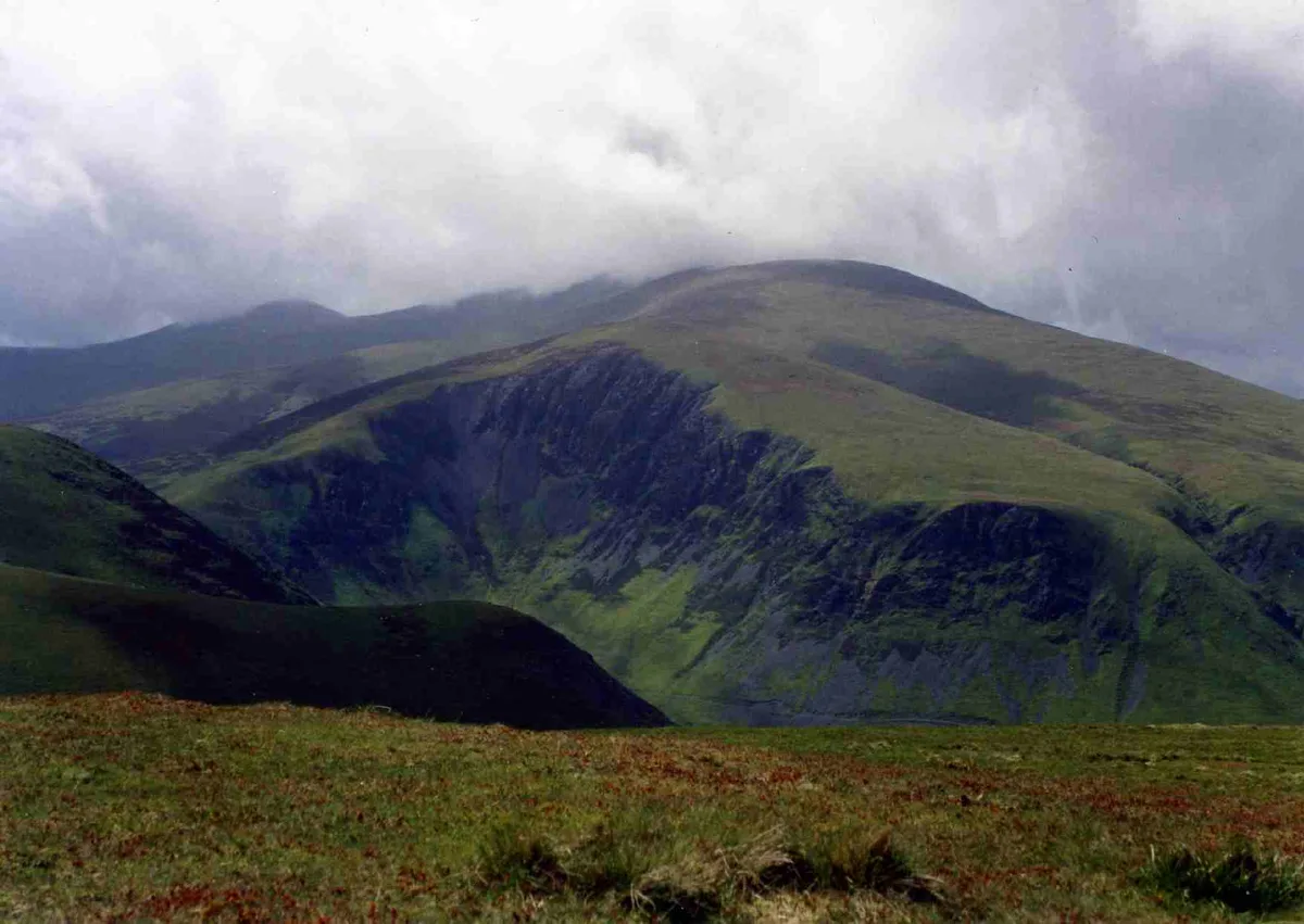
Bakestall
Bakestall — mountain in United Kingdom.
Frequently asked questions
- Where is Maidenhead Bay?
- Maidenhead Bay is in the Scottish Lowlands, United Kingdom.
- What is Maidenhead Bay?
- Maidenhead Bay — a natural feature in scotland lowlands.
- How do I get to Maidenhead Bay?
- Its coordinates are 54.8482°, -5.1312°.