Historic churches · Northern Ireland
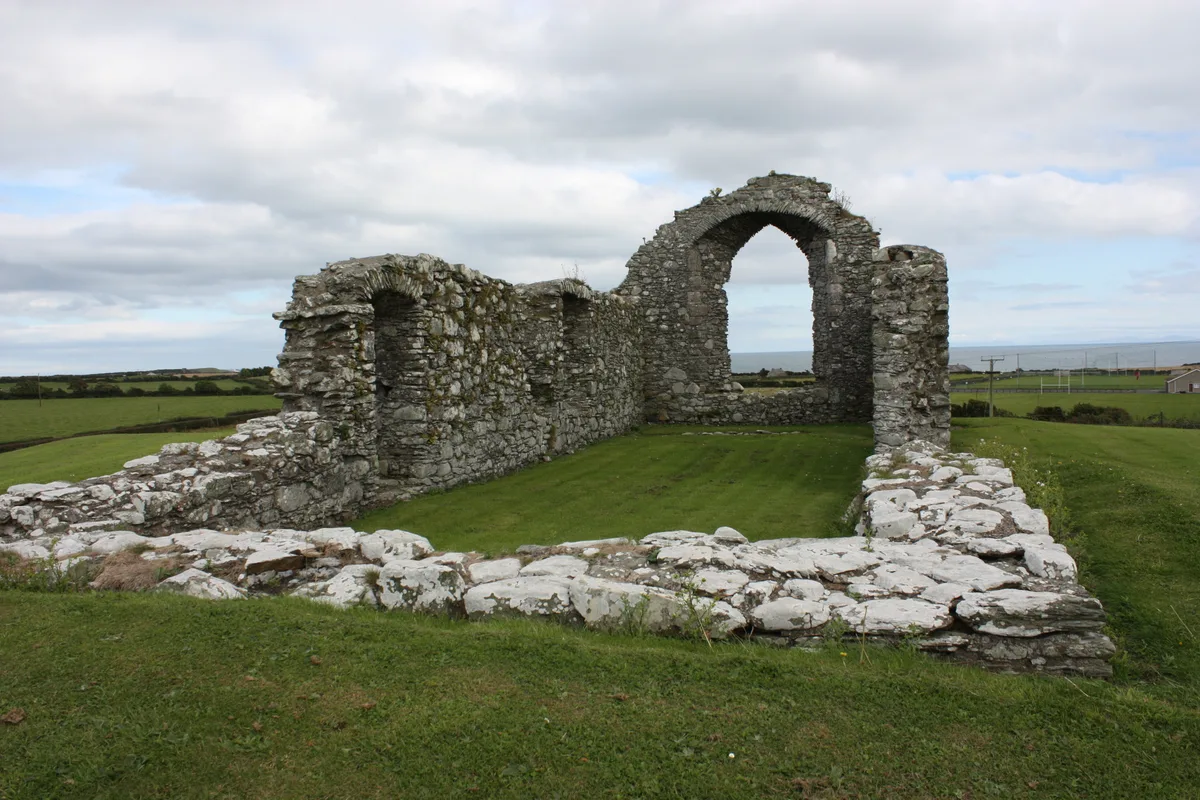
Maghera Old Church
In or near Upperlands.
Maghera Old Church in Northern Ireland, United Kingdom.

Rossographer — CC BY-SA 2.0 via Wikimedia Commons licence
Plan your visit
- Typical visit
- 30 min–1 h
- Free entry
About
Maghera Old Church is a place of interest in Northern Ireland, United Kingdom — drawn from open-data sources for visitor reference. See the linked Wikipedia article for the full description.
Photo gallery
From the Wikipedia article
Maghera Old Church (also known as Old St. Lurach's Church) is the ruins of a church in Maghera, County Londonderry, Northern Ireland. It is a scheduled monument and a Monument in State Care. It was originally founded by St Lurach at some point during the 6th century, likely as a monastery. It is mentioned in the Annals of Ulster when it was plundered by Vikings in 832 and many of its abbots killed. The church later suffered significant damaged when it was burned in 1135. From the mid-12th century until 1245 it was the seat of a bishop, after which it became a parish church. It was damaged due to warfare in 1688, but rebuilt. It was later abandoned in 1819 when the new St. Lurach's Church was built across the road. In 1880, following the disestablishment of the Church of Ireland, it passed into state care. An extensive conservation effort was completed in 1984. In the graveyard, west of the church, is a cross-carved pillar stone, which is traditionally believed to hold the remains of St. Lurach. The church also contains one of the earliest depictions of the crucifixion in Irish architecture, and is one of the most important Romanesque monuments in Ulster.
Excerpt from Wikipedia under CC BY-SA 4.0. See the source article linked in Sources below.
- Coordinates
- 54.8427, -6.6700
- District
- Mid Ulster
- Postcode
- BT46 5AZ
- Parliamentary constituency
- Mid Ulster
Sources
- wikidata: Q120568620 (CC0)
- wikipedia: Maghera Old Church (CC BY-SA 4.0)
Other places nearby
Old St Lurachs Church
Historic houses · 0.0 km

Movie House
Cinemas · 0.3 km

Maghera
Natural landmarks · 0.3 km

Maghera railway station
Natural landmarks · 0.3 km
Movie House Maghera
Theatres · 0.3 km

St. Patrick's College, Maghera
Historic churches · 0.3 km

Mullagh Church
Historic houses · 1.0 km

Craigadick Picnic Area
Natural landmarks · 1.1 km
Craigadick
Natural landmarks · 1.2 km

Glen GAC
Natural landmarks · 1.2 km

Craigmore Fairy Ring Fort
Archaeological sites · 1.7 km

Falgortrevy
Natural landmarks · 1.7 km
Nearby
📷 3Historic houses · Northern Ireland
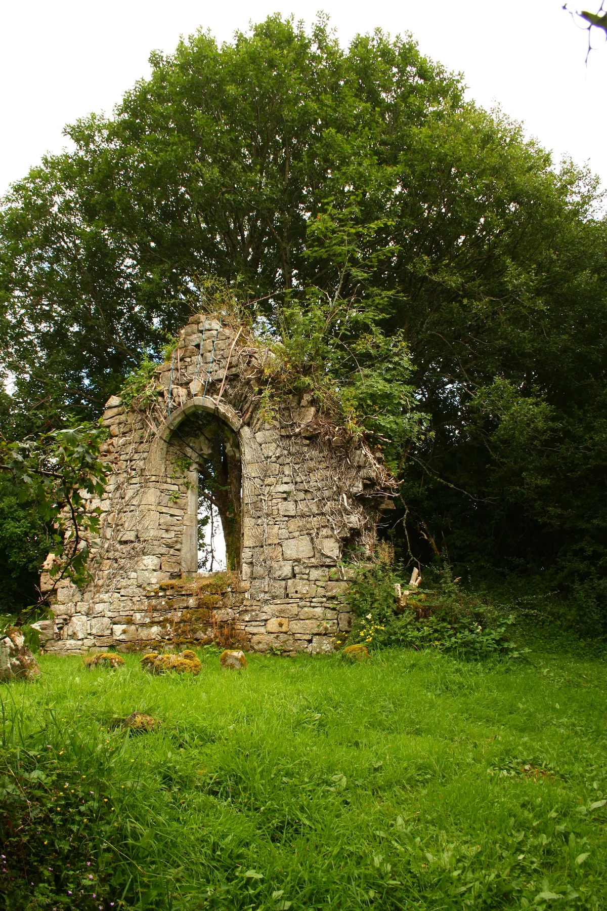
Old St Lurachs Church
Old St Lurachs Church — a historic house in northern-ireland, United Kingdom.
📷 5📷 5Natural landmarks · Northern Ireland
Maghera
Maghera in Northern Ireland, United Kingdom.
📷 3Natural landmarks · Northern Ireland
Maghera railway station
Maghera railway station in Northern Ireland, United Kingdom.
📷 3Theatres · Northern Ireland
Movie House Maghera
Movie House Maghera in Northern Ireland, United Kingdom.
📷 3Historic churches · Northern Ireland
St. Patrick's College, Maghera
St. Patrick's College, Maghera in Northern Ireland, United Kingdom.
Where to eat & stay near Maghera Old Church
Places to stay
 📷 5
📷 5
 📷 5📷 5
 📷 3
📷 3 📷 3
📷 3Places to eat & drink
 📷 7
📷 7Historic pubs · Northern Ireland
1-3 High Street, Moneymore
1-3 High Street, Moneymore in Northern Ireland, United Kingdom.
More places in this region
 📷 5
📷 5Historic churches · Northern Ireland
Ardtole Church
Ardtole Church — ruined church in County Down, Northern Ireland.
 📷 3
📷 3Historic churches · Northern Ireland
Ballylinney Presbyterian Church
Ballylinney Presbyterian Church — church building in United Kingdom.
 📷 3
📷 3Historic churches · Northern Ireland
Carrick Church
Carrick Church — ruinous church in Fermanagh, Northern Ireland.
 📷 3
📷 3Historic churches · Northern Ireland
Drumcree Church
Drumcree Church — church building in Portadown, County Armagh, Northern Ireland.
Frequently asked questions
- Where is Maghera Old Church?
- Maghera Old Church is in Northern Ireland, United Kingdom (postcode BT46 5AZ).
- What is Maghera Old Church?
- Maghera Old Church in Northern Ireland, United Kingdom.
- How do I get to Maghera Old Church?
- Drivers can use postcode BT46 5AZ.
- Is Maghera Old Church free to visit?
- Yes, Maghera Old Church is free to enter.
- How do I get to Maghera Old Church?
- Drivers can navigate to postcode BT46 5AZ. It sits within the Mid Ulster parliamentary constituency.