Natural landmarks · Northern Ireland
M22 motorway
In or near Groggan.
M22 motorway in Northern Ireland, United Kingdom.

David Purchase — CC BY-SA 2.0 via Wikimedia Commons licence
Plan your visit
- Typical visit
- 1 h–2 h
- Nearest railway station
- Antrim · 5.4 km
- Free entry
- Dog-friendly
About
M22 motorway is a place of interest in Northern Ireland, United Kingdom — drawn from open-data sources for visitor reference. See the linked Wikipedia article for the full description.
Photo gallery
From the Wikipedia article
The M22 is a motorway in County Antrim, Northern Ireland. It is 5.6 miles (9 km) long and connects the A6 with the M2. It forms part of the unsigned European route E16.
Excerpt from Wikipedia under CC BY-SA 4.0. See the source article linked in Sources below.
Background
History
In 1964, the Northern Ireland Government announced plans for an extensive network of motorways. Part of this was an M22 motorway from the M2 near Antrim to Castledawson, County Londonderry. With the increase in civil disorder, known as the Troubles, and the introduction of direct rule, the motorway programme was nearly all cancelled and the M22 was left as it currently stood in 1975. It was opened in two sections: As of May 2019, the A6 from the western end of the M22 to Castledawson is under construction as a dual carriageway.
Sourced from Wikipedia under CC BY-SA 4.0.
- Coordinates
- 54.7428, -6.2840
- District
- Antrim and Newtownabbey
- Postcode
- BT41 2DZ
- Parliamentary constituency
- South Antrim
- Established
- 1971
- Nearest railway station
- Antrim — 5.4 km
Sources
- wikidata: Q1890846 (CC0)
- wikipedia: M22 motorway (Northern Ireland) (CC BY-SA 4.0)
Other places nearby

Randalstown
Villages · 1.3 km

Randalstown
Natural landmarks · 1.5 km

Cookstown Junction railway station
Natural landmarks · 1.5 km

Ballygrooby
Natural landmarks · 1.7 km
St Benedict's College
Historic churches · 1.9 km
Randalstown railway station
Natural landmarks · 2.0 km
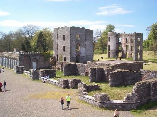
Shane's Castle ruins
Castles · 2.0 km

World of Owls
Zoos & aquariums · 2.5 km

Magheralane
Villages · 2.8 km

Rarh
Archaeological sites · 3.1 km

Londonderry Line
Historic bridges · 3.3 km
Randalstown Forest Nature Reserve
Wildlife reserves · 3.4 km
Nearby
📷 5📷 5Natural landmarks · Northern Ireland
Randalstown
Randalstown in Northern Ireland, United Kingdom.
📷 4Natural landmarks · Northern Ireland
Cookstown Junction railway station
Cookstown Junction railway station in Northern Ireland, United Kingdom.
📷 3Natural landmarks · Northern Ireland
Ballygrooby
Ballygrooby in Northern Ireland, United Kingdom.
📷 3Historic churches · Northern Ireland
St Benedict's College
St Benedict's College in Northern Ireland, United Kingdom.
📷 4Natural landmarks · Northern Ireland
Randalstown railway station
Randalstown railway station in Northern Ireland, United Kingdom.
Where to eat & stay near M22 motorway
Places to stay
 📷 5
📷 5Caravan parks · Northern Ireland
Six Mile Water Caravan Park
Six Mile Water Caravan Park — a caravan park in northern ireland.
 📷 3
📷 3 📷 5
📷 5Hotels · Northern Ireland
Maldron Hotel Belfast International
Maldron Hotel Belfast International — a hotel in northern ireland. 3-star. Brand: Maldron Hotels.
 📷 5
📷 5Hotels · Northern Ireland
DoubleTree by Hilton Belfast Templepatrick
DoubleTree by Hilton Belfast Templepatrick — a hotel in northern ireland. 4-star. Brand: Hilton.
 📷 3
📷 3Places to eat & drink
 📷 5
📷 5More natural landmarks in this region
 Flagship📷 4
Natural landmarks · Northern Ireland
Lough Erne
Lough Erne — lake in County Fermanagh, Northern Ireland, UK.
 Flagship📷 4
Natural landmarks · Northern Ireland
Lough Neagh
Lough Neagh — large lake in Northern Ireland.
 📷 3
📷 3Natural landmarks · Northern Ireland
Ballysaggart Lough
Ballysaggart Lough — lake in the United Kingdom.
 📷 5
📷 5Natural landmarks · Northern Ireland
Belmore Mountain
Belmore Mountain — mountain in the United Kingdom.
Frequently asked questions
- Where is M22 motorway?
- M22 motorway is in Northern Ireland, United Kingdom (postcode BT41 2DZ).
- What is M22 motorway?
- M22 motorway in Northern Ireland, United Kingdom.
- How do I get to M22 motorway?
- The nearest railway station is Antrim, about 5.4 km away. Drivers can use postcode BT41 2DZ.
- When was M22 motorway built?
- Built or established in 1971.
- Is M22 motorway free to visit?
- Yes, M22 motorway is free to enter.
- How do I get to M22 motorway?
- The nearest railway station is Antrim, about 5.4 km away. Drivers can navigate to postcode BT41 2DZ.