
Historic churches · South West England
Luxulyan
In or near Rescorla.
Luxulyan (; Cornish: Logsulyan), also spelt Luxullian or Luxulian, is a village and civil parish in mid Cornwall, England, United Kingdom. The village lies four miles (6.5 km) northeast of St Austell

Rob Farrow — CC BY-SA 2.0 via Wikimedia Commons licence

Plan your visit
- Typical visit
- 30 min–1 h
- Nearest railway station
- Luxulyan · 0.3 km
- Free entry
About
Luxulyan (; Cornish: Logsulyan), also spelt Luxullian or Luxulian, is a village and civil parish in mid Cornwall, England, United Kingdom. The village lies four miles (6.5 km) northeast of St Austell and six miles (10 km) south of Bodmin. The population of the parish was 1,371 in the 2001 census. This had risen to 1,381 at the 2011 census.
Photo gallery
Protected designations
- Site of Special Scientific Interest: Mid Cornwall Moors SSSI
- Area of Outstanding Natural Beauty: Cornwall
Designations sourced from Natural England open data under OGL v3.
From the Wikipedia article
Luxulyan (; Cornish: Logsulyan), also spelt Luxullian or Luxulian, is a village and civil parish in mid Cornwall, England, United Kingdom. The village lies four miles (6.5 km) northeast of St Austell and six miles (10 km) south of Bodmin. The population of the parish was 1,371 in the 2001 census. This had risen to 1,381 at the 2011 census.
Excerpt from Wikipedia under CC BY-SA 4.0. See the source article linked in Sources below.
Background
History
St Sulien, or Sulian, was abbot here during the sixth century. The church in the village may have been dedicated to him originally, but it is now dedicated to Saints Ciricius (Cyr, Cyriacus, Quiricus) and Julitta. near Luxulyan]] in Luxulyan Valley]] There are roads in Luxulyan named after all three saints. Sulien is a Welsh variant of the given name "Julian," but has also been interpreted as being derived from the Welsh sul, meaning "sun" + geni, meaning "born," Sulien being the name of a Celtic solar deity. In the early 1980s Luxulyan was the site of a six-month occupation of farmland by much of the village population, with many groups and individuals from across Cornwall helping, to…
Sourced from Wikipedia under CC BY-SA 4.0.
- Coordinates
- 50.3900, -4.7440
- District
- Cornwall
- Parish
- Luxulyan
- Postcode
- PL30 5EB
- Parliamentary constituency
- South East Cornwall
- Nearest railway station
- Luxulyan — 0.3 km
Sources
- wikipedia: Luxulyan (CC BY-SA 4.0)
Other places nearby

Luxulian
Villages · 0.0 km
Three Stiles Cross
Historic houses · 0.1 km
Church of St Ciricius and St Julitta
Historic churches · 0.2 km

Treffry Viaduct
Historic bridges · 1.0 km
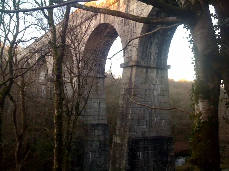
Treffry Viaduct
Aqueducts · 1.1 km

Croft Farm Campsite
Campsites · 1.3 km

Wheelpit Mill
Watermills · 2.0 km
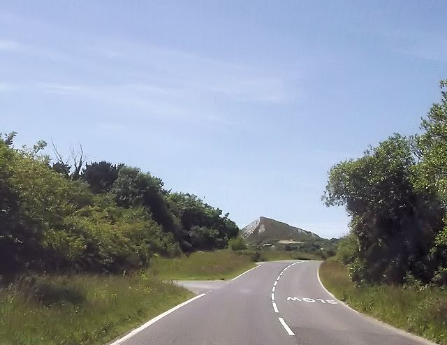
Innis Inn Campsite
Campsites · 2.0 km

Checker’s Cabin
Historic houses · 2.1 km

Lanlivery Hill
Mountains & hills · 2.3 km

Rescorla
Towns & cities · 2.4 km

Prideaux Castle
Vineyards · 2.5 km
Nearby
📷 5📷 3Historic houses · South West England
Three Stiles Cross
Three Stiles Cross — a Grade II-listed historic house in england-south-west, United Kingdom.
📷 3Historic churches · South West England
Church of St Ciricius and St Julitta
Church of St Ciricius and St Julitta — Grade I listed building-listed church in england-south-west, United Kingdom.
📷 3Historic bridges · South West England
Treffry Viaduct
Treffry Viaduct is a historic bridge in the United Kingdom.
📷 3📷 5Campsites · South West England
Croft Farm Campsite
Croft Farm Campsite — a campsite in england south west.
Where to eat & stay near Luxulyan
Places to stay
📷 5Campsites · South West England
Croft Farm Campsite
Croft Farm Campsite — a campsite in england south west.
📷 5Campsites · South West England
Innis Inn Campsite
Innis Inn Campsite — a campsite in england south west.
📷 3Caravan parks · South West England
Resugga Green
Resugga Green — a caravan park in england south west.
 📷 5📷 5
Hostels · South West England
YHA Eden Project
YHA Eden Project — a hostel in england south west. Brand: Youth Hostels Association.
 📷 5
📷 5Campsites · South West England
Eden Valley Holiday Park
Eden Valley Holiday Park — a campsite in england south west.
Places to eat & drink
 📷 7
📷 7Historic pubs · South West England
The Pack Horse Public House
The Pack Horse Public House in England South West, United Kingdom.
 📷 5
📷 5 📷 5
📷 5Restaurants · South West England
Pier House Hotel
Pier House Hotel — a restaurant in england south west.
 📷 7
📷 7Historic pubs · South West England
Methodist Chapel
Methodist Chapel in England South West, United Kingdom.
 📷 7
📷 7Restaurants · South West England
The House on the Props
The House on the Props — a restaurant in england south west.
 📷 7
📷 7More places in this region
 📷 5
📷 5Historic churches · South West England
Abbey Church of St Gregory the Great, Downside Abbey
Abbey Church of St Gregory the Great, Downside Abbey — church in Stratton-on-the-Fosse, Somerset, England, UK.
 📷 5
📷 5Historic churches · South West England
All Saints Church
All Saints Church — Grade I listed church in Woolley, Somerset, England, UK.
 📷 5
📷 5Historic churches · South West England
All Saints Church, Hampreston
All Saints Church, Hampreston — church in Hampreston, Dorset, England, UK.
 📷 5
📷 5Historic churches · South West England
All Saints Church, Nether Cerne
All Saints Church, Nether Cerne — church in Nether Cerne, Dorset, England, UK.
Frequently asked questions
- Where is Luxulyan?
- Luxulyan is in South-West England, United Kingdom (postcode PL30 5EB), in the parish of Luxulyan.
- What is Luxulyan?
- Luxulyan (; Cornish: Logsulyan), also spelt Luxullian or Luxulian, is a village and civil parish in mid Cornwall, England, United Kingdom. The village lies four miles (6.5 km) northeast of St Austell
- How do I get to Luxulyan?
- The nearest railway station is Luxulyan, about 0.3 km away. The nearest town is Rescorla. Drivers can use postcode PL30 5EB.
- Is Luxulyan a protected site?
- Yes — Luxulyan is part of the Mid Cornwall Moors SSSI Site of Special Scientific Interest and the Cornwall National Landscape (AONB).
- Is Luxulyan free to visit?
- Yes, Luxulyan is free to enter.
- How do I get to Luxulyan?
- The nearest railway station is Luxulyan, about 0.3 km away. Drivers can navigate to postcode PL30 5EB.