
Forts · West Midlands
Lunt Roman Fort
In or near Ryton-on-Dunsmore.
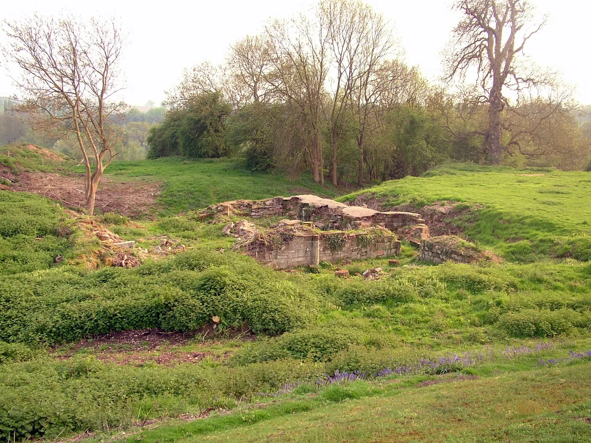
Lunt Roman Fort is a fort in the United Kingdom.

Wikimedia Commons contributors — see linked file page for photographer and licence licence

Plan your visit
- Typical visit
- 45 min–1.5 h
- Nearest railway station
- Midgeway · 0.7 km
- Family-friendly
Getting there & planning your visit
Lunt Roman Fort is located in Warwickshire, with the nearest railway station being Midgeway, approximately 0.7 km away. The postcode for navigation is CV8 3AD. Entry details are not provided, so please check locally for accessibility information.
About
Lunt Roman Fort is a historic fort or fortified site in the United Kingdom. Opening hours: Mo-Fr School Holidays only. Coordinates: 52.3733°, -1.4956°.
Photo gallery
Official information
Lunt Roman Fort is a historical site that represents a reconstructed Roman fort. Visitors can explore the remains and learn about Roman military life and the fort's significance in history.
From the Wikipedia article
The Roman fort at The Lunt, also known as the Lunt Roman fort, is the archaeological site of a Roman fort, of unknown name, in the Roman province of Britannia. It is open to the public and located in the village of Baginton on the south eastern outskirts of Coventry. The fort has now been fully excavated and partially reconstructed; the wooden gateway rebuild was led by archaeologist Margaret Rylatt, using the same tools and techniques that the military engineers of the Roman Army would have used. In 2001, Anglo Saxon artefacts dating to Sub-Roman Britain were discovered on the site. The site has a large steep wooded bank, known as The Lunt, just beyond the northern boundary of the fort, which descends to the River Sowe. The elevation from the top of the bank provides good views of the landscape to the north for two or three miles (about 4.0 km).
Excerpt from Wikipedia under CC BY-SA 4.0. See the source article linked in Sources below.
Background
History
Four periods of occupation of the fort during periods of unrest in Roman Britain have been identified by excavation. The fort was built around AD 60 to act as a supply depot and headquarters for an unknown legion during the final campaign against Boudica. From AD 64 it was used, in the second phase, by a cohort which reduced the size of the fort, but from which the principia, praetorium, two granaries and six barrack blocks have been excavated. A number of buildings were demolished to construct a gyrus. Many horse fittings, possible stabling, an extensive metalworking area, granary and storage space suggests a cavalry unit was present at this time. This second phase lasted until AD 77/8.…
Sourced from Wikipedia under CC BY-SA 4.0.
- Coordinates
- 52.3733, -1.4956
- County
- Warwickshire
- District
- Warwick
- Parish
- Baginton
- Postcode
- CV8 3AD
- Parliamentary constituency
- Kenilworth and Southam
- Nearest railway station
- Midgeway — 0.7 km
- Opening
- Mo-Fr School Holidays only
Sources
- osm: w32111121 (ODbL)
- wikipedia: Roman fort at The Lunt (CC BY-SA 4.0)
- commons: Lunt fort baginton.JPG (CC BY-SA 4.0)
Other places nearby

Praetorium
Historic houses · 0.1 km
Principia
Historic houses · 0.1 km
foundations of Barrack Blocks (4 of 6)
Historic houses · 0.1 km
foundations of Barrack Blocks? (2 of 6)
Historic houses · 0.1 km
Roman fort at The Lunt
Archaeological sites · 0.1 km

River Sherbourne
Museums · 0.4 km

Bagots Castle
Castles · 0.5 km
Baginton Castle
Castles · 0.5 km

Baginton
Museums · 0.5 km

Baginton Bridge
Historic bridges · 0.6 km
Bridge View Light Railway
Miniature railways · 0.7 km

Midland Air Museum
Museums · 1.1 km
Nearby
📷 3Historic houses · West Midlands
Praetorium
Praetorium — a historic house in West Midlands, United Kingdom.
📷 3Historic houses · West Midlands
Principia
Principia — a historic house in West Midlands, United Kingdom.
📷 3Historic houses · West Midlands
foundations of Barrack Blocks (4 of 6)
foundations of Barrack Blocks (4 of 6) — a historic house in West Midlands, United Kingdom.
📷 3Historic houses · West Midlands
foundations of Barrack Blocks? (2 of 6)
foundations of Barrack Blocks? (2 of 6) — a historic house in West Midlands, United Kingdom.
📷 5Archaeological sites · West Midlands
Roman fort at The Lunt
Roman fort at The Lunt — a other in england-west-midlands, United Kingdom.
📷 5Museums · West Midlands
River Sherbourne
The River Sherbourne is a river that flows through the city of Coventry in the West Midlands, England. The name Sherbourne is said to derive from Scir Burna, "clear stream" in Old English.
Where to eat & stay near Lunt Roman Fort
Places to stay
 📷 5
📷 5 📷 7
📷 7Hotels · West Midlands
Ramada Hotel & Suites Coventry
Ramada Hotel & Suites Coventry — a hotel in england west midlands. 4-star. Brand: Ramada.
 📷 6
📷 6Hotels · West Midlands
Telegraph Hotel
Telegraph Hotel — a hotel in england west midlands.
 📷 5
📷 5Hotels · West Midlands
Premier Inn
Premier Inn — a hotel in england west midlands.
 📷 5
📷 5 📷 5
📷 5Hotels · West Midlands
DoubleTree by Hilton Hotel Coventry
DoubleTree by Hilton Hotel Coventry — a hotel in england west midlands.
Places to eat & drink
 📷 5
📷 5Historic pubs · West Midlands
The Malt Shovel
The Malt Shovel — Historic pub — listed building or notable heritage status.
 📷 5
📷 5Cafés · West Midlands
Warwick Row Espresso
Warwick Row Espresso — a café in england west midlands.
 📷 5📷 5
 📷 3
📷 3Historic pubs · West Midlands
The Whitefriars
The Whitefriars — Historic pub — listed building or notable heritage status.
 📷 5
📷 5Historic pubs · West Midlands
The Castle Grounds
The Castle Grounds — Historic pub — listed building or notable heritage status.
More forts in this region
 📷 3
📷 3Forts · West Midlands
Battle of Birmingham (Camp Hill) 1643
Battle of Birmingham (Camp Hill) 1643 — Battlefield site, dating to 1643-04-03.
 📷 3
📷 3Forts · West Midlands
Battle of Blore Heath (A.D. 1459)
Battle of Blore Heath (A.D. 1459) is a fort in the United Kingdom.
 📷 3
📷 3 📷 3
📷 3Frequently asked questions
- Where is Lunt Roman Fort?
- Lunt Roman Fort is in Warwickshire, the West Midlands, United Kingdom (postcode CV8 3AD), in the parish of Baginton.
- What is Lunt Roman Fort?
- Lunt Roman Fort is a fort in the United Kingdom.
- How do I get to Lunt Roman Fort?
- The nearest railway station is Midgeway, about 0.7 km away. The nearest town is Ryton-on-Dunsmore. Drivers can use postcode CV8 3AD.
- Who owns Lunt Roman Fort?
- Lunt Roman Fort is owned by Herbert Art Gallery and Museum.
- How do I get to Lunt Roman Fort?
- The nearest railway station is Midgeway, about 0.7 km away. Drivers can navigate to postcode CV8 3AD.