
Historic houses · North Wales
Lower Kinnerton Hall
In or near Broughton.
Lower Kinnerton Hall — a Grade II*-listed historic house in wales-north, United Kingdom.

John S Turner — CC BY-SA 2.0 via Wikimedia Commons licence

Plan your visit
- Typical visit
- 1 h–2 h
- Nearest railway station
- Penyffordd · 4.6 km
- Family-friendly
- Limited wheelchair access
Getting there & planning your visit
To visit Lower Kinnerton Hall, the nearest railway station is Penyffordd, located 4.6 km away. The postcode for sat-nav is CH4 9AF. Accessibility is limited for wheelchair users.
About
Lower Kinnerton Hall is a Grade II*-listed building in wales-north, United Kingdom. Grade II* status is conferred by Historic England (or Cadw, Historic Environment Scotland or NIEA equivalents) on buildings of exceptional national interest. See the linked Wikipedia article for full historical and architectural details.
Photo gallery
See it from the streetimagery from 2020
Imagery © Mapillary contributors, CC BY-SA 4.0
Protected designations
- Site of Special Scientific Interest: River Dee (England) SSSI
Designations sourced from Natural England open data under OGL v3.
From the Wikipedia article
Lower Kinnerton Hall, also known as Bridge Farmhouse, stands adjacent to the England-Wales border to the west of the village of Lower Kinnerton, Cheshire, England. The house is dated 1685, and carries the initials TTET. Attached to it is a shippon (cattle-shed) dating from the 18th century. A wing was added to the rear in the 19th century. The house is constructed in brown brick with stone dressings, and has a slated roof. It is in two storeys and its entrance front has five bays. There are three large Dutch gables on the entrance front, and another on the north face, each with reverse-curved scrolls supporting pediments. The windows are casements. At the rear of the house is a semi-hexagonal bay window and a timber-framed porch. The shippon is also in two storeys, and constructed in brick with slate roofs. Also at the rear of the house is a cobbled courtyard. The architectural historian Nikolaus Pevsner describes the building as "quite an impressive house". The house and attached shippon are recorded in the National Heritage List for England as a designated Grade II listed building.
Excerpt from Wikipedia under CC BY-SA 4.0. See the source article linked in Sources below.
- Coordinates
- 53.1516, -2.9872
- District
- Cheshire West and Chester
- Parish
- Dodleston
- Postcode
- CH4 9AF
- Parliamentary constituency
- Chester South and Eddisbury
- Nearest railway station
- Penyffordd — 4.6 km
- Official site
- thegreatbritainguide.com
Sources
- wikidata: Q6693552 (CC0)
- wikipedia: Lower Kinnerton Hall (CC BY-SA 4.0)
Other places nearby

All Saints Church, Higher Kinnerton
Historic churches · 1.4 km

Cineworld
Cinemas · 1.9 km

Broughton
Towns & cities · 1.9 km

Cineworld Cinema Broughton
Theatres · 1.9 km

Broughton Shopping Park
Parks · 2.1 km

Dodlestone Castle
Castles · 2.4 km

Dodleston Castle
Castles · 2.4 km
Dodleston Castle
Literary houses · 2.4 km

Dodleston
Towns & cities · 2.4 km
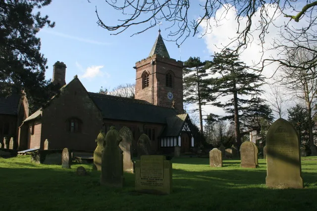
St Mary's Church, Dodleston
Historic churches · 2.4 km

Bretton Hall, Flintshire
Stately homes · 3.0 km

Connahs Hey Mound
Castles · 3.1 km
Nearby
📷 3Historic churches · North Wales
All Saints Church, Higher Kinnerton
All Saints Church, Higher Kinnerton — church in United Kingdom.
📷 5📷 3📷 3Theatres · North Wales
Cineworld Cinema Broughton
Cineworld Cinema Broughton in Wales North, United Kingdom.
📷 4Parks · North Wales
Broughton Shopping Park
Broughton Shopping Park (Welsh: Parc Siopa Brychdyn), also known as Broughton Centre (Welsh: Canolfan Brychdyn), is a retail park in Broughton, Flintshire, Wales. It is the busiest retail park in Nort
📷 5Where to eat & stay near Lower Kinnerton Hall
Places to stay
 📷 5
📷 5 📷 5
📷 5 📷 5📷 5
Caravan parks · North West England
Fir Trees Holiday Park
Fir Trees Holiday Park — a caravan park in wales north.
 📷 5
📷 5 📷 7
📷 7Places to eat & drink
 📷 7
📷 7 📷 7
📷 7Restaurants · North Wales
The Crown Inn
The Crown Inn — a restaurant in wales north.
 📷 5
📷 5 📷 2
📷 2 📷 5
📷 5Historic pubs · North West England
Old Custom House Inn, Chester
Old Custom House Inn, Chester in Wales North, United Kingdom.
 📷 5
📷 5Historic pubs · North West England
Golden Eagle Public House
Golden Eagle Public House in Wales North, United Kingdom.
More historic houses in this region
 📷 3
📷 3Historic houses · North Wales
2 & 2A Record Street, Ruthin
2 & 2A Record Street, Ruthin — Grade II listed house in Ruthin, Denbighshire.
 📷 3
📷 3Historic houses · North Wales
Aberconwy House
Aberconwy House — historic house in Conwy, Wales.
 📷 3
📷 3 📷 3
📷 3Frequently asked questions
- Where is Lower Kinnerton Hall?
- Lower Kinnerton Hall is in North Wales, United Kingdom (postcode CH4 9AF), in the parish of Dodleston.
- What is Lower Kinnerton Hall?
- Lower Kinnerton Hall — a Grade II*-listed historic house in wales-north, United Kingdom.
- How do I get to Lower Kinnerton Hall?
- The nearest railway station is Penyffordd, about 4.6 km away. Drivers can use postcode CH4 9AF.
- Is Lower Kinnerton Hall a listed building?
- Lower Kinnerton Hall is officially recognised as Grade II* listed.
- Is Lower Kinnerton Hall a protected site?
- Yes — Lower Kinnerton Hall is part of the River Dee (England) SSSI Site of Special Scientific Interest.
- How do I get to Lower Kinnerton Hall?
- The nearest railway station is Penyffordd, about 4.6 km away. Drivers can navigate to postcode CH4 9AF.