
Wildlife reserves · North East England
Low Redford Meadows
In or near South Side.
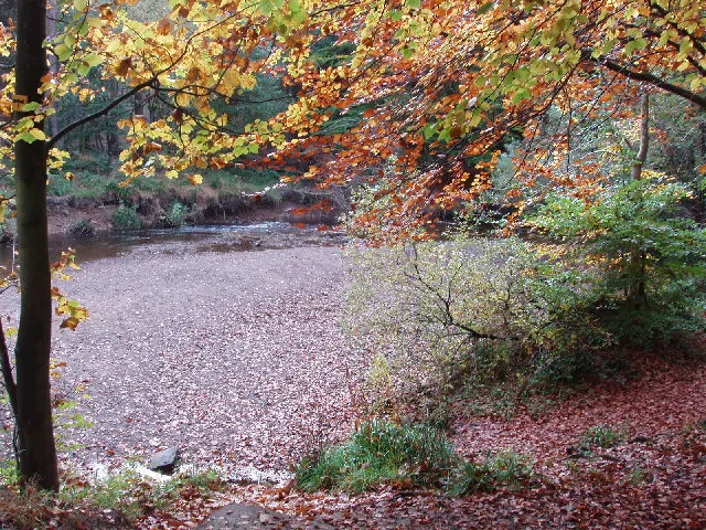
Low Redford Meadows in England North East, United Kingdom.

Oliver Dixon — CC BY-SA 2.0 via Wikimedia Commons licence

Plan your visit
- Typical visit
- 2 h–4 h
- Best time of year
- Autumn & winter (migration & wildfowl)
- Nearest railway station
- Wolsingham · 5.9 km
- Free entry
- Dog-friendly
Getting there & planning your visit
To visit Low Redford Meadows, the nearest railway station is Wolsingham, located 5.9 km away. The postcode for sat-nav is DL13 3NL, and entry to the reserve is free.
About
Low Redford Meadows is a place of interest in England North East, United Kingdom — drawn from open-data sources for visitor reference. See the linked Wikipedia article for the full description.
Photo gallery
Official information
Low Redford Meadows is a Site of Special Scientific Interest (SSSI) located in County Durham. It is recognized for its biological interest and features a variety of natural habitats and species.
Protected designations
- Site of Special Scientific Interest: Low Redford Meadows SSSI
- Site of Special Scientific Interest: Bollihope, Pikestone, Eggleston and Woodland Fells SSSI
- Area of Outstanding Natural Beauty: North Pennines
Designations sourced from Natural England open data under OGL v3.
From the Wikipedia article
Low Redford Meadows is a Site of Special Scientific Interest in the Teesdale district of County Durham, England. It consists of two separate areas of meadows, situated in the floodplain and on the valley slopes of Bedburn Beck, 2 km upstream from the village of Bedburn. Like Frog Wood Bog SSSI, a short distance upstream, the meadows lie within the confines of Hamsterley Forest. The site is important as preserving a rich assemblage of plant species, in a habitat that is becoming increasingly scarcer as a result of intensive agricultural practices. A wide variety of flowering plants is found, with some, such as wood cranesbill, Geranium sylvaticum, great burnet, Sanguisorba officinalis, and cat's ear, Hypochaeris radicata, present in such abundance as to be locally dominant in different fields.
Excerpt from Wikipedia under CC BY-SA 4.0. See the source article linked in Sources below.
- Coordinates
- 54.6736, -1.8758
- District
- County Durham
- Parish
- South Bedburn
- Postcode
- DL13 3NL
- Parliamentary constituency
- Bishop Auckland
- Established
- 1991
- Nearest railway station
- Wolsingham — 5.9 km
- Official site
- designatedsites.naturalengland.org.uk
Sources
- wikidata: Q14995484 (CC0)
- wikipedia: Low Redford Meadows (CC BY-SA 4.0)
Other places nearby
Green Man Life Cycle
National landscapes (AONB) · 0.1 km

The Loop
Mountain bike trails · 0.7 km

South Bedburn
Other places · 0.8 km

Black (Severe)
Mountain bike trails · 0.8 km

Metcalf's House
Historic houses · 1.0 km
Hamsterley Forest
Archaeological sites · 1.3 km

Frog Wood Bog
Forests & woodlands · 1.3 km

Bedburn
Forests & woodlands · 2.0 km

Podge Hole Bridge And Wall With Tail Race
Historic bridges · 2.1 km

Blue route (moderate)
Mountain bike trails · 2.2 km

County Durham
Other places · 2.8 km

The Castles
Archaeological sites · 3.1 km
Nearby
📷 3National landscapes (AONB) · North East England
Green Man Life Cycle
Green Man Life Cycle — Public artwork (sculpture) by Phil Townsend.
📷 5📷 3📷 5Mountain bike trails · North East England
Black (Severe)
Black (Severe) — a mtb trail in scotland lowlands.
📷 3Historic houses · North East England
Metcalf's House
Metcalf's House — a historic house in scotland-lowlands, United Kingdom.
📷 3Archaeological sites · North East England
Hamsterley Forest
Hamsterley Forest — near Bishop Auckland.
Where to eat & stay near Low Redford Meadows
Places to stay
 📷 5
📷 5Campsites · North East England
Green Acres Hamsterley
Green Acres Hamsterley — a campsite in scotland lowlands.
 📷 3
📷 3Campsites · North East England
High Shipley Farm Bungalow
High Shipley Farm Bungalow — a campsite in scotland lowlands.
 📷 5
📷 5Caravan parks · North East England
Bradley Burn Farm Touring site
Bradley Burn Farm Touring site — a caravan park in scotland lowlands.
 📷 5
📷 5Caravan parks · North East England
The Paddock Touring Park
The Paddock Touring Park — a caravan park in scotland lowlands.
 📷 5
📷 5Caravan parks · North East England
Holebeck Touring Caravan Park
Holebeck Touring Caravan Park — a caravan park in scotland lowlands.
 📷 5
📷 5Caravan parks · North East England
High Doctor Pasture Caravan Park
High Doctor Pasture Caravan Park — a caravan park in scotland lowlands.
Places to eat & drink
 📷 5
📷 5Historic pubs · North East England
Black Bull Public House
Black Bull Public House in Scotland Lowlands, United Kingdom.
 📷 5
📷 5Historic pubs · North East England
The Welcome Public House, With Walls And Piers In Front
The Welcome Public House, With Walls And Piers In Front in Scotland Lowlands, United Kingdom.
 📷 3
📷 3 📷 7
📷 7Historic pubs · North East England
The Eden Arms Public House
The Eden Arms Public House in Scotland Lowlands, United Kingdom.
 📷 5
📷 5Historic pubs · North East England
Wheatsheaf Public House
Wheatsheaf Public House in Scotland Lowlands, United Kingdom.
 📷 5
📷 5Cafés · North East England
The Country Teashop
The Country Teashop — a café in england north east.
More places in this region
 📷 3
📷 3Wildlife reserves · North East England
Augill Pasture
Augill Pasture — nature reserve in Cumbria, England.
 📷 4
📷 4Wildlife reserves · North East England
Ash Fell Edge
Ash Fell Edge in England North East, United Kingdom.
 📷 4
📷 4Wildlife reserves · North East England
Sunbiggin Tarn
Sunbiggin Tarn in England North East, United Kingdom.
 📷 3
📷 3Wildlife reserves · North East England
Aules Hill Meadows
Aules Hill Meadows in England North East, United Kingdom.
Frequently asked questions
- Where is Low Redford Meadows?
- Low Redford Meadows is in North-East England, United Kingdom (postcode DL13 3NL), in the parish of South Bedburn.
- What is Low Redford Meadows?
- Low Redford Meadows in England North East, United Kingdom.
- How do I get to Low Redford Meadows?
- The nearest railway station is Wolsingham, about 5.9 km away. Drivers can use postcode DL13 3NL.
- When was Low Redford Meadows built?
- Built or established in 1991.
- Is Low Redford Meadows a protected site?
- Yes — Low Redford Meadows is part of the Low Redford Meadows SSSI Site of Special Scientific Interest and the Bollihope, Pikestone, Eggleston and Woodland Fells SSSI Site of Special Scientific Interest.
- Is Low Redford Meadows free to visit?
- Yes, Low Redford Meadows is free to enter.
- How do I get to Low Redford Meadows?
- The nearest railway station is Wolsingham, about 5.9 km away. Drivers can navigate to postcode DL13 3NL.
- Are dogs allowed at Low Redford Meadows?
- Most wildlife reserves allow dogs on lead only, with restrictions during ground-nesting bird season (March-July). Check signage at the reserve.