
Mountains & hills · Yorkshire & the Humber
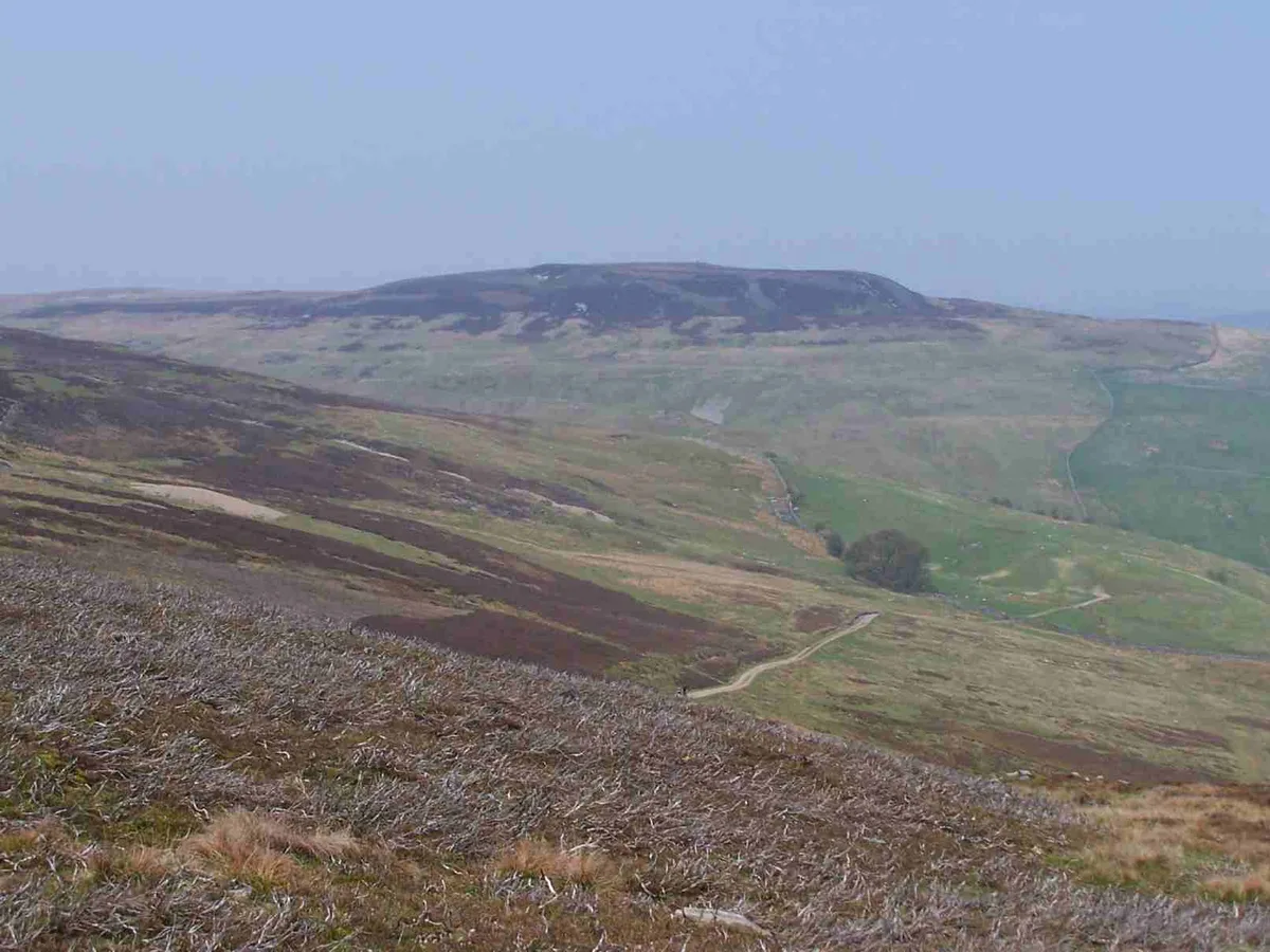
Lovely Seat
Also known as: Lunasett
In or near Satron.
Lovely Seat — Named summit at 675 m.

Wikimedia Commons contributors — see linked file page for photographer and licence licence

Plan your visit
- Typical visit
- 3 h–8 h
- Best time of year
- Late spring – early autumn (May–Oct)
- Nearest railway station
- Garsdale · 9.6 km
- Free entry
- Dog-friendly
Getting there & planning your visit
To visit Lovely Seat, the nearest railway station is Garsdale, located 9.6 km away. Admission is free.
About
Lovely Seat is a named summit in the United Kingdom. Also known as: Lunasett. Wikidata describes it as: "Named summit at 675 m.". Coordinates: 54.3508°, -2.1876°.
Photo gallery
Protected designations
- Site of Special Scientific Interest: Cliff Force Cave SSSI
- Site of Special Scientific Interest: Lovely Seat - Stainton Moor SSSI
Designations sourced from Natural England open data under OGL v3.
From the Wikipedia article
Lovely Seat, originally known as Lunasett, is a fell in the Yorkshire Dales National Park in North Yorkshire, England. Situated at grid reference SD878950 three miles (five km) north of the town of Hawes, it is part of the high ground which separates Wensleydale from Swaledale and the highest point of Abbotside Common reaching a height of 675 metres (2,215 feet). The fell is separated from its neighbour to the west, Great Shunner Fell, by the Buttertubs Pass which carries the minor motor road between Hawes in Wensleydale and Thwaite in Swaledale. The name Lunasett derives from the Norse dialect moon pasture; Commoners of Abbotside still use the original name. It appears as Lovely Seat in an Ordnance Survey map of 1856. The fell is very rarely climbed directly from the valley and is usually ascended from the top of the Buttertubs Pass in conjunction with nearby Great Shunner Fell. The latter is climbed first from Hawes or Thwaite using the Pennine Way, after which it is a short walk to descend to the top of the pass and then climb to the summit of Lovely Seat following a fence which helps navigation in bad conditions. The summit is adorned by a fair-sized cairn and a stone-built chair, and gives good views of the Yorkshire Three Peaks to the south. 300 metres west of the summit are a series of stone cairns which are clearly visible on the skyline when the fell is viewed from a distance.
Excerpt from Wikipedia under CC BY-SA 4.0. See the source article linked in Sources below.
- Coordinates
- 54.3508, -2.1876
- Address
- Yorkshire Dales, England
- Nearest railway station
- Garsdale — 9.6 km
Sources
- osm: n503706929 (ODbL)
- wikipedia: Lovely Seat (CC BY-SA 4.0)
- commons: Lovely Seat from Askrigg Common.jpg (CC BY-SA 4.0)
Other places nearby
Lovely Seat
Natural landmarks · 0.1 km

Butter Tubs
Mountain passes · 0.3 km

Cliffe Force Cave
Caves · 1.1 km
Cliff Force
Waterfalls · 1.1 km

Butter Tubs
Natural landmarks · 1.1 km

Fossdale Beck Cave
Caves · 1.6 km

Round Hill
Mountains & hills · 2.4 km

Little Shunner Fell
Mountains & hills · 2.7 km

Bridge Over Hearne Beck
Historic bridges · 3.0 km

Scar House Force
Waterfalls · 3.2 km

Shaw Ghyll caravan and camping
Campsites · 3.2 km

Thwaite
Villages · 3.3 km
Nearby
📷 3📷 5Mountain passes · Yorkshire & the Humber
Butter Tubs
Butter Tubs — a mountain pass in england north west.
📷 5Caves · Yorkshire & the Humber
Cliffe Force Cave
Cliffe Force Cave — a cave broad in england-north-west, United Kingdom.
📷 5📷 3Natural landmarks · Yorkshire & the Humber
Butter Tubs
Butter Tubs — a place in Yorkshire & the Humber, United Kingdom.
📷 5Caves · North West England
Fossdale Beck Cave
Fossdale Beck Cave — a cave broad in england-north-west, United Kingdom.
Where to eat & stay near Lovely Seat
Places to stay
📷 5Campsites · North West England
Shaw Ghyll caravan and camping
Shaw Ghyll caravan and camping — a campsite in england north west.
 📷 5
📷 5Campsites · Yorkshire & the Humber
Usha Gap Campsite
Usha Gap Campsite — a campsite in england north west.
 📷 5
📷 5Hostels · North West England
Old School Bunkhouse
Old School Bunkhouse — a hostel in england north west.
 📷 5
📷 5Hotels · Yorkshire & the Humber
Stone House Hotel
Stone House Hotel — a hotel in england north west.
 📷 5
📷 5Caravan parks · Yorkshire & the Humber
Hawes Caravan Club Site
Hawes Caravan Club Site — a caravan park in england north west.
 📷 5
📷 5Hostels · Yorkshire & the Humber
Chapel Gallery Bunkhouse
Chapel Gallery Bunkhouse — a hostel in england north west.
Places to eat & drink
 📷 5
📷 5Historic pubs · Yorkshire & the Humber
Kings Head Inn
Kings Head Inn in England North West, United Kingdom.
 📷 5
📷 5 📷 5
📷 5 📷 7
📷 7Cafés · North West England
The White Hare Cafe
The White Hare Cafe — a café in england north west.
 📷 5
📷 5Cafés · North West England
The Cross Keys Temperance Inn
The Cross Keys Temperance Inn — a café in england north west.
 📷 7
📷 7Historic pubs · Yorkshire & the Humber
Fox And Hounds Inn
Fox And Hounds Inn in England Yorkshire, United Kingdom.
More mountains in this region
 📷 3
📷 3 📷 5
📷 5Mountains & hills · Yorkshire & the Humber
Whaley Moor
Whaley Moor — a hill or mountain in england west midlands.
 📷 5
📷 5Mountains & hills · Yorkshire & the Humber
Idle Hill
Idle Hill — a hill or mountain in england west midlands.
 📷 5
📷 5Mountains & hills · Yorkshire & the Humber
Hollingworthhall Moor
Hollingworthhall Moor — a hill or mountain in england west midlands.
Frequently asked questions
- Where is Lovely Seat?
- Lovely Seat is in Yorkshire, United Kingdom.
- What is Lovely Seat?
- Lovely Seat — Named summit at 675 m.
- How do I get to Lovely Seat?
- The nearest railway station is Garsdale, about 9.6 km away. The nearest town is Satron. Its coordinates are 54.3508°, -2.1876°.
- Is Lovely Seat a protected site?
- Yes — Lovely Seat is part of the Cliff Force Cave SSSI Site of Special Scientific Interest and the Lovely Seat - Stainton Moor SSSI Site of Special Scientific Interest.
- Is Lovely Seat free to visit?
- Yes, Lovely Seat is free to enter.