
Natural landmarks · Northern Ireland
Loughgilly
Also known as: Loch Goilí
In or near Mountnorris.
Loughgilly in Northern Ireland, United Kingdom.

Wikimedia Commons licence
Plan your visit
- Typical visit
- 1 h–2 h
- Nearest railway station
- Poyntzpass · 7.2 km
- Free entry
- Dog-friendly
About
Loughgilly is a place of interest in Northern Ireland, United Kingdom — drawn from open-data sources for visitor reference. See the linked Wikipedia article for the full description.
Photo gallery
See it from the streetimagery from 2025
Imagery © Mapillary contributors, CC BY-SA 4.0
From the Wikipedia article
Loughgilly ( lokh-GIL-ee; from Irish Loch Gile or Loch Goilí) is a small village, townland and civil parish in County Armagh, Northern Ireland. It is on the main Armagh to Newry road, about halfway between the two. It is within the Armagh City and District Council area. It had a population of 84 people (42 households) in the 2011 Census. (2001 census: 69 people)
Excerpt from Wikipedia under CC BY-SA 4.0. See the source article linked in Sources below.
Background
History
The Loughgilly Together residents group was formed in October 1942 by people worried about deterioration of facilities and the appearance of the area. Today it runs a park and children's play area.
Sourced from Wikipedia under CC BY-SA 4.0.
- Coordinates
- 54.2806, -6.4803
- Postcode
- BT60 1RN
- Parliamentary constituency
- Newry and Armagh
- Nearest railway station
- Poyntzpass — 7.2 km
Sources
- wikidata: Q6686196 (CC0)
- wikipedia: Loughgilly (CC BY-SA 4.0)
Other places nearby

Loughgilly
Villages · 1.8 km

Mowhan
Villages · 2.8 km

Mountnorris
Towns & cities · 3.2 km

Market Hill
Villages · 3.2 km

Orior Lower
Natural landmarks · 3.3 km

Markethill
Towns & cities · 3.3 km
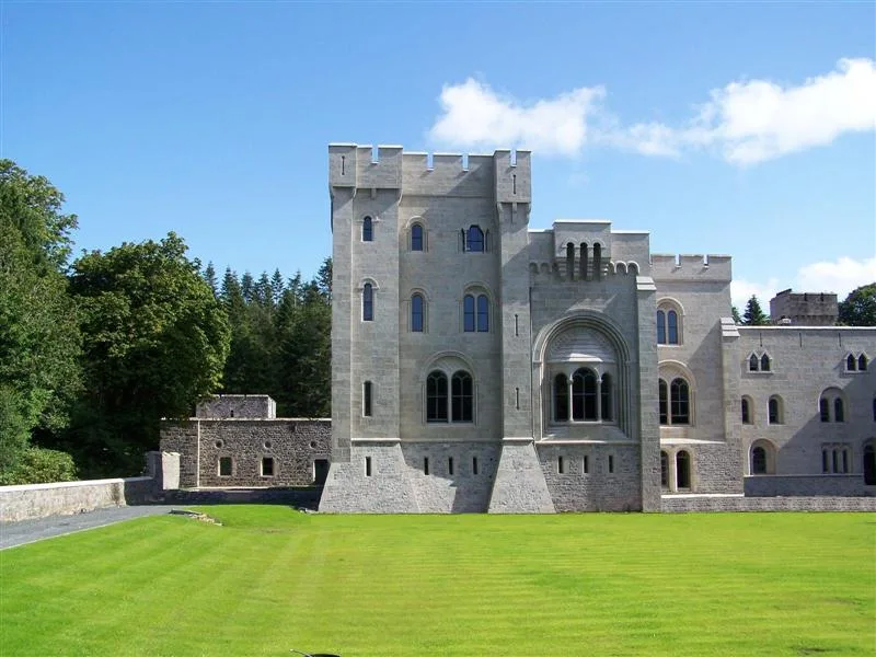
Gosford Forest Park
Archaeological sites · 3.6 km

The View
Campsites · 3.7 km

Dean Swift's Well
Natural landmarks · 3.7 km

The Maple
Campsites · 3.8 km
Tannyoky
Natural landmarks · 3.9 km
.jpg?width=1200)
Mavemacullen (Ballymore)
Natural landmarks · 4.0 km
Nearby
📷 5📷 5📷 3Towns & cities · Northern Ireland
Mountnorris
Mountnorris — village in County Armagh, Northern Ireland.
📷 5📷 4Natural landmarks · Northern Ireland
Orior Lower
Orior Lower in Northern Ireland, United Kingdom.
📷 4Towns & cities · Northern Ireland
Markethill
Markethill — village in County Armagh, Northern Ireland, United Kingdom.
Where to eat & stay near Loughgilly
Places to stay
📷 5📷 5 📷 4
📷 4Caravan parks · Northern Ireland
Clare Glen Caravan Park
Clare Glen Caravan Park — a caravan park in northern ireland.
 📷 5
📷 5Caravan parks · Northern Ireland
Slieve Gullion Getaways
Slieve Gullion Getaways — a caravan park in northern ireland.
 📷 5
📷 5Caravan parks · Northern Ireland
Kinnego Marina Camping & Caravanning
Kinnego Marina Camping & Caravanning — a caravan park in northern ireland.
Places to eat & drink
 📷 5
📷 5More natural landmarks in this region
 Flagship📷 4
Natural landmarks · Northern Ireland
Lough Erne
Lough Erne — lake in County Fermanagh, Northern Ireland, UK.
 Flagship📷 4
Natural landmarks · Northern Ireland
Lough Neagh
Lough Neagh — large lake in Northern Ireland.
 📷 3
📷 3Natural landmarks · Northern Ireland
Ballysaggart Lough
Ballysaggart Lough — lake in the United Kingdom.
 📷 5
📷 5Natural landmarks · Northern Ireland
Belmore Mountain
Belmore Mountain — mountain in the United Kingdom.
Frequently asked questions
- Where is Loughgilly?
- Loughgilly is in Northern Ireland, United Kingdom (postcode BT60 1RN).
- What is Loughgilly?
- Loughgilly in Northern Ireland, United Kingdom.
- How do I get to Loughgilly?
- The nearest railway station is Poyntzpass, about 7.2 km away. Drivers can use postcode BT60 1RN.
- Is Loughgilly free to visit?
- Yes, Loughgilly is free to enter.
- How do I get to Loughgilly?
- The nearest railway station is Poyntzpass, about 7.2 km away. Drivers can navigate to postcode BT60 1RN.