Historic churches · North East England
Longnewton
In or near Sadberge.
Longnewton in England North East, United Kingdom.

Hilary Jones — CC BY-SA 2.0 via Wikimedia Commons licence
%2C_Darlington_Road%2C_Longnewton_-_geograph.org.uk_-_7435387.jpg)
Plan your visit
- Typical visit
- 30 min–1 h
- Nearest railway station
- Allens West · 3.8 km
- Free entry
Getting there & planning your visit
To visit Longnewton church, the nearest railway station is Allens West, located 3.8 km away. The postcode for sat-nav is TS21 1DJ, and entry is free.
About
Longnewton is a place of interest in England North East, United Kingdom — drawn from open-data sources for visitor reference. See the linked Wikipedia article for the full description.
Photo gallery
From the Wikipedia article
Longnewton (also known as Long Newton) is a village and civil parish in the borough of Stockton-on-Tees and ceremonial county of Durham, England. The population taken at the 2001 Census was 733 increasing to 828 at the 2011 Census. It is situated between Darlington and Stockton-on-Tees. The village is mostly privately owned dwellings, and has a public house, The Derry, St. Mary's church and Saint Mary's Church of England primary school. Longnewton is not home to a secondary school however it is in the catchment area for Egglescliffe Secondary School, which is located 3 miles away and around a 10-minute drive. Located in the village is also a community centre, most commonly known as the Wilson Centre which has 3 different venue rooms, for a variety of activities and occasions. Longnewton is also a 10 minutes drive north of Teesside International Airport. In March 2007 a new bypass and junction on the A66 which runs just north of the village was created after almost 30 years of proposals, the junction was fully open to traffic in May 2008. A new roundabout has been put in place to service Teesside International Airport and ease traffic levels around the surrounding area.
Excerpt from Wikipedia under CC BY-SA 4.0. See the source article linked in Sources below.
Background
History
The historical population of Longnewton fluctuated numerous times according to early data, in 1801 the population was recorded at 295, this had increased to 325 in 1851 however during this 50-year period the population had fluctuated to 253 in 1811, 338 in 1821, 313 in 1831 and 293 in 1841. The next recorded date was 1871 where the population was counted at 313, however this is disputed as John Marius Wilson stated the population at this time was 353. At this point in time he also described part of the village stating it was home to 67 houses, as well as this he also wrote that there was a large manor, that was home to Marchioness of Londonderry and was valued at £604. By 1901 the…
Description
The Wilson Centre was built in 1886 donated by Rev. J. Wilson, the vicar of St Mary’s Church to be used to benefit the education of the population of Longnewton. The centre was built by Mr Kipling and cost a total of £380, it was subsequently named the Wilson Institute after Rev. J. Wilson himself. In 2003 it was decided to explore the option of using the building as a village hall. A £266,000 grant was obtained from the Big Lottery Community Halls Fund in 2008. The centre was refurbished and finally opened again in October 2009. The Wilson Centre offers three rooms, one of these providing seating for up to 80 people. and is £13 per hour. The other two rooms are smaller, and offer seating…
Sourced from Wikipedia under CC BY-SA 4.0.
- Coordinates
- 54.5412, -1.4138
- District
- Stockton-on-Tees
- Parish
- Longnewton
- Postcode
- TS21 1DJ
- Parliamentary constituency
- Stockton West
- Nearest railway station
- Allens West — 3.8 km
- Official site
- neighbourhood.statistics.gov.uk
Sources
- wikidata: Q6674170 (CC0)
- wikipedia: Longnewton (CC BY-SA 4.0)
Other places nearby
St Mary's Church, Longnewton
Historic churches · 0.3 km
Stockton West
Cathedrals · 0.3 km

Long Newton
Villages · 0.9 km

Larberry Pastures settlement site
Archaeological sites · 1.6 km

Larberry Pastures settlement site
Vineyards · 1.6 km

Elton
Historic churches · 2.2 km
Elton Home Park Residential
Caravan parks · 2.3 km

Urlay Nook
Natural landmarks · 2.6 km

Teesside Airport railway station
Heritage railway stations · 2.6 km

Whinney Hill
Natural landmarks · 2.7 km
GNAAS Statue
Memorials & monuments · 2.8 km
Scenic Air Tours North East
Natural landmarks · 2.9 km
Nearby
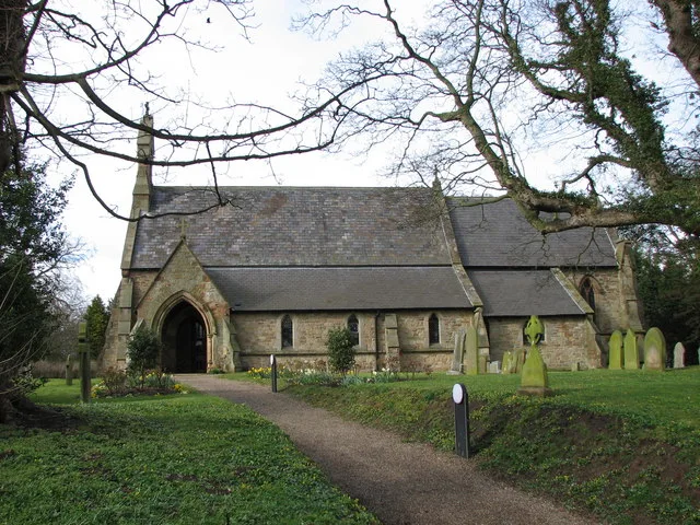
📷 5Historic churches · North East England
St Mary's Church, Longnewton
St Mary's Church, Longnewton — church in Longnewton, County Durham, England, UK.
📷 4Cathedrals · North East England
Stockton West
Stockton West in England North East, United Kingdom.
📷 5📷 2Archaeological sites · North East England
Larberry Pastures settlement site
Larberry Pastures settlement site — a archaeological in england-north-east, United Kingdom.
📷 2Vineyards · North East England
Larberry Pastures settlement site
Larberry Pastures settlement site — a UK vineyard in england north east, producing English or Welsh wine from cool-climate grape varieties.
📷 4Where to eat & stay near Longnewton
Places to stay
📷 5Caravan parks · North East England
Elton Home Park Residential
Elton Home Park Residential — a caravan park in england north east.
 📷 5
📷 5Hostels · North East England
Bridge House Hostel
Bridge House Hostel — a hostel in england north east.
📷 5Hostels · North East England
Bridge House Hostel
Bridge House Hostel — a hostel in england north east.
 📷 5
📷 5Hotels · North East England
Hampton by Hilton Stockton on Tees
Hampton by Hilton Stockton on Tees — a hotel in england north east. 3-star. Brand: Hampton.
 📷 5
📷 5Caravan parks · North East England
White Water Park Caravan Club Site
White Water Park Caravan Club Site — a caravan park in england north east.
 📷 5
📷 5Places to eat & drink
 📷 5
📷 5Historic pubs · North East England
The Three Tuns Public House
The Three Tuns Public House in England North East, United Kingdom.
 📷 5
📷 5Historic pubs · North East England
The Ketton Ox Public House
The Ketton Ox Public House in England North East, United Kingdom.
 📷 5
📷 5Restaurants · North East England
Borrelli Delicatessen
Borrelli Delicatessen — a restaurant in england north east.
 📷 5
📷 5Restaurants · North East England
Soul Curry
Soul Curry — a restaurant in england north east.
 📷 5
📷 5Historic pubs · North East England
1 Bridgewater, Levenbank
1 Bridgewater, Levenbank in England North East, United Kingdom.
 📷 7
📷 7Historic pubs · North East England
The Boot And Shoe Public House
The Boot And Shoe Public House in England North East, United Kingdom.
More places in this region
 📷 3
📷 3Historic churches · North East England
Church of St Andrew
Church of St Andrew — Grade I listed church in Winston, County Durham, England, UK.
 📷 3
📷 3Historic churches · North East England
Church of St Andrew
Church of St Andrew — Grade I listed church, County Durham, England, UK.
 📷 3
📷 3Historic churches · North East England
Church of St Mary
Church of St Mary — Grade I listed church in Gainford, County Durham, England, UK.
 📷 3
📷 3Historic churches · North East England
Church of St Mary
Church of St Mary — church in Barnard Castle, County Durham, England, UK.
Frequently asked questions
- Where is Longnewton?
- Longnewton is in North-East England, United Kingdom (postcode TS21 1DJ), in the parish of Longnewton.
- What is Longnewton?
- Longnewton in England North East, United Kingdom.
- How do I get to Longnewton?
- The nearest railway station is Allens West, about 3.8 km away. Drivers can use postcode TS21 1DJ.
- Is Longnewton free to visit?
- Yes, Longnewton is free to enter.
- How do I get to Longnewton?
- The nearest railway station is Allens West, about 3.8 km away. Drivers can navigate to postcode TS21 1DJ.