Castles · Central Scotland
Lochgilphead
Also known as: Ceann Loch Gilb
In or near Ardrishaig.
Lochgilphead in Scotland Islands, United Kingdom.

Chris Minto — CC BY-SA 2.0 via Wikimedia Commons licence
_-_geograph.org.uk_-_6521063.jpg)
Plan your visit
- Typical visit
- 1.5 h–3 h
- Family-friendly
- Limited wheelchair access
About
Lochgilphead is a place of interest in Scotland Islands, United Kingdom — drawn from open-data sources for visitor reference. See the linked Wikipedia article for the full description.
Photo gallery
360° viewimagery from 2024
Imagery © Mapillary contributors, CC BY-SA 4.0
From the Wikipedia article
Lochgilphead (; Scottish Gaelic: Ceann Loch Gilb [kʲʰan̪ˠ l̪ˠɔx ˈkʲilip]) is a town and former burgh in Argyll and Bute, Scotland, with a population of around 2,300 people. It is the administrative centre of Argyll and Bute Council. The village lies at the end of Loch Gilp (a branch of Loch Fyne) and lies on the banks of the Crinan Canal. Lochgilphead sits on the A83, with Ardrishaig 2 miles (3 km) to the south and Inveraray 24 miles (39 km) to the north-east; Oban lies 37 miles (60 km) north on the A816. The council is based at Kilmory Castle, around which is located a woodland park and an Iron Age fort. Forestry and Land Scotland also have an office there.
Excerpt from Wikipedia under CC BY-SA 4.0. See the source article linked in Sources below.
Background
History
As a planned settlement, Lochgilphead was created in 1790, shortly after the completion of a road from Inveraray to Campbeltown. After the completion of the Crinan Canal in 1801, the town became more important as a link across the Kintyre peninsula. When a road was completed in 1830, Lochgilphead was linked to Oban. In 1831 a pier was built, promoting maritime transit between Lochgilphead and Glasgow, and other ports along the Irish Sea. s.]] In 1975 Lochgilphead was chosen as the administrative headquarters of the Argyll and Bute District Council as part of local government reorganisation, due to its central location. There are a large number of Neolithic remains, including cup and ring…
Sourced from Wikipedia under CC BY-SA 4.0.
- Coordinates
- 56.0400, -5.4400
- District
- Argyll and Bute
- Postcode
- PA31 8NN
- Parliamentary constituency
- Argyll, Bute and South Lochaber
- Established
- 1790
Sources
- wikidata: Q1017159 (CC0)
- wikipedia: Lochgilphead (CC BY-SA 4.0)
Other places nearby

Christ Church, Bishopston Road, Lochgilphead
Historic churches · 0.2 km

Lochgilphead Caravan Park
Campsites · 0.2 km

Lochgilphead Parish Church
Historic churches · 0.5 km

Lochgilphead War Memorial
Memorials & monuments · 0.6 km

Kilmory Quay, Lochgilphead
Marinas · 0.9 km

Mid Argyll Community Hospital
Other places · 1.1 km

Argyll and Bute Hospital
Historic houses · 1.3 km

Stane Alane, standing stone 190m S of Corbiere
Windmills · 1.6 km
standing stone 275m SSW of Achnabreck
Windmills · 1.9 km

Kilmory Castle
Castles · 1.9 km

Glengilp distillery
Distilleries · 2.0 km

Achnabreck Eastern Rock
Natural landmarks · 2.3 km
Nearby
📷 5Historic churches · Central Scotland
Christ Church, Bishopston Road, Lochgilphead
Christ Church, Bishopston Road, Lochgilphead — category B listed building-listed church in scotland-highlands, United Kingdom.
📷 5Campsites · Central Scotland
Lochgilphead Caravan Park
Lochgilphead Caravan Park — a campsite in scotland highlands.
📷 5Historic churches · Central Scotland
Lochgilphead Parish Church
Lochgilphead Parish Church — category B listed building-listed church in scotland-highlands, United Kingdom.
📷 3Memorials & monuments · Central Scotland
Lochgilphead War Memorial
Lochgilphead War Memorial — a memorial in scotland-highlands, United Kingdom.
📷 5Marinas · Central Scotland
Kilmory Quay, Lochgilphead
Kilmory Quay, Lochgilphead — a marina in scotland highlands.
📷 4Other places · Central Scotland
Mid Argyll Community Hospital
Mid Argyll Community Hospital in Scotland Islands, United Kingdom.
Where to eat & stay near Lochgilphead
Places to stay
📷 5Campsites · Central Scotland
Lochgilphead Caravan Park
Lochgilphead Caravan Park — a campsite in scotland highlands.
 📷 5
📷 5 📷 5
📷 5Campsites · Central Scotland
Leachive Caravan Park
Leachive Caravan Park — a campsite in scotland highlands.
 📷 5
📷 5Campsites · Central Scotland
Glendaruel Caravan & Camping Park
Glendaruel Caravan & Camping Park — a campsite in scotland highlands.
 📷 5
📷 5Caravan parks · Central Scotland
Ardfern Motorhome Park
Ardfern Motorhome Park — a caravan park in scotland highlands.
 📷 5
📷 5Caravan parks · Central Scotland
Strathlachlan Caravan Park
Strathlachlan Caravan Park — a caravan park in scotland highlands.
Places to eat & drink
 📷 7
📷 7Historic pubs · Central Scotland
Cairnbaan Hotel, Crinan Canal
Cairnbaan Hotel, Crinan Canal in Scotland Central, United Kingdom.
More castles in this region
 📷 3
📷 3 📷 2
📷 2 📷 4
📷 4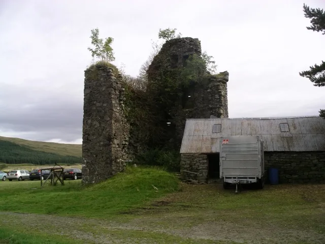 📷 3
📷 3Castles · Central Scotland
Achallader Castle
Achallader Castle — castle in Argyll and Bute, Scotland, UK.
Frequently asked questions
- Where is Lochgilphead?
- Lochgilphead is in the Scottish Highlands, United Kingdom (postcode PA31 8NN).
- What is Lochgilphead?
- Lochgilphead in Scotland Islands, United Kingdom.
- How do I get to Lochgilphead?
- Drivers can use postcode PA31 8NN.
- When was Lochgilphead built?
- Built or established in 1790.
- Does Lochgilphead charge admission?
- Lochgilphead typically charges admission. Check the official site for current ticket prices and opening hours.
- How do I get to Lochgilphead?
- Drivers can navigate to postcode PA31 8NN. It sits within the Argyll, Bute and South Lochaber parliamentary constituency.