
Natural landmarks · Scottish Lowlands
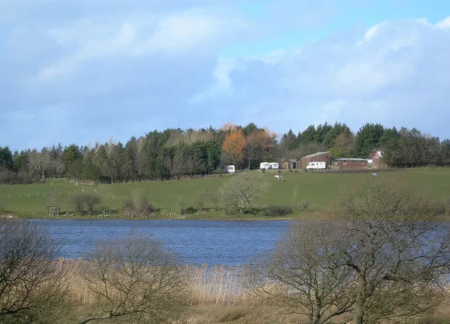
Loch Fergus
In or near Coylton.
Loch Fergus — lake in South Ayrshire, Scotland, UK, outflows west via a watercousrse to Snipe Loch.

Wikimedia Commons contributors — see linked file page for photographer and licence licence

Plan your visit
- Typical visit
- 1 h–2 h
- Nearest railway station
- Ayr · 6.1 km
- Free entry
- Dog-friendly
Getting there & planning your visit
To visit Loch Fergus in the Scottish Lowlands, the nearest railway station is Ayr, located 6.1 km away. The postcode for Loch Fergus is KA6 6ER, which can be used for sat-nav coordinates. Entry to the site is free.
About
Loch Fergus is a named natural landmark in the United Kingdom. Wikidata describes it as: "lake in South Ayrshire, Scotland, UK, outflows west via a watercousrse to Snipe Loch". Coordinates: 55.4316°, -4.5409°.
Photo gallery
From the Wikipedia article
Loch Fergus (NS 3932 1823) is a freshwater post-glacial "Kettle Hole" sometimes recorded as Fergus Loch. It is quite visible and is situated in a low-lying area close to the B742 road between the farms and dwellings of Trees, Lochfergus and Bowmanston in the Parish of Ayr, South Ayrshire, Scotland. The loch lies to the north of Martnaham Loch, four miles (six kilometres) east-southeast of Ayr. It drains to the southwest into the Snipe Loch.
Excerpt from Wikipedia under CC BY-SA 4.0. See the source article linked in Sources below.
Background
History
The ground running towards Mossend Farm is marshy and prone to extensive flooding, indicating the previous extent of the loch. The outflow is a drain and once higher water levels are illustrated by physical indications of the once higher loch margins. In the work titled A Summary of the Character of Scotland dated 1624 it is stated that Loch Fergus, with an isle with many growing trees, where a great quantity of heron resort with the loch seal. There is a decayed monastery in it. Loch Fergus is mentioned in the charter of the Burgh of Ayr from King William in 1205, when the boundary of the burgh is delineated.
Description
The roughly oval island, around 190 yd long and 0.814 ha in area, is said to have been reached by a causeway, no longer extant, that ran from the bank near Lochfergus Farm. Two totally formless low mounds of boulders are located on the island which may be the remains of a building. The 25 in OS map indicates a small rectangular structure near the centre of the island. An anglers club-house was constructed in 1976 ten metres from the ruins. The island is covered in dense vegetation. The island is designated by the Scottish Wildlife Trust as a Local Nature Conservation Site (LNCS) and maps show that it has long been covered in woodland.
Sourced from Wikipedia under CC BY-SA 4.0.
- Coordinates
- 55.4316, -4.5409
- District
- South Ayrshire
- Postcode
- KA6 6ER
- Parliamentary constituency
- Ayr, Carrick and Cumnock
- Nearest railway station
- Ayr — 6.1 km
Sources
- wikidata: Q6664917 (CC0)
- wikipedia: Loch Fergus (CC BY-SA 4.0)
- commons: Fergus Loch - geograph.org.uk - 178763.jpg (CC BY-SA 4.0)
Other places nearby
Martnaham Loch
Natural landmarks · 0.9 km

Martnaham Castle
Castles · 0.9 km

Martnaham Castle
Literary houses · 0.9 km
Snipe Loch
Natural landmarks · 1.1 km

Roodlea Golf Centre
Golf courses · 1.2 km

Martnaham Loch
Lakes · 1.7 km

Coylton
Towns & cities · 1.9 km

Lindston House Henge
Archaeological sites · 2.0 km

Lindston Henge
Archaeological sites · 2.5 km

Lochend Loch
Natural landmarks · 2.7 km

Sundrum Castle Holiday Park
Caravan parks · 2.7 km

Lindston Loch
Natural landmarks · 2.9 km
Nearby
📷 5Natural landmarks · Scottish Lowlands
Martnaham Loch
Martnaham Loch — lake in East Ayrshire, Scotland, UK, outflows west to Perclewan Burn.
📷 3Castles · Scottish Lowlands
Martnaham Castle
Martnaham Castle — a castle in Scottish Lowlands, United Kingdom.
📷 4Literary houses · Scottish Lowlands
Martnaham Castle
Martnaham Castle — a literary house museum in scotland lowlands.
📷 5Natural landmarks · Scottish Lowlands
Snipe Loch
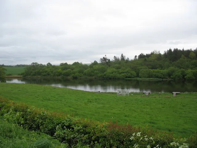
Snipe Loch — lake in East Ayrshire, Scotland, UK, outflows south-east to Martnaham Loch.
📷 3Golf courses · Scottish Lowlands
Roodlea Golf Centre
Roodlea Golf Centre — golf course in South Ayrshire, Scotland, UK.
📷 5Where to eat & stay near Loch Fergus
Places to stay
📷 5Caravan parks · Scottish Lowlands
Sundrum Castle Holiday Park
Sundrum Castle Holiday Park — a caravan park in scotland lowlands. Brand: Parkdean Resorts.
 📷 5
📷 5Caravan parks · Scottish Lowlands
Crofthead Holiday Park
Crofthead Holiday Park — a caravan park in scotland lowlands.
 📷 5
📷 5Caravan parks · Scottish Lowlands
Ayr Cragie Gardens Caravan Club
Ayr Cragie Gardens Caravan Club — a caravan park in scotland lowlands.
 📷 6
📷 6 📷 5
📷 5Caravan parks · Scottish Lowlands
Craig Tara
Craig Tara — a caravan park in scotland lowlands.
 📷 5
📷 5Caravan parks · Scottish Lowlands
Dutch House Caravan Park
Dutch House Caravan Park — a caravan park in scotland highlands.
Places to eat & drink
 📷 5
📷 5Historic pubs · Scottish Lowlands
Railway Tavern, 18 Smith Street, Ayr
Railway Tavern, 18 Smith Street, Ayr in Scotland Lowlands, United Kingdom.
 📷 5
📷 5Historic pubs · Scottish Lowlands
The White House and Adjoining Joiner's Shop, Kirkmichael Arms, Straiton Road, Kirkmichael
The White House and Adjoining Joiner's Shop, Kirkmichael Arms, Straiton Road, Kirkmichael in Scotland Lowlands, United Kingdom.
 📷 7
📷 7Historic pubs · Scottish Lowlands
Commercial Inn, 1-3 Mill Street, Ochiltree
Commercial Inn, 1-3 Mill Street, Ochiltree in Scotland Lowlands, United Kingdom.
 📷 5
📷 5Historic pubs · Scottish Lowlands
Doon Tavern, High Street, Dalmellington
Doon Tavern, High Street, Dalmellington in Scotland Lowlands, United Kingdom.
 📷 5
📷 5Historic pubs · Scottish Lowlands
The Sun Inn, 23 The Square, Cumnock
The Sun Inn, 23 The Square, Cumnock in Scotland Lowlands, United Kingdom.
 📷 5
📷 5Historic pubs · Scottish Lowlands
The Clansman, 58, 60, 62 John Finnie Street, Kilmarnock
The Clansman, 58, 60, 62 John Finnie Street, Kilmarnock in Scotland Central, United Kingdom.
More natural landmarks in this region
 📷 5
📷 5Natural landmarks · Scottish Lowlands
Birkenside
Birkenside in England North East, United Kingdom.
 📷 4
📷 4Natural landmarks · Scottish Lowlands
River Teviot
River Teviot in England North East, United Kingdom.
 📷 5
📷 5Natural landmarks · Scottish Lowlands
River Leader
River Leader in England North East, United Kingdom.
 📷 4
📷 4Natural landmarks · Scottish Lowlands
Makerstoun
Makerstoun in England North East, United Kingdom.
Frequently asked questions
- Where is Loch Fergus?
- Loch Fergus is in the Scottish Lowlands, United Kingdom (postcode KA6 6ER).
- What is Loch Fergus?
- Loch Fergus — lake in South Ayrshire, Scotland, UK, outflows west via a watercousrse to Snipe Loch.
- How do I get to Loch Fergus?
- The nearest railway station is Ayr, about 6.1 km away. The nearest town is Coylton. Drivers can use postcode KA6 6ER.
- Is Loch Fergus free to visit?
- Yes, Loch Fergus is free to enter.
- How do I get to Loch Fergus?
- The nearest railway station is Ayr, about 6.1 km away. Drivers can navigate to postcode KA6 6ER.