Country parks · London
Lloyd Park
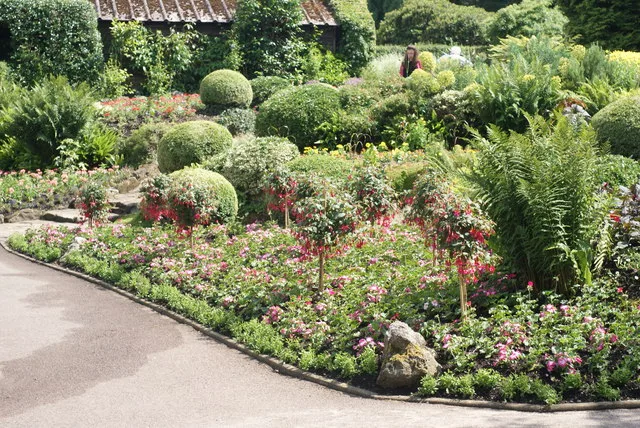
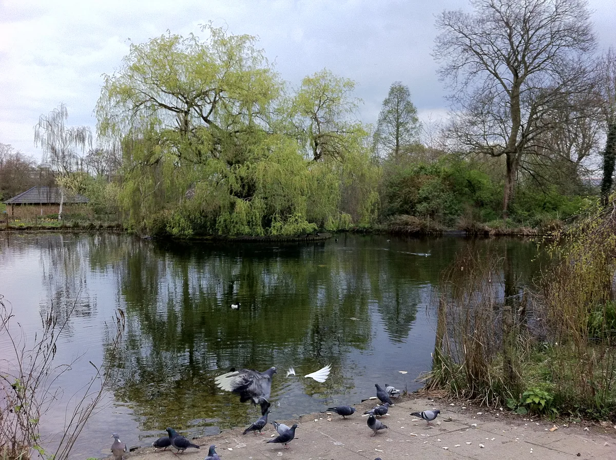
Lloyd Park — public park in Croydon, UK.

Wikimedia Commons contributors — see linked file page for photographer and licence licence
Plan your visit
- Typical visit
- 1.5 h–3 h
- Nearest railway station
- South Croydon · 1.0 km
- Free entry
- Family-friendly
- Dog-friendly
About
Lloyd Park is a country park in the United Kingdom. Records date its origin to 1927. It covers approximately 114 km². Wikidata describes it as: "public park in Croydon, UK". Coordinates: 51.3640°, -0.0795°.
Photo gallery
From the Wikipedia article
Lloyd Park (also known as Lloyd Country Park) is a 114 acres (46 ha) park on the outskirts of central Croydon, Greater London, managed by the London Borough of Croydon. It is bordered by Coombe Road to the south and Lloyd Park Avenue to the west. To the north, access is from Deepdene and Mapledale Avenue, and the park adjoins Grimwade Avenue and Addiscombe Cricket Club. To the east the park is bordered by Shirley Park Golf Course. It was created from land owned by Frank Lloyd (son of Edward Lloyd) a newspaper proprietor who died in 1927 which was bequeathed to the Borough of Croydon by his family, after his death. The Tramlink, New Addington line, runs along the southern edge of the park parallel to Coombe Road. Lloyd Park hosts Lloyd parkrun every Saturday morning at 9 am and Lloyd junior parkrun every Sunday morning at 9 am.
Excerpt from Wikipedia under CC BY-SA 4.0. See the source article linked in Sources below.
Background
Description
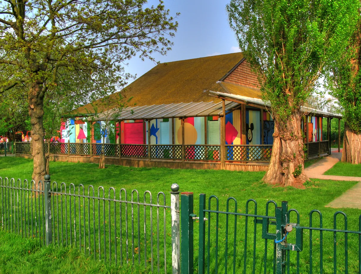
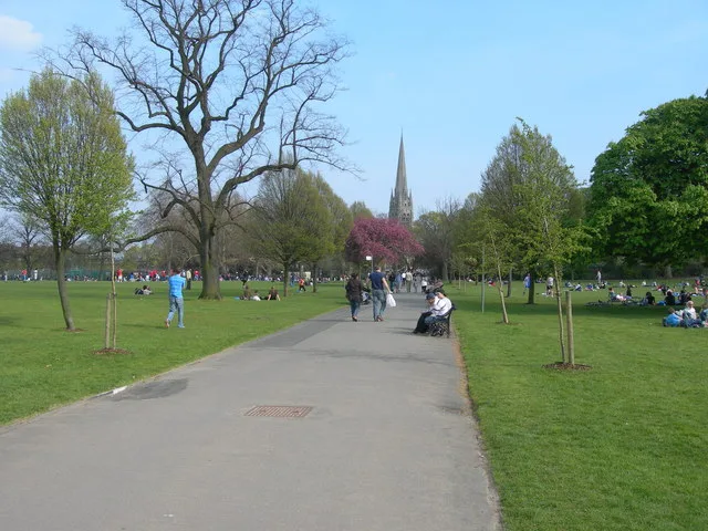
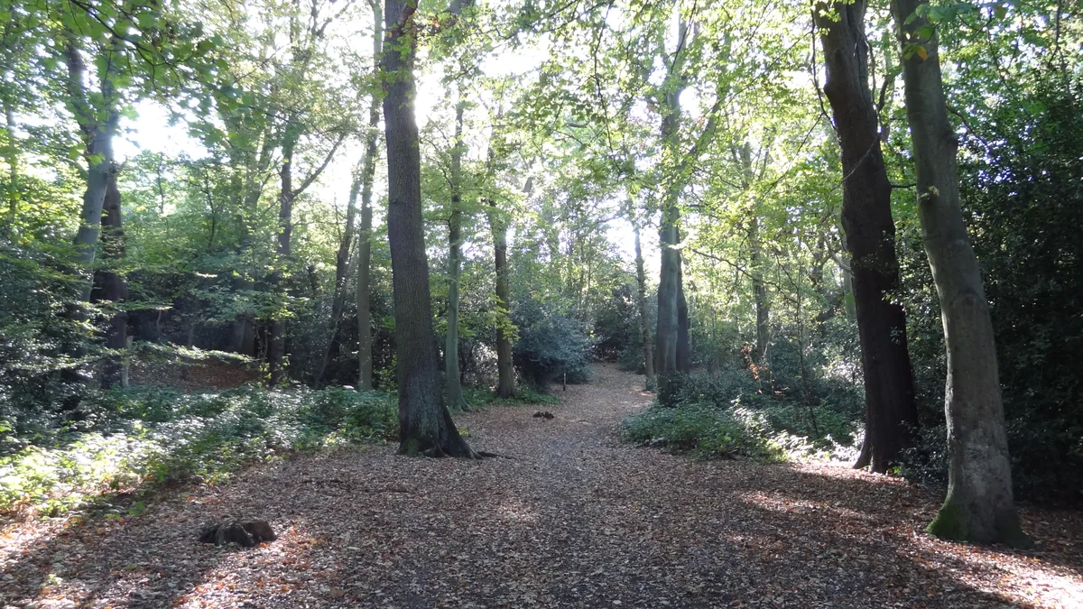
The park is not enclosed, as would typically be the case for suburban parks. Coombe Road is bordered by a low hedge and grass-covered earth banks have been raised along the open Lloyd Park Avenue side to deter vehicular access. It is open 24 hours a day throughout the year. The main entrance is from Coombe Road, immediately adjacent to the Lloyd Park tram stop, where two car-parking areas are available. 'The Lounge Cafe' is also sited next to the car parks. Facilities available include rugby and football pitches, bowls, hard court tennis, children's playground, car parking, cafe, open-air gymnasium, disc golf, changing rooms and facilities, orienteering, cross country courses, horse riding…
Sourced from Wikipedia under CC BY-SA 4.0.
- Coordinates
- 51.3640, -0.0795
- District
- Croydon
- Parish
- Croydon, unparished area
- Postcode
- CR0 5RA
- Parliamentary constituency
- Croydon South
- Established
- 1927
- Nearest railway station
- South Croydon — 1 km
Sources
- wikidata: Q63491467 (CC0)
- wikipedia: Lloyd Park (Croydon) (CC BY-SA 4.0)
- commons: Lloyd Park, Croydon.jpg (CC BY-SA 4.0)
Other places nearby
Loading nearby places…
Nearby
 📷 5
📷 5Natural landmarks · London
Rutherford School
Rutherford School — a school heritage in england-london, United Kingdom.
 📷 5
📷 5Chapels · London
Coombe
Coombe — a methodist chapel in england-london, United Kingdom.
 Flagship📷 10
Country parks · London
Coombe Wood
Coombe Wood — woodland and garden area in the London Borough of Croydon.
 📷 5
📷 5Memorials & monuments · London
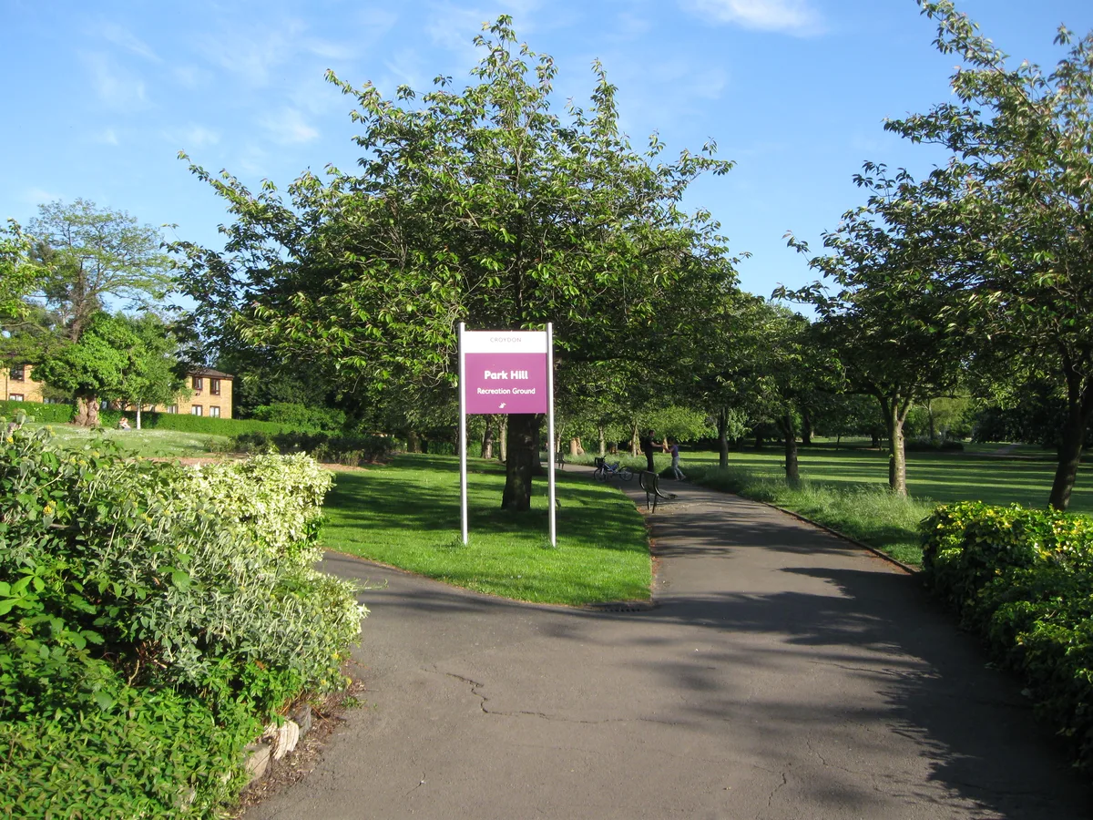
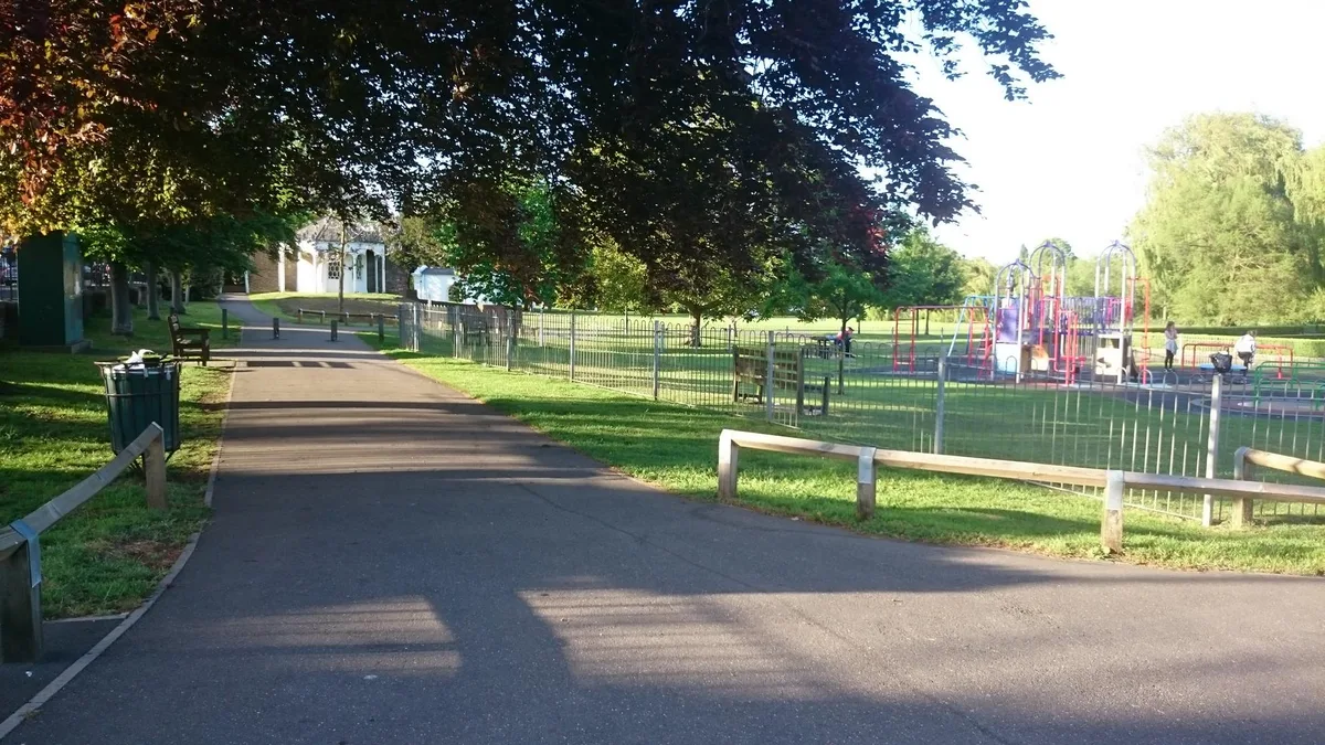
Park Hill Water Tower (In Park Hill Recreation Ground)
Park Hill Water Tower (In Park Hill Recreation Ground) — a water tower in england-london, United Kingdom.
 📷 5
📷 5Memorials & monuments · London
John Horniman and Frederick John Horniman
John Horniman and Frederick John Horniman — a memorial in england-london, United Kingdom.
 Flagship📷 10
Parks · London
Park Hill Recreation Ground
Park Hill Recreation Ground is a park in the United Kingdom.
Other places from this era
 📷 5
📷 5Country parks · London
Coronation Gardens
Coronation Gardens — park in the London Borough of Havering, England, UK.
 📷 5
📷 5Country parks · London
Lyle Park
Lyle Park — Riverside park in east London.
 📷 5
📷 5Country parks · London
Radnor Gardens
Radnor Gardens — park in Strawberry Hill, London.
 📷 5
📷 5Country parks · London
Sydenham Wells Park
Sydenham Wells Park — park in London, England.
More places in this region
 Flagship📷 10
Country parks · London
Brockwell Park
Brockwell Park — park in south London, England, UK.
 Flagship📷 10
Country parks · London
Clissold Park
Clissold Park — park in Stoke Newington, London.
Flagship📷 10Country parks · London
Coombe Wood
Coombe Wood — woodland and garden area in the London Borough of Croydon.
 Flagship📷 10
Country parks · London
Croham Hurst
Croham Hurst — woodland in Croydon, Greater London, England, United Kingdom.
Frequently asked questions
- Where is Lloyd Park?
- Lloyd Park is in London, United Kingdom (postcode CR0 5RA), in the parish of Croydon, unparished area.
- When was Lloyd Park built?
- Built or established in 1927.
- Who owns Lloyd Park?
- Lloyd Park is owned by London Borough of Croydon.
- Is Lloyd Park free to visit?
- Yes, Lloyd Park is free to enter.
- How do I get to Lloyd Park?
- The nearest railway station is South Croydon, about 1.0 km away. Drivers can navigate to postcode CR0 5RA.