
Castles · South Wales
Llangynwyd Castle
Llangynwyd Castle — castle in Bridgend County Borough, Wales, UK.

Wikimedia Commons contributors — see linked file page for photographer and licence licence

Plan your visit
- Typical visit
- 1.5 h–3 h
- Nearest railway station
- Garth (Bridgend) · 1.7 km
- Family-friendly
- Limited wheelchair access
Getting there & planning your visit
To visit Llangynwyd Castle, the nearest railway station is Garth (Bridgend), located 1.7 km away. The postcode for sat-nav is CF34 9SB. Please note that accessibility is limited for wheelchair users.
About
Llangynwyd Castle is a castle in the United Kingdom — fortified architecture from the medieval, Tudor, or Victorian-revival period. Heritage designation: scheduled monument. Wikidata describes it as: "castle in Bridgend County Borough, Wales, UK". Coordinates: 51.5853°, -3.6593°.
Photo gallery
From the Wikipedia article
Llangynwyd Castle is a ruined castle, probably of the 12th century, in Llangynwyd, in Bridgend County Borough, South Wales, just to the south of Maesteg.
Excerpt from Wikipedia under CC BY-SA 4.0. See the source article linked in Sources below.
Background
History
In medieval times it was a prominent outpost in the Gorfynydd Cantref uplands of the lordship of Glamorgan, it is believed to have been annexed in around 1147, and it was mentioned in documents in 1246. The castle was plundered in 1258 and underwent a reconstruction but it was burned down in around 1293-4 and likely never rebuilt.
Architecture
The Royal Commission on the Ancient and Historical Monuments of Wales describes the ruined castle as occupying the "tip of a steep sided spur between two streams" and consisting of a "heart shaped walled inner court some 35-39m across set at the south-east end of a larger outer court". The twin-towered gatehouse overlooking the outer court was said to resemble that of the great gatehouse at Caerphilly Castle. It is believed to date to the time of the rebuilding in the 1260s. The inner court is surrounded by a deep ditch, except on the northeastern side. The curtain wall around it is in a poorly degraded state, and possibly predates 1257. Several of the building foundations can still be seen…
Sourced from Wikipedia under CC BY-SA 4.0.
- Coordinates
- 51.5853, -3.6593
- District
- Bridgend
- Parish
- Llangynwyd Middle
- Postcode
- CF34 9SB
- Parliamentary constituency
- Aberafan Maesteg
- Nearest railway station
- Garth (Bridgend) — 1.7 km
- Official site
- www.castlewales.com
Sources
- wikidata: Q23726802 (CC0)
- wikipedia: Llangynwyd Castle (CC BY-SA 4.0)
- commons: Llangynwyd Castle gateway.jpg (CC BY-SA 4.0)
Other places nearby

The Hopcyn Cross
Memorials & monuments · 0.6 km

Jenkins Monument in the churchyard, Church of St Cynwyd
Memorials & monuments · 0.6 km
St Cynwyd's Church
Historic churches · 0.6 km

Llangynwyd
Villages · 0.6 km

Mynydd Troed-y-rhiw
Mountains & hills · 0.9 km

Moel Troed-Y-Rhiw
Mountains & hills · 0.9 km

Y Bwlwarcau Iron Age hillfort
Hill forts · 1.3 km
Twmpath Diwlith
Archaeological sites · 1.4 km

Llwdarth
Literary houses · 1.6 km

Bodvoc's Stone
Archaeological sites · 2.1 km

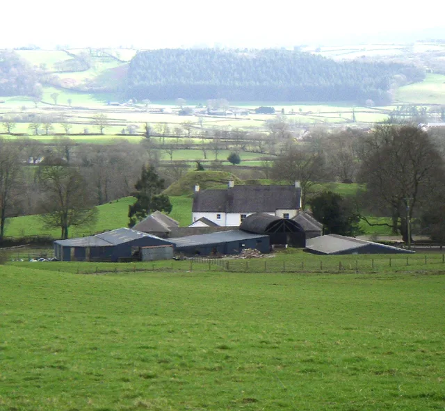
Farmstead
Archaeological sites · 2.1 km

Maes-Cadlawr
Vineyards · 2.1 km
Nearby
📷 3Memorials & monuments · South Wales
The Hopcyn Cross
The Hopcyn Cross is a memorial in the United Kingdom.
📷 5Memorials & monuments · South Wales
Jenkins Monument in the churchyard, Church of St Cynwyd
Jenkins Monument in the churchyard, Church of St Cynwyd — Grade II listed building-listed memorial in wales-south, United Kingdom.
📷 5Historic churches · South Wales
St Cynwyd's Church
St Cynwyd's Church — Grade II* listed building-listed church in wales-south, United Kingdom.
📷 5📷 5Mountains & hills · South Wales
Mynydd Troed-y-rhiw
Mynydd Troed-y-rhiw — a hill or mountain in wales south.
📷 5Mountains & hills · South Wales
Moel Troed-Y-Rhiw
Moel Troed-Y-Rhiw — mountain in wales south. Elevation: 234 m.
Where to eat & stay near Llangynwyd Castle
Places to stay
 📷 5
📷 5Campsites · South Wales
Red rock camping
Red rock camping — a campsite in wales south.
 📷 5
📷 5 📷 5
📷 5Caravan parks · South Wales
Cae Garw Caravan Site
Cae Garw Caravan Site — a caravan park in wales south.
 📷 7
📷 7 📷 5
📷 5 📷 5
📷 5Places to eat & drink
 📷 7
📷 7Historic pubs · South Wales
Tŷ Mawr Aka The Great House
Tŷ Mawr Aka The Great House in Wales South, United Kingdom.
 📷 5
📷 5Restaurants · South Wales
Bagle Brook
Bagle Brook — a restaurant in wales south. Cuisine: burger;steak house. Brand: Beefeater.
 📷 7
📷 7 📷 3
📷 3Restaurants · South Wales
The Golden Mile
The Golden Mile — a restaurant in wales south.
 📷 5
📷 5Restaurants · South Wales
The Old Mill
The Old Mill — a restaurant in wales south. Cuisine: american. Brand: Harvester.
 📷 5
📷 5More castles in this region
 📷 5
📷 5Castles · South Wales
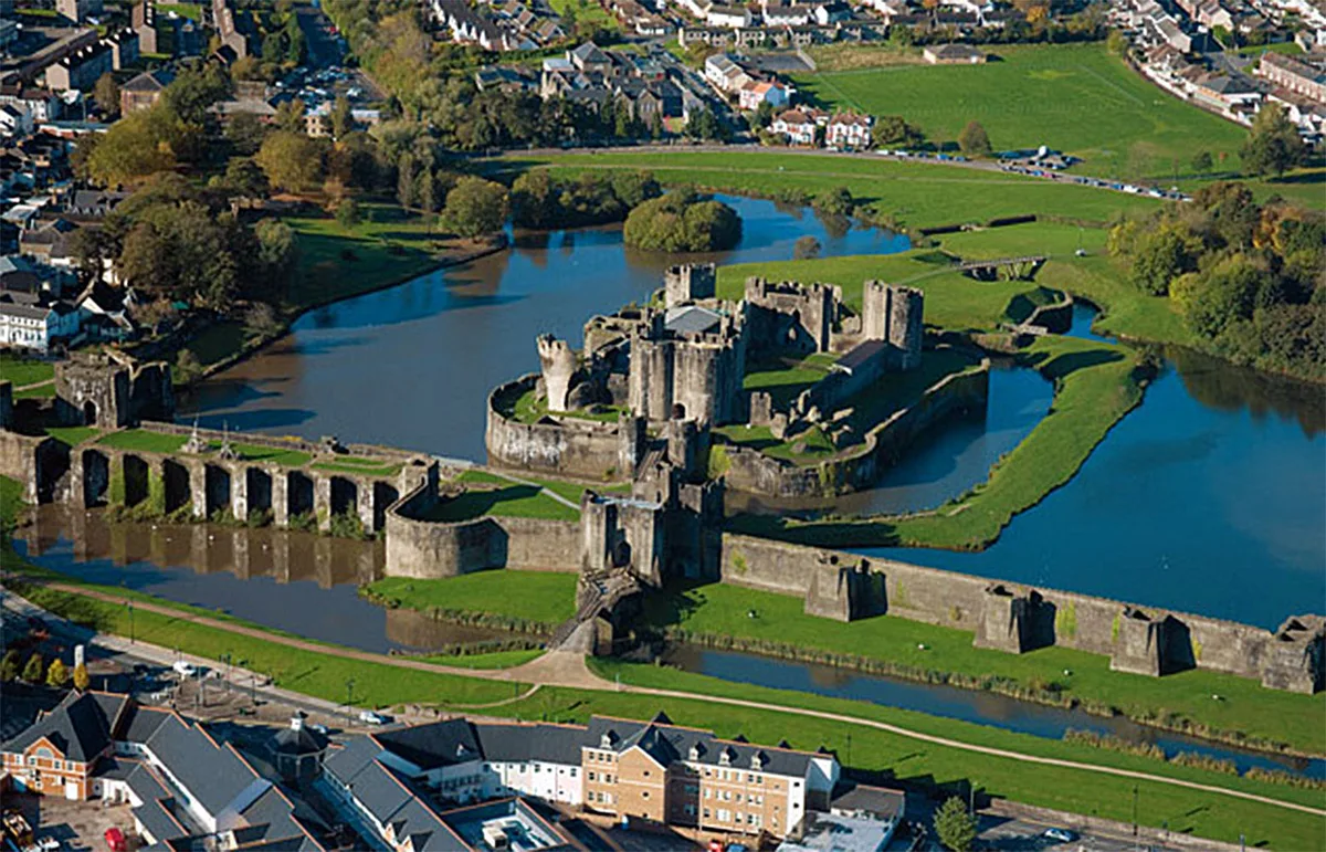
Caerphilly Castle
Caerphilly Castle — castle in Caerphilly, Wales.
 📷 3
📷 3Castles · South Wales
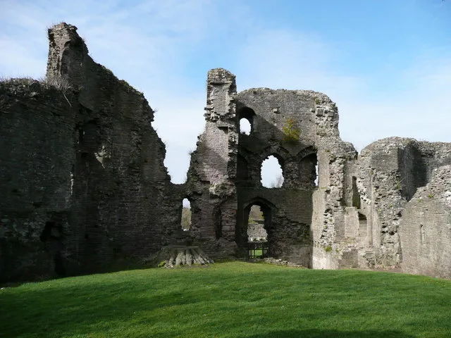
Abergavenny Castle
Abergavenny Castle — Grade I listed building in Abergavenny. Ruined castle in the market town of Abergavenny, Monmouthshire, Wales.
 📷 3
📷 3 📷 3
📷 3Frequently asked questions
- Where is Llangynwyd Castle?
- Llangynwyd Castle is in South Wales, United Kingdom (postcode CF34 9SB), in the parish of Llangynwyd Middle.
- What is Llangynwyd Castle?
- Llangynwyd Castle — castle in Bridgend County Borough, Wales, UK.
- How do I get to Llangynwyd Castle?
- The nearest railway station is Garth (Bridgend), about 1.7 km away. Drivers can use postcode CF34 9SB.
- Is Llangynwyd Castle a listed building?
- Llangynwyd Castle is officially recognised as scheduled monument listed.
- Does Llangynwyd Castle charge admission?
- Llangynwyd Castle typically charges admission. Check the official site for current ticket prices and opening hours.
- How do I get to Llangynwyd Castle?
- The nearest railway station is Garth (Bridgend), about 1.7 km away. Drivers can navigate to postcode CF34 9SB.