
Historic churches · North Wales
Llanfair-Mathafarn-Eithaf
In or near Llanfairpwllgwyngyll.
Llanfair-Mathafarn-Eithaf (Welsh pronunciation: [ˌɬanvair maˈθavarn ˈei̯θav]) is a parish and community in Anglesey, Wales including the small seaside town of Benllech. The community population taken

Gordon Hatton — CC BY-SA 2.0 via Wikimedia Commons licence

Plan your visit
- Typical visit
- 30 min–1 h
- Free entry
About
Llanfair-Mathafarn-Eithaf (Welsh pronunciation: [ˌɬanvair maˈθavarn ˈei̯θav]) is a parish and community in Anglesey, Wales including the small seaside town of Benllech. The community population taken at the 2011 census was 3,382. Local buildings include the medieval St Mary's Church, where the 18th century poet Goronwy Owen once served as curate. The parish has five Scheduled Monuments, including two collections of hut circles and the stone remains of a dolmen type Neolithic burial mound, called the Pant-y-Saer Cromlech. The remains of a Viking Age settlement have also been found in the parish. The parish lies on an area of Carboniferous Limestone and supports a variety of wildlife, including red squirrels. The Cors Goch nature reserve is a rich fenland habitat in the west of the parish and is designated an SSSI. Other settlements include Brynteg, Llanbedrgoch, Tyn-y-Gongl, and Red Wharf Bay.
Photo gallery
From the Wikipedia article
Llanfair-Mathafarn-Eithaf (Welsh pronunciation: [ˌɬanvair maˈθavarn ˈei̯θav]) is a parish and community in Anglesey, Wales including the small seaside town of Benllech. The community population taken at the 2011 census was 3,382. Local buildings include the medieval St Mary's Church, where the 18th century poet Goronwy Owen once served as curate. The parish has five Scheduled Monuments, including two collections of hut circles and the stone remains of a dolmen type Neolithic burial mound, called the Pant-y-Saer Cromlech. The remains of a Viking Age settlement have also been found in the parish. The parish lies on an area of Carboniferous Limestone and supports a variety of wildlife, including red squirrels. The Cors Goch nature reserve is a rich fenland habitat in the west of the parish and is designated an SSSI. Other settlements include Brynteg, Llanbedrgoch, Tyn-y-Gongl, and Red Wharf Bay.
Excerpt from Wikipedia under CC BY-SA 4.0. See the source article linked in Sources below.
- Coordinates
- 53.3121, -4.2360
- District
- Isle of Anglesey
- Parish
- Llanfair-Mathafarn-Eithaf
- Postcode
- LL74 8RF
- Parliamentary constituency
- Ynys Môn
Sources
- wikipedia: Llanfair-Mathafarn-Eithaf (CC BY-SA 4.0)
Other places nearby

Breeze Hill
Hotels · 0.8 km
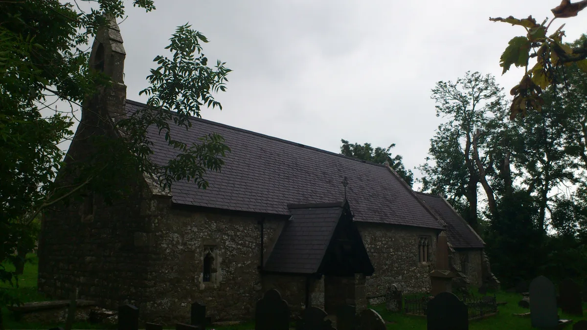
St Mary's Church, Llanfair-Mathafarn-Eithaf
Historic churches · 1.2 km

Benllech
Historic churches · 1.3 km

Llanbedrgoch
Historic churches · 1.3 km

Dinas
Forts · 1.4 km

Storws Wen Golf Club
Golf courses · 1.4 km
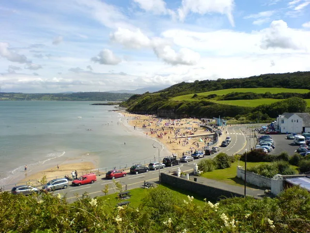
Q65296415
Beaches · 1.4 km

Moel Castell Mawr
Mountains & hills · 1.5 km

Ysgubor Fadog
Caravan parks · 1.5 km
Brynteg
Caravan parks · 1.6 km

Y Garnedd
Campsites · 1.7 km

Golden Sunset Caravan Park
Caravan parks · 1.7 km
Nearby
📷 5📷 3Historic churches · North Wales
St Mary's Church, Llanfair-Mathafarn-Eithaf
St Mary's Church, Llanfair-Mathafarn-Eithaf — church in Llanfair-Mathafarn-Eithaf, Anglesey, Wales.
📷 5Historic churches · North Wales
Benllech
Benllech (Welsh: [ˈbɛnɬɛχ]) is a village on the Isle of Anglesey in Wales. It is in the community of Llanfair-Mathafarn-Eithaf, which has a population of 3,382. The name of Benllech village had been r
📷 5Historic churches · North Wales
Llanbedrgoch
Llanbedrgoch — a church in wales-north, United Kingdom.
📷 3📷 3Where to eat & stay near Llanfair-Mathafarn-Eithaf
Places to stay
📷 5📷 5📷 5Caravan parks · North Wales
Brynteg
Brynteg — a caravan park in wales north.
📷 5📷 5Caravan parks · North Wales
Golden Sunset Caravan Park
Golden Sunset Caravan Park — a caravan park in wales north.
 📷 5
📷 5Caravan parks · North Wales
Bodafon Caravan Park
Bodafon Caravan Park — a caravan park in wales north.
Places to eat & drink
 📷 5
📷 5 📷 5
📷 5Historic pubs · North Wales
The Bull Hotel, Llangefni
The Bull Hotel, Llangefni in Wales North, United Kingdom.
 📷 5
📷 5Historic pubs · North Wales
The George and Dragon
The George and Dragon — Historic pub — listed building or notable heritage status.
 📷 7
📷 7 📷 7
📷 7 📷 5
📷 5Historic pubs · North Wales
The Kings Head Hotel
The Kings Head Hotel in Wales North, United Kingdom.
More places in this region
 📷 3
📷 3Historic churches · North Wales
All Saints Church
All Saints Church — Anglican church in Deganwy, Wales.
 📷 3
📷 3Historic churches · North Wales
All Saints Church, Great Saughall
All Saints Church, Great Saughall — grade II listed church in Saughall, Cheshire West and Chester, Cheshire, England, UK.
 📷 3
📷 3Historic churches · North Wales
All Saints Church, Higher Kinnerton
All Saints Church, Higher Kinnerton — church in United Kingdom.
 📷 3
📷 3Historic churches · North Wales
All Saints' Church, Gresford
All Saints' Church, Gresford — church in Gresford, north Wales.
Frequently asked questions
- Where is Llanfair-Mathafarn-Eithaf?
- Llanfair-Mathafarn-Eithaf is in North Wales, United Kingdom (postcode LL74 8RF), in the parish of Llanfair-Mathafarn-Eithaf.
- What is Llanfair-Mathafarn-Eithaf?
- Llanfair-Mathafarn-Eithaf (Welsh pronunciation: [ˌɬanvair maˈθavarn ˈei̯θav]) is a parish and community in Anglesey, Wales including the small seaside town of Benllech. The community population taken
- How do I get to Llanfair-Mathafarn-Eithaf?
- Drivers can use postcode LL74 8RF.
- Is Llanfair-Mathafarn-Eithaf free to visit?
- Yes, Llanfair-Mathafarn-Eithaf is free to enter.
- How do I get to Llanfair-Mathafarn-Eithaf?
- Drivers can navigate to postcode LL74 8RF. It sits within the Ynys Môn parliamentary constituency.