
Towns & cities · East of England
Little Witchingham
Little Witchingham — a village located in Broadland, United Kingdom.

Wikimedia Commons contributors — see linked file page for photographer and licence licence

Plan your visit
- Typical visit
- 3 h–6 h
- Nearest railway station
- Aylsham · 9.6 km
- Free entry
- Family-friendly
- Dog-friendly
Getting there & planning your visit
To visit Little Witchingham, the nearest railway station is Aylsham, located 9.6 km away. The postcode for navigation is NR9 5FY. Entry to the town is free.
About
Little Witchingham is a town, city, village or settlement in the United Kingdom. It covers approximately 3 km². Recent population estimates put it at around 40 people. Wikidata describes it as: "a village located in Broadland, United Kingdom". Coordinates: 52.7407°, 1.1390°.
Photo gallery
Protected designations
- Site of Special Scientific Interest: River Wensum SSSI
- Area of Outstanding Natural Beauty: Norfolk Coast
Designations sourced from Natural England open data under OGL v3.
From the Wikipedia article
Little Witchingham is a village and civil parish in the English county of Norfolk. It covers an area of 3.01 km2 (1.16 sq mi) and had a population of 36 in 14 households at the 2001 census. For the purposes of local government, it falls within the district of Broadland. St Faith's Church (right) is now redundant.
Excerpt from Wikipedia under CC BY-SA 4.0. See the source article linked in Sources below.
- Coordinates
- 52.7407, 1.1390
- County
- Norfolk
- District
- Broadland
- Parish
- Little Witchingham
- Postcode
- NR9 5FY
- Parliamentary constituency
- Broadland and Fakenham
- Population
- 40
- Nearest railway station
- Aylsham — 9.6 km
Sources
- wikidata: Q985707 (CC0)
- wikipedia: Little Witchingham (CC BY-SA 4.0)
- commons: St. Faiths Church, Little Witchingham - geograph.org.uk - 73612.jpg (CC BY-SA 4.0)
Other places nearby
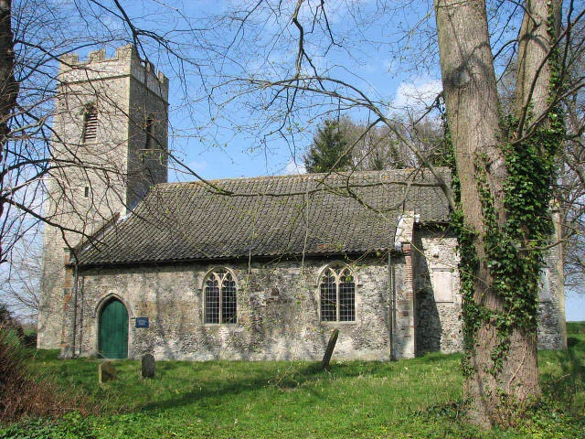
St Faith's Church, Little Witchingham
Historic churches · 0.5 km

Guton
Vineyards · 1.3 km

Swannington Manor
Manor houses · 1.7 km

Alderford
Towns & cities · 1.7 km

Witchingham
Villages · 1.7 km

Swannington
Villages · 1.9 km

Church of St Margaret
Historic churches · 1.9 km

St Michael the Archangel's Church, Booton
Historic churches · 1.9 km

Swannington Village Sign
Public art & sculpture · 2.2 km
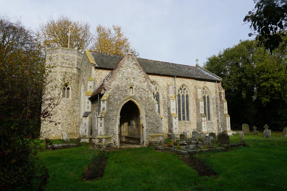
St Nicholas' Church, Brandiston
Historic churches · 2.3 km
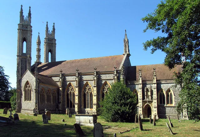
Booton
Towns & cities · 2.4 km

Booton Common
Forests & woodlands · 2.6 km
Little Witchingham is a village in Norfolk, located in the East Midlands, with a population of 40. Our guide lists N attractions within reach.
At a glance
- Population
- 40
- Administrative county
- Norfolk
- Constituency
- Broadland and Fakenham
- Top categories near here
Things to see in Little Witchingham
3 attractions within 12 km.
📷 3Historic churches · East of England
St Faith's Church, Little Witchingham
St Faith's Church, Little Witchingham — church in Little Witchingham, Norfolk, England, UK.
📷 5Vineyards · East of England
Guton
Guton — a UK vineyard in england east midlands, producing English or Welsh wine from cool-climate grape varieties.
📷 5Nearby
📷 3Historic churches · East of England
St Faith's Church, Little Witchingham
St Faith's Church, Little Witchingham — church in Little Witchingham, Norfolk, England, UK.
📷 5Vineyards · East of England
Guton
Guton — a UK vineyard in england east midlands, producing English or Welsh wine from cool-climate grape varieties.
📷 3Manor houses · East of England
Swannington Manor
Swannington Manor — Grade II listed building-listed manor in england-east-midlands, United Kingdom.
Flagship📷 4📷 5📷 5Where to eat & stay near Little Witchingham
Places to stay
 📷 5
📷 5Campsites · East of England
Whitwell and Reepham Railway Camping
Whitwell and Reepham Railway Camping — a campsite in england east midlands.
 📷 5
📷 5 📷 5
📷 5Caravan parks · East of England
Charmbeck Park
Charmbeck Park — a caravan park in england east midlands.
📷 5Campsites · East of England
Moat Island Glamping
Moat Island Glamping — a campsite in england east midlands.
 📷 5
📷 5Caravan parks · East of England
Martintole Farm
Martintole Farm — a caravan park in england east midlands.
 📷 5
📷 5Places to eat & drink
 📷 5
📷 5 📷 5
📷 5Historic pubs · East of England
Buckinghamshire Arms Public House
Buckinghamshire Arms Public House in England East, United Kingdom.
 📷 5
📷 5Historic pubs · East of England
Saracen's Head
Saracen's Head in England East, United Kingdom.
 📷 5
📷 5Historic pubs · East of England
The Marlpit Public House
The Marlpit Public House in England East, United Kingdom.
 📷 5
📷 5 📷 7
📷 7Historic pubs · East of England
Recruiting Sergeant Inn
Recruiting Sergeant Inn in England East, United Kingdom.
More towns in this region
 Flagship📷 10
 Flagship📷 10
Towns & cities · East of England
Cambridge
Cambridge — city in Cambridgeshire, England.
 Flagship📷 10
Towns & cities · East of England
Chelmsford
Chelmsford — city in Essex, United Kingdom.
 Flagship📷 10
Towns & cities · East of England
Colney Heath
Colney Heath — village and civil parish in St Albans, Hertfordshire, England, UK.
Frequently asked questions
- Where is Little Witchingham?
- Little Witchingham is in Norfolk, the East Midlands, United Kingdom (postcode NR9 5FY), in the parish of Little Witchingham.
- What is Little Witchingham?
- Little Witchingham — a village located in Broadland, United Kingdom.
- How do I get to Little Witchingham?
- The nearest railway station is Aylsham, about 9.6 km away. Drivers can use postcode NR9 5FY.
- Is Little Witchingham a protected site?
- Yes — Little Witchingham is part of the River Wensum SSSI Site of Special Scientific Interest and the Norfolk Coast National Landscape (AONB).
- Is Little Witchingham free to visit?
- Yes, Little Witchingham is free to enter.
- How do I get to Little Witchingham?
- Drivers can navigate to postcode NR9 5FY. It sits within the Broadland and Fakenham parliamentary constituency.