Mountains & hills · North West England
Little Cockup
In or near Bassenthwaite.
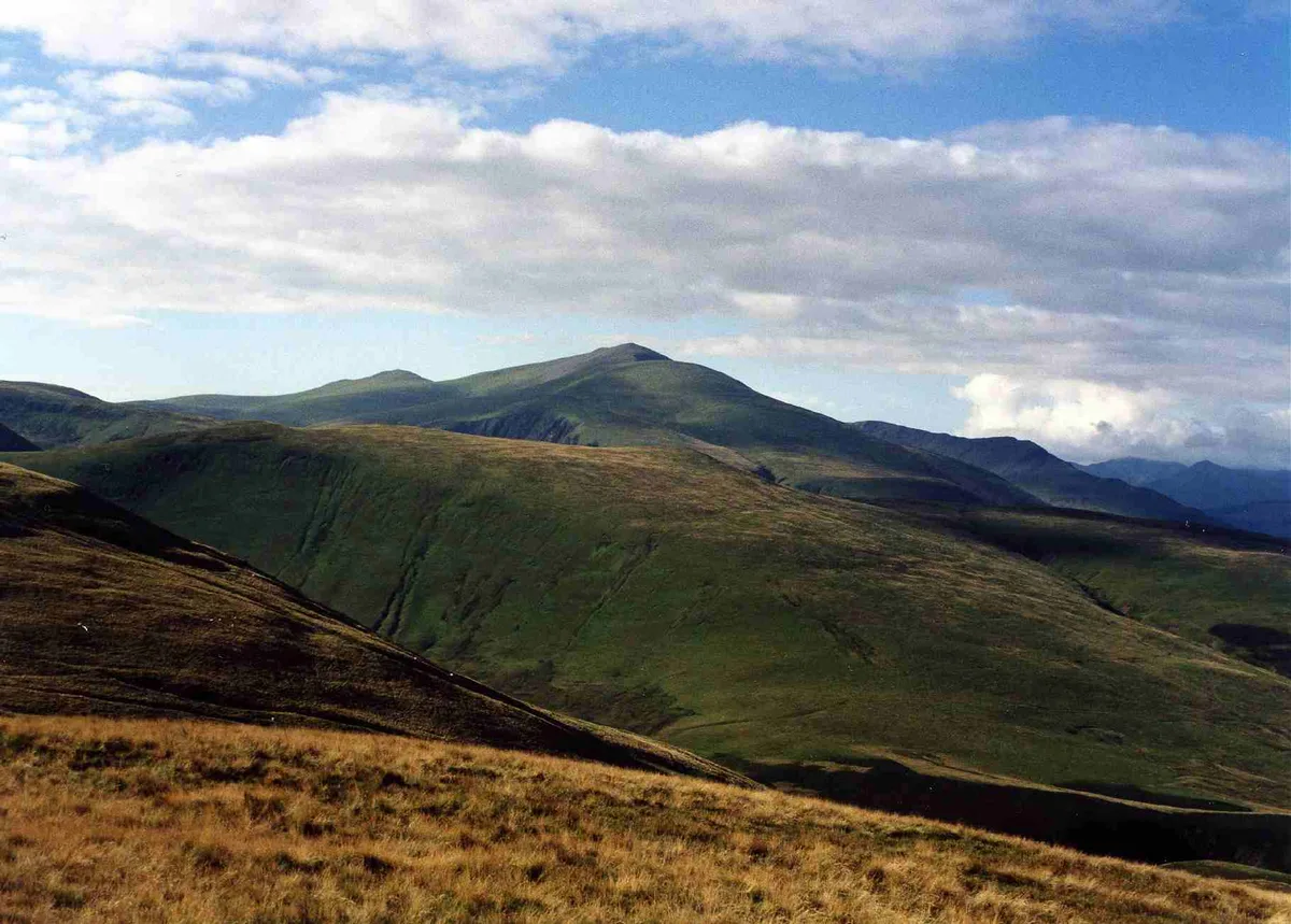
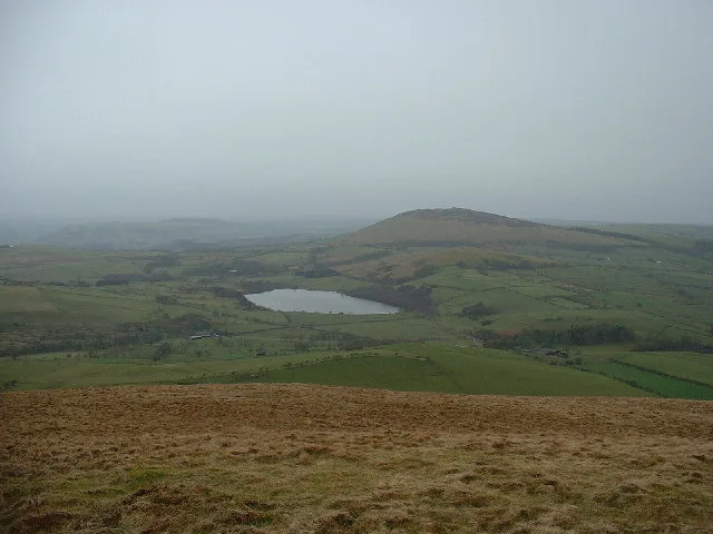
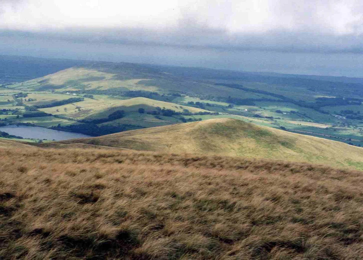
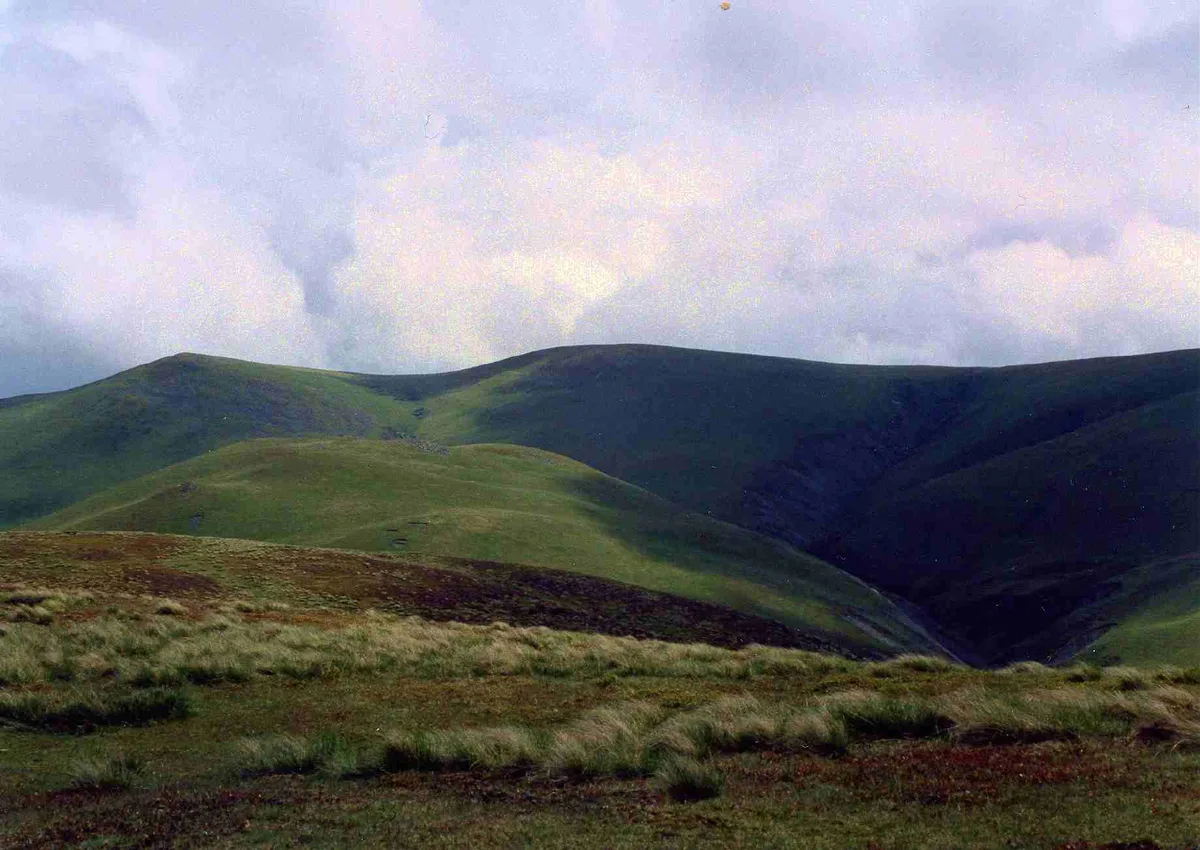
Little Cockup — Named summit at 399 m.

Wikimedia Commons contributors — see linked file page for photographer and licence licence
Plan your visit
- Typical visit
- 3 h–8 h
- Best time of year
- Late spring – early autumn (May–Oct)
- Free entry
- Dog-friendly
About
Little Cockup is a named summit in the United Kingdom. Wikidata describes it as: "Named summit at 399 m.". Coordinates: 54.6931°, -3.1468°.
Photo gallery
Protected designations
- Site of Special Scientific Interest: Skiddaw Group SSSI
Designations sourced from Natural England open data under OGL v3.
From the Wikipedia article
Little Cockup is a fell in the Northern Fells area of the Lake District, Cumbria, England. It is located in the Uldale Fells, about 5 kilometres (3 mi) north of Skiddaw, near the larger fell of Great Cockup 1 kilometre (0.62 mi) to the east, and has an elevation of 395 metres (1,296 ft). Another hill called plain Cockup is about 2 kilometres (1.2 mi) to the south.
Excerpt from Wikipedia under CC BY-SA 4.0. See the source article linked in Sources below.
Background
Visiting
Little Cockup has been referred to in an edition of Punch magazine and was also mentioned in Alfred Wainwright's walking guidebooks about the Lake District alongside Great Cockup. Because the name of Little Cockup is a double entendre, it is often included on lists of rude-sounding place names.
Sourced from Wikipedia under CC BY-SA 4.0.
- Coordinates
- 54.6931, -3.1468
- District
- Cumberland
- Parish
- Ireby and Uldale
- Postcode
- CA7 1HL
- Parliamentary constituency
- Penrith and Solway
Sources
- osm: n4859334862 (ODbL)
- wikipedia: Little Cockup (CC BY-SA 4.0)
- commons: Little Cockup - geograph.org.uk - 1024014.jpg (CC BY-SA 4.0)
Other places nearby

Castle How
Mountains & hills · 0.7 km

Great Cockup
Natural landmarks · 1.2 km
Great Cockup
Mountains & hills · 1.2 km

Uldale Fells
Vineyards · 1.5 km
Over Water
Natural landmarks · 1.6 km

Lowthwaite Fell West Top
Mountains & hills · 1.7 km

Lowthwaite Fell
Mountains & hills · 1.9 km

Meal Fell
Natural landmarks · 2.0 km

Overwater Hall
Historic houses · 2.0 km

Chapelhouse Reservoir
Reservoirs & lochs · 2.0 km
Longlands Fell
Natural landmarks · 2.1 km
Meal Fell
Mountains & hills · 2.1 km
Nearby
📷 5Mountains & hills · North West England
Castle How
Castle How — mountain in scotland lowlands. Elevation: 306.2 m.
📷 3📷 3📷 5Vineyards · North West England
Uldale Fells
Uldale Fells — a UK vineyard in scotland lowlands, producing English or Welsh wine from cool-climate grape varieties.
📷 3📷 5Mountains & hills · North West England
Lowthwaite Fell West Top
Lowthwaite Fell West Top — mountain in scotland lowlands. Elevation: 311 m.
Where to eat & stay near Little Cockup
Places to stay
 📷 5
📷 5Caravan parks · North West England
High Close Holiday Homes
High Close Holiday Homes — a caravan park in scotland lowlands.
 📷 5
📷 5Caravan parks · North West England
Robin Hood Park
Robin Hood Park — a caravan park in scotland lowlands.
 📷 5
📷 5Caravan parks · North West England
Trafford Caravan Park
Trafford Caravan Park — a caravan park in scotland lowlands.
 📷 5
📷 5Hostels · North West England
YHA Skiddaw Bunkhouse
YHA Skiddaw Bunkhouse — a hostel in scotland lowlands.
 📷 5
📷 5Caravan parks · North West England
Bassenthwaite Lakeside Lodges
Bassenthwaite Lakeside Lodges — a caravan park in scotland lowlands.
 📷 5
📷 5Caravan parks · North West England
Coal Beck Caravan Park
Coal Beck Caravan Park — a caravan park in scotland lowlands.
Places to eat & drink
 📷 7
📷 7Historic pubs · North West England
The Pheasant Inn
The Pheasant Inn in Scotland Lowlands, United Kingdom.
 📷 4
📷 4Historic pubs · North West England
Oddfellows Arms
Oddfellows Arms — Historic pub — listed building or notable heritage status.
 📷 5
📷 5 📷 5
📷 5Historic pubs · North West England
Kings Arms Walter Willsons
Kings Arms Walter Willsons in Scotland Lowlands, United Kingdom.
 📷 7
📷 7Cafés · North West England
Grange Bridge Cottage
Grange Bridge Cottage — a café in england north east.
 📷 5
📷 5More mountains in this region
 📷 5
📷 5Mountains & hills · North West England
Appleton Park
Appleton Park — a hill or mountain in england west midlands.
 📷 5
📷 5Mountains & hills · North West England
High Warren
High Warren — mountain in england west midlands. Elevation: 105 m.
 📷 5
📷 5Mountains & hills · North West England
Alderley Edge
Alderley Edge — mountain in england west midlands. Elevation: 194 m.
 📷 3
📷 3Frequently asked questions
- Where is Little Cockup?
- Little Cockup is in the Scottish Lowlands, United Kingdom (postcode CA7 1HL), in the parish of Ireby and Uldale.
- What is Little Cockup?
- Little Cockup — Named summit at 399 m.
- How do I get to Little Cockup?
- Drivers can use postcode CA7 1HL.
- Is Little Cockup a protected site?
- Yes — Little Cockup is part of the Skiddaw Group SSSI Site of Special Scientific Interest.
- Is Little Cockup free to visit?
- Yes, Little Cockup is free to enter.
- How do I get to Little Cockup?
- Drivers can navigate to postcode CA7 1HL. It sits within the Penrith and Solway parliamentary constituency.