
Archaeological sites · South West England
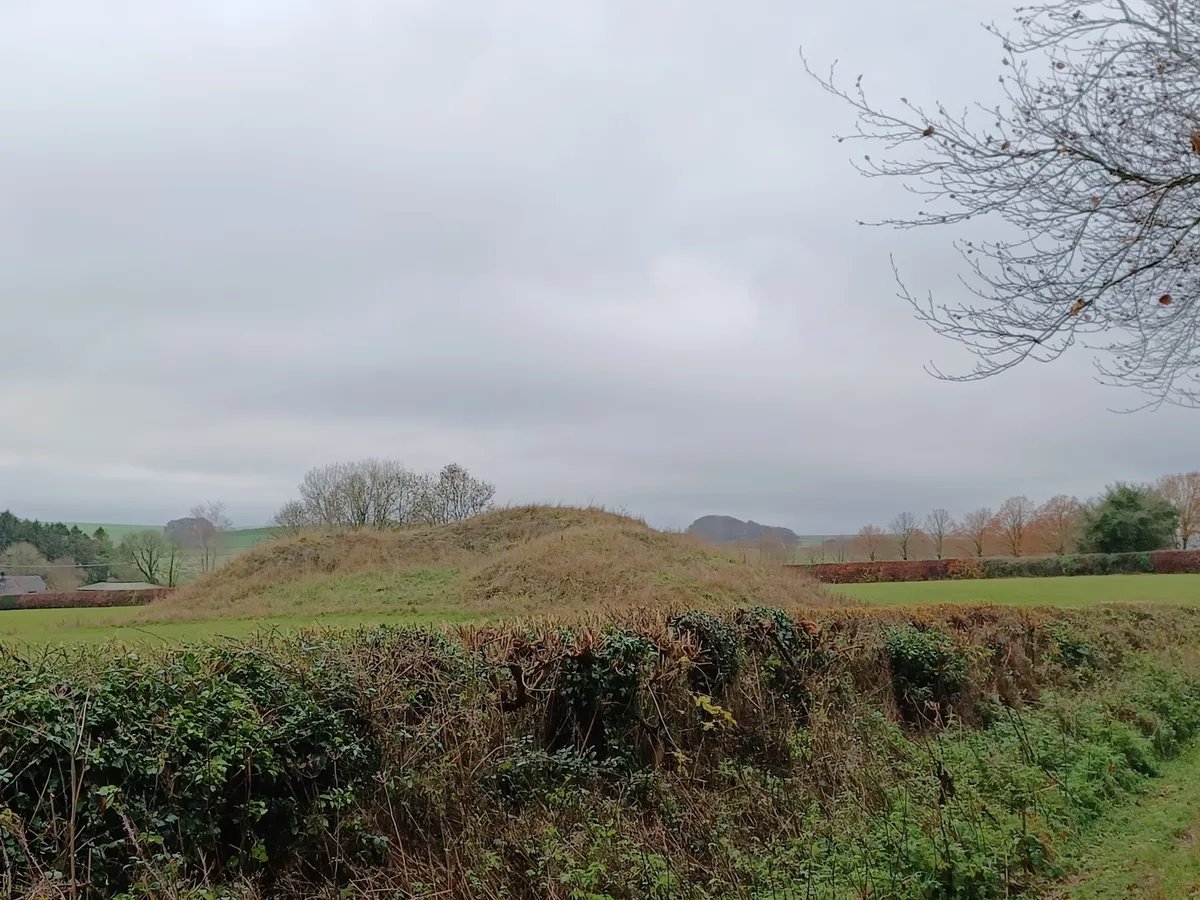
Linear boundary earthwork and associated field system on Cherhill Down
In or near Avebury.
Linear boundary earthwork and associated field system on Cherhill Down — archaeological site in Cherhill, Wiltshire, England, UK.

Wikimedia Commons contributors — see linked file page for photographer and licence licence

Plan your visit
- Typical visit
- 45 min–1.5 h
- Free entry
- Dog-friendly
About
Linear boundary earthwork and associated field system on Cherhill Down is an archaeological site in the United Kingdom. Heritage designation: scheduled monument. Wikidata describes it as: "archaeological site in Cherhill, Wiltshire, England, UK". Coordinates: 51.4251°, -1.9107°.
Photo gallery
Protected designations
- Area of Outstanding Natural Beauty: Cotswolds
- Area of Outstanding Natural Beauty: North Wessex Downs
Designations sourced from Natural England open data under OGL v3.
Place summary
The Linear boundary earthwork and associated field system on Cherhill Down is an archaeological site located in South-East England. It is designated as a scheduled monument and lies within the Areas of Outstanding Natural Beauty of the Cotswolds and North Wessex Downs.
AI-generated from the structured facts on this page (operator, designation, listing, era). Not a substitute for visiting.
- Coordinates
- 51.4251, -1.9107
- District
- Wiltshire
- Parish
- Cherhill
- Postcode
- SN11 8HS
- Parliamentary constituency
- Chippenham
Sources
- wikidata: Q17675359 (CC0)
- commons: Linear earthwork on Cherhill Down, Wiltshire 02.jpg (CC BY-SA 4.0)
Other places nearby

Cherhill Down
Mountains & hills · 1.2 km
Cherhill Hill
Mountains & hills · 1.2 km

Cherhill White Horse
Archaeological sites · 1.3 km

Cherhill White Horse
Natural landmarks · 1.3 km

Oldbury Camp
Vineyards · 1.4 km

Oldbury Castle
Castles · 1.4 km

Lansdowne Monument
Memorials & monuments · 1.5 km

Yatesbury
Villages · 1.9 km

Grange Stables bell barrow
Burial mounds & barrows · 2.2 km

Grange Stables bell barrow
Archaeological sites · 2.2 km
Long Stones long barrow 150m north of Beckhampton House
Archaeological sites · 2.4 km

Horslip Long Barrow
Burial mounds & barrows · 2.5 km
Nearby
📷 5Mountains & hills · South West England
Cherhill Down
Cherhill Down — a hill or mountain in england south east.
📷 5Mountains & hills · South West England
Cherhill Hill
Cherhill Hill — mountain in england south east. Elevation: 264 m.
📷 5Archaeological sites · South West England
Cherhill White Horse
Cherhill White Horse — archaeological in england south east.
📷 4Natural landmarks · South West England
Cherhill White Horse
Cherhill White Horse is a hill figure on Cherhill Down in Wiltshire, England, just outside the village of Cherhill and about 3.5 miles (5.6 km) east of Calne. Dating from the late 18th century, it is
📷 5Vineyards · South West England
Oldbury Camp
Oldbury Camp — a UK vineyard in england south east, producing English or Welsh wine from cool-climate grape varieties.
📷 5Castles · South West England
Oldbury Castle
Oldbury Castle — a castle in england-south-east, United Kingdom.
Where to eat & stay near Linear boundary earthwork and associated field system on Cherhill Down
Places to stay
 📷 5
📷 5 📷 7
📷 7Hotels · South West England
Lansdowne Strand Hotel
Lansdowne Strand Hotel — a hotel in england south east.
 📷 7
📷 7Hotels · South West England
The Castle Hotel
The Castle Hotel — a hotel in england south east.
 📷 7
📷 7Hotels · South West England
The Peppermill Hotel
The Peppermill Hotel — a hotel in england south east.
 📷 5
📷 5Hotels · South West England
The Bear Hotel
The Bear Hotel — a hotel in england south east.
 📷 5
📷 5Campsites · South West England
Escape To The Fields
Escape To The Fields — a campsite in england south east.
Places to eat & drink
 📷 7
📷 7Historic pubs · South West England
The Talbot Public House
The Talbot Public House in England South West, United Kingdom.
 📷 5
📷 5Historic pubs · South West England
Bricklayers Arms Public House
Bricklayers Arms Public House in England South West, United Kingdom.
 📷 5
📷 5 📷 7
📷 7Historic pubs · South West England
Black Swan Hotel
Black Swan Hotel in England South West, United Kingdom.
 📷 7
📷 7Historic pubs · South West England
Jolly Trooper Public House
Jolly Trooper Public House in England South West, United Kingdom.
 📷 7
📷 7Cafés · South East England
St Peter's and St Paul's
St Peter's and St Paul's — a café in england south east.
More archaeological sites in this region
 📷 5
📷 5Archaeological sites · South West England
Battlesbury Camp Monuments: hillfort, settlement, cemetery, barrows, enclosure, and field systems
Battlesbury Camp Monuments: hillfort, settlement, cemetery, barrows, enclosure, and field systems — archaeological site in Warminster, Wiltshire, England, UK.
 📷 5
📷 5Archaeological sites · South West England
Blandford Forest
Blandford Forest — forest in Blandford Forum, England.
 📷 5
📷 5Archaeological sites · South West England
Boulsbury Wood
Boulsbury Wood — protected area in Dorset and Hampshire, England.
.jpg?width=1200) 📷 5
📷 5Archaeological sites · South West England
Cranborne Chase
Cranborne Chase — Plateau in southern England.
Frequently asked questions
- Where is Linear boundary earthwork and associated field system on Cherhill Down?
- Linear boundary earthwork and associated field system on Cherhill Down is in South-West England, United Kingdom (postcode SN11 8HS), in the parish of Cherhill.
- What is Linear boundary earthwork and associated field system on Cherhill Down?
- Linear boundary earthwork and associated field system on Cherhill Down — archaeological site in Cherhill, Wiltshire, England, UK.
- How do I get to Linear boundary earthwork and associated field system on Cherhill Down?
- The nearest town is Avebury. Drivers can use postcode SN11 8HS.
- Is Linear boundary earthwork and associated field system on Cherhill Down a listed building?
- Linear boundary earthwork and associated field system on Cherhill Down is officially recognised as scheduled monument listed.
- Is Linear boundary earthwork and associated field system on Cherhill Down a protected site?
- Yes — Linear boundary earthwork and associated field system on Cherhill Down is part of the Cotswolds National Landscape (AONB) and the North Wessex Downs National Landscape (AONB).
- Is Linear boundary earthwork and associated field system on Cherhill Down free to visit?
- Yes, Linear boundary earthwork and associated field system on Cherhill Down is free to enter.
- How do I get to Linear boundary earthwork and associated field system on Cherhill Down?
- Drivers can navigate to postcode SN11 8HS. It sits within the Chippenham parliamentary constituency.