
Forests & woodlands · East of England
Lime Kiln Close
In or near Cherry Hinton.
Lime Kiln Close is a forest or woodland in the United Kingdom.

Wikimedia Commons contributors — see linked file page for photographer and licence licence

Plan your visit
- Typical visit
- 1 h–3 h
- Nearest railway station
- Cambridge · 2.6 km
- Free entry
- Family-friendly
- Dog-friendly
- Wheelchair accessible
Getting there & planning your visit
To visit Lime Kiln Close, the nearest railway station is Cambridge, located 2.6 km away. Entry is free, and the site is accessible for wheelchair users. The postcode for sat-nav is CB1 8AG.
About
Lime Kiln Close is a named forest, woodland or nature reserve in the United Kingdom. Coordinates: 52.1828°, 0.1715°. This entry is part of The Great Britain Guide, a free, ad-free, open-data tourist directory.
Photo gallery
See it from the streetimagery from 2019
Imagery © Mapillary contributors, CC BY-SA 4.0
From the Wikipedia article
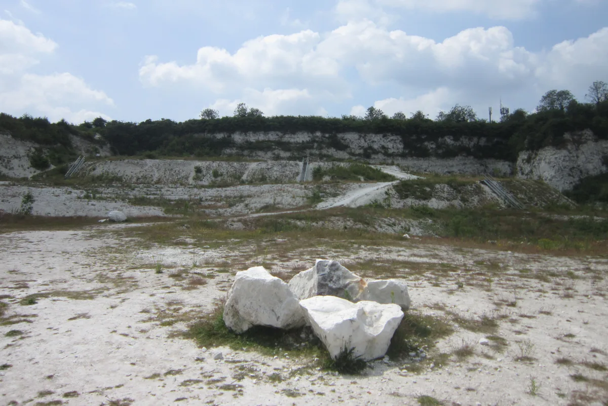
Limekiln Close and East Pit is a 10 hectare Local Nature Reserve (LNR) in Cherry Hinton, on the south-eastern outskirts of Cambridge. It is managed by the Wildlife Trust for Bedfordshire, Cambridgeshire and Northamptonshire as Cherry Hinton Chalk Pits. East Pit is part of the Cherry Hinton Pit biological Site of Special Scientific Interest, which excludes Limekiln Close but includes the neighbouring West Pit. The two parts of the site are both former chalk quarries. East Pit is surrounded by steep walls of chalk, and the base is wildflower grassland with areas of scrub. Flowers include millkwort, harebell, kidney vetch and the rare moon carrot, which is on the British Red List of Threatened Species. Quarrying ceased 200 years ago in Limekiln Close, and it is now steeply sloping mature woodland with ash and cherry trees. The site has been designated a Local Nature Reserve by Cambridge City Council, which shows it as one LNR and West Pit as a separate LNR. However, the LNRs are confusingly shown on the Natural England website. One is shown as Limekiln Close and West Pit on the details page, but the map only covers Limekiln Close. The other LNR is shown on the details page as East Pit, whereas the map covers both East and West Pits. There is no access between the two parts of the site, but they have adjacent entrances on Limekiln Road.
Excerpt from Wikipedia under CC BY-SA 4.0. See the source article linked in Sources below.
- Coordinates
- 52.1828, 0.1715
- County
- Cambridgeshire
- District
- Cambridge
- Parish
- Cambridge, unparished area
- Postcode
- CB1 8AG
- Parliamentary constituency
- South Cambridgeshire
- Nearest railway station
- Cambridge — 2.6 km
Sources
- osm: w42760457 (ODbL)
- wikipedia: Limekiln Close and East Pit (CC BY-SA 4.0)
- commons: East Pit 7.jpg (CC BY-SA 4.0)
Other places nearby

The Robin Hood
Historic pubs · 0.1 km
East Pit
Forests & woodlands · 0.3 km
Cherry Hinton Pit
Wildlife reserves · 0.4 km

Cherry Hinton
Towns & cities · 0.4 km

War Ditches
Vineyards · 0.4 km

Cambridge Cherry Hinton Caravan and Motorhome Club
Caravan parks · 0.4 km

West Pit
Forests & woodlands · 0.4 km
West Pit
Forests & woodlands · 0.4 km

Cherry Hinton Hall
Historic houses · 0.6 km

Church of St Andrew
Historic churches · 1.1 km

Baitul Mu'eed
Historic churches · 1.5 km
Beechwoods nature reserve
Wildlife reserves · 1.6 km
Nearby
📷 7Historic pubs · East of England
The Robin Hood
The Robin Hood in England East, United Kingdom.
📷 5Forests & woodlands · East of England
East Pit
East Pit is a forest or woodland in the United Kingdom.
📷 5Wildlife reserves · East of England
Cherry Hinton Pit
Cherry Hinton Pit — nature reserve in the United Kingdom.
📷 5Towns & cities · East of England
Cherry Hinton
Cherry Hinton — village and electoral ward in Cambridge, United Kingdom.
📷 5Vineyards · East of England
War Ditches
War Ditches — a UK vineyard in england london, producing English or Welsh wine from cool-climate grape varieties.
📷 5Caravan parks · East of England
Cambridge Cherry Hinton Caravan and Motorhome Club
Cambridge Cherry Hinton Caravan and Motorhome Club — a caravan park in england london.
Where to eat & stay near Lime Kiln Close
Places to stay
📷 5Caravan parks · East of England
Cambridge Cherry Hinton Caravan and Motorhome Club
Cambridge Cherry Hinton Caravan and Motorhome Club — a caravan park in england london.
 📷 7
📷 7Hotels · East of England
Travelodge Cambridge Central
Travelodge Cambridge Central — a hotel in england london. 2-star. Brand: Travelodge.
 📷 5
📷 5 📷 5
📷 5Campsites · East of England
Bounds Campsite
Bounds Campsite — a campsite in england london.
 📷 7
📷 7 📷 5
📷 5Places to eat & drink
📷 7Historic pubs · East of England
The Robin Hood
The Robin Hood in England East, United Kingdom.
 📷 7
📷 7 📷 5
📷 5Historic pubs · East of England
The Oak Public House
The Oak Public House in England East, United Kingdom.
 📷 7
📷 7Historic pubs · East of England
The Globe Public House
The Globe Public House in England East, United Kingdom.
 📷 7
📷 7Restaurants · East of England
sole & duck
sole & duck — a restaurant in england london.
 📷 7
📷 7More forests in this region
 📷 5
📷 5Forests & woodlands · East of England
Adams Road Bird Sanctuary
Adams Road Bird Sanctuary is a forest or woodland in the United Kingdom.
 📷 5
📷 5Forests & woodlands · East of England
Arthur's Meadow NR
Arthur's Meadow NR is a forest or woodland in the United Kingdom.
 📷 5
📷 5Forests & woodlands · East of England
Ashwell Quarry & Quarry Springs
Ashwell Quarry & Quarry Springs is a forest or woodland in the United Kingdom.
 📷 5
📷 5Forests & woodlands · East of England
Ashwell Springs
Ashwell Springs is a forest or woodland in the United Kingdom.
Frequently asked questions
- Where is Lime Kiln Close?
- Lime Kiln Close is in Cambridgeshire, East of England, United Kingdom (postcode CB1 8AG), in the parish of Cambridge, unparished area.
- What is Lime Kiln Close?
- Lime Kiln Close is a forest or woodland in the United Kingdom.
- How do I get to Lime Kiln Close?
- The nearest railway station is Cambridge, about 2.6 km away. The nearest town is Cherry Hinton. Drivers can use postcode CB1 8AG.
- Who owns Lime Kiln Close?
- Lime Kiln Close is owned by Wildlife Trust for Bedfordshire, Cambridgeshire and Northamptonshire.
- Is Lime Kiln Close free to visit?
- Yes, Lime Kiln Close is free to enter.
- How do I get to Lime Kiln Close?
- The nearest railway station is Cambridge, about 2.6 km away. Drivers can navigate to postcode CB1 8AG.