
Museums · London
Leatherhead
In or near Great Bookham.
Leatherhead is a town in the Mole Valley district of Surrey, England, about 17 mi (27 km) south of Central London. The settlement grew up beside a ford on the River Mole, from which its name is though

Ian Capper — CC BY-SA 2.0 via Wikimedia Commons licence

Plan your visit
- Typical visit
- 1.5 h–3 h
- Best time of year
- Year-round
- Nearest railway station
- Leatherhead · 0.5 km
- Family-friendly
- Limited wheelchair access
Getting there & planning your visit
To visit the Leatherhead Museum, you can reach it via the nearest railway station, Leatherhead, which is 0.5 km away. The postcode for sat-nav is KT22 8DP. Please note that accessibility is limited for wheelchair users.
About
Leatherhead is a town in the Mole Valley district of Surrey, England, about 17 mi (27 km) south of Central London. The settlement grew up beside a ford on the River Mole, from which its name is thought to derive. During the late Anglo-Saxon period, Leatherhead was a royal vill and is first mentioned in the will of Alfred the Great in 880 AD. The first bridge across the Mole may have been constructed in around 1200 and this may have coincided with the expansion of the town and the enlargement of the parish church. For much of its history, Leatherhead was primarily an agricultural settlement, with a weekly market being held until the mid-Elizabethan era. The construction of turnpike roads in the mid-18th century and the arrival of the railways in the second half of the 19th century attracted newcomers and began to stimulate the local economy. Large-scale manufacturing industries arrived following the end of the First World War and companies with factories in the town included Ronson and Goblin Vacuum Cleaners. Several organisations working with disabled people also opened treatment and training facilities, including The Royal School for the Blind, Queen Elizabeth's Foundation and the Ex-services Welfare Society. Towards the end of the 20th century, manufacturing in Leatherhead had begun to decline and the town was instead starting to attract service sector employers. The former industrial areas were converted to business parks, which attracted multinational companies, including
Photo gallery
Summary from the official site
Leatherhead is a town in Surrey, England, known for its historical significance and charming architecture. Visitors can explore various local attractions, including parks, shops, and cultural sites that reflect the town's rich heritage.
Protected designations
- Area of Outstanding Natural Beauty: Surrey Hills
Designations sourced from Natural England open data under OGL v3.
From the Wikipedia article
Leatherhead is a town in the Mole Valley district of Surrey, England, about 17 mi (27 km) south of Central London. The settlement grew up beside a ford on the River Mole, from which its name is thought to derive. During the late Anglo-Saxon period, Leatherhead was a royal vill and is first mentioned in the will of Alfred the Great in 880 AD. The first bridge across the Mole may have been constructed in around 1200 and this may have coincided with the expansion of the town and the enlargement of the parish church. For much of its history, Leatherhead was primarily an agricultural settlement, with a weekly market being held until the mid-Elizabethan era. The construction of turnpike roads in the mid-18th century and the arrival of the railways in the second half of the 19th century attracted newcomers and began to stimulate the local economy. Large-scale manufacturing industries arrived following the end of the First World War and companies with factories in the town included Ronson and Goblin Vacuum Cleaners. Several organisations working with disabled people also opened treatment and training facilities, including The Royal School for the Blind, Queen Elizabeth's Foundation and the Ex-services Welfare Society. Towards the end of the 20th century, manufacturing in Leatherhead had begun to decline and the town was instead starting to attract service sector employers. The former industrial areas were converted to business parks, which attracted multinational companies, including Esso and Unilever. A controversial redevelopment took place in the town centre in the early 1980s, which included the construction of the Swan Centre. The work, which also included the pedestrianisation of the main shopping area, was widely blamed for a decline in the local retail economy. In 2002, the BBC identified Leatherhead as having one of the worst High Streets in England, but in 2007, the local press described the town centre as "bustling".
Excerpt from Wikipedia under CC BY-SA 4.0. See the source article linked in Sources below.
Background
History
The earliest evidence of human activity in Leatherhead comes from the Iron Age. Flints, a probable well and two pits were discovered in 2012 during building work on Garlands Road and the finds suggest that the site was also used in the early Roman period. Traces of Iron Age field systems and settlement activity have been observed at Hawks Hill, Fetcham (about 1 km southwest of the town centre) and on Mickleham Downs (about 3 km to the south). Also to the south, the Druid's Grove at Norbury Park may have been used for pre-Christian pagan gatherings. An Anglo-Saxon settlement at Leatherhead was most likely founded on the east side of the River Mole in the second half of the 6th century. A…
Description
The first presentation of a cinematograph film in the town took place at the Leatherhead Institute in October 1898. The following year, a second screening took place at the Victoria Hall in the High Street, which had been built in 1890. By 1914, the Victoria Hall was renamed to become the Grand Theatre and was operating as a cinema with a capacity of 550. Further name changes took place before 1946, around which time the venue became known as the Ace Cinema. In 1949, the Ace Cinema was converted to a 300-seat theatre and a year later, the Leatherhead Theatre was established at the venue. The theatre operated until 1969, but as its popularity increased, its size became restrictive and there…
Sourced from Wikipedia under CC BY-SA 4.0.
- Coordinates
- 51.2950, -0.3290
- County
- Surrey
- District
- Mole Valley
- Parish
- Mole Valley, unparished area
- Postcode
- KT22 8DP
- Parliamentary constituency
- Epsom and Ewell
- Nearest railway station
- Leatherhead — 0.5 km
- Official site
- web.archive.org
Sources
- wikipedia: Leatherhead (CC BY-SA 4.0)
Other places nearby
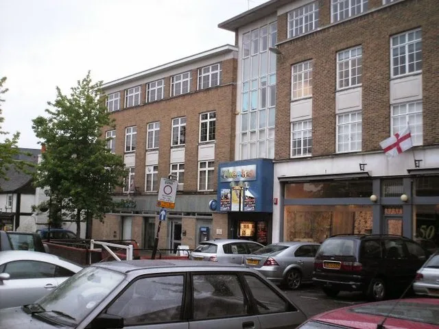
The Leatherhead Theatre
Theatres · 0.0 km

Leatherhead Theatre
Open-air theatres · 0.0 km
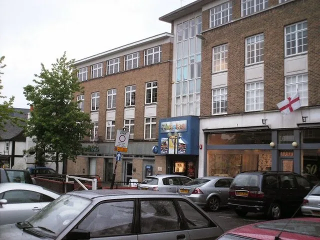
Thorndike Theatre
Theatres · 0.0 km

Leatherhead Museum of Local History
Museums · 0.1 km

Bindi Dreamer
Public art & sculpture · 0.1 km

Leatherhead War Memorial
Memorials & monuments · 0.1 km

The Mansion
Historic houses · 0.1 km

The Running Horse
Historic pubs · 0.2 km

Wesley House, With Steps And Walls To Front
Gardens · 0.2 km

Need Monument Approximately 12 Metres North East Of Chancel Of Church Of St Mary And St Nicholas
Memorials & monuments · 0.3 km
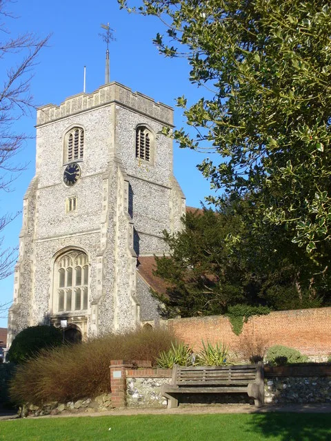
Church of St. Mary & St. Nicholas, Leatherhead
Historic churches · 0.3 km

Leatherhead railway station
Heritage railway stations · 0.5 km
Nearby
📷 5Theatres · London
The Leatherhead Theatre
The Leatherhead Theatre is a theatre in the United Kingdom.
📷 5Open-air theatres · London
Leatherhead Theatre
Leatherhead Theatre — a open-air theatre in england london.
📷 5Theatres · London
Thorndike Theatre
Thorndike Theatre is a theatre in the United Kingdom.
📷 5Museums · London
Leatherhead Museum of Local History
Leatherhead Museum of Local History — a museum in england-london, United Kingdom.
📷 5Public art & sculpture · London
Bindi Dreamer
Bindi Dreamer — a public art in england-london, United Kingdom.
📷 5Memorials & monuments · London
Leatherhead War Memorial
Leatherhead War Memorial — a memorial in england-london, United Kingdom.
Where to eat & stay near Leatherhead
Places to stay
 📷 7
📷 7Hotels · London
Woodlands Park Hotel
Woodlands Park Hotel — a hotel in england london.
 📷 5
📷 5 📷 5
📷 5Campsites · London
Polyapes Scout Camp
Polyapes Scout Camp — a campsite in england london.
 📷 5
📷 5Caravan parks · South East England
Conifer Park Caravan Site
Conifer Park Caravan Site — a caravan park in england london.
 📷 5
📷 5Campsites · South East England
Ranmore Common Campsite
Ranmore Common Campsite — a campsite in england london.
 📷 5
📷 5Campsites · South East England
Dorking Scouts Camp Site
Dorking Scouts Camp Site — a campsite in england london.
Places to eat & drink
📷 5 📷 5
📷 5Historic pubs · London
The Leg Of Mutton And Cauliflower Public House
The Leg Of Mutton And Cauliflower Public House in England London, United Kingdom.
 📷 5
📷 5Historic pubs · South East England
The Windsor Castle Public House
The Windsor Castle Public House in England South East, United Kingdom.
 📷 5
📷 5Historic pubs · London
The Cricketers Public House
The Cricketers Public House in England London, United Kingdom.
 📷 5📷 5
Historic pubs · London
Marquis Of Granby Public House
Marquis Of Granby Public House in England London, United Kingdom.
More museums in this region
 Flagship📷 10
Museums · London
Kenwood House
Kenwood House — art museum and historic house in Hampstead, London.
 📷 5
📷 5Museums · London
Amora London
Amora London — European touring exhibition dedicated to love, relationships and sexual wellbeing.
 📷 5
📷 5Museums · London
Antique Breadboard Museum
Antique Breadboard Museum — small museum in Putney, London, England, UK.
 📷 5
📷 5Museums · London
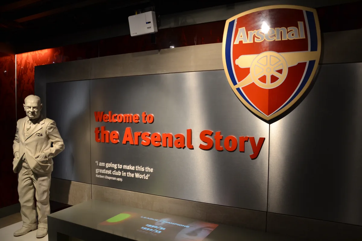
Arsenal Football Club Museum
Arsenal Football Club Museum — sports museum in London.
Frequently asked questions
- Where is Leatherhead?
- Leatherhead is in Surrey, London, United Kingdom (postcode KT22 8DP), in the parish of Mole Valley, unparished area.
- What is Leatherhead?
- Leatherhead is a town in the Mole Valley district of Surrey, England, about 17 mi (27 km) south of Central London. The settlement grew up beside a ford on the River Mole, from which its name is though
- How do I get to Leatherhead?
- The nearest railway station is Leatherhead, about 0.5 km away. The nearest town is Great Bookham. Drivers can use postcode KT22 8DP.
- Is Leatherhead a protected site?
- Yes — Leatherhead is part of the Surrey Hills National Landscape (AONB).
- How do I get to Leatherhead?
- The nearest railway station is Leatherhead, about 0.5 km away. Drivers can navigate to postcode KT22 8DP.