
Archaeological sites · South East England
Langdean Stone Circle
In or near Avebury.
Langdean Stone Circle — archaeological in england south east.

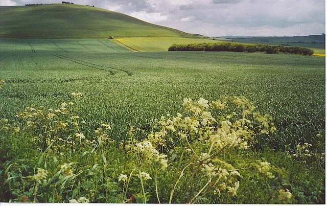
Michael Dibb — CC BY-SA 2.0 via Wikimedia Commons licence

Plan your visit
- Typical visit
- 45 min–1.5 h
- Nearest railway station
- Pewsey · 6.8 km
About
Langdean Stone Circle is a archaeological located in england south east. A British archaeological site recorded in OpenStreetMap with at least one heritage quality signal (Wikidata link, Wikipedia article or designated operator).
Photo gallery
Protected designations
- Area of Outstanding Natural Beauty: Cotswolds
- Area of Outstanding Natural Beauty: North Wessex Downs
Designations sourced from Natural England open data under OGL v3.
Place summary
Langdean Stone Circle is an archaeological site located in South-East England. This stone circle is a prehistoric monument, indicative of ancient ritual practices. It serves as a point of interest for those studying Neolithic structures and their cultural significance in the region. Visitors can observe the arrangement of stones, which provides insight into the ceremonial landscape of early inhabitants.
AI-generated from the structured facts on this page (operator, designation, listing, era). Not a substitute for visiting.
- Coordinates
- 51.3906, -1.8318
- District
- Wiltshire
- Parish
- West Overton
- Postcode
- SN8 4LU
- Parliamentary constituency
- East Wiltshire
- Nearest railway station
- Pewsey — 6.8 km
Sources
- osm: w1054411653 (ODbL)
- wikidata: Q17643567 (CC0)
Other places nearby

Langdean Stone Circle
Stone circles · 0.0 km

Thorn Hill
Mountains & hills · 0.4 km

Furze Hill
Mountains & hills · 0.5 km

Lurkeley Hill
Mountains & hills · 0.8 km

East Kennet
Villages · 1.1 km

East Kennett Long Barrow
Burial mounds & barrows · 1.1 km
East Kennett Long Barrow
Archaeological sites · 1.1 km

Lavington Monument In Churchyard, Against South West Corner Of Christ Church
Memorials & monuments · 1.7 km

Wymans Hill
Mountains & hills · 1.7 km
Milk Hill
Mountains & hills · 1.9 km

Golden Ball Hill
Mountains & hills · 2.1 km
Golden Ball
Mountains & hills · 2.1 km
Nearby
📷 5Stone circles · South East England
Langdean Stone Circle
Langdean Stone Circle — a stone circle in england-south-east, United Kingdom.
📷 5Mountains & hills · South East England
Thorn Hill
Thorn Hill — mountain in england south east. Elevation: 233 m.
📷 5Mountains & hills · South East England
Furze Hill
Furze Hill — mountain in england south east. Elevation: 245 m.
📷 5Mountains & hills · South East England
Lurkeley Hill
Lurkeley Hill — mountain in england south east. Elevation: 227 m.
📷 5📷 5Burial mounds & barrows · South East England
East Kennett Long Barrow
East Kennett Long Barrow — a burial mound in england-south-east, United Kingdom.
Where to eat & stay near Langdean Stone Circle
Places to stay
 📷 5
📷 5 📷 7
📷 7Hotels · South East England
Castle & Ball Hotel
Castle & Ball Hotel — a hotel in england south east.
 📷 7
📷 7 📷 5
📷 5B&Bs · South West England
Puckshipton House
Puckshipton House — a bed-and-breakfast in england south east.
 📷 5
📷 5Campsites · South East England
Totteridge Farm
Totteridge Farm — a campsite in england south east.
 📷 5
📷 5Places to eat & drink
 📷 7
📷 7Cafés · South East England
St Peter's and St Paul's
St Peter's and St Paul's — a café in england south east.
 📷 7
📷 7 📷 7
📷 7Historic pubs · South West England
The Queens Head Inn
The Queens Head Inn in England South West, United Kingdom.
 📷 5
📷 5 📷 7
📷 7Historic pubs · South West England
The Talbot Public House
The Talbot Public House in England South West, United Kingdom.
 📷 7
📷 7Historic pubs · South West England
Black Swan Hotel
Black Swan Hotel in England South West, United Kingdom.
More archaeological sites in this region
 📷 5
📷 5Archaeological sites · South East England
Chatham Dockyard, site of South Mast Pond
Chatham Dockyard, site of South Mast Pond — archaeological site in Medway, Kent, England, UK.
 📷 5
📷 5Archaeological sites · South East England
Open areas within Roman, Saxon and medieval town
Open areas within Roman, Saxon and medieval town — archaeological site in Medway, Kent, England, UK.
 📷 5
📷 5Archaeological sites · South East England
Oxmoor Copse
Oxmoor Copse — woodland in Surrey, England.
 📷 5
📷 5Frequently asked questions
- Where is Langdean Stone Circle?
- Langdean Stone Circle is in South-East England, United Kingdom (postcode SN8 4LU), in the parish of West Overton.
- What is Langdean Stone Circle?
- Langdean Stone Circle — archaeological in england south east.
- How do I get to Langdean Stone Circle?
- The nearest railway station is Pewsey, about 6.8 km away. Drivers can use postcode SN8 4LU.
- Is Langdean Stone Circle a protected site?
- Yes — Langdean Stone Circle is part of the Cotswolds National Landscape (AONB) and the North Wessex Downs National Landscape (AONB).
- How do I get to Langdean Stone Circle?
- The nearest railway station is Pewsey, about 6.8 km away. Drivers can navigate to postcode SN8 4LU.