
Caves · Yorkshire & the Humber
Langcliffe Pot
In or near Hawkswick.
Langcliffe Pot is a cave in the United Kingdom.

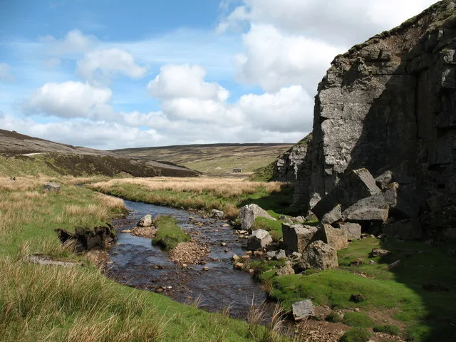
Wikimedia Commons contributors — see linked file page for photographer and licence licence
Plan your visit
- Typical visit
- 45 min–1.5 h
- Free entry
- Dog-friendly
About
Langcliffe Pot is a named cave entrance in the United Kingdom. Coordinates: 54.1355°, -2.0080°. This entry is part of The Great Britain Guide, a free, ad-free, open-data tourist directory.
Photo gallery
Official information
Langcliffe Pot is a cave located in the Yorkshire Dales, accessible to cavers without the need for prior permission. Visitors can explore the cave system while being mindful of potential hazards and the landowner's presence.
Protected designations
- Site of Special Scientific Interest: Black Keld Catchment SSSI
- Site of Special Scientific Interest: West Nidderdale, Barden and Blubberhouses Moors SSSI
Designations sourced from Natural England open data under OGL v3.
From the Wikipedia article
Langcliffe Pot is a cave system on the slopes of Great Whernside in Upper Wharfedale, about 3 kilometres (1.9 mi) SSE of Kettlewell in North Yorkshire. It is part of the Black Keld Site of Special Scientific Interest where the "underground drainage system which feeds the stream resurgence at Black Keld is one of the largest and deepest in Britain, although only a small proportion of its cave passages are accessible at present." Mossdale Caverns is also part of the Black Keld SSSI. Although a considerable length of passage has been explored in Langcliffe Pot, the current end is over 170 metres (560 ft) above the resurgence, and over 4 kilometres (2.5 mi) in distance. A trip to the far end has been described as "one of the most serious undertakings in British caving".
Excerpt from Wikipedia under CC BY-SA 4.0. See the source article linked in Sources below.
Background
History
Langcliffe Pot was first spotted in December 1935 by members of the Craven Pothole Club (CPC), and they made the first descent the following April when the first 45 m of traverse in the downstream passage was explored to a pool. Soon after, they dye tested the Langcliffe Pot and Rigg Pot streams and various others to Black Keld. Another party from the same club descended in 1954 and pushed on for a further 400 m along what is now known as Craven Crawl before turning back. In August 1968 a team from the Yorkshire Underground Research Team explored over 1 km beyond the CPC limit as far as the Kilnsey Boulder Crawl. They weren't too impressed with the place, and handed over the baton to the…
Description
The entrance lies within a shakehole where a small hole between blocks leads to a ledge at the top of a 26 m shaft. This lands in a chamber with a narrow rift passage leading off which degenerates into the Craven Crawl, 200 m of low, wet passage. At a junction with an inlet, the passage enlarges into Stagger Passage, 600 m of walking and stooping. At the start of a deep canal it passes a passage on the left which is the main way to the alternative entrance of Oddmire Pot. The canal passage continues to meet a major junction at Hammerdale Dub, where over a 1000 m of upstream passages also lead back towards Oddmire Pot. Downstream, 1500 m of boulder-strewn streamway finishes where the water…
Sourced from Wikipedia under CC BY-SA 4.0.
- Coordinates
- 54.1355, -2.0080
- District
- North Yorkshire
- Parish
- Kettlewell with Starbotton
- Postcode
- BD23 5HU
- Parliamentary constituency
- Skipton and Ripon
- Official site
- cncc.org.uk
Sources
- osm: n690963690 (ODbL)
- wikipedia: Langcliffe Pot (CC BY-SA 4.0)
- commons: Entrance to Oddmire Pot, Yorkshire.jpg (CC BY-SA 4.0)
Other places nearby

Rigg Pot
Caves · 0.7 km

Rain Pot Hole
Caves · 1.2 km

Old Wife's Pot Well
Caves · 1.6 km
Old Wife's Pot Well
Caves · 1.6 km
Old Wife's Pot Hole
Caves · 1.6 km

Scargill House
Historic houses · 1.8 km

Providence Pot
Caves · 1.8 km

Spring Trap Cave
Caves · 2.1 km

High Hill Castles Lathe
Historic houses · 2.3 km

Hag Dyke Scout Hostel
Hostels · 2.3 km

Mossdale Caverns
Caves · 2.4 km
Mossdale Caverns
Mountains & hills · 2.4 km
Nearby
📷 3📷 3📷 5📷 5📷 5📷 5Historic houses · Yorkshire & the Humber
Scargill House
Scargill House — house in Kettlewell with Starbotton, North Yorkshire, United Kingdom.
Where to eat & stay near Langcliffe Pot
Places to stay
📷 5Hostels · Yorkshire & the Humber
Hag Dyke Scout Hostel
Hag Dyke Scout Hostel — a hostel in england north west.
 📷 5
📷 5Campsites · Yorkshire & the Humber
Kettlewell Camping Top Field
Kettlewell Camping Top Field — a campsite in england north west.
 📷 5
📷 5Campsites · Yorkshire & the Humber
Kettlewell Camping
Kettlewell Camping — a campsite in england north west.
 📷 5
📷 5Hostels · Yorkshire & the Humber
Kettlewell Youth Hostel
Kettlewell Youth Hostel — a hostel in england north west.
 📷 5
📷 5 📷 5
📷 5Caravan parks · Yorkshire & the Humber
Causeway Croft
Causeway Croft — a caravan park in england north west.
Places to eat & drink
 📷 5
📷 5Historic pubs · Yorkshire & the Humber
Grassington House Hotel
Grassington House Hotel in England Yorkshire, United Kingdom.
 📷 5
📷 5Restaurants · Yorkshire & the Humber
The Angel Inn
The Angel Inn — a restaurant in england north west.
 📷 5
📷 5Historic pubs · Yorkshire & the Humber
Foresters Arms Inn
Foresters Arms Inn in England Yorkshire, United Kingdom.
 📷 5
📷 5Historic pubs · Yorkshire & the Humber
Elm Tree Inn
Elm Tree Inn in England Yorkshire, United Kingdom.
 📷 7
📷 7Cafés · Yorkshire & the Humber
The Dalesman Cafe, Tea Room and Sweet Emporium
The Dalesman Cafe, Tea Room and Sweet Emporium — a café in england north west.
 📷 7
📷 7Historic pubs · Yorkshire & the Humber
Fox And Hounds Inn
Fox And Hounds Inn in England Yorkshire, United Kingdom.
More caves in this region


Frequently asked questions
- Where is Langcliffe Pot?
- Langcliffe Pot is in North-West England, United Kingdom (postcode BD23 5HU), in the parish of Kettlewell with Starbotton.
- What is Langcliffe Pot?
- Langcliffe Pot is a cave in the United Kingdom.
- How do I get to Langcliffe Pot?
- Drivers can use postcode BD23 5HU.
- Is Langcliffe Pot a protected site?
- Yes — Langcliffe Pot is part of the Black Keld Catchment SSSI Site of Special Scientific Interest and the West Nidderdale, Barden and Blubberhouses Moors SSSI Site of Special Scientific Interest.
- Is Langcliffe Pot free to visit?
- Yes, Langcliffe Pot is free to enter.
- How do I get to Langcliffe Pot?
- Drivers can navigate to postcode BD23 5HU. It sits within the Skipton and Ripon parliamentary constituency.