Mountains & hills · North West England
Ladyside Pike
In or near Thackthwaite.
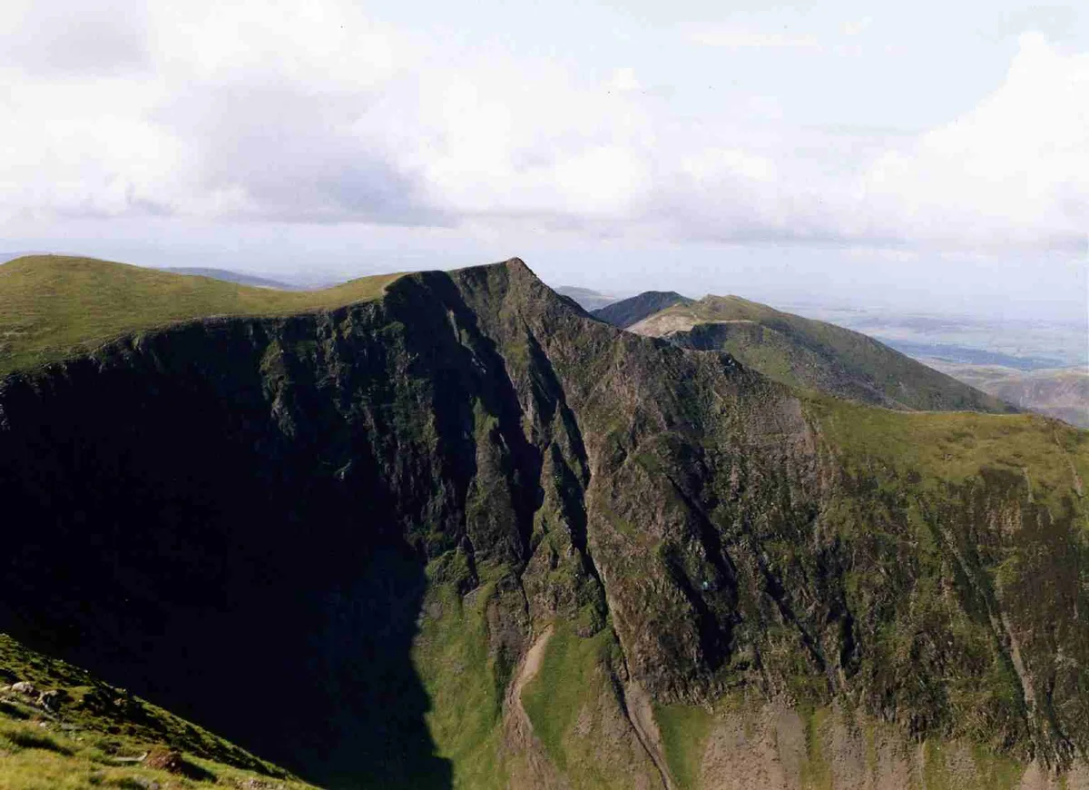
Ladyside Pike — Named summit at 703.5 m.

Wikimedia Commons contributors — see linked file page for photographer and licence licence
Plan your visit
- Typical visit
- 3 h–8 h
- Best time of year
- Late spring – early autumn (May–Oct)
- Free entry
- Dog-friendly
About
Ladyside Pike is a named summit in the United Kingdom. Wikidata describes it as: "Named summit at 703.5 m.". Coordinates: 54.5933°, -3.2630°.
Photo gallery
Protected designations
- Site of Special Scientific Interest: River Derwent and Tributaries SSSI
- Site of Special Scientific Interest: Buttermere Fells SSSI
Designations sourced from Natural England open data under OGL v3.
From the Wikipedia article
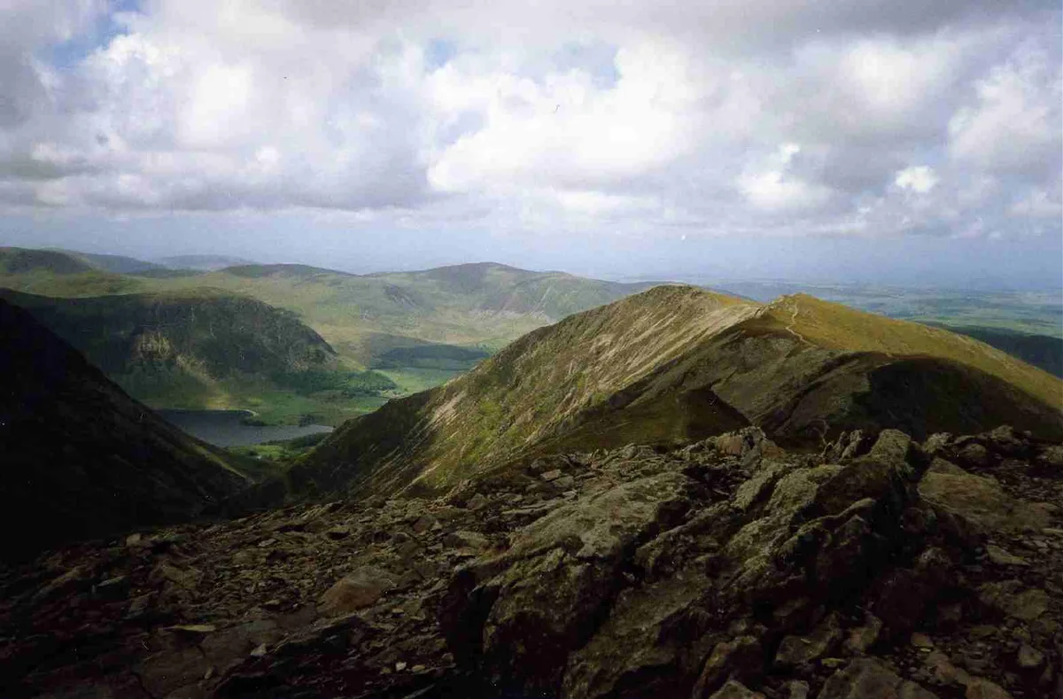
Hopegill Head is a fell in the English Lake District in Cumbria. It is located nine kilometres (5+1⁄2 miles) west of the town of Keswick and is well seen from the B5292 road which crosses the Whinlatter Pass.
Excerpt from Wikipedia under CC BY-SA 4.0. See the source article linked in Sources below.
- Coordinates
- 54.5933, -3.2630
- Address
- Cumbria, England
Sources
- osm: n5022221187 (ODbL)
- wikipedia: Hopegill Head (CC BY-SA 4.0)
- commons: Hopegill Head from Grisedale Pike.jpg (CC BY-SA 4.0)
Other places nearby

Hopegill Head
Mountains & hills · 0.6 km

Hopegill Head
Natural landmarks · 0.6 km

Whiteside-Gasgale Crags Summit
Mountains & hills · 0.8 km
Sand Hill
Mountains & hills · 0.9 km

Hobcarton Crag
Mountains & hills · 1.1 km
Whiteside East Top
Mountains & hills · 1.2 km

Whiteside
Natural landmarks · 1.2 km

Hobcarton End
Mountains & hills · 1.3 km

Grisedale Pike
Mountains & hills · 1.4 km
Grisedale Pike
Natural landmarks · 1.4 km

Dodd
Mountains & hills · 1.6 km

Whiteside (Wainwright)
Mountains & hills · 1.6 km
Nearby
📷 3📷 3📷 3Mountains & hills · North West England
Whiteside-Gasgale Crags Summit
Whiteside-Gasgale Crags Summit — Named summit at 703.3 m.
📷 3📷 5Mountains & hills · North West England
Hobcarton Crag
Hobcarton Crag — mountain in england north east. Elevation: 737.6 m.
📷 3Mountains & hills · North West England
Whiteside East Top
Whiteside East Top — Named summit at 719.4 m.
Where to eat & stay near Ladyside Pike
Places to stay
 📷 5
📷 5Caravan parks · North West England
Whinfell Caravan Park
Whinfell Caravan Park — a caravan park in scotland lowlands.
 📷 5
📷 5Campsites · North West England
Whinfell Hall Farm Campsite
Whinfell Hall Farm Campsite — a campsite in scotland lowlands.
 📷 5
📷 5Campsites · North West England
Hope Memorial Camp
Hope Memorial Camp — a campsite in scotland lowlands.
 📷 5
📷 5Caravan parks · North West England
Wheatsheaf Caravan and Camping Park
Wheatsheaf Caravan and Camping Park — a caravan park in scotland lowlands.
 📷 5
📷 5Caravan parks · North West England
Lanefoot Farm
Lanefoot Farm — a caravan park in scotland lowlands.
📷 5Places to eat & drink
 📷 7
📷 7Historic pubs · North West England
The Pheasant Inn
The Pheasant Inn in Scotland Lowlands, United Kingdom.
 📷 5
📷 5 📷 7
📷 7Cafés · North West England
Grange Bridge Cottage
Grange Bridge Cottage — a café in england north east.
 📷 7
📷 7Historic pubs · North West England
The Travellers Rest
The Travellers Rest in England North West, United Kingdom.
 📷 5
📷 5Historic pubs · North West England
Fox and Grapes
Fox and Grapes in England North West, United Kingdom.
 📷 4
📷 4Historic pubs · North West England
Oddfellows Arms
Oddfellows Arms — Historic pub — listed building or notable heritage status.
More mountains in this region
 📷 5
📷 5Mountains & hills · North West England
Appleton Park
Appleton Park — a hill or mountain in england west midlands.
 📷 5
📷 5Mountains & hills · North West England
High Warren
High Warren — mountain in england west midlands. Elevation: 105 m.
 📷 5
📷 5Mountains & hills · North West England
Alderley Edge
Alderley Edge — mountain in england west midlands. Elevation: 194 m.
 📷 3
📷 3Frequently asked questions
- Where is Ladyside Pike?
- Ladyside Pike is in North-East England, United Kingdom.
- What is Ladyside Pike?
- Ladyside Pike — Named summit at 703.5 m.
- How do I get to Ladyside Pike?
- Its coordinates are 54.5933°, -3.2630°.
- Is Ladyside Pike a protected site?
- Yes — Ladyside Pike is part of the River Derwent and Tributaries SSSI Site of Special Scientific Interest and the Buttermere Fells SSSI Site of Special Scientific Interest.
- Is Ladyside Pike free to visit?
- Yes, Ladyside Pike is free to enter.