
Villages · South East England
Kingsgate
In or near Westwood.
Kingsgate — a village in england south east.

David Anstiss — CC BY-SA 2.0 via Wikimedia Commons licence

Plan your visit
- Typical visit
- 1 h–2 h
- Nearest railway station
- Broadstairs · 2.0 km
About
A British village — settlements of this size traditionally cluster a green, parish church, pub and post office around historic land routes.
Photo gallery
Protected designations
- Site of Special Scientific Interest: Thanet Coast SSSI
- Ramsar wetland: Thanet Coast & Sandwich Bay
Designations sourced from Natural England open data under OGL v3.
Place summary
Kingsgate is a village located in South-East England. It is characterised by its coastal setting and proximity to the sea. The area is known for its residential developments and local amenities. Visitors can expect a quiet village atmosphere, typical of the region.
AI-generated from the structured facts on this page (operator, designation, listing, era). Not a substitute for visiting.
- Coordinates
- 51.3783, 1.4315
- County
- Kent
- District
- Thanet
- Parish
- Broadstairs and St. Peters
- Postcode
- CT10 3QA
- Parliamentary constituency
- East Thanet
- Nearest railway station
- Broadstairs — 2 km
Sources
- manual: geonames-2645467 (CC BY 4.0)
Other places nearby

Hackemdown Tower
Memorials & monuments · 0.7 km

Kingsgate Castle
Castles · 1.0 km
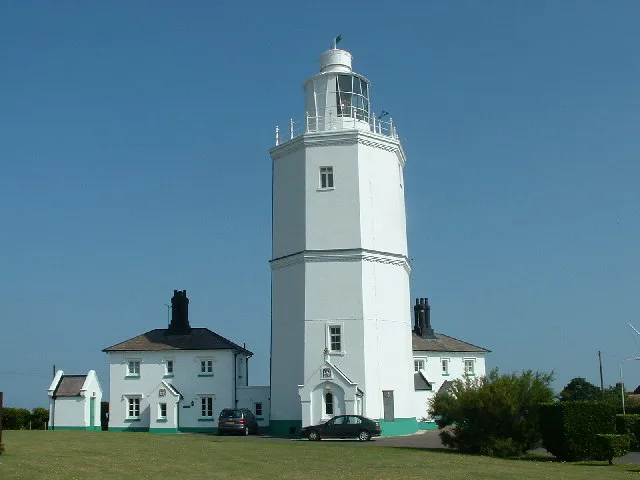
North Foreland Lighthouse
Lighthouses · 1.0 km

Kingsgate Bay
Beaches · 1.0 km

Joss Bay
Beaches · 1.1 km

North Foreland
Natural landmarks · 1.1 km

Neptune's Tower
Historic houses · 1.2 km

Holy Trinity Church, Margate
Historic churches · 1.2 km
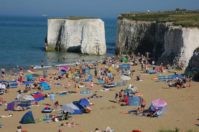
Botany Bay
Mountains & hills · 1.2 km

Easternmost Point of Kent
Viewpoints · 1.3 km

Botany Bay
Wild swimming spots · 1.4 km

Broadstairs WWI Memorial Cross and Tablet
Memorials & monuments · 1.7 km
Nearby
📷 5Memorials & monuments · South East England
Hackemdown Tower
Hackemdown Tower — Grade II listed building-listed memorial in england-south-east, United Kingdom.
📷 5Castles · South East England
Kingsgate Castle
Kingsgate Castle — castle in england south east.
📷 5Lighthouses · South East England
North Foreland Lighthouse
North Foreland Lighthouse — lighthouse at North Foreland, England.
📷 5📷 5📷 5Natural landmarks · South East England
North Foreland
North Foreland — natural landmark in england south east.
Where to eat & stay near Kingsgate
Places to stay
 📷 5
B&Bs · South East England
Copperfields Vegetarian Guest House
Copperfields Vegetarian Guest House — a bed-and-breakfast in england south east.
 📷 5
Hotels · South East England
Royal Albion Hotel
Royal Albion Hotel — a hotel in england south east.
 📷 5
 📷 5
Hotels · South East England
The Yarrow Hotel
The Yarrow Hotel — a hotel in england south east.
 📷 5
Hotels · South East England
Nayland Rock Hotel
Nayland Rock Hotel — a hotel in england south east.
 📷 7
Hotels · South East England
The House at Ramsgate
The House at Ramsgate — a hotel in england south east.
Places to eat & drink
 📷 5
Historic pubs · South East England
Neptune Hall Public House
Neptune Hall Public House in England South East, United Kingdom.
📷 5Cafés · South East England
The Old Curiosity Shop
The Old Curiosity Shop — a café in england south east.
 📷 7
Historic pubs · South East England
The Tartar Frigate Public House
The Tartar Frigate Public House in England South East, United Kingdom.
 📷 5
Restaurants · South East England
Osteria Posillipo Pizzeria
Osteria Posillipo Pizzeria — a restaurant in england south east. Cuisine: italian.
 📷 5
Historic pubs · South East England
Spread Eagle Public House
Spread Eagle Public House in England South East, United Kingdom.
 📷 5
Restaurants · South East England
Hantverk & Found
Hantverk & Found — a restaurant in england south east.
More places in this region
 📷 5
 📷 5
 📷 5
 📷 5
Frequently asked questions
- Where is Kingsgate?
- Kingsgate is in Kent, South-East England, United Kingdom (postcode CT10 3QA), in the parish of Broadstairs and St. Peters.
- What is Kingsgate?
- Kingsgate — a village in england south east.
- How do I get to Kingsgate?
- The nearest railway station is Broadstairs, about 2.0 km away. The nearest town is Westwood. Drivers can use postcode CT10 3QA.
- Is Kingsgate a protected site?
- Yes — Kingsgate is part of the Thanet Coast SSSI Site of Special Scientific Interest and the Thanet Coast & Sandwich Bay Ramsar wetland.
- How do I get to Kingsgate?
- The nearest railway station is Broadstairs, about 2.0 km away. Drivers can navigate to postcode CT10 3QA.