
Historic houses · East of England
Kilverstone Hall
In or near Barnham.
Kilverstone Hall — a Grade II*-listed historic house in england-east, United Kingdom.

Evelyn Simak — CC BY-SA 2.0 via Wikimedia Commons licence

Plan your visit
- Typical visit
- 1 h–2 h
- Nearest railway station
- Thetford · 2.5 km
- Family-friendly
- Limited wheelchair access
Getting there & planning your visit
To visit Kilverstone Hall, the nearest railway station is Thetford, located 2.5 km away. The postcode for sat-nav is IP24 2RL. Please note that wheelchair accessibility is limited.
About
Kilverstone Hall is a Grade II*-listed building in england-east, United Kingdom. Grade II* status is conferred by Historic England (or Cadw, Historic Environment Scotland or NIEA equivalents) on buildings of exceptional national interest. See the linked Wikipedia article for full historical and architectural details.
Photo gallery
Protected designations
- Site of Special Scientific Interest: Breckland Forest SSSI
- Site of Special Scientific Interest: Breckland Farmland SSSI
Designations sourced from Natural England open data under OGL v3.
From the Wikipedia article
Kilverstone Hall is a Grade II listed building in Kilverstone in Norfolk, England.
Excerpt from Wikipedia under CC BY-SA 4.0. See the source article linked in Sources below.
Background
History
Kilverstone Hall is a country house built in the early 17th century It was greatly enlarged by Josiah Vavasseur, technical director of the arms manufacturing firm William Armstrong Ltd. It included a parkland estate of 3000 acre. Upon Vavasseur's death in 1908 the house and park were inherited by Cecil Fisher, son of Admiral Lord Fisher and adopted heir to Vavasseur. Admiral Fisher and his wife moved into the Hall by invitation of Cecil Fisher upon the Admiral's retirement as First Sea Lord in 1910 and lived there until he was recalled as First Sea Lord upon the outbreak of World War I in 1914. Lord Fisher's grave is in Kilverstone churchyard. The house was remodelled in a Jacobean style in…
Sourced from Wikipedia under CC BY-SA 4.0.
- Coordinates
- 52.4227, 0.7813
- County
- Norfolk
- District
- Breckland
- Parish
- Kilverstone
- Postcode
- IP24 2RL
- Parliamentary constituency
- South West Norfolk
- Nearest railway station
- Thetford — 2.5 km
- Official site
- thegreatbritainguide.com
Sources
- wikidata: Q15979031 (CC0)
- wikipedia: Kilverstone Hall (CC BY-SA 4.0)
Other places nearby

Water Tower To Kilverstone Hall
Memorials & monuments · 0.1 km
Kilverstone Village Sign
Public art & sculpture · 0.2 km

Kilverstone
Villages · 0.2 km

Water Trough And War Memorial
Memorials & monuments · 0.2 km

Melford Bridge
Historic bridges · 1.8 km

The Harbord Almshouses
Memorials & monuments · 2.1 km
Black Horse Mural
Public art & sculpture · 2.1 km

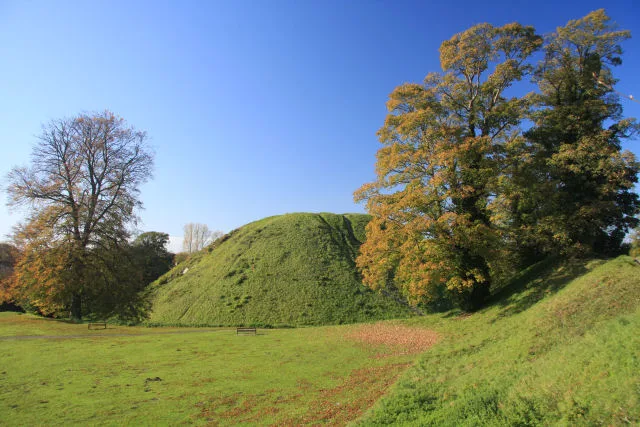
Thetford Castle Hill
Castles · 2.2 km
Thetford Castle
Castles · 2.3 km

Thetford Castle
Vineyards · 2.3 km
_(geograph_6718240).jpg?width=1200)
Thetford War Memorial
Memorials & monuments · 2.3 km

Thetford Market
Farmers’ markets · 2.3 km
Nearby
📷 5Memorials & monuments · East of England
Water Tower To Kilverstone Hall
Water Tower To Kilverstone Hall — a water tower in england-east, United Kingdom.
📷 3Public art & sculpture · East of England
Kilverstone Village Sign
Kilverstone Village Sign — a public art in england-east, United Kingdom.
📷 5📷 3Memorials & monuments · East of England
Water Trough And War Memorial
Water Trough And War Memorial — Grade II listed building-listed memorial in england-east, United Kingdom.
📷 3Historic bridges · East of England
Melford Bridge
Melford Bridge is a historic bridge in the United Kingdom.
📷 3Memorials & monuments · East of England
The Harbord Almshouses
The Harbord Almshouses — a memorial in england-east, United Kingdom.
Where to eat & stay near Kilverstone Hall
Places to stay
 📷 7
📷 7Hotels · East of England
The Thomas Paine Hotel
The Thomas Paine Hotel — a hotel in england east.
 📷 5
📷 5 📷 5
📷 5Campsites · East of England
Two Mile Bottom Scout and Guide Camp Site
Two Mile Bottom Scout and Guide Camp Site — a campsite in england east.
 📷 5
📷 5Campsites · East of England
Escape Pods
Escape Pods — a campsite in england east.
 📷 5
📷 5Campsites · East of England
Grove Farm Campsite
Grove Farm Campsite — a campsite in england east.
 📷 5
📷 5Caravan parks · East of England
Poppyfields
Poppyfields — a caravan park in england east.
Places to eat & drink
 📷 5
📷 5Historic pubs · East of England
Old Mill Public House, Rudolph's Nite Spot And Old Mill Pizza House
Old Mill Public House, Rudolph's Nite Spot And Old Mill Pizza House in England East, United Kingdom.
 📷 5
📷 5Historic pubs · East of England
The Railway Public House
The Railway Public House in England East, United Kingdom.
 📷 5
📷 5Restaurants · East of England
Wong's Taste of China
Wong's Taste of China — a restaurant in england east.
 📷 5
📷 5Historic pubs · East of England
The Old Woolpack Public House
The Old Woolpack Public House in England East, United Kingdom.
 📷 7
📷 7Historic pubs · East of England
Three Kings Public House And Attached House Stable Block
Three Kings Public House And Attached House Stable Block in England East, United Kingdom.
 📷 5
📷 5Historic pubs · East of England
Griffin Hotel, Attleborough
Griffin Hotel, Attleborough in England East, United Kingdom.
More historic houses in this region
 📷 5
📷 5Historic houses · East of England
41 and 41a, Broad Street
41 and 41a, Broad Street — Grade II* listed house in Ely, East Cambridgeshire, England, UK.
 📷 5
📷 5Historic houses · East of England
Abbey Gate House
Abbey Gate House — house in St Albans, Hertfordshire, England, UK.
 📷 5
📷 5Historic houses · East of England
Abbey House
Abbey House — house in Cambridge, Cambridgeshire, England, UK.
.jpg?width=1200) 📷 5
📷 5Historic houses · East of England
Amores Including Outbuildings
Amores Including Outbuildings — architectural structure in Hertford, East Hertfordshire, England, UK.
Frequently asked questions
- Where is Kilverstone Hall?
- Kilverstone Hall is in Norfolk, East of England, United Kingdom (postcode IP24 2RL), in the parish of Kilverstone.
- What is Kilverstone Hall?
- Kilverstone Hall — a Grade II*-listed historic house in england-east, United Kingdom.
- How do I get to Kilverstone Hall?
- The nearest railway station is Thetford, about 2.5 km away. Drivers can use postcode IP24 2RL.
- Is Kilverstone Hall a listed building?
- Kilverstone Hall is officially recognised as Grade II* listed.
- Is Kilverstone Hall a protected site?
- Yes — Kilverstone Hall is part of the Breckland Forest SSSI Site of Special Scientific Interest and the Breckland Farmland SSSI Site of Special Scientific Interest.
- How do I get to Kilverstone Hall?
- The nearest railway station is Thetford, about 2.5 km away. Drivers can navigate to postcode IP24 2RL.