Historic churches · Central Scotland
Kilspindie
In or near Balbeggie.
Kilspindie in Scotland Islands, United Kingdom.

Elliott Simpson — CC BY-SA 2.0 via Wikimedia Commons licence
Plan your visit
- Typical visit
- 30 min–1 h
- Free entry
About
Kilspindie is a place of interest in Scotland Islands, United Kingdom — drawn from open-data sources for visitor reference. See the linked Wikipedia article for the full description.
Photo gallery
Heritage listing
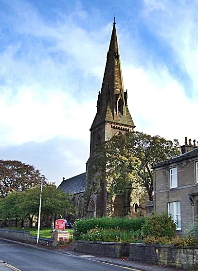
Kilspindie is a village in Perth and Kinross, Scotland. It is situated on the Kilspindie burn, approximately 2+3⁄4 miles (4.5 kilometres) northwest of Errol, 12 miles (19 kilometres) west of Dundee centre and 6+1⁄2 miles (10 kilometres) east of Perth. The village has an area of 6,500 acres (2,600 hectares) of which 3,500 acres (1,400 hectares) are arable land and 200 acres (81 hectares) are woodland, the local geology is mostly whinstone, amygdule and trap. Records show there was a chapel in the village since at least 1214 though the current church, the Kilspindie and Rait Parish Church, was built in 1670 and refurbished in 1938. The village previously housed the Kilspindie Castle which was demolished before 1670.
From Historic Environment Scotland under OGL v3.
From the Wikipedia article
Kilspindie is a village in Perth and Kinross, Scotland. It is situated on the Kilspindie burn, approximately 2+3⁄4 miles (4.5 kilometres) northwest of Errol, 12 miles (19 kilometres) west of Dundee centre and 6+1⁄2 miles (10 kilometres) east of Perth. The village has an area of 6,500 acres (2,600 hectares) of which 3,500 acres (1,400 hectares) are arable land and 200 acres (81 hectares) are woodland, the local geology is mostly whinstone, amygdule and trap. Records show there was a chapel in the village since at least 1214 though the current church, the Kilspindie and Rait Parish Church, was built in 1670 and refurbished in 1938. The village previously housed the Kilspindie Castle which was demolished before 1670. In the Ordnance Gazetteer of Scotland (1882–84) Francis Groome described Kilspindie: Kilspindie, a village and a parish in Gowrie district, SE Perthshire. The village, standing in the mouth of a small glen, 1 mile SSW of Rait, 2⅛ miles NNW of Errol station, and 3⅜ NNE of Glencarse station, had anciently a castle, now extinct, and figures in Blind Harry's narrative as the place where Sir William Wallace, with his mother, found refuge in his boyhood. The village is twinned with Fléac in France.
Excerpt from Wikipedia under CC BY-SA 4.0. See the source article linked in Sources below.
- Coordinates
- 56.4162, -3.2659
- District
- Perth and Kinross
- Postcode
- PH2 7RX
- Parliamentary constituency
- Perth and Kinross-shire
Sources
- wikidata: Q6408207 (CC0)
- wikipedia: Kilspindie (CC BY-SA 4.0)
Other places nearby
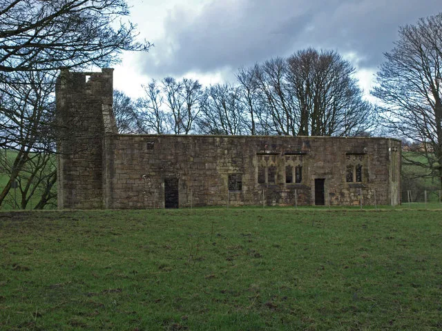
Kilspindie Parish Church And Old Parish Church
Historic churches · 0.1 km

Kilspindie
Literary houses · 0.2 km

Pitroddie Farm
Archaeological sites · 0.5 km

Nether Durdie
Archaeological sites · 0.8 km

Old Manse and Former Secession Church, Pitroddie, Errol
Historic churches · 1.0 km

Myreside
Archaeological sites · 1.1 km

Over Durdie
Archaeological sites · 1.2 km

Over Durdie
Vineyards · 1.2 km

Rait
Historic churches · 1.3 km

Rait, Old Parish Church
Historic churches · 1.5 km
Rait Church
Historic houses · 1.5 km

Rait
Vineyards · 1.5 km
Nearby
📷 5Historic churches · Central Scotland
Kilspindie Parish Church And Old Parish Church
Kilspindie Parish Church And Old Parish Church — category B listed building-listed church in scotland-central, United Kingdom.
📷 5Literary houses · Central Scotland
Kilspindie
Kilspindie — a literary house museum in scotland central.
📷 3Archaeological sites · Central Scotland
Pitroddie Farm
Pitroddie Farm — a archaeological in scotland-central, United Kingdom.
📷 3Archaeological sites · Central Scotland
Nether Durdie
Nether Durdie — a archaeological in scotland-central, United Kingdom.
📷 5Historic churches · Central Scotland
Old Manse and Former Secession Church, Pitroddie, Errol
Old Manse and Former Secession Church, Pitroddie, Errol — category B listed building-listed church in scotland-central, United Kingdom.
📷 3Archaeological sites · Central Scotland
Myreside
Myreside — a archaeological in scotland-central, United Kingdom.
Where to eat & stay near Kilspindie
Places to stay
 📷 5
📷 5Caravan parks · Central Scotland
South Valleyfield
South Valleyfield — a caravan park in scotland central.
 📷 5
📷 5Caravan parks · Central Scotland
Fernlea CL Caravan Site
Fernlea CL Caravan Site — a caravan park in scotland central.
 📷 5
📷 5Caravan parks · Central Scotland
Inchmartine Caravan Park
Inchmartine Caravan Park — a caravan park in scotland central.
 📷 5
📷 5Caravan parks · Central Scotland
Scone Camping and Caravanning Club Site
Scone Camping and Caravanning Club Site — a caravan park in scotland central.
 📷 5
📷 5Hostels · Central Scotland
Perth Youth Hostel
Perth Youth Hostel — a hostel in scotland central.
 📷 5
📷 5Places to eat & drink
 📷 5
📷 5Historic pubs · Central Scotland
57, 59, 61 West Port, Dundee
57, 59, 61 West Port, Dundee in Scotland Central, United Kingdom.
 📷 5
📷 5 📷 7
📷 7Historic pubs · Central Scotland
The Counting House
The Counting House in Scotland Central, United Kingdom.
 📷 7
📷 7Historic pubs · Central Scotland
The Pillars Bar, 9, 11 Crichton Street, Dundee
The Pillars Bar, 9, 11 Crichton Street, Dundee in Scotland Central, United Kingdom.
 📷 5
📷 5Historic pubs · Central Scotland
Public House, 15 Dock Street, Dundee
Public House, 15 Dock Street, Dundee in Scotland Central, United Kingdom.
 📷 7
📷 7Historic pubs · Central Scotland
Ladywell Tavern, 16 Victoria Road, Dundee
Ladywell Tavern, 16 Victoria Road, Dundee in Scotland Central, United Kingdom.
More places in this region
 📷 5
📷 5Historic churches · Central Scotland
Castle Semple Collegiate Church
Castle Semple Collegiate Church — church building in Renfrewshire, Scotland, UK.
 📷 3
📷 3Historic churches · Central Scotland
Chapel of St Fyndoca, Inishail
Chapel of St Fyndoca, Inishail — architectural structure in Argyll and Bute, Scotland, UK.
 📷 3
📷 3Historic churches · Central Scotland
Chapel of St. Oran, Colonsay
Chapel of St. Oran, Colonsay — chapel on Colonsay, Argyll and Bute, Scotland, UK.
 📷 3
📷 3Historic churches · Central Scotland
Church of St Mary the Virgin, Arbroath
Church of St Mary the Virgin, Arbroath — church in Arbroath, UK.
Frequently asked questions
- Where is Kilspindie?
- Kilspindie is in the Scottish Highlands, United Kingdom (postcode PH2 7RX).
- What is Kilspindie?
- Kilspindie in Scotland Islands, United Kingdom.
- How do I get to Kilspindie?
- Drivers can use postcode PH2 7RX.
- Is Kilspindie a listed building?
- Kilspindie is officially recognised as category C listed building listed.
- Is Kilspindie free to visit?
- Yes, Kilspindie is free to enter.
- How do I get to Kilspindie?
- Drivers can navigate to postcode PH2 7RX. It sits within the Perth and Kinross-shire parliamentary constituency.