Historic churches · Scottish Islands
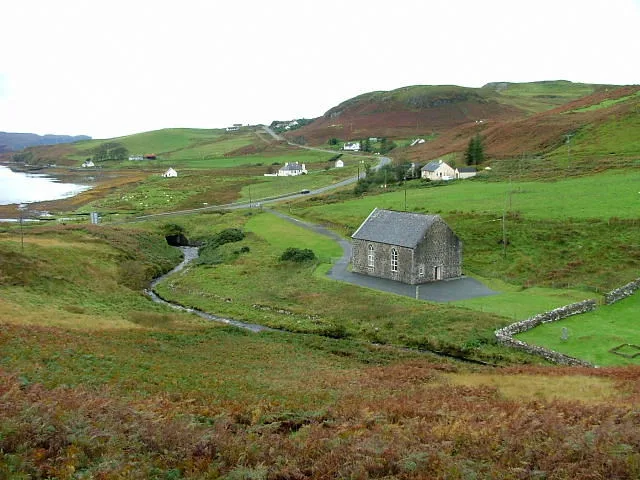
Kilmaluag
In or near Uig.
Kilmaluag in Scotland Islands, United Kingdom.

Elliott Simpson — CC BY-SA 2.0 via Wikimedia Commons licence
Plan your visit
- Typical visit
- 30 min–1 h
- Free entry
About
Kilmaluag is a place of interest in Scotland Islands, United Kingdom — drawn from open-data sources for visitor reference. See the linked Wikipedia article for the full description.
Photo gallery
From the Wikipedia article
Kilmaluag (Scottish Gaelic: Cill Moluaig, meaning St. Moluag's Cell, Church or Chapel) is a township made up of several small settlements on the most northerly point of the Trotternish peninsula of the Isle of Skye, Scotland. Kilmaluag is within the parish of Kilmuir. The settlements within the township include Balmacqueen (Gaelic: Macqueen's Place), Kendram (Gaelic: Head of the Ridge), Connista (Norse: High Farm), Aird (Gaelic: Point or Promontory) and Solitote (Gaelic: Ruin Hill). The Kilmaluag also gives its name to a Jurassic geological formation, the Kilmaluag Formation. This limestone and sandstone formation is Bathonian in age, and outcrops in the harbour of the village and in several other locations on Skye.
Excerpt from Wikipedia under CC BY-SA 4.0. See the source article linked in Sources below.
- Coordinates
- 57.6800, -6.2900
- District
- Highland
- Postcode
- IV51 9UP
- Parliamentary constituency
- Inverness, Skye and West Ross-shire
Sources
Other places nearby

Cnoc Ghrianal Mòr
Mountains & hills · 0.6 km

Skye, Tom na h-Uraich
Vineyards · 0.7 km

Tom Na h-Uraich, dun site
Archaeological sites · 0.7 km

Kilmaluag
Villages · 1.1 km

Dùn Hollan, dun site
Archaeological sites · 1.1 km

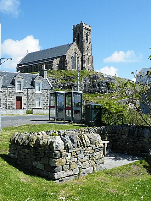
St Moluah's Church
Historic churches · 1.5 km

St Moluah's Church
Archaeological sites · 1.5 km

Kilmaluag Bay
Natural landmarks · 1.6 km

Steall a' Ghreip
Waterfalls · 1.9 km

Aird, dun site
Archaeological sites · 1.9 km

Cnoc Riasal
Mountains & hills · 1.9 km

Cnoc a' Chlachain
Mountains & hills · 2.0 km
Nearby
📷 5Mountains & hills · Scottish Islands
Cnoc Ghrianal Mòr
Cnoc Ghrianal Mòr — mountain in scotland highlands. Elevation: 70 m.
📷 5Vineyards · Scottish Islands
Skye, Tom na h-Uraich
Skye, Tom na h-Uraich — a UK vineyard in scotland highlands, producing English or Welsh wine from cool-climate grape varieties.
📷 3Archaeological sites · Scottish Islands
Tom Na h-Uraich, dun site
Tom Na h-Uraich, dun site — a archaeological in scotland-highlands, United Kingdom.
📷 5📷 3Archaeological sites · Scottish Islands
Dùn Hollan, dun site
Dùn Hollan, dun site — a archaeological in scotland-highlands, United Kingdom.
📷 3Historic churches · Scottish Islands
St Moluah's Church
St Moluah's Church — a church in scotland-highlands, United Kingdom.
Where to eat & stay near Kilmaluag
Places to stay
 📷 5
📷 5Campsites · Scottish Islands
Camus More Camping
Camus More Camping — a campsite in scotland highlands.
 📷 5
📷 5Campsites · Scottish Highlands
Staffin Campsite
Staffin Campsite — a campsite in scotland highlands.
 📷 7
📷 7Hotels · Scottish Islands
Uig Hotel
Uig Hotel — a hotel in scotland highlands.
 📷 5
📷 5Campsites · Scottish Islands
Uig Bay Campsite
Uig Bay Campsite — a campsite in scotland highlands.
 📷 5
📷 5 📷 5
📷 5Hotels · Scottish Islands
Greshornish House
Greshornish House — a hotel in scotland highlands.
More places in this region
 📷 3
📷 3Historic churches · Scottish Islands
Bracadale Free Presbyterian Church
Bracadale Free Presbyterian Church — church in Highland, Scotland, UK.
 📷 3
📷 3Historic churches · Scottish Islands
Church of our Lady, Star of the Sea, Barra
Church of our Lady, Star of the Sea, Barra — church in Castlebay, UK.
 📷 3
📷 3 📷 3
📷 3Historic churches · Scottish Islands
Nunton Church
Nunton Church — church in Nunton, Outer Hebrides, Scotland, UK.
Frequently asked questions
- Where is Kilmaluag?
- Kilmaluag is in the Scottish Islands, United Kingdom (postcode IV51 9UP).
- What is Kilmaluag?
- Kilmaluag in Scotland Islands, United Kingdom.
- How do I get to Kilmaluag?
- Drivers can use postcode IV51 9UP.
- Is Kilmaluag free to visit?
- Yes, Kilmaluag is free to enter.
- How do I get to Kilmaluag?
- Drivers can navigate to postcode IV51 9UP. It sits within the Inverness, Skye and West Ross-shire parliamentary constituency.