
Castles · Northern Ireland
Killowen Castle
In or near Macosquin.
Killowen Castle — castle at Killowen, County Down, Northern Ireland.

Wikimedia Commons licence
Plan your visit
- Typical visit
- 1.5 h–3 h
- Nearest railway station
- Coleraine · 0.8 km
- Free entry
- Family-friendly
- Limited wheelchair access
Getting there & planning your visit
To visit Killowen Castle, the nearest railway station is Coleraine, which is 0.8 km away. The postcode for sat-nav is BT51 3AA. Accessibility is limited for wheelchair users.
About
Killowen Castle is a castle in the United Kingdom — fortified architecture from the medieval, Tudor, or Victorian-revival period. Wikidata describes it as: "castle at Killowen, County Down, Northern Ireland". Coordinates: 55.1317°, -6.6753°.
Photo gallery
See it from the streetimagery from 2025
Imagery © Mapillary contributors, CC BY-SA 4.0
Official information
Coleraine Museum, located in the historic Coleraine Town Hall, showcases temporary exhibitions and events that highlight the rich history of the area, including the story of Mountsandel, Ireland's first known settlement. The museum features a collection of local artwork and historical documents, and visitors can make appointments to explore parts of the collection not on display.
From the Wikipedia article
Killowen Castle (Irish: Caislen Cill Eoghain) was a castle situated in the parish of Killowen, County Londonderry, Northern Ireland. The area was once known as Drumtarsy (Druim-tairsigh) and the castle known as Drumtarsy castle. The name "Drumtarsy" is no longer commonly recognized in the local area. Its identification has been aided by historical records, notably the Ecclesiastical Taxation, which lists the church of Drumtarssi between those of Camus and Dunhoe within the Diocese of Derry. The location of Drumtarsy Castle is uncertain. In 1213, according to the annals, English forces under Thomas mac Uchtry built a castle at Coleraine. This construction was considered a destructive event in the region, as most of the town’s cemeteries and buildings, except for the church, were dismantled to provide building materials. In 1288, a church, St. Eugene’s, was built to serve the castle and the surrounding community. The parish took its name from the church, originally known in Irish as Cill Eogain (meaning "Church of Eugene"). Over time, this name was anglicised to Killowen. The area was commonly referred to as "the Castle-side of the river." However, as Drumtarsy Castle deteriorated and was eventually demolished, the name lost relevance. The area later became known as the Waterside. In the mid-13th century, the English crown concentrated its efforts on consolidating control over Ulster and Connacht. The death of Aed O’Neill in 1230 triggered a dynastic struggle within the Cenél Eóghain weakening their resistance to external forces. Donal Mac Lochlainn, with support from the Anglo-Norman administration in Dublin, initially subdued rival O’Neill claimants but was killed in 1241 at the Battle of Camergi, an unidentified site in County Tyrone, by Brian O’Neill, allied with the O’Donnells of Tír Conaill (modern-day County Donegal). Exploiting this instability, John FitzGeoffrey, Justiciar of Ireland under King Henry III, launched a campaign in 1248 to assert royal authority…
Excerpt from Wikipedia under CC BY-SA 4.0. See the source article linked in Sources below.
- Coordinates
- 55.1317, -6.6753
- District
- Causeway Coast and Glens
- Postcode
- BT51 3AA
- Parliamentary constituency
- East Londonderry
- Phone
- 028 2766 0230
- Nearest railway station
- Coleraine — 0.8 km
Sources
- wikidata: Q6407895 (CC0)
- wikipedia: Killowen Castle (CC BY-SA 4.0)
Other places nearby

Coleraine Bridge
Historic bridges · 0.0 km

Coleraine Castle
Castles · 0.1 km

Old Courthouse
Natural landmarks · 0.2 km

Ecology
Galleries · 0.2 km

Town Hall The Diamond Coleraine Co.londonderry
Historic houses · 0.3 km
Coleraine Museum
Museums · 0.3 km

County Hall, Coleraine
Historic houses · 0.4 km

St. Patrick's Church, Coleraine
Historic churches · 0.4 km

Borough of Coleraine
Natural landmarks · 0.5 km
County Coleraine
Natural landmarks · 0.5 km

Coleraine College
Natural landmarks · 0.6 km

Causeway Institute
Natural landmarks · 0.7 km
Nearby
📷 4Historic bridges · Northern Ireland
Coleraine Bridge
Coleraine Bridge in Northern Ireland, United Kingdom.
📷 3Castles · Northern Ireland
Coleraine Castle
Coleraine Castle — castle in County Londonderry, Northern Ireland.
📷 4Natural landmarks · Northern Ireland
Old Courthouse
Old Courthouse in Northern Ireland, United Kingdom.
📷 3📷 4Historic houses · Northern Ireland
Town Hall The Diamond Coleraine Co.londonderry
Town Hall The Diamond Coleraine Co.londonderry in Northern Ireland, United Kingdom.
📷 3Museums · Northern Ireland
Coleraine Museum
Coleraine Museum — a museum in Northern Ireland, United Kingdom.
Where to eat & stay near Killowen Castle
Places to stay
 📷 5
📷 5Caravan parks · Northern Ireland
Tullans Farm Caravan Park
Tullans Farm Caravan Park — a caravan park in northern ireland.
 📷 5
📷 5Caravan parks · Northern Ireland
Bellemont Caravan Park
Bellemont Caravan Park — a caravan park in northern ireland.
 📷 3
📷 3Caravan parks · Northern Ireland
Ballyleese Town and Country Caravan Park
Ballyleese Town and Country Caravan Park — a caravan park in northern ireland.
 📷 5
📷 5Campsites · Northern Ireland
Maddybenny
Maddybenny — a campsite in northern ireland.
 📷 4
📷 4 📷 5
📷 5Caravan parks · Northern Ireland
Hilltop Camping
Hilltop Camping — a caravan park in northern ireland.
More castles in this region
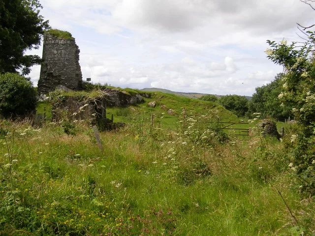 📷 3
📷 3Castles · Northern Ireland
Aileach Castle
Aileach Castle — castle in Derry, County Londonderry, Northern Ireland.
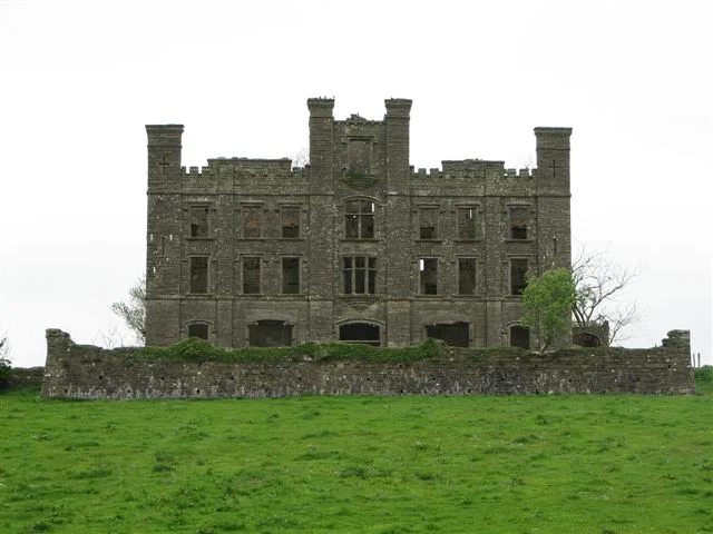 📷 3
📷 3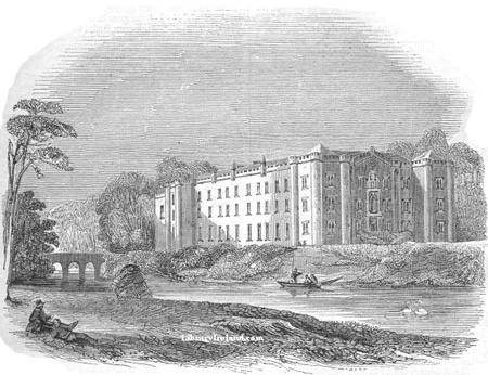 📷 5
📷 5Castles · Northern Ireland
Antrim Castle
Antrim Castle — 17th century house in Antrim, Ireland, now demolished.
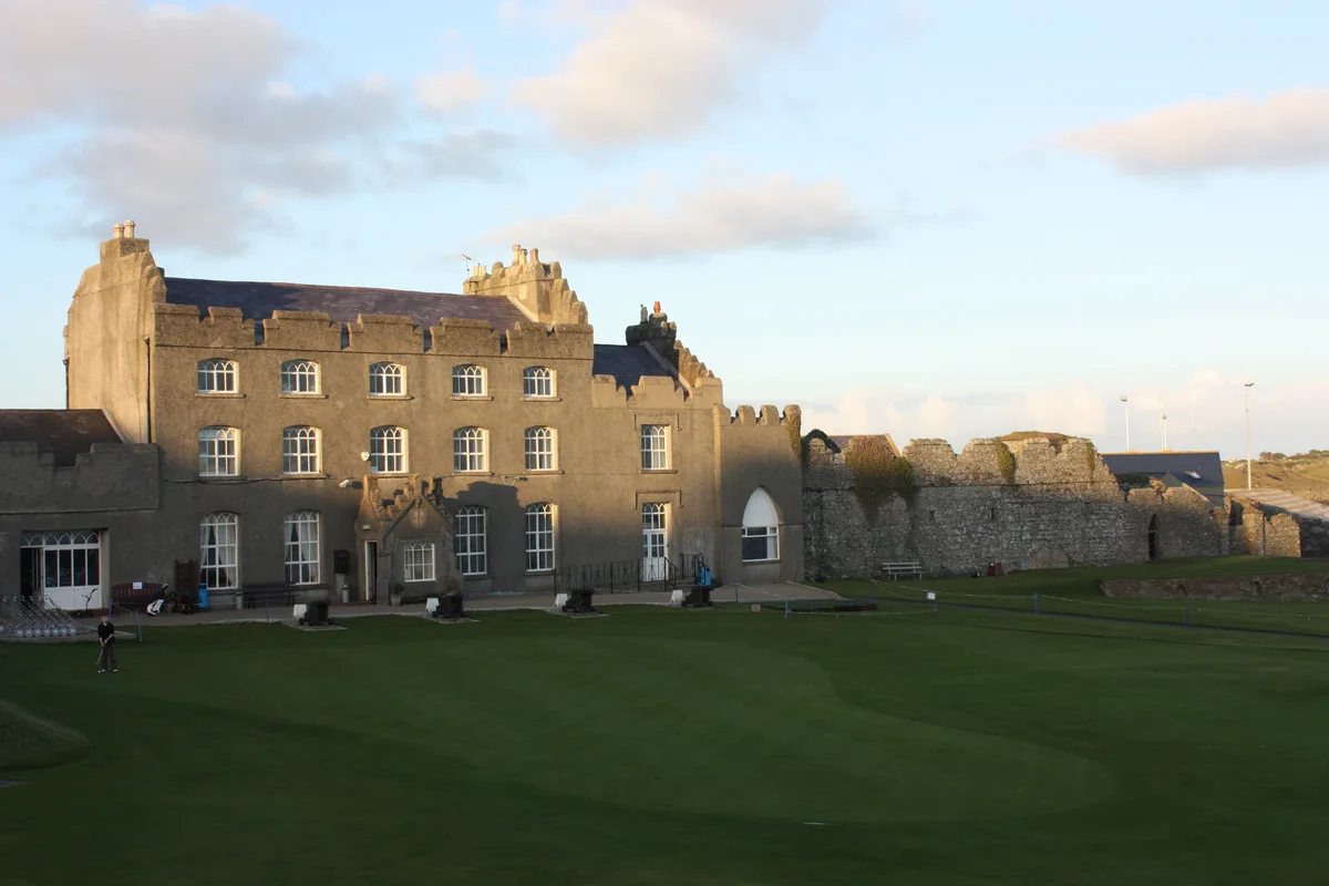 📷 5
📷 5Castles · Northern Ireland
Ardglass Castle
Ardglass Castle — row of 15th century warehouses in Northern Ireland.
Frequently asked questions
- Where is Killowen Castle?
- Killowen Castle is in Northern Ireland, United Kingdom (postcode BT51 3AA).
- What is Killowen Castle?
- Killowen Castle — castle at Killowen, County Down, Northern Ireland.
- How do I get to Killowen Castle?
- The nearest railway station is Coleraine, about 0.8 km away. The nearest town is Macosquin. Drivers can use postcode BT51 3AA.
- Is Killowen Castle free to visit?
- Yes, Killowen Castle is free to enter.
- How do I get to Killowen Castle?
- The nearest railway station is Coleraine, about 0.8 km away. Drivers can navigate to postcode BT51 3AA.