
Natural landmarks · Northern Ireland
Killen
Also known as: Cillín, Contae Thír Eoghain
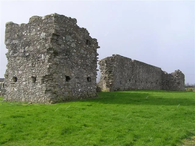
Killen in Northern Ireland, United Kingdom.

Kenneth Allen — CC BY-SA 2.0 via Wikimedia Commons licence

Plan your visit
- Typical visit
- 1 h–2 h
- Free entry
- Dog-friendly
About
Killen is a place of interest in Northern Ireland, United Kingdom — drawn from open-data sources for visitor reference. See the linked Wikipedia article for the full description.
Photo gallery
See it from the streetimagery from 2020
Imagery © Mapillary contributors, CC BY-SA 4.0
From the Wikipedia article
Killen (from Irish Cillín, meaning 'little church') is a small village and townland (of 356 acres) in County Tyrone, Northern Ireland. It is several miles southwest of Castlederg, on the road leading south over Scraghy Mountain. A short distance to the west lies County Donegal, in the Republic of Ireland. It is situated in the civil parish of Longfield West and the historic barony of Omagh West. In the 2001 Census it had a population of 231 people. In recent years, Killen Creamery has been turned into a community centre and business centre.
Excerpt from Wikipedia under CC BY-SA 4.0. See the source article linked in Sources below.
- Coordinates
- 54.6756, -7.6249
- District
- Derry City and Strabane
- Postcode
- BT81 7TJ
- Parliamentary constituency
- West Tyrone
Sources
- wikidata: Q6407421 (CC0)
- wikipedia: Killen, County Tyrone (CC BY-SA 4.0)
Other places nearby

Mourne Beg
Villages · 1.0 km

Killen
Villages · 1.1 km

Garvetagh
Natural landmarks · 3.2 km

Dartans
Natural landmarks · 3.2 km

Dergview F.C.
Natural landmarks · 3.5 km

Killeter
Natural landmarks · 3.8 km

Omagh West
Natural landmarks · 3.8 km
Castlederg St. Eugene's GAC
Natural landmarks · 3.9 km
Castlederg Castle
Castles · 3.9 km

Derg Castle
Castles · 3.9 km

Castlederg and Victoria Bridge Tramway
Historic bridges · 4.0 km

Castlederg railway station
Natural landmarks · 4.2 km
Nearby
📷 5📷 5📷 5📷 5📷 3Natural landmarks · Northern Ireland
Dergview F.C.
Dergview F.C. in Northern Ireland, United Kingdom.
📷 4Where to eat & stay near Killen
Places to stay
 📷 5
📷 5 📷 5
📷 5Caravan parks · Northern Ireland
Edgewater Holiday Park & Marina
Edgewater Holiday Park & Marina — a caravan park in northern ireland.
 📷 5
📷 5Caravan parks · Northern Ireland
Clareview Caravan Park
Clareview Caravan Park — a caravan park in northern ireland.
 📷 5
📷 5 📷 5
📷 5Caravan parks · Northern Ireland
Drumhoney Holiday Park
Drumhoney Holiday Park — a caravan park in northern ireland.
More natural landmarks in this region
 Flagship📷 4
Natural landmarks · Northern Ireland
Lough Erne
Lough Erne — lake in County Fermanagh, Northern Ireland, UK.
 Flagship📷 4
Natural landmarks · Northern Ireland
Lough Neagh
Lough Neagh — large lake in Northern Ireland.
 📷 3
📷 3Natural landmarks · Northern Ireland
Ballysaggart Lough
Ballysaggart Lough — lake in the United Kingdom.
 📷 5
📷 5Natural landmarks · Northern Ireland
Belmore Mountain
Belmore Mountain — mountain in the United Kingdom.
Frequently asked questions
- Where is Killen?
- Killen is in Northern Ireland, United Kingdom (postcode BT81 7TJ).
- What is Killen?
- Killen in Northern Ireland, United Kingdom.
- How do I get to Killen?
- Drivers can use postcode BT81 7TJ.
- Is Killen free to visit?
- Yes, Killen is free to enter.
- How do I get to Killen?
- Drivers can navigate to postcode BT81 7TJ. It sits within the West Tyrone parliamentary constituency.