
Villages · Scottish Lowlands
Kilkerran
In or near Dailly.
Kilkerran — a village in scotland lowlands.

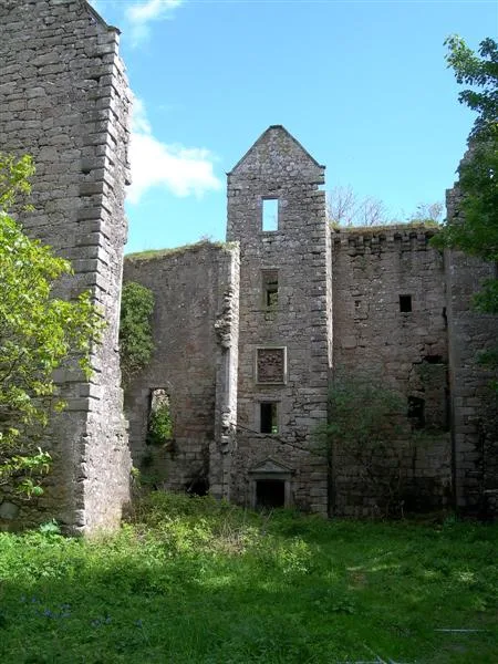
Billy McCrorie — CC BY-SA 2.0 via Wikimedia Commons licence

Plan your visit
- Typical visit
- 1 h–2 h
- Nearest railway station
- Maybole · 8.0 km
About
A British village — settlements of this size traditionally cluster a green, parish church, pub and post office around historic land routes.
Photo gallery
Place summary
Kilkerran is a village located in the Scottish Lowlands. It is characterised by its rural setting and traditional architecture. The village is part of a region known for its scenic landscapes and agricultural heritage. Visitors can expect a quiet atmosphere typical of small Scottish communities.
AI-generated from the structured facts on this page (operator, designation, listing, era). Not a substitute for visiting.
- Coordinates
- 55.2833, -4.6667
- District
- South Ayrshire
- Postcode
- KA19 7SJ
- Parliamentary constituency
- Ayr, Carrick and Cumnock
- Nearest railway station
- Maybole — 8 km
Sources
- manual: geonames-2645656 (CC BY 4.0)
Other places nearby

Kilkerran House
Historic houses · 1.0 km

Aird Bridge
Historic bridges · 1.9 km

More Knowe, dun site
Archaeological sites · 2.1 km

Kilkerran Castle
Literary houses · 2.1 km

Drumgirnan Bridge
Historic bridges · 2.2 km

The Pilot
Mountains & hills · 2.5 km

Captain's Bridge, dun site
Historic bridges · 2.6 km

Captain's Bridge, Drummochreen
Vineyards · 2.7 km

Sawmill
Historic houses · 2.9 km

Knockinculloch
Mountains & hills · 3.3 km

Craiginmoddie
Mountains & hills · 3.4 km
Old Dalquharran Castle
Castles · 3.5 km
Nearby
📷 5Historic houses · Scottish Lowlands
Kilkerran House
Kilkerran House — house in South Ayrshire, Scotland, UK.
📷 5Historic bridges · Scottish Lowlands
Aird Bridge
Aird Bridge — category B listed building-listed bridge in scotland-lowlands, United Kingdom.
📷 3Archaeological sites · Scottish Lowlands
More Knowe, dun site
More Knowe, dun site — an archaeological site in Scottish Lowlands, United Kingdom.
📷 5Literary houses · Scottish Lowlands
Kilkerran Castle
Kilkerran Castle — a literary house museum in scotland lowlands.
📷 5Historic bridges · Scottish Lowlands
Drumgirnan Bridge
Drumgirnan Bridge — category B listed building-listed bridge in scotland-lowlands, United Kingdom.
📷 5Where to eat & stay near Kilkerran
Places to stay
 📷 5
📷 5 📷 5
📷 5Caravan parks · Scottish Lowlands
Turnberry Holiday Park
Turnberry Holiday Park — a caravan park in scotland lowlands.
 📷 5
📷 5Campsites · Scottish Lowlands
Culzean Castle Camping and Caravanning Club Site
Culzean Castle Camping and Caravanning Club Site — a campsite in scotland lowlands.
 📷 5
📷 5Caravan parks · Scottish Lowlands
Redgates Holiday Park
Redgates Holiday Park — a caravan park in scotland lowlands.
📷 5Caravan parks · Scottish Lowlands
Sandy Beach Caravan Park
Sandy Beach Caravan Park — a caravan park in scotland lowlands.
 📷 5
📷 5Caravan parks · Scottish Lowlands
Old Mill Caravan Park
Old Mill Caravan Park — a caravan park in scotland lowlands.
Places to eat & drink
 📷 5
📷 5Historic pubs · Scottish Lowlands
The White House and Adjoining Joiner's Shop, Kirkmichael Arms, Straiton Road, Kirkmichael
The White House and Adjoining Joiner's Shop, Kirkmichael Arms, Straiton Road, Kirkmichael in Scotland Lowlands, United Kingdom.
 📷 5
📷 5Historic pubs · Scottish Lowlands
Doon Tavern, High Street, Dalmellington
Doon Tavern, High Street, Dalmellington in Scotland Lowlands, United Kingdom.
 📷 5
📷 5Historic pubs · Scottish Lowlands
Railway Tavern, 18 Smith Street, Ayr
Railway Tavern, 18 Smith Street, Ayr in Scotland Lowlands, United Kingdom.
More places in this region
 📷 5
📷 5 📷 5
📷 5 📷 5
📷 5 📷 5
📷 5Frequently asked questions
- Where is Kilkerran?
- Kilkerran is in the Scottish Lowlands, United Kingdom (postcode KA19 7SJ).
- What is Kilkerran?
- Kilkerran — a village in scotland lowlands.
- How do I get to Kilkerran?
- The nearest railway station is Maybole, about 8.0 km away. The nearest town is Dailly. Drivers can use postcode KA19 7SJ.
- How do I get to Kilkerran?
- Drivers can navigate to postcode KA19 7SJ. It sits within the Ayr, Carrick and Cumnock parliamentary constituency.