
Natural landmarks · Central Scotland
Kilbirnie Loch
In or near Lochwinnoch.
Kilbirnie Loch — lake in North Ayrshire, Scotland, UK.

Wikimedia Commons contributors — see linked file page for photographer and licence licence

Plan your visit
- Typical visit
- 1 h–2 h
- Nearest railway station
- Glengarnock · 1.8 km
- Free entry
- Dog-friendly
Getting there & planning your visit
Kilbirnie Loch is located in North Ayrshire, postcode KA15 2HU. The nearest railway station is Glengarnock, which is 1.8 km away. Entry to the loch is free.
About
Kilbirnie Loch is a named natural landmark in the United Kingdom. Wikidata describes it as: "lake in North Ayrshire, Scotland, UK". Coordinates: 55.7540°, -4.6627°.
Photo gallery
From the Wikipedia article
Kilbirnie Loch (NS 330 543) is a freshwater Loch situated in the floodplain between Kilbirnie, Glengarnock and Beith, North Ayrshire, Scotland. It runs south-west to north-east for almost 2 km (1.2 mi), is about 0.5 km (0.31 mi) wide for the most part and has an area of roughly 3 km2 (740 acres). It has a general depth of around 5.2 metres (17 feet) to a maximum of around 11 metres (36 feet). The loch is fed mainly by the Maich Water, which rises in the Kilbirnie Hills near Misty Law (507m or 1663 feet), and is drained by the Dubbs Water that runs past the Barr Loch into Castle Semple Loch, followed by the Black Cart, the White Cart at Renfrew and finally the River Clyde. The boundary between East Renfrewshire and North Ayrshire, in the vicinity of the loch, runs down the course of the Maich Water along the northern loch shore to then run up beside the Dubbs Water.
Excerpt from Wikipedia under CC BY-SA 4.0. See the source article linked in Sources below.
Background
History
of the Lord Sempill]] looking over the loch from the north]] Hector Boece (1465–1536) is the first to publish a reference to the loch, using the name 'Garnoth', in his book of 1527 the 'Historia Gentis Scotorum' (History of the Scottish People), saying that nocht unlike the Loch Doune full of fische. There is a long history of drainage schemes and farming operations in the area, with co-ordinated attempts dating from about 1691 by Lord Sempill, followed by Colonel McDowal of Castle Sempil in 1774, James Adams of Burnfoot, and by others. Until these drainage works the two lochs nearly met and often did during flooding, to the extent that early writers such as Boece, Hollings and Petruccio…
Description
that lies close to the site of the old Onthank Farm]] This was the only island on the loch and was thought as late as the 1860s An artificial island was created at the south-east end of the loch for nesting birds in the 1980s.
Visiting
At the Kilbirnie end the loch can be accessed by following the B777 to the Lochshore Industrial Estate. This provides ample parking and the road leads to the boat launching area in the south-west corner of the loch. At the Beith end the unclassified 'Kerse' road runs between Beith and the A760 enables access to the northern shore of the loch. Parking along the roadside is difficult. At the railway bridge (NS 338 552) close to the old station is a rough track which leads down to the lochside and parking in this area is hazardous. The track and the area at the bottom are used by the local Kayak Club. Access to the land along the north shore is dependent upon the good will of the landowner at…
Sourced from Wikipedia under CC BY-SA 4.0.
- Coordinates
- 55.7540, -4.6627
- District
- North Ayrshire
- Postcode
- KA15 2HU
- Parliamentary constituency
- North Ayrshire and Arran
- Nearest railway station
- Glengarnock — 1.8 km
Sources
- wikidata: Q6406556 (CC0)
- wikipedia: Kilbirnie Loch (CC BY-SA 4.0)
- commons: Kilbirnie Loch looking towards Kilbirnie.JPG (CC BY-SA 4.0)
Other places nearby

David Colville and Sons Ltd War Memorial
Memorials & monuments · 1.4 km

Radio Cinema
Theatres · 1.4 km

Walker Memorial Hall
Memorials & monuments · 1.4 km
Monument to William Walker
Memorials & monuments · 1.4 km
Monument to William Walker, Main Street, Kilbirnie
Memorials & monuments · 1.4 km

St Brigid's Church, Kilbirnie
Historic churches · 1.5 km

Valefield Park
Stadiums · 1.6 km

Kilbirnie
Villages · 1.6 km

Kilbirnie War Memorial
Memorials & monuments · 1.7 km
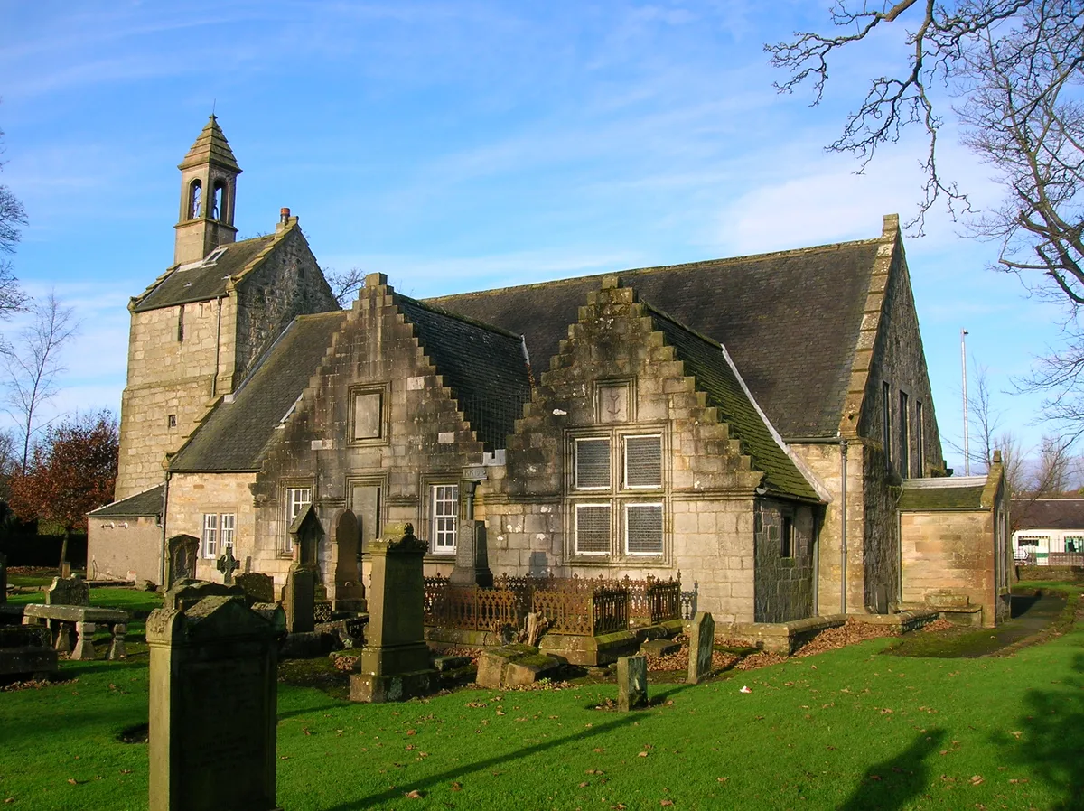
Kilbirnie Auld Kirk
Historic churches · 1.7 km

War Memorial, Viewpark, Beith
Memorials & monuments · 1.7 km

Glengarnock
Villages · 1.9 km
Nearby
📷 3Memorials & monuments · Scottish Lowlands
David Colville and Sons Ltd War Memorial
David Colville and Sons Ltd War Memorial — a memorial in Scottish Lowlands, United Kingdom.
📷 3📷 4Memorials & monuments · Central Scotland
Walker Memorial Hall
Walker Memorial Hall — a memorial in Central Scotland, United Kingdom.
📷 3Memorials & monuments · Central Scotland
Monument to William Walker
Monument to William Walker — a memorial in Central Scotland, United Kingdom.
📷 5Memorials & monuments · Central Scotland
Monument to William Walker, Main Street, Kilbirnie
Monument to William Walker, Main Street, Kilbirnie — category B listed building-listed memorial in scotland-highlands, United Kingdom.
📷 3Historic churches · Central Scotland
St Brigid's Church, Kilbirnie
St Brigid's Church, Kilbirnie — church building in North Ayrshire, Scotland, UK.
Where to eat & stay near Kilbirnie Loch
Places to stay
 📷 5
📷 5 📷 5
📷 5Caravan parks · Scottish Lowlands
Viewfield Manor Leisure Park
Viewfield Manor Leisure Park — a caravan park in scotland highlands.
 📷 5
📷 5Caravan parks · Scottish Lowlands
Crosbie Towers
Crosbie Towers — a caravan park in scotland highlands.
 📷 5
📷 5 📷 5
📷 5Campsites · Scottish Lowlands
Eglinton Camping and Touring Site
Eglinton Camping and Touring Site — a campsite in scotland highlands.
 📷 7
📷 7Places to eat & drink
 📷 5
📷 5Historic pubs · Central Scotland
The Smugglers Tavern, 53, 55 Eglinton Street, Beith
The Smugglers Tavern, 53, 55 Eglinton Street, Beith in Scotland Central, United Kingdom.
 📷 5
📷 5Historic pubs · Scottish Lowlands
The Auld Hoose Bar, 9 Main Street, Dalry
The Auld Hoose Bar, 9 Main Street, Dalry in Scotland Central, United Kingdom.
 📷 5
📷 5Restaurants · Scottish Lowlands
Braidwoods
Braidwoods — a restaurant in scotland highlands.
 📷 5
📷 5Historic pubs · Scottish Lowlands
Kingsway Bar, 26-28 Main Street, Kilwinning
Kingsway Bar, 26-28 Main Street, Kilwinning in Scotland Central, United Kingdom.
 📷 5
📷 5Historic pubs · Central Scotland
10 The Cross, Kilbarchan
10 The Cross, Kilbarchan in Scotland Central, United Kingdom.
 📷 5
📷 5Historic pubs · Scottish Lowlands
Public House, Lawthorn, Irvine
Public House, Lawthorn, Irvine in Scotland Central, United Kingdom.
More natural landmarks in this region
 📷 4
📷 4Natural landmarks · Central Scotland
Blackadder Water
Blackadder Water in England North East, United Kingdom.
 📷 3
📷 3Natural landmarks · Central Scotland
A6105 road
A6105 road in England North East, United Kingdom.
 📷 3
📷 3 📷 3
📷 3Frequently asked questions
- Where is Kilbirnie Loch?
- Kilbirnie Loch is in central Scotland, United Kingdom (postcode KA15 2HU).
- What is Kilbirnie Loch?
- Kilbirnie Loch — lake in North Ayrshire, Scotland, UK.
- How do I get to Kilbirnie Loch?
- The nearest railway station is Glengarnock, about 1.8 km away. The nearest town is Lochwinnoch. Drivers can use postcode KA15 2HU.
- Is Kilbirnie Loch free to visit?
- Yes, Kilbirnie Loch is free to enter.
- How do I get to Kilbirnie Loch?
- The nearest railway station is Glengarnock, about 1.8 km away. Drivers can navigate to postcode KA15 2HU.