
Beaches · Scottish Islands
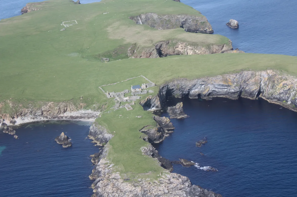
Kettla Ness
In or near Hamnavoe.
Kettla Ness in Orkney + Shetland, United Kingdom.

Alan Bowring — CC BY-SA 2.0 via Wikimedia Commons licence

Plan your visit
- Typical visit
- 1 h–3 h
- Best time of year
- Summer (Jun–Aug)
- Free entry
- Family-friendly
- Dog-friendly
About
Kettla Ness is a place of interest in Orkney + Shetland, United Kingdom — drawn from open-data sources for visitor reference. See the linked Wikipedia article for the full description.
Photo gallery
From the Wikipedia article
Kettla Ness, Kettlaness or just Kettla is a tied island and headland in Shetland. It is connected by the tombolo Minn beach (Banna Minn), to the south end of West Burra, part of the Scalloway Islands. The headland itself is conspicuous and circa 160 feet high. The island is accessible to walkers via Minn beach and is now uninhabitated. It is principally used for Sheep farming and pasture.
Excerpt from Wikipedia under CC BY-SA 4.0. See the source article linked in Sources below.
Background
History
The former settlements of Minn, Gossigarth and Point of Guide lie on the north-west part of the island. The ruined village was principally abandoned following the Highland Clearances in the 19th century although some occupation continued into the early 20th century. Several of these are located in the Bight of the Sandy Geos, an area on the eastern side of Kettla Ness. Iron-age pottery fragments have also been found around Sandy Geos. On the south side of Kettla Ness is a stream flowing from the Outra Loch. Along the stream there are numerous examples of ruined historic horizontal watermills that extend down to Groot Ness on the south coast. In 1959, a triangulation pillar was erected on…
Sourced from Wikipedia under CC BY-SA 4.0.
- Coordinates
- 60.0471, -1.3765
Sources
- wikidata: Q24640053 (CC0)
- wikipedia: Kettla Ness (CC BY-SA 4.0)
Other places nearby

The Ward
Mountains & hills · 1.1 km

Banna Minn Beach
Beaches · 2.1 km

Symbister
Vineyards · 2.4 km

Ruined windmill
Windmills · 2.7 km
South Havra
Islands · 2.7 km

Ward of Symbister
Mountains & hills · 2.9 km
Ward of Symbister
Mountains & hills · 2.9 km

church and burial ground 130m NW of Papil
Historic churches · 3.0 km

Little Havra
Islands · 3.0 km
Papil Stone
Museums · 3.1 km

The Outpost
Zoos & aquariums · 3.4 km

Hill of Sandwick
Mountains & hills · 3.7 km
Nearby
📷 5📷 3📷 5Vineyards · Scottish Islands
Symbister
Symbister — a UK vineyard in scotland islands, producing English or Welsh wine from cool-climate grape varieties.
Windmills · Scottish Islands
Ruined windmill
Ruined windmill — a windmill in scotland-islands, United Kingdom.
📷 3Islands · Scottish Islands
South Havra
South Havra — uninhabited island in the Scalloway Islands, Shetland, Scotland.
📷 5Mountains & hills · Scottish Islands
Ward of Symbister
Ward of Symbister — a hill or mountain in scotland islands.
Where to eat & stay near Kettla Ness
Places to stay
 📷 5
📷 5Caravan parks · Scottish Islands
Cunningsburgh Touring Park
Cunningsburgh Touring Park — a caravan park in scotland islands.
 📷 5
📷 5Campsites · Scottish Islands
Levenwick Campsite
Levenwick Campsite — a campsite in scotland islands.
 📷 5
📷 5Caravan parks · Scottish Islands
Scalloway Caravan Park
Scalloway Caravan Park — a caravan park in scotland islands.
 📷 5
📷 5Campsites · Scottish Islands
Skeld Caravan Park and Campsite
Skeld Caravan Park and Campsite — a campsite in scotland islands.
 📷 5
📷 5Hostels · Scottish Islands
Islesburgh House Hostel
Islesburgh House Hostel — a hostel in scotland islands.
 📷 5
📷 5Hostels · Scottish Islands
Betty Mouat's Camping Böd
Betty Mouat's Camping Böd — a hostel in scotland islands.
Places to eat & drink
 📷 7
📷 7Historic pubs · Scottish Islands
86 Commercial Street, Lerwick
86 Commercial Street, Lerwick in England South East, United Kingdom.
More beaches in this region
 📷 3
📷 3 📷 3
📷 3 📷 3
📷 3Beaches · Scottish Islands
An Tràigh-lochain
An Tràigh-lochain is a beach in the United Kingdom.
 📷 3
📷 3Frequently asked questions
- Where is Kettla Ness?
- Kettla Ness is in the Scottish Islands, United Kingdom.
- What is Kettla Ness?
- Kettla Ness in Orkney + Shetland, United Kingdom.
- How do I get to Kettla Ness?
- Its coordinates are 60.0471°, -1.3765°.
- Is Kettla Ness free to visit?
- Yes, Kettla Ness is free to enter.