Historic churches · Mid Wales
Kerry
Also known as: Ceri (cymuned), Ceri
In or near Newtown and Llanllwchaiarn.
Kerry in Wales Mid, United Kingdom.

John Firth — CC BY-SA 2.0 via Wikimedia Commons licence
Plan your visit
- Typical visit
- 30 min–1 h
- Nearest railway station
- Newtown · 3.8 km
- Free entry
Getting there & planning your visit
To visit Kerry, the nearest railway station is Newtown, located 3.8 km away. The postcode for navigation is SY16 4AP, and entry to the church is free.
About
Kerry is a place of interest in Wales Mid, United Kingdom — drawn from open-data sources for visitor reference. See the linked Wikipedia article for the full description.
Photo gallery
See it from the streetimagery from 2026
Imagery © Mapillary contributors, CC BY-SA 4.0
From the Wikipedia article
Kerry (Welsh: Ceri) is a village and geographically large community in Montgomeryshire, Powys, Wales. The village lies on the A489 road 2.8 miles (4.5 km) southeast of Newtown and possesses two pubs — the Herbert Arms and the Kerry Lamb — a village hall, a bowling green, a post office, a primary school and a hairdresser. Kerry also has a parish church of Norman origins dedicated to St. Michael and All Angels, as well as a baptist church. It gives its name to the Kerry Hill breed of sheep.
Excerpt from Wikipedia under CC BY-SA 4.0. See the source article linked in Sources below.
Background
History
The Battle of Kerry was fought nearby in 1228 between Llywelyn Fawr and Hubert de Burgh. The area around the village was the Welsh commote and Lordship of Ceri, part of the region of Rhwng Gwy a Hafren, and it was originally ruled by the Princes of Maelienydd and their descendants. Kerry was the terminus of the Kerry Railway, later a branch of the Cambrian Railways, connecting it to Abermule that ceased operating in 1956. The narrow gauge Kerry Tramway brought timber from the forests to the main line station.
Sourced from Wikipedia under CC BY-SA 4.0.
- Coordinates
- 52.5012, -3.2580
- District
- Powys
- Parish
- Kerry
- Postcode
- SY16 4AP
- Parliamentary constituency
- Montgomeryshire and Glyndwr
- Nearest railway station
- Newtown — 3.8 km
Sources
- wikidata: Q6394440 (CC0)
- wikipedia: Kerry, Powys (CC BY-SA 4.0)
Other places nearby
Kerry Tramway
Heritage railways · 0.0 km

Morris monument in churchyard, Church of St Michael
Memorials & monuments · 0.1 km

St Michael and All Angels Church, Kerry
Historic churches · 0.1 km

Kerry F.C.
Stadiums · 0.3 km
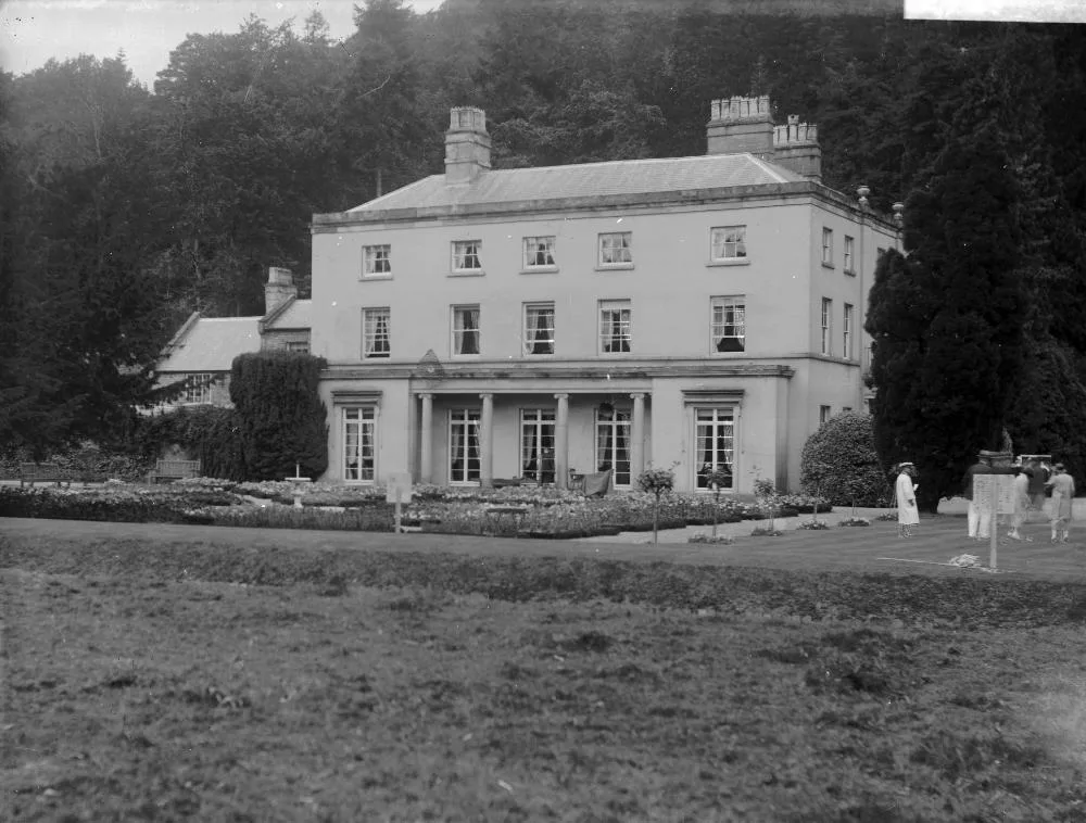
Dolforgan Hall
Stately homes · 0.5 km

Ceri Castle
Literary houses · 0.5 km
The Moat; Kerry
Castles · 0.5 km

Tomen Madoc Motte
Literary houses · 0.9 km

Weston
Mountains & hills · 0.9 km

Pen Arron
Mountains & hills · 1.3 km

A489 road
Other places · 1.4 km

Gwenthriew Enclosure
Vineyards · 1.5 km
Nearby
📷 5📷 5Memorials & monuments · Mid Wales
Morris monument in churchyard, Church of St Michael
Morris monument in churchyard, Church of St Michael — Grade II listed building-listed memorial in wales-mid, United Kingdom.
📷 5Historic churches · Mid Wales
St Michael and All Angels Church, Kerry
St Michael and All Angels Church, Kerry — a church in wales-mid, United Kingdom.
📷 3📷 3📷 5Where to eat & stay near Kerry
Places to stay
 📷 5
📷 5 📷 5
📷 5 📷 5
📷 5Caravan parks · Mid Wales
Glandulas Holiday Home Park
Glandulas Holiday Home Park — a caravan park in wales mid.
 📷 5
📷 5Caravan parks · Mid Wales
Cefn Lea Holiday Park
Cefn Lea Holiday Park — a caravan park in wales mid.
 📷 5📷 5
Places to eat & drink
 📷 4
📷 4 📷 4
📷 4Historic pubs · Mid Wales
The Checkers
The Checkers in Wales Mid, United Kingdom.
 📷 4
📷 4 📷 7
📷 7 📷 7
📷 7 📷 5
📷 5Historic pubs · Mid Wales
The Black Lion And Forecourt Railings
The Black Lion And Forecourt Railings in Wales Mid, United Kingdom.
More places in this region
 📷 3
📷 3Historic churches · Mid Wales
Church of St Peter
Church of St Peter — Grade I listed church, Shropshire, England, UK.
 📷 4
📷 4Historic churches · Mid Wales
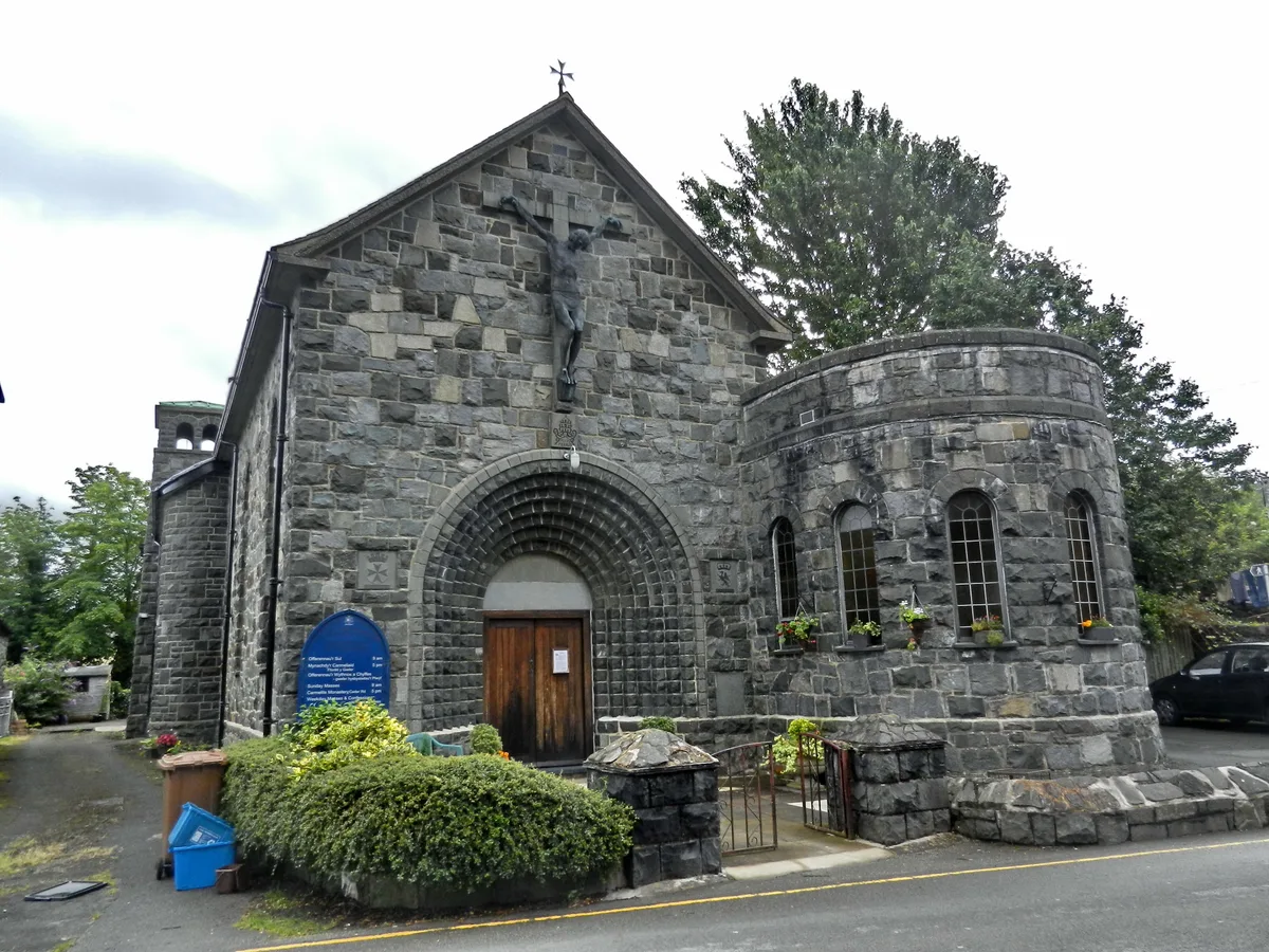
Our Lady of Seven Sorrows Church
Our Lady of Seven Sorrows Church — church in Dolgellau, Wales.
 📷 4
📷 4Historic churches · Mid Wales
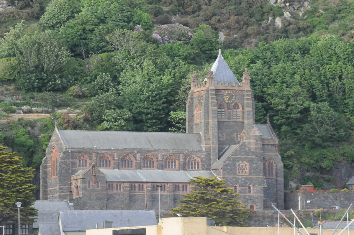
St David's Church
St David's Church — church in Barmouth, Gwynedd, Wales.
 📷 5
📷 5Historic churches · Mid Wales
St John's Church
St John's Church — church in Barmouth, north Wales.
Frequently asked questions
- Where is Kerry?
- Kerry is in Mid Wales, United Kingdom (postcode SY16 4AP), in the parish of Kerry.
- What is Kerry?
- Kerry in Wales Mid, United Kingdom.
- How do I get to Kerry?
- The nearest railway station is Newtown, about 3.8 km away. Drivers can use postcode SY16 4AP.
- Is Kerry free to visit?
- Yes, Kerry is free to enter.
- How do I get to Kerry?
- The nearest railway station is Newtown, about 3.8 km away. Drivers can navigate to postcode SY16 4AP.