
Historic churches · South West England
Kea, Cornwall
In or near Truro.
Kea ( KEE; Cornish: Sen Ke) is a civil parish and village in Cornwall, England, United Kingdom. It is a "large straggling parish" in a former mining area south of Truro. Kea village is situated just

Jowaninpensans — CC BY-SA 4.0 via Wikimedia Commons licence
.jpg)
Plan your visit
- Typical visit
- 30 min–1 h
- Nearest railway station
- Truro · 2.4 km
- Free entry
Getting there & planning your visit
To visit Kea in Cornwall, the nearest railway station is Truro, located 2.4 km away. The postcode for navigation is TR3 6AE. Entry to the church is free.
About
Kea ( KEE; Cornish: Sen Ke) is a civil parish and village in Cornwall, England, United Kingdom. It is a "large straggling parish" in a former mining area south of Truro. Kea village is situated just over one mile (1.6 km) southwest of Truro. Old Kea is situated two miles (3 km) to the east on the west bank of the Truro River at grid reference SW 843 417. St Kea reputedly landed at Old Kea on his first visit to Cornwall and established a church there, which was the parish church until replaced by All Hallows. His life is described in the medieval Cornish language play Bewnans Ke (The Life of St Kea, c. 1550). Today, the parish is mainly agricultural, and is noted for giving its name to the damson-type Kea plum. It is bounded to the north by Calenick Creek and Truro civil parish; to the east by the Truro River and River Fal; to the south by the parishes of Feock, Perranarworthal and Gwennap; and to the west by Kenwyn. Other settlements in the parish include Calenick, Come-to-Good, Killiow, Nansavallan, Playing Place, Porth Kea, and the tiny hamlet of Quenchwell consisting of a few houses and a chapel. It takes its name from the Quench-well, a natural spring. Kea was described in 1870–72, John Marius Wilson's Imperial Gazetteer of England and Wales (1870) as: A parish and a sub-district in Truro district, Cornwall. The parish lies on the Falmouth and Redruth railways, 2¼ miles SSW of Truro; is bounded, on the E, by the river Fal, on the N, by Kenwyn, on the W, by Gwennap; and
Photo gallery
Protected designations
- Area of Outstanding Natural Beauty: Cornwall
Designations sourced from Natural England open data under OGL v3.
From the Wikipedia article
Kea ( KEE; Cornish: Sen Ke) is a civil parish and village in Cornwall, England, United Kingdom. It is a "large straggling parish" in a former mining area south of Truro. Kea village is situated just over one mile (1.6 km) southwest of Truro. Old Kea is situated two miles (3 km) to the east on the west bank of the Truro River at grid reference SW 843 417. St Kea reputedly landed at Old Kea on his first visit to Cornwall and established a church there, which was the parish church until replaced by All Hallows. His life is described in the medieval Cornish language play Bewnans Ke (The Life of St Kea, c. 1550). Today, the parish is mainly agricultural, and is noted for giving its name to the damson-type Kea plum. It is bounded to the north by Calenick Creek and Truro civil parish; to the east by the Truro River and River Fal; to the south by the parishes of Feock, Perranarworthal and Gwennap; and to the west by Kenwyn. Other settlements in the parish include Calenick, Come-to-Good, Killiow, Nansavallan, Playing Place, Porth Kea, and the tiny hamlet of Quenchwell consisting of a few houses and a chapel. It takes its name from the Quench-well, a natural spring. Kea was described in 1870–72, John Marius Wilson's Imperial Gazetteer of England and Wales (1870) as:
A parish and a sub-district in Truro district, Cornwall. The parish lies on the Falmouth and Redruth railways, 2¼ miles SSW of Truro; is bounded, on the E, by the river Fal, on the N, by Kenwyn, on the W, by Gwennap; and contains parts of the chapelries of Baldhu, Chacewater, and Mithian. Real property £7,158 of which £1,234 are in mines. Pop(ulation) in 1861 3,949. Houses, 824. The manor belongs to Viscount Falmouth.
Excerpt from Wikipedia under CC BY-SA 4.0. See the source article linked in Sources below.
- Coordinates
- 50.2430, -5.0730
- District
- Cornwall
- Parish
- Kea
- Postcode
- TR3 6AE
- Parliamentary constituency
- Truro and Falmouth
- Nearest railway station
- Truro — 2.4 km
Sources
- wikipedia: Kea, Cornwall (CC BY-SA 4.0)
Other places nearby

St Kea War Memorial
Memorials & monuments · 0.0 km

Kea
Villages · 0.1 km

Plen an Gwary
Archaeological sites · 0.8 km

Plen an Gwary
Archaeological sites · 0.8 km
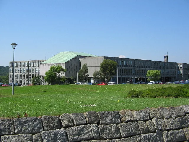
New County Hall
Galleries · 1.9 km

Carnon Downs Caravan & Camping Park
Caravan parks · 2.0 km
Carnon Downs C. & C. Park
Campsites · 2.0 km
.jpg?width=1200)
Lander Monument
Memorials & monuments · 2.2 km

Daniell Arms Public House
Historic pubs · 2.2 km

Friends Meeting House, Come-to-Good
Historic houses · 2.3 km

St John the Evangelist's Church, Truro
Historic churches · 2.3 km
Come-to-Good
Historic churches · 2.3 km
Nearby
📷 3Memorials & monuments · South West England
St Kea War Memorial
St Kea War Memorial — Grade II listed building-listed memorial in england-south-west, United Kingdom.
📷 5📷 3Archaeological sites · South West England
Plen an Gwary
Plen an Gwary — a archaeological in england-south-west, United Kingdom.
📷 5Archaeological sites · South West England
Plen an Gwary
Plen an Gwary — archaeological in england south west.
📷 5Galleries · South West England
New County Hall
New County Hall — art museum in Truro, Cornwall, England, UK.
📷 5Caravan parks · South West England
Carnon Downs Caravan & Camping Park
Carnon Downs Caravan & Camping Park — a caravan park in england south west.
Where to eat & stay near Kea, Cornwall
Places to stay
📷 5Caravan parks · South West England
Carnon Downs Caravan & Camping Park
Carnon Downs Caravan & Camping Park — a caravan park in england south west.
📷 5Campsites · South West England
Carnon Downs C. & C. Park
Carnon Downs C. & C. Park — a campsite in england south west.
 📷 6
📷 6Hotels · South West England
Alverton Manor Hotel
Alverton Manor Hotel — a hotel in england south west.
 📷 5
📷 5Campsites · South West England
Tomperrow Scout Campsite
Tomperrow Scout Campsite — a campsite in england south west.
 📷 5
📷 5Caravan parks · South West England
Truro Caravan and Camping Park
Truro Caravan and Camping Park — a caravan park in england south west.
 📷 4
📷 4Campsites · South West England
Summer Valley Tour. Park
Summer Valley Tour. Park — a campsite in england south west.
Places to eat & drink
📷 7Historic pubs · South West England
Daniell Arms Public House
Daniell Arms Public House in England South West, United Kingdom.
 📷 5
📷 5Historic pubs · South West England
The Wig And Pen Public House And Attached Forecourt Walls And Railings
The Wig And Pen Public House And Attached Forecourt Walls And Railings in England South West, United Kingdom.
 📷 3
📷 3Historic pubs · South West England
Seven Stars
Seven Stars — Historic pub — listed building or notable heritage status.
 📷 5
📷 5Historic pubs · South West England
Kings Arms
Kings Arms — Historic pub — listed building or notable heritage status.
 📷 5
📷 5Historic pubs · South West England
The Famous Barrel Public House
The Famous Barrel Public House in England South West, United Kingdom.
 📷 5
📷 5Historic pubs · South West England
The Kimberley Public House
The Kimberley Public House in England South West, United Kingdom.
More places in this region
 📷 5
📷 5Historic churches · South West England
Abbey Church of St Gregory the Great, Downside Abbey
Abbey Church of St Gregory the Great, Downside Abbey — church in Stratton-on-the-Fosse, Somerset, England, UK.
 📷 5
📷 5Historic churches · South West England
All Saints Church
All Saints Church — Grade I listed church in Woolley, Somerset, England, UK.
 📷 5
📷 5Historic churches · South West England
All Saints Church, Hampreston
All Saints Church, Hampreston — church in Hampreston, Dorset, England, UK.
 📷 5
📷 5Historic churches · South West England
All Saints Church, Nether Cerne
All Saints Church, Nether Cerne — church in Nether Cerne, Dorset, England, UK.
Frequently asked questions
- Where is Kea, Cornwall?
- Kea, Cornwall is in South-West England, United Kingdom (postcode TR3 6AE), in the parish of Kea.
- What is Kea, Cornwall?
- Kea ( KEE; Cornish: Sen Ke) is a civil parish and village in Cornwall, England, United Kingdom. It is a "large straggling parish" in a former mining area south of Truro. Kea village is situated just
- How do I get to Kea, Cornwall?
- The nearest railway station is Truro, about 2.4 km away. Drivers can use postcode TR3 6AE.
- Is Kea, Cornwall a protected site?
- Yes — Kea, Cornwall is part of the Cornwall National Landscape (AONB).
- Is Kea, Cornwall free to visit?
- Yes, Kea, Cornwall is free to enter.
- How do I get to Kea, Cornwall?
- The nearest railway station is Truro, about 2.4 km away. Drivers can navigate to postcode TR3 6AE.