
Historic houses · South East England
Joldwynds
In or near Wonersh.
Joldwynds — house in Abinger, Surrey, England, UK.

Hugh Craddock — CC BY-SA 2.0 via Wikimedia Commons licence

Plan your visit
- Typical visit
- 1 h–2 h
- Nearest railway station
- Gomshall · 5.4 km
- Family-friendly
- Limited wheelchair access
Getting there & planning your visit
To visit Joldwynds, the nearest railway station is Gomshall, located 5.4 km away. The postcode for sat-nav is RH5 6NS. Please note that wheelchair accessibility is limited.
About
Joldwynds is a historic house in the United Kingdom — typically a country seat, manor, or town house with notable architecture or history. Designed by Oliver Hill. Heritage designation: Grade II listed building. Wikidata describes it as: "house in Abinger, Surrey, England, UK". Coordinates: 51.1736°, -0.4139°.
Photo gallery
Protected designations
- Area of Outstanding Natural Beauty: Surrey Hills
Designations sourced from Natural England open data under OGL v3.
From the Wikipedia article
Joldwynds is a modernist style house in Holmbury St Mary, Surrey, England, designed by architect Oliver Hill for Wilfred Greene, 1st Baron Greene. Completed in 1932, it is a Grade II listed building. It replaced an 1874 Arts and Crafts style house designed by Philip Webb, which itself replaced an earlier house of that name. Greene also had an additional house, The Wilderness, built in the grounds of Joldwynds, to a design by the modernist architectural partnership Tecton. This house, completed in 1939, is also Grade II listed.
Excerpt from Wikipedia under CC BY-SA 4.0. See the source article linked in Sources below.
Background
Description
The new house was built against a south-facing slope in a part of the Joldwynds estate known as the wilderness garden, and became known as The Wilderness. The house was completed in 1939. Margaret Lubetkin was the principal designer. Unusually for Tecton, the design combined traditional with modernist elements. The house is largely of brick, with pitched slate roofs. In a more modern style, however, on the south, garden elevation there are concrete piers supporting balconies and a canopy. It is an early example of this kind of stylistic mixture.
Sourced from Wikipedia under CC BY-SA 4.0.
- Coordinates
- 51.1736, -0.4139
- County
- Surrey
- District
- Waverley
- Parish
- Ewhurst
- Postcode
- RH5 6NS
- Parliamentary constituency
- Dorking and Horley
- Established
- 1932
- Nearest railway station
- Gomshall — 5.4 km
Sources
Other places nearby

Holmbury Hill Road to Horsham Road
Mountain bike trails · 0.2 km

Holmbury Hill Road to Horsham Road
Mountain bike trails · 0.2 km

Wet n Wild
Mountain bike trails · 0.5 km

Wet n Wild
Mountain bike trails · 0.5 km

Crackpipe
Mountain bike trails · 0.5 km

Holmbury Camp
Archaeological sites · 0.6 km

Holmbury Camp: a small multivallate hillfort north of Three Mile Road
Vineyards · 0.6 km
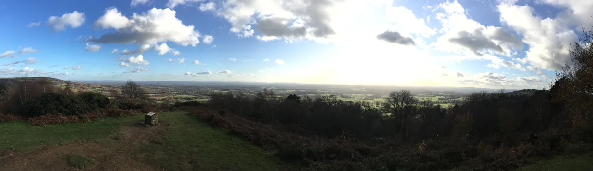
Holmbury Hill
Mountains & hills · 0.6 km

Crackpipe
Mountain bike trails · 0.6 km
Crackpipe
Mountain bike trails · 0.6 km
Horsham Road to Leith Hill Road
Mountain bike trails · 0.7 km

Yoghurt Pots
Mountain bike trails · 0.8 km
Nearby
📷 5Mountain bike trails · South East England
Holmbury Hill Road to Horsham Road
Holmbury Hill Road to Horsham Road — a mtb trail in england south east.
📷 5Mountain bike trails · South East England
Holmbury Hill Road to Horsham Road
Holmbury Hill Road to Horsham Road — a mtb trail in england south east.
📷 5📷 5📷 5📷 5Archaeological sites · South East England
Holmbury Camp
Holmbury Camp — an archaeological site in South East England, United Kingdom.
Where to eat & stay near Joldwynds
Places to stay
 📷 5
📷 5 📷 5
📷 5Hostels · South East England
Hurtwood Hideout
Hurtwood Hideout — a hostel in england south east.
 📷 5
📷 5 📷 5
📷 5 📷 5
📷 5Campsites · South East England
Bentley Copse Activity Centre
Bentley Copse Activity Centre — a campsite in england south east.
 📷 5
📷 5Places to eat & drink
 📷 5
📷 5Historic pubs · South East England
The Scarlett Arms Public House
The Scarlett Arms Public House in England South East, United Kingdom.
 📷 5
📷 5Historic pubs · South East England
The Old School Public House
The Old School Public House in England South East, United Kingdom.
 📷 7
📷 7 📷 5
📷 5Historic pubs · South East England
The Chequers Inn Public House
The Chequers Inn Public House in England South East, United Kingdom.
 📷 7
📷 7Historic pubs · South East England
Duke Of Wellington Public House
Duke Of Wellington Public House in England South East, United Kingdom.
 📷 7
📷 7Historic pubs · South East England
The Sussex Oak Inn
The Sussex Oak Inn in England South East, United Kingdom.
Other works by Oliver Hill
 📷 5
📷 5Historic houses · London
213 and 215 King's Road
213 and 215 King's Road — houses in Royal Borough of Kensington and Chelsea, London, England, UK.
 📷 5
📷 5Hotels · North West England
The Midland Hotel
The Midland Hotel — a hotel in england north west.
More historic houses in this region
 📷 5
📷 5Historic houses · South East England
12 and 14 High Street, Rochester
12 and 14 High Street, Rochester — building in Rochester, Kent, England, UK.
 📷 5
📷 5Historic houses · South East England
Berkeley House
Berkeley House — house in Rochester, Kent, England, UK.
.jpg?width=1200) 📷 5
📷 5Historic houses · South East England
Betchworth House
Betchworth House — house in Betchworth, Mole Valley, England, UK.
 📷 5
📷 5Historic houses · South East England
Bookham Grove
Bookham Grove — building in Mole Valley, Surrey, England, UK.
Frequently asked questions
- Where is Joldwynds?
- Joldwynds is in Surrey, South-East England, United Kingdom (postcode RH5 6NS), in the parish of Ewhurst.
- What is Joldwynds?
- Joldwynds — house in Abinger, Surrey, England, UK.
- How do I get to Joldwynds?
- The nearest railway station is Gomshall, about 5.4 km away. The nearest town is Wonersh. Drivers can use postcode RH5 6NS.
- When was Joldwynds built?
- Built or established in 1932. Designed by Oliver Hill.
- Who owns Joldwynds?
- Joldwynds is owned by | designation1 = Grade II.
- Is Joldwynds a listed building?
- Joldwynds is officially recognised as Grade II listed building listed.
- Is Joldwynds a protected site?
- Yes — Joldwynds is part of the Surrey Hills National Landscape (AONB).
- How do I get to Joldwynds?
- The nearest railway station is Gomshall, about 5.4 km away. Drivers can navigate to postcode RH5 6NS.