
National parks · Central Scotland
John Muir Way
In or near North Berwick.
The John Muir Way is a 215-kilometre (130 mi) continuous long-distance route in southern Scotland, running from Helensburgh, Argyll and Bute in the west to Dunbar, East Lothian in the east. It is name

Mel Towler — CC BY-SA 2.0 via Wikimedia Commons licence

Plan your visit
- Typical visit
- 4 h–8 h
- Best time of year
- Spring – autumn (Apr–Oct)
- Nearest railway station
- North Berwick · 1.2 km
- Free entry
- Family-friendly
- Dog-friendly
Getting there & planning your visit
To visit the John Muir Way, the nearest railway station is North Berwick, located 1.2 km away. Entry is free, and the postcode for navigation is EH39 4EZ.
About
The John Muir Way is a 215-kilometre (130 mi) continuous long-distance route in southern Scotland, running from Helensburgh, Argyll and Bute in the west to Dunbar, East Lothian in the east. It is named in honour of the Scottish conservationist John Muir, who was born in Dunbar in 1838 and became a founder of the United States National Park Service. The route provides a coast-to-coast route across Scotland, linking Muir's birthplace with Scotland's first national park, Loch Lomond and The Trossachs, and Helensburgh, from where he left Scotland for the United States. It is suitable for walkers and cyclists although some sections are on rougher terrain and may not be suitable for road bicycles. The John Muir Way opened on 21 April 2014. Previously a shorter 'John Muir Way' existed only in East Lothian, but the majority of this older route has now been absorbed into the much longer new route. A shorter section of the older route from Dunbar to the Scottish Borders has been renamed as the 'John Muir Link'. In 2017 the route was designated as one of Scotland's Great Trails by NatureScot. The Independent declared the original John Muir Way its Walk of the Month for February 2014. Between 240,000 and 300,000 people use the path every year, of whom about 5,500 walk the entire route.
Photo gallery
Official information
The John Muir Way is a long-distance walking and cycling trail that spans 134 miles across central Scotland, connecting Helensburgh to Dunbar. It offers a diverse experience of Scotland's landscapes, history, and heritage, including woodlands, beaches, and urban areas, while also featuring several UNESCO World Heritage sites. Visitors can explore the trail in its entirety or in sections, making it accessible for day trips or weekend excursions.
From the Wikipedia article
The John Muir Way is a 215-kilometre (130 mi) continuous long-distance route in southern Scotland, running from Helensburgh, Argyll and Bute in the west to Dunbar, East Lothian in the east. It is named in honour of the Scottish conservationist John Muir, who was born in Dunbar in 1838 and became a founder of the United States National Park Service. The route provides a coast-to-coast route across Scotland, linking Muir's birthplace with Scotland's first national park, Loch Lomond and The Trossachs, and Helensburgh, from where he left Scotland for the United States. It is suitable for walkers and cyclists although some sections are on rougher terrain and may not be suitable for road bicycles. The John Muir Way opened on 21 April 2014. Previously a shorter 'John Muir Way' existed only in East Lothian, but the majority of this older route has now been absorbed into the much longer new route. A shorter section of the older route from Dunbar to the Scottish Borders has been renamed as the 'John Muir Link'. In 2017 the route was designated as one of Scotland's Great Trails by NatureScot. The Independent declared the original John Muir Way its Walk of the Month for February 2014. Between 240,000 and 300,000 people use the path every year, of whom about 5,500 walk the entire route.
Excerpt from Wikipedia under CC BY-SA 4.0. See the source article linked in Sources below.
- Coordinates
- 56.0481, -2.7191
- District
- East Lothian
- Postcode
- EH39 4EZ
- Parliamentary constituency
- Lothian East
- Nearest railway station
- North Berwick — 1.2 km
- Official site
- johnmuirway.org
Sources
- wikipedia: John Muir Way (CC BY-SA 4.0)
Other places nearby

St. Mary's Priory
Abbeys & priories · 0.2 km
North Berwick Law
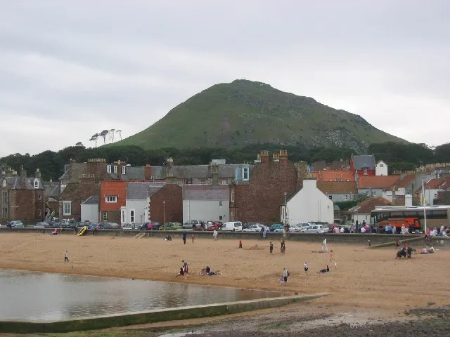
Mountains & hills · 0.3 km

Whale Jawbone Arch
Memorials & monuments · 0.3 km

John Wallace Menzies Memorial
Memorials & monuments · 0.3 km

North Berwick Law
Vineyards · 0.3 km

Signal Station
Historic houses · 0.3 km

Edington Cottage Hospital
Other places · 0.8 km

Star of The Sea, R.C. Church of Our Lady, Law Road, North Berwick
Historic churches · 0.9 km

Dovecot
Historic houses · 0.9 km

Gilsland Caravan Park
Caravan parks · 1.0 km

North Berwick, Old Parish Church And Churchyard
Historic churches · 1.1 km

North Berwick Priory, nunnery 60m NE of 4 Priory Gate
Abbeys & priories · 1.1 km
Nearby
Flagship📷 4Abbeys & priories · Central Scotland
St. Mary's Priory
St. Mary's Priory in Scotland Islands, United Kingdom.
📷 5Mountains & hills · Central Scotland
North Berwick Law
North Berwick Law — Named summit at 187 m.
📷 3Memorials & monuments · Central Scotland
Whale Jawbone Arch
Whale Jawbone Arch is a memorial in the United Kingdom.
📷 3Memorials & monuments · Central Scotland
John Wallace Menzies Memorial
John Wallace Menzies Memorial — a memorial in scotland-central, United Kingdom.
📷 5Vineyards · Central Scotland
North Berwick Law
North Berwick Law — a UK vineyard in scotland central, producing English or Welsh wine from cool-climate grape varieties.
📷 3Historic houses · Central Scotland
Signal Station
Signal Station — a historic house in scotland-central, United Kingdom.
Where to eat & stay near John Muir Way
Places to stay
📷 5Caravan parks · Central Scotland
Gilsland Caravan Park
Gilsland Caravan Park — a caravan park in scotland central.
 📷 5
📷 5Campsites · Central Scotland
Tantallon Caravan & Camping Park
Tantallon Caravan & Camping Park — a campsite in scotland central.
 📷 5
📷 5Caravan parks · Central Scotland
Yellowcraig Caravan & Motorhome Club Site
Yellowcraig Caravan & Motorhome Club Site — a caravan park in scotland central.
 📷 5
📷 5Caravan parks · Central Scotland
Station Park Caravan Site
Station Park Caravan Site — a caravan park in scotland central.
 📷 5
📷 5Caravan parks · Central Scotland
East Fortune Farm CL
East Fortune Farm CL — a caravan park in scotland central.
 📷 5
📷 5Places to eat & drink
 📷 5
📷 5Historic pubs · Central Scotland
The Crown & Kitchen
The Crown & Kitchen in Scotland Central, United Kingdom.
 📷 5
📷 5Historic pubs · Central Scotland
Gardner's Arms Public House, Market Street, Haddington
Gardner's Arms Public House, Market Street, Haddington in Scotland Central, United Kingdom.
 📷 7
📷 7Historic pubs · Central Scotland
Railway Tavern, 14, 16 High Street West, Anstruther Wester
Railway Tavern, 14, 16 High Street West, Anstruther Wester in Scotland Central, United Kingdom.
 📷 7
📷 7Historic pubs · Central Scotland
12 Shore Street, Anstruther Easter
12 Shore Street, Anstruther Easter in Scotland Central, United Kingdom.
 📷 5
📷 5Historic pubs · Central Scotland
Gothenburg Tavern, High Street, Prestonpans
Gothenburg Tavern, High Street, Prestonpans in Scotland Central, United Kingdom.
 📷 7
📷 7Historic pubs · Central Scotland
Balcarres Arms Hotel, 59 Main Street, Colinsburgh
Balcarres Arms Hotel, 59 Main Street, Colinsburgh in Scotland Central, United Kingdom.
More national parks in this region
 Flagship📷 5
National parks · Central Scotland
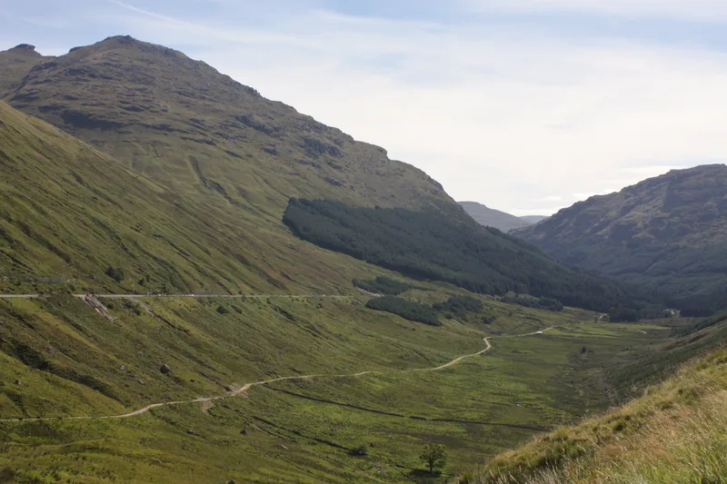
Loch Lomond and The Trossachs National Park
Loch Lomond and The Trossachs National Park is a National park in Scotland.
 📷 5
📷 5National parks · Central Scotland
Whistlefield
Whistlefield in Scotland Islands, United Kingdom.
 📷 4
📷 4 📷 3
📷 3Frequently asked questions
- Where is John Muir Way?
- John Muir Way is in central Scotland, United Kingdom (postcode EH39 4EZ).
- What is John Muir Way?
- The John Muir Way is a 215-kilometre (130 mi) continuous long-distance route in southern Scotland, running from Helensburgh, Argyll and Bute in the west to Dunbar, East Lothian in the east. It is name
- How do I get to John Muir Way?
- The nearest railway station is North Berwick, about 1.2 km away. Drivers can use postcode EH39 4EZ.
- Is John Muir Way free to visit?
- Yes, John Muir Way is free to enter.
- How do I get to John Muir Way?
- The nearest railway station is North Berwick, about 1.2 km away. Drivers can navigate to postcode EH39 4EZ.