Islands · Central Scotland
Isle of May
In or near Pittenweem.
Isle of May — island in the north of the outer Firth of Forth.

Wikimedia Commons contributors — see linked file page for photographer and licence licence
Plan your visit
- Typical visit
- 4 h–12 h
- Free entry
- Dog-friendly
Getting there & planning your visit
Isle of May is located in central Scotland, with coordinates 56.1876° N latitude and -2.5567° W longitude. There is no nearest railway station or postcode provided, and entry to the island is free. Accessibility details are not specified.
About
Isle of May is a island in the United Kingdom. Wikidata describes it as: "island in the north of the outer Firth of Forth". Coordinates: 56.1876°, -2.5567°.
Photo gallery
Summary from the official site
The Isle of May National Nature Reserve is a haven for seabirds and seals, offering visitors the chance to witness a variety of wildlife, including puffins and grey seals. The island features cliff-top paths for exploring and provides insights into its rich history, including its past connections with Vikings and smugglers.
Read more on the official property page.
From the Wikipedia article
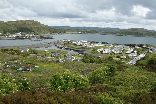
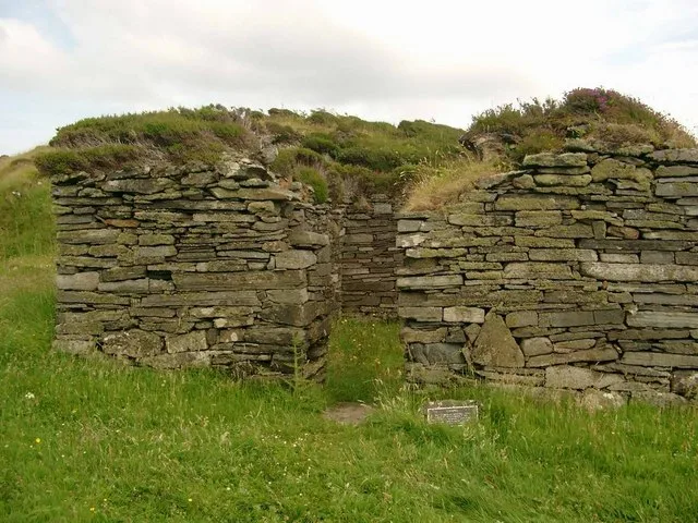
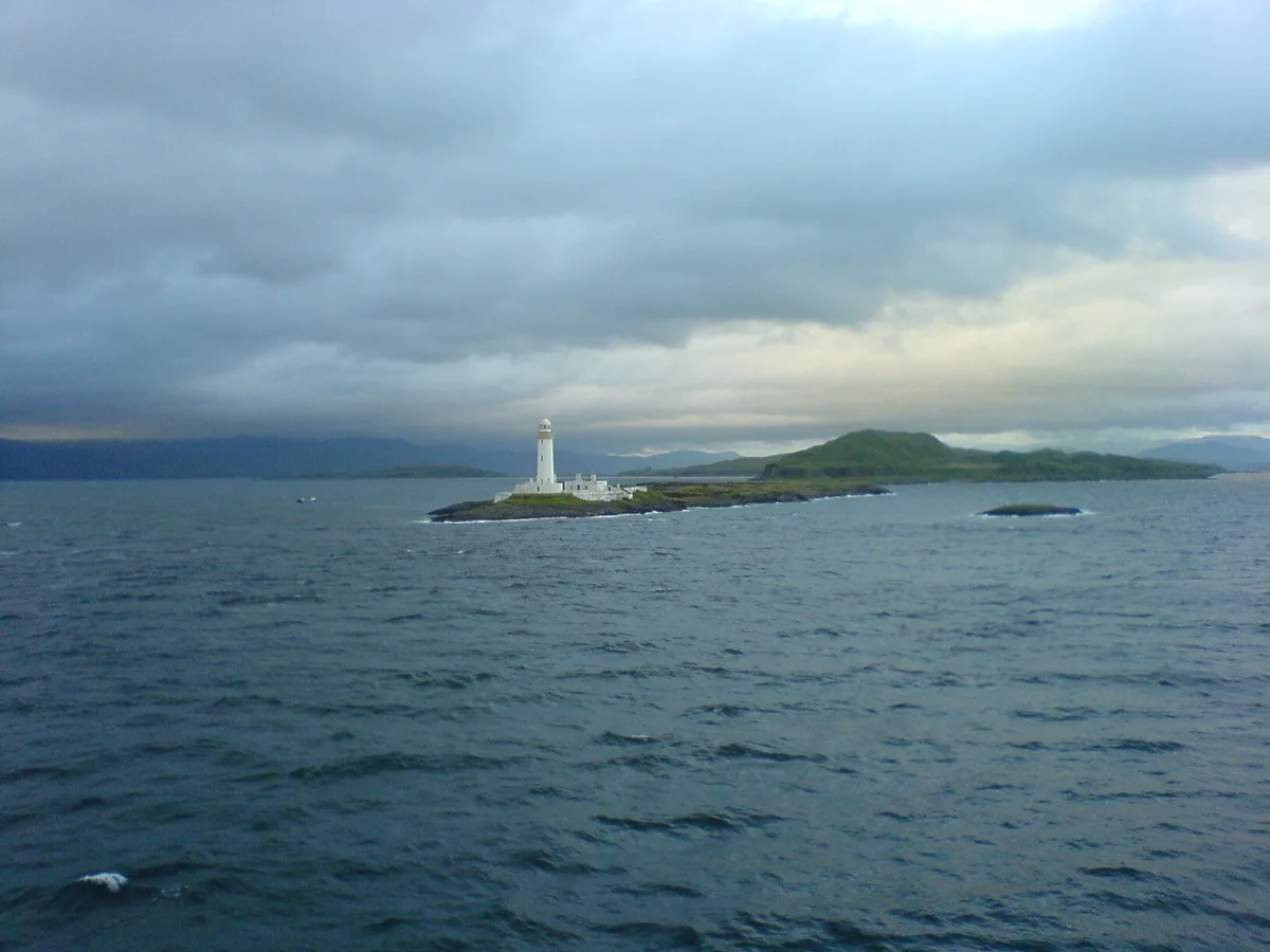
The Isle of May is located in the north of the outer Firth of Forth, approximately eight kilometres (4+1⁄2 nautical miles) off the coast of mainland Scotland. It is about 1.5 kilometres (7⁄8 mile) long and 0.5 kilometres (5⁄16 mile) wide. The island is owned and managed by NatureScot as a national nature reserve. There are now no permanent residents, but the island was the site of St Adrian's Priory during the Middle Ages. Most visitors to the island are daytrippers taking the ferry from Anstruther in Fife, although up to six visitors can stay at the bird observatory, usually for a week at a time. The only way to get there is by ferry; the journey takes 45 minutes from the small harbours of Anstruther and Crail, and also from North Berwick. As of 2015, around 11,000 people visit the island each year. The island is closed to visitors from 1 October until Easter to prevent disturbance to the large number of seal pups. The Scottish Seabird Centre at North Berwick has two live cameras on the island, which can be remotely controlled by visitors, to allow close viewing of the seabird cities, including puffins, guillemots, razorbills, shags, cormorants and terns and the fluffy grey seal pups in winter, without disturbance. The Scottish Seabird Centre also runs boat trips to the Isle of May. As well as its natural heritage, the Isle of May also has a rich cultural heritage, including St Adrian's Chapel, which is a Scheduled Monument. Furthermore, the Isle of May Lighthouse; Keepers' Houses; North and South Horns; the Low and Light Cottages; the Coal Store and Stable Block; and the former Lighthouse Beacon have all been included in the list of Buildings of Special Architectural or Historic Interest.
Excerpt from Wikipedia under CC BY-SA 4.0. See the source article linked in Sources below.
Background
History
The island's name is of disputed etymology, but is possibly of Old Norse origin, meaning "island of seagulls". Alternatively, it is from the Gaelic Magh meaning a plain – most of the other islands in the Forth, such as Inchmickery, Inchcolm and Craigleith have Gaelic etymologies. There are certainly names on the island from both languages, including "Tarbet" (tairbeart, an isthmus), "St Colme's Hole" (Colm Cille) and "Ardchattan" from Gaelic, and "Kirkhaven" which may refer a Norse original "Kirkshavn". It is also thought that the name may refer to the use of the island by the Maeatae as a royal burial site. The island was the site of one of the earliest Christian churches in Scotland,…
Sourced from Wikipedia under CC BY-SA 4.0.
- Coordinates
- 56.1876, -2.5567
- Phone
- 01738 458800
- Official site
- www.nature.scot
Sources
- wikidata: Q1575611 (CC0)
- wikipedia: Isle of May (CC BY-SA 4.0)
- commons: Isle of May Stevenson Lighthouse.jpg (CC BY-SA 4.0)
Other places nearby

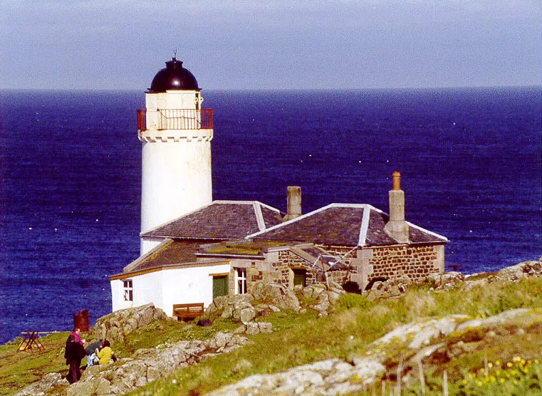
Isle of May Low Light (historical)
Lighthouses · 0.1 km
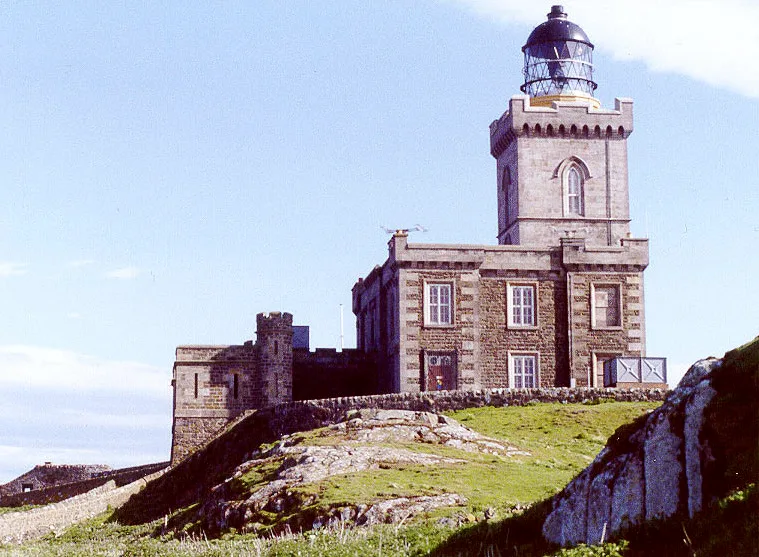
Old Isle of May Lighthouse
Lighthouses · 0.2 km

Battle of May Island
Battlefields & battle sites · 0.2 km
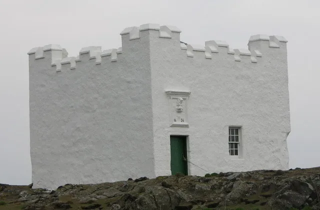
Isle of May Lighthouse
Lighthouses · 0.2 km

Isle of May
Mountains & hills · 0.2 km

Bishop's Cove
Viewpoints · 0.3 km

Altarstanes
Viewpoints · 0.4 km
Isle of May Low Light
Lighthouses · 0.6 km

Isle of May Priory
Cathedrals · 0.7 km

Caves of Caiplie
Caves · 8.4 km
Caiplie Caves
Natural landmarks · 8.4 km

Barns Mill
Vineyards · 8.4 km
Nearby
📷 5Lighthouses · Central Scotland
Isle of May Low Light (historical)
Isle of May Low Light (historical) — a lighthouse in scotland central.
📷 3Lighthouses · Central Scotland
Old Isle of May Lighthouse
Old Isle of May Lighthouse — lighthouse in Fife, Scotland, UK.
Battlefields & battle sites · Central Scotland
Battle of May Island
Battle of May Island in Scotland Islands, United Kingdom.
📷 3Lighthouses · Central Scotland
Isle of May Lighthouse
Isle of May Lighthouse — lighthouse in Fife, Scotland, UK.
Mountains & hills · Central Scotland
Isle of May
Isle of May — mountain in scotland central. Elevation: 50 m.
📷 3Viewpoints · Central Scotland
Bishop's Cove
Bishop's Cove is a viewpoint in the United Kingdom.
Where to eat & stay near Isle of May
Places to stay
 📷 5
📷 5Caravan parks · Central Scotland
Sauchope Links Holiday Park
Sauchope Links Holiday Park — a caravan park in scotland central.
 📷 5
📷 5Caravan parks · Central Scotland
Kilrenny Mill Caravan Park
Kilrenny Mill Caravan Park — a caravan park in scotland central.
 📷 5
📷 5Campsites · Central Scotland
Bankhead Farm
Bankhead Farm — a campsite in scotland central.
 📷 5
📷 5Caravan parks · Central Scotland
Silverdyke Park
Silverdyke Park — a caravan park in scotland central.
 📷 5
📷 5Caravan parks · Central Scotland
Sauchope Links Holiday Park
Sauchope Links Holiday Park — a caravan park in scotland central.
 📷 7
📷 7Hotels · Central Scotland
Balcomie Links Hotel
Balcomie Links Hotel — a hotel in scotland central.
Places to eat & drink
 📷 7
📷 7Historic pubs · Central Scotland
12 Shore Street, Anstruther Easter
12 Shore Street, Anstruther Easter in Scotland Central, United Kingdom.
 📷 7
📷 7Historic pubs · Central Scotland
Railway Tavern, 14, 16 High Street West, Anstruther Wester
Railway Tavern, 14, 16 High Street West, Anstruther Wester in Scotland Central, United Kingdom.
 📷 7
📷 7Historic pubs · Central Scotland
Balcarres Arms Hotel, 59 Main Street, Colinsburgh
Balcarres Arms Hotel, 59 Main Street, Colinsburgh in Scotland Central, United Kingdom.
 📷 7
📷 7 📷 5
📷 5Historic pubs · Central Scotland
The Crown & Kitchen
The Crown & Kitchen in Scotland Central, United Kingdom.
 📷 6
📷 6More places in this region
 Flagship📷 5
Islands · Central Scotland
Easdale
Easdale — one of the Slate Islands, in the Firth of Lorn, Scotland.
 Flagship📷 5
Islands · Central Scotland
Eileach an Naoimh
Eileach an Naoimh — uninhabited island, Garvellachs, Scotland.
 Flagship📷 3
Islands · Central Scotland
Eilean Musdile
Eilean Musdile — an islet to the south west of Lismore in the Inner Hebrides.
 📷 5
📷 5Islands · Central Scotland
Eorsa
Eorsa — island. Off the coast of Mull, Scotland, in United Kingdom.
Frequently asked questions
- Where is Isle of May?
- Isle of May is in central Scotland, United Kingdom.
- What is Isle of May?
- Isle of May — island in the north of the outer Firth of Forth.
- How do I get to Isle of May?
- Its coordinates are 56.1876°, -2.5567°.
- Is Isle of May free to visit?
- Yes, Isle of May is free to enter.