
Islands · North East England
Islandshire
In or near Lowick.
Islandshire in England North East, United Kingdom.

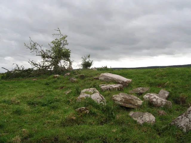
Anne Burgess — CC BY-SA 2.0 via Wikimedia Commons licence
_-_geograph.org.uk_-_8153728.jpg)
Plan your visit
- Typical visit
- 4 h–12 h
- Free entry
- Dog-friendly
About
Islandshire is a place of interest in England North East, United Kingdom — drawn from open-data sources for visitor reference. See the linked Wikipedia article for the full description.
Photo gallery
Protected designations
- Site of Special Scientific Interest: Lindisfarne SSSI
- Site of Special Scientific Interest: Northumberland Shore SSSI
- National Nature Reserve: LINDISFARNE
- Area of Outstanding Natural Beauty: Northumberland Coast
Designations sourced from Natural England open data under OGL v3.
From the Wikipedia article
Islandshire was a 'liberty' north of Northumberland, England, comprising Lindisfarne or Holy Island, plus five parishes on the mainland. Its main settlements were Tweedmouth and Scremerston. It is historically associated with the Bishop of Durham, and was administratively an exclave of the County Palatinate of Durham. It was transferred to the county of Northumberland by the Counties (Detached Parts) Act 1844, becoming a hundred. Much of it (minus Tweedmouth) formed part of the Norham and Islandshires Rural District from 1894 until 1974, and then formed part of the borough of Berwick-upon-Tweed district within the County of Northumberland. In 2009 the borough of Berwick-upon-Tweed was abolished as part of wider structural changes to local government in England, with the area now falling under the unitary council of Northumberland County Council. The area, combined with Norham, still forms one of the unitary council's electoral divisions today. It consisted of the parishes of Ancroft, Belford, Elwick, Holy Island, Kyloe and Tweedmouth.
Excerpt from Wikipedia under CC BY-SA 4.0. See the source article linked in Sources below.
- Coordinates
- 55.6790, -1.8620
- District
- Northumberland
- Parish
- Holy Island
- Postcode
- TD15 2SS
- Parliamentary constituency
- North Northumberland
Sources
- wikidata: Q15228870 (CC0)
- wikipedia: Islandshire (CC BY-SA 4.0)
Other places nearby

Stable and tower at Snook House
Memorials & monuments · 1.5 km

Goswick Sands
Beaches · 2.1 km

Barn at Beal campsite
Campsites · 2.1 km
Fenham Castle
Castles · 2.1 km

Fenham Hill
Mountains & hills · 2.4 km
Fenhamhill
Vineyards · 2.4 km

Beal railway station
Islands · 2.6 km

Fenham
Vineyards · 2.7 km

Brock Mill Farm CL
Caravan parks · 2.9 km

Sandeel Beds
Beaches · 3.2 km

Fenham
Villages · 3.3 km
Eat & Sleep Lindisfarne
Hostels · 3.4 km
Nearby
📷 3Memorials & monuments · North East England
Stable and tower at Snook House
Stable and tower at Snook House — Grade II listed building-listed memorial in scotland-central, United Kingdom.
📷 3📷 5Campsites · North East England
Barn at Beal campsite
Barn at Beal campsite — a campsite in scotland central.
📷 3📷 5Mountains & hills · North East England
Fenham Hill
Fenham Hill — mountain in scotland central. Elevation: 52 m.
📷 5Vineyards · North East England
Fenhamhill
Fenhamhill — a UK vineyard in scotland central, producing English or Welsh wine from cool-climate grape varieties.
Where to eat & stay near Islandshire
Places to stay
📷 5Campsites · North East England
Barn at Beal campsite
Barn at Beal campsite — a campsite in scotland central.
📷 4Caravan parks · North East England
Brock Mill Farm CL
Brock Mill Farm CL — a caravan park in scotland central.
Hostels · North East England
Eat & Sleep Lindisfarne
Eat & Sleep Lindisfarne — a hostel in england north east.
 📷 6
📷 6 📷 7
📷 7 📷 5
📷 5Campsites · North East England
Haggerston Campsite
Haggerston Campsite — a campsite in scotland central.
Places to eat & drink
 📷 7
📷 7Historic pubs · North East England
59 And 61, Bridge Street
59 And 61, Bridge Street in Scotland Lowlands, United Kingdom.
 📷 5
📷 5Historic pubs · North East England
The Berwick Arms
The Berwick Arms in Scotland Lowlands, United Kingdom.
 📷 7
📷 7Historic pubs · North East England
Red Lion Public House
Red Lion Public House in Scotland Lowlands, United Kingdom.
 📷 7
📷 7 📷 7
📷 7Historic pubs · Scottish Lowlands
The Victoria Hotel
The Victoria Hotel in Scotland Lowlands, United Kingdom.
 📷 5
📷 5Historic pubs · Scottish Lowlands
The Masons Arms
The Masons Arms in Scotland Lowlands, United Kingdom.
More places in this region
 📷 4
📷 4 📷 4
📷 4 📷 3
📷 3Islands · North East England
Bradbury and the Isle
Bradbury and the Isle in England North East, United Kingdom.
 📷 4
📷 4Islands · North East England
United Kingdom
United Kingdom in England North East, United Kingdom.
Frequently asked questions
- Where is Islandshire?
- Islandshire is in North-East England, United Kingdom (postcode TD15 2SS), in the parish of Holy Island.
- What is Islandshire?
- Islandshire in England North East, United Kingdom.
- How do I get to Islandshire?
- The nearest town is Lowick. Drivers can use postcode TD15 2SS.
- Is Islandshire a protected site?
- Yes — Islandshire is part of the Lindisfarne SSSI Site of Special Scientific Interest and the Northumberland Shore SSSI Site of Special Scientific Interest.
- Is Islandshire free to visit?
- Yes, Islandshire is free to enter.
- How do I get to Islandshire?
- Drivers can navigate to postcode TD15 2SS. It sits within the North Northumberland parliamentary constituency.