
Museums · East Midlands
Irthlingborough
In or near Finedon.
Irthlingborough () is a town on the River Nene in North Northamptonshire, England. As of 2021, it has a population of 9,325, and was at one point the smallest town in England to have had a Football Le

Philip Pankhurst — CC BY-SA 2.0 via Wikimedia Commons licence

Plan your visit
- Typical visit
- 1.5 h–3 h
- Best time of year
- Year-round
- Nearest railway station
- Wellingborough · 4.8 km
- Family-friendly
- Limited wheelchair access
Getting there & planning your visit
To visit Irthlingborough Museum, the nearest railway station is Wellingborough, located 4.8 km away. The postcode for the museum is NN9 5QN. Please note that wheelchair accessibility is limited.
About
Irthlingborough () is a town on the River Nene in North Northamptonshire, England. As of 2021, it has a population of 9,325, and was at one point the smallest town in England to have had a Football League team, Rushden & Diamonds F.C. The parish church, St Peter, has a lantern tower, unusual for Northamptonshire churches, which was built to guide travellers across the Nene valley in foggy weather. It also has doors at the four cardinal points and has eight misericords in the chancel. Irthlingborough railway station opened in 1845 and closed to passengers in 1964.
Photo gallery
Official information
Irthlingborough Town Council offers local services and information for residents and visitors. The website provides resources about community activities and how the council operates.
Protected designations
- Site of Special Scientific Interest: Upper Nene Valley Gravel Pits SSSI
- Ramsar wetland: Upper Nene Valley Gravel Pits
Designations sourced from Natural England open data under OGL v3.
From the Wikipedia article
Irthlingborough () is a town on the River Nene in North Northamptonshire, England. As of 2021, it has a population of 9,325, and was at one point the smallest town in England to have had a Football League team, Rushden & Diamonds F.C. The parish church, St Peter, has a lantern tower, unusual for Northamptonshire churches, which was built to guide travellers across the Nene valley in foggy weather. It also has doors at the four cardinal points and has eight misericords in the chancel. Irthlingborough railway station opened in 1845 and closed to passengers in 1964.
Excerpt from Wikipedia under CC BY-SA 4.0. See the source article linked in Sources below.
Background
History
The town's name origin is uncertain. 'Ploughmen's fortification', with the suggestion that oxen were once kept here. Perhaps, 'fortification of Yrtla's people'. Alternatively, the first element may be an Old English 'yrthling', a type of bird such as a wren, wagtail, or lapwing. Bird names are frequently used to form compounds with Old English 'burh'. Irthlingborough was called Yrtlingaburg in the 8th century, Erdiburn in the Domesday Book of 1086, and Artleborough later. King Offa of Mercia held court near Irthlingborough circa 790. John Pyel, the mayor of London in 1372, is believed to have been born at Irthlingborough circa 1310. In 1913, a feature film showing the Battle of Waterloo was…
Sourced from Wikipedia under CC BY-SA 4.0.
- Coordinates
- 52.3240, -0.6140
- District
- North Northamptonshire
- Parish
- Irthlingborough
- Postcode
- NN9 5QN
- Parliamentary constituency
- Wellingborough and Rushden
- Nearest railway station
- Wellingborough — 4.8 km
- Official site
- www.irthlingborough-tc.gov.uk
Sources
- wikipedia: Irthlingborough (CC BY-SA 4.0)
Other places nearby
Market Cross At Junction Of Station And Finedon Roads
Historic houses · 0.4 km

Manor House Upper Manor
Manor houses · 0.6 km
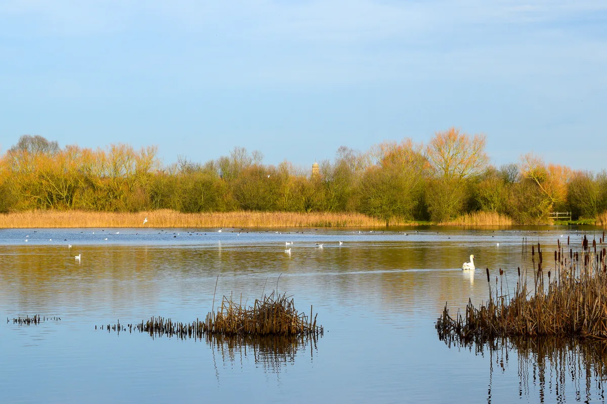
Irthlingborough Lakes and Meadows
Wildlife reserves · 0.9 km

Irthlingborough Old Bridge
Historic bridges · 1.1 km

Higham Mill
Watermills · 1.3 km

Roman temple in Higham Ferrers
Follies · 1.5 km
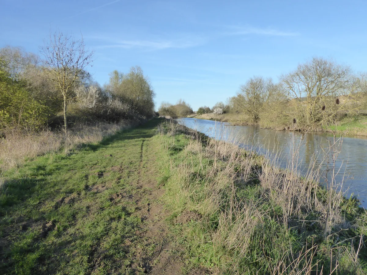
Higham Ferrers Pits
Wildlife reserves · 1.7 km

Higham Ferrers Pits and Wilson's Pits
Forests & woodlands · 1.7 km

Finedon Top Lodge Quarry
Quarries · 2.0 km

Swan Sculpture
Public art & sculpture · 2.3 km

Chichele College, North Range And Attached Foundations
Historic houses · 2.3 km
Chichele College
Historic houses · 2.3 km
Nearby
📷 3Historic houses · East Midlands
Market Cross At Junction Of Station And Finedon Roads
Market Cross At Junction Of Station And Finedon Roads — a Grade I-listed historic house in england-west-midlands, United Kingdom.
📷 3Manor houses · East Midlands
Manor House Upper Manor
Manor House Upper Manor — Grade II listed building-listed manor in england-west-midlands, United Kingdom.
📷 3Wildlife reserves · East Midlands
Irthlingborough Lakes and Meadows
Irthlingborough Lakes and Meadows — nature reserve in the United Kingdom.
📷 3Historic bridges · East Midlands
Irthlingborough Old Bridge
Irthlingborough Old Bridge — a Grade I-listed bridge in england-west-midlands, United Kingdom.
📷 3📷 5Follies · East Midlands
Roman temple in Higham Ferrers
Roman temple in Higham Ferrers — a temple folly in england-west-midlands, United Kingdom.
Where to eat & stay near Irthlingborough
Places to stay
 📷 5
📷 5 📷 7
📷 7Hotels · East Midlands
The Hind Hotel
The Hind Hotel — a hotel in england west midlands.
 📷 5
📷 5 📷 5
📷 5Campsites · East Midlands
Wicksteed Park Camping
Wicksteed Park Camping — a campsite in england west midlands.
 📷 3
📷 3Campsites · East Midlands
Grendon Lake Camping
Grendon Lake Camping — a campsite in england west midlands.
 📷 5
📷 5Places to eat & drink
 📷 5
📷 5Historic pubs · East Midlands
67 and 69 High Street
67 and 69 High Street in England East, United Kingdom.
 📷 5
📷 5Historic pubs · East Midlands
Mulso Arms Public House And Barns Attached To North West And South West
Mulso Arms Public House And Barns Attached To North West And South West in England East, United Kingdom.
📷 5Historic pubs · East Midlands
The Bell Inn Public House
The Bell Inn Public House in England East, United Kingdom.
 📷 5
📷 5Historic pubs · East Midlands
Hare And Hounds Public House
Hare And Hounds Public House in England East, United Kingdom.
 📷 5
📷 5 📷 5
📷 5Historic pubs · East Midlands
Ye Golden Lion Public House
Ye Golden Lion Public House in England East, United Kingdom.
More museums in this region
 📷 5
📷 5Museums · East Midlands
Stamford Town Hall
Stamford Town Hall — building in Stamford, Lincolnshire, England, UK.
 📷 5
📷 5Museums · East Midlands
Thorney Museum
Thorney Museum — a museum in East Midlands, United Kingdom.
 📷 5
📷 5Museums · East Midlands
Octavia Hill Birthplace Museum
Octavia Hill Birthplace Museum — a museum in East Midlands, United Kingdom.
 📷 5
📷 5Museums · East Midlands
Museum of Technology
Museum of Technology — a museum in East Midlands, United Kingdom.
Frequently asked questions
- Where is Irthlingborough?
- Irthlingborough is in the East Midlands, United Kingdom (postcode NN9 5QN), in the parish of Irthlingborough.
- What is Irthlingborough?
- Irthlingborough () is a town on the River Nene in North Northamptonshire, England. As of 2021, it has a population of 9,325, and was at one point the smallest town in England to have had a Football Le
- How do I get to Irthlingborough?
- The nearest railway station is Wellingborough, about 4.8 km away. The nearest town is Finedon. Drivers can use postcode NN9 5QN.
- Is Irthlingborough a protected site?
- Yes — Irthlingborough is part of the Upper Nene Valley Gravel Pits SSSI Site of Special Scientific Interest and the Upper Nene Valley Gravel Pits Ramsar wetland.
- How do I get to Irthlingborough?
- The nearest railway station is Wellingborough, about 4.8 km away. Drivers can navigate to postcode NN9 5QN.