
Historic bridges · East of England
Iron Bridge, Approximately 275 Metres South Of Marks Hall Cottages
In or near Earls Colne.
Iron Bridge, Approximately 275 Metres South Of Marks Hall Cottages — Grade II listed building-listed bridge in england-east, United Kingdom.

Geographer — CC BY-SA 2.0 via Wikimedia Commons licence

Plan your visit
- Typical visit
- 15 min–30 min
- Nearest railway station
- Kelvedon · 6.3 km
- Free entry
- Dog-friendly
Getting there & planning your visit
The nearest railway station is Kelvedon, which is approximately 6.3 km away. The postcode for the Iron Bridge is CO6 1TG, and entry is free. Accessibility details are not provided.
About
Iron Bridge, Approximately 275 Metres South Of Marks Hall Cottages is a Grade II listed building-listed bridge in england-east, United Kingdom, registered on the National Heritage List for England (NHLE entry 1123124). Listed status protects buildings and structures of special architectural or historic interest. See the linked Wikipedia article for further details.
Photo gallery
Heritage listing
Details TL 82 NW COGGESHALL MARKS HALL ROAD 2/157 Iron Bridge, approximately 275 metres south of Marks Hall Cottages GV II Garden bridge. Circa 1800. Red brick with limestone copings and cast iron railings. Carries an estate road (of Marks Hall Estate) from E to W across Robin's Brook, width approximately 4.50 metres, length overall approximately 10 metres. Semi-circular arch (damaged on N side) with segmental coping of plain stone slabs. Cast iron railings each side, made of 6 large sections over the bridge itself, and 2 straight sections on the road approaches to the bridge, jointed together and sealed with lead. The NE straight section is dismounted and damaged at time of survey, March 1987; the SW straight section is missing. The sections over the bridge are of radial design with a central boss; the straight sections are of crossed diagonals; 3 plain vertical bars between the sections, 2 at each end. On the handrail are urn finials, 2 complete and one damaged on the N side, one damaged finial on the S side; all are mounted in square mortices and sealed with lead. The bosses are of lion's head design, sealed with lead into iron rings. On the N (inner) side of the S railing the 6 bosses are complete; on the S side of the same railing are 5 bosses, all but one cracked. On the S (inner) side of the N railing are 2 intact bosses and 2 damaged; on the N side of the same railing are 4 bosses. The carriageway and approaches were covered with concrete for wartime use; this could be removed. S of the bridge the river channel is contained by 2 brick walls with sloping stone copings terminating in square piers, each with a plain spiked railing with 3 stirrup stays. 3 iron ties through the bridge with simple roundels and square nuts at each end. Brick dam across N arch. Listing
From the Historic England List Entry under OGL v3.
Place summary
Iron Bridge, located approximately 275 metres south of Marks Hall Cottages in Coggeshall, Essex, is a Grade II listed structure. This bridge is notable for its historical significance and architectural merit, contributing to the region's heritage.
AI-generated from the structured facts on this page (operator, designation, listing, era). Not a substitute for visiting.
- Coordinates
- 51.8949, 0.6729
- County
- Essex
- District
- Braintree
- Parish
- Coggeshall
- Postcode
- CO6 1TG
- Parliamentary constituency
- Witham
- Nearest railway station
- Kelvedon — 6.3 km
Sources
- wikidata: Q26416217 (CC0)
Other places nearby

Saint Margaret’s Church
Historic churches · 0.2 km

Markshall
Natural landmarks · 0.2 km

Markshall
Villages · 0.9 km

Memorial to Bomber Command and Operation Varsity
Memorials & monuments · 1.3 km
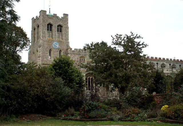
St Peter ad Vincula
Historic churches · 2.5 km

Josiah Greenwood
Memorials & monuments · 2.6 km

Coggeshall Museum
Museums · 2.7 km

Pattiswick
Villages · 2.7 km

Chapel Hotel
Historic houses · 2.8 km
Constantines
Memorials & monuments · 2.8 km

Paycocke's
Gardens · 2.8 km

The Fleece Public House
Historic pubs · 2.8 km
Nearby
📷 3Historic churches · East of England
Saint Margaret’s Church
Saint Margaret’s Church — a church in england-east, United Kingdom.
📷 3Natural landmarks · East of England
Markshall
Markshall — a other in england-east, United Kingdom.
📷 5📷 3Memorials & monuments · East of England
Memorial to Bomber Command and Operation Varsity
Memorial to Bomber Command and Operation Varsity is a memorial in the United Kingdom.
📷 3Historic churches · East of England
St Peter ad Vincula
St Peter ad Vincula — church in Coggeshall, Essex, England, UK.
📷 3Memorials & monuments · East of England
Josiah Greenwood
Josiah Greenwood — a memorial in england-east, United Kingdom.
Where to eat & stay near Iron Bridge, Approximately 275 Metres South Of Marks Hall Cottages
Places to stay
 📷 7
📷 7Hotels · East of England
White Hart Hotel
White Hart Hotel — a hotel in england east.
 📷 3
📷 3 📷 5
📷 5Caravan parks · East of England
Gosfield Lake Resort
Gosfield Lake Resort — a caravan park in england east.
📷 5Campsites · East of England
Gosfield Lake Resort
Gosfield Lake Resort — a campsite in england east.
Caravan parks · East of England
Colchester Country Park
Colchester Country Park — a caravan park in england east.
 📷 5
📷 5Campsites · East of England
Colchester Country Park
Colchester Country Park — a campsite in england east.
Places to eat & drink
📷 7Historic pubs · East of England
The Fleece Public House
The Fleece Public House in England East, United Kingdom.
 📷 5
📷 5Historic pubs · East of England
The Griffin Public House
The Griffin Public House in England East, United Kingdom.
 📷 5
📷 5Historic pubs · East of England
The Locomotive Public House
The Locomotive Public House in England East, United Kingdom.
 📷 7
📷 7Historic pubs · East of England
Napier Arms Public House
Napier Arms Public House in England East, United Kingdom.
 📷 7
📷 7Historic pubs · East of England
Bird In Hand Public House
Bird In Hand Public House in England East, United Kingdom.
 📷 5
📷 5More bridges in this region
.JPG?width=1200) 📷 5
📷 5Historic bridges · East of England
Albert Bridge
Albert Bridge is a historic bridge in the United Kingdom.
.jpg?width=1200) 📷 5
📷 5Historic bridges · East of England
Bedford Town Bridge
Bedford Town Bridge is a historic bridge in the United Kingdom.
 📷 5
📷 5Historic bridges · East of England
Bethnal Green and King's Lynn Line
Bethnal Green and King's Lynn Line is a historic bridge in the United Kingdom.
 📷 5
📷 5Historic bridges · East of England
Bethnal Green and King's Lynn Line
Bethnal Green and King's Lynn Line is a historic bridge in the United Kingdom.
Frequently asked questions
- Where is Iron Bridge, Approximately 275 Metres South Of Marks Hall Cottages?
- Iron Bridge, Approximately 275 Metres South Of Marks Hall Cottages is in Essex, East of England, United Kingdom (postcode CO6 1TG), in the parish of Coggeshall.
- What is Iron Bridge, Approximately 275 Metres South Of Marks Hall Cottages?
- Iron Bridge, Approximately 275 Metres South Of Marks Hall Cottages — Grade II listed building-listed bridge in england-east, United Kingdom.
- How do I get to Iron Bridge, Approximately 275 Metres South Of Marks Hall Cottages?
- The nearest railway station is Kelvedon, about 6.3 km away. The nearest town is Earls Colne. Drivers can use postcode CO6 1TG.
- Is Iron Bridge, Approximately 275 Metres South Of Marks Hall Cottages a listed building?
- Iron Bridge, Approximately 275 Metres South Of Marks Hall Cottages is officially recognised as Grade II listed building listed.
- Is Iron Bridge, Approximately 275 Metres South Of Marks Hall Cottages free to visit?
- Yes, Iron Bridge, Approximately 275 Metres South Of Marks Hall Cottages is free to enter.
- How do I get to Iron Bridge, Approximately 275 Metres South Of Marks Hall Cottages?
- The nearest railway station is Kelvedon, about 6.3 km away. Drivers can navigate to postcode CO6 1TG.