
Historic bridges · Yorkshire & the Humber
Ireland Bridge
In or near Haworth.
Ireland Bridge is a historic bridge in the United Kingdom.

Wikimedia Commons contributors — see linked file page for photographer and licence licence

Plan your visit
- Typical visit
- 15 min–30 min
- Nearest railway station
- Bingley · 0.3 km
- Free entry
- Dog-friendly
Getting there & planning your visit
To visit Ireland Bridge, you can take a train to Bingley station, which is just 0.3 km away. Entry to the bridge is free. The postcode for your sat-nav is BD16 2QX.
About
Ireland Bridge is a named historic bridge in the United Kingdom. Coordinates: 53.8503°, -1.8416°. This entry is part of The Great Britain Guide, a free, ad-free, open-data tourist directory.
Photo gallery
Heritage listing
Bingley's Ireland Bridge is a Grade II* listed structure and a historically significant crossing point over the River Aire in West Yorkshire, England. It now provides the main route between Bingley and the nearby villages of Harden, Wilsden and Cullingworth (the B6429).
From the Historic England List Entry under OGL v3.
Protected designations
- Site of Special Scientific Interest: South Pennine Moors SSSI
- National Nature Reserve: BRADFORD PENNINE GATEWAY
Designations sourced from Natural England open data under OGL v3.
From the Wikipedia article
Bingley's Ireland Bridge is a Grade II* listed structure and a historically significant crossing point over the River Aire in West Yorkshire, England. It now provides the main route between Bingley and the nearby villages of Harden, Wilsden and Cullingworth (the B6429).
Excerpt from Wikipedia under CC BY-SA 4.0. See the source article linked in Sources below.
Background
History
A bridge has existed at this point over the river since mediaeval times. The current bridge dates from 1686 and replaced an earlier timber structure. During renovations in 2010, engineers found unique stonemason marks carved into sections of the bridge that were previously inaccessible until the scaffolding went up around it. The bridge was widened and a parapet added in 1775. Previous to the bridge being built, visitors to the town would ford the river at a crossing just south of the bridge that would lead them to the bottom of what is now Ferrand Lane. When the water is low enough, the stones of this crossing are said to be visible. The mill was demolished in 1984 and the site has now…
Sourced from Wikipedia under CC BY-SA 4.0.
- Coordinates
- 53.8503, -1.8416
- District
- Bradford
- Parish
- Bingley
- Postcode
- BD16 2QX
- Parliamentary constituency
- Shipley
- Nearest railway station
- Bingley — 0.3 km
Sources
- osm: w658099018 (ODbL)
- wikipedia: Ireland Bridge (CC BY-SA 4.0)
- commons: Bingley Ireland Bridge 1.jpg (CC BY-SA 4.0)
Other places nearby

Old White Horse Inn
Historic houses · 0.0 km

Old White Horse Inn
Historic pubs · 0.0 km
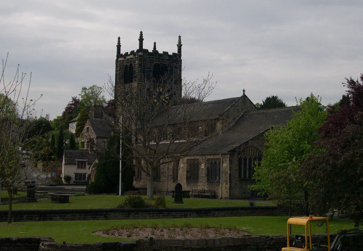
Church of All Saints, Bingley
Historic churches · 0.1 km

Bingley Hippodrome
Theatres · 0.2 km

Bingley Three Rise Locks
Canal locks · 0.2 km

Throstle Nest Plaque
Memorials & monuments · 0.3 km

Bingley Arts Centre
Open-air theatres · 0.3 km

Bingley railway station
Heritage railway stations · 0.3 km

Myrtle Cinema
Theatres · 0.4 km

Family cycle route
Mountain bike trails · 0.5 km

Bingley War Memorial
Memorials & monuments · 0.5 km

Bingley
Museums · 0.6 km
Nearby
📷 5Historic houses · Yorkshire & the Humber
Old White Horse Inn
Old White Horse Inn — a Grade II-listed historic house in england-yorkshire, United Kingdom.
📷 5Historic pubs · Yorkshire & the Humber
Old White Horse Inn
Old White Horse Inn in England Yorkshire, United Kingdom.
📷 5Historic churches · Yorkshire & the Humber
Church of All Saints, Bingley
Church of All Saints, Bingley — church in Bingley, West Yorkshire, England,UK.
📷 3Theatres · Yorkshire & the Humber
Bingley Hippodrome
Bingley Hippodrome in England Yorkshire, United Kingdom.
📷 3Canal locks · Yorkshire & the Humber
Bingley Three Rise Locks
Bingley Three Rise Locks — staircase of three locks on the Leeds and Liverpool Canal at Bingley, West Yorkshire, England, UK.
📷 3Memorials & monuments · Yorkshire & the Humber
Throstle Nest Plaque
Throstle Nest Plaque — a memorial in Yorkshire & the Humber, United Kingdom.
Where to eat & stay near Ireland Bridge
Places to stay
 📷 5
📷 5 📷 5
📷 5Hotels · Yorkshire & the Humber
Bankfield Hotel
Bankfield Hotel — a hotel in england yorkshire. 3-star. Brand: Mercure Bradford.
 📷 5
📷 5Caravan parks · Yorkshire & the Humber
Crook Farm Caravan Park
Crook Farm Caravan Park — a caravan park in england yorkshire.
 📷 5
📷 5Caravan parks · Yorkshire & the Humber
Harden Park Homes
Harden Park Homes — a caravan park in england yorkshire.
 📷 5
📷 5Caravan parks · Yorkshire & the Humber
Dobrudden Farm Caravan Park
Dobrudden Farm Caravan Park — a caravan park in england yorkshire.
 📷 5
📷 5Caravan parks · Yorkshire & the Humber
Moor Valley Caravan Park
Moor Valley Caravan Park — a caravan park in england yorkshire.
Places to eat & drink
📷 5Historic pubs · Yorkshire & the Humber
Old White Horse Inn
Old White Horse Inn in England Yorkshire, United Kingdom.
 📷 5
📷 5Historic pubs · Yorkshire & the Humber
Airedale Heifer Public House And Attached Barn
Airedale Heifer Public House And Attached Barn in England Yorkshire, United Kingdom.
 📷 5
📷 5Historic pubs · Yorkshire & the Humber
The Duke Of York Public House
The Duke Of York Public House in England Yorkshire, United Kingdom.
 📷 7
📷 7Historic pubs · Yorkshire & the Humber
The Spotted House Public House
The Spotted House Public House in England Yorkshire, United Kingdom.
 📷 5
📷 5Cafés · Yorkshire & the Humber
White Wells
White Wells — a café in england yorkshire.
 📷 5
📷 5Historic pubs · Yorkshire & the Humber
White Cross Hotel
White Cross Hotel in England Yorkshire, United Kingdom.
More bridges in this region
 📷 5
📷 5Historic bridges · Yorkshire & the Humber
Broadbottom Viaduct
Broadbottom Viaduct is a historic bridge in the United Kingdom.
 📷 3
📷 3Historic bridges · Yorkshire & the Humber
Goyt Cliff Viaduct
Goyt Cliff Viaduct is a historic bridge in the United Kingdom.
 📷 3
📷 3Historic bridges · Yorkshire & the Humber
Iron Bridge
Iron Bridge is a historic bridge in the United Kingdom.
.jpg?width=1200) 📷 5
📷 5Historic bridges · Yorkshire & the Humber
Marple Aqueduct
Marple Aqueduct is a historic bridge in the United Kingdom.
Frequently asked questions
- Where is Ireland Bridge?
- Ireland Bridge is in Yorkshire, United Kingdom (postcode BD16 2QX), in the parish of Bingley.
- What is Ireland Bridge?
- Ireland Bridge is a historic bridge in the United Kingdom.
- How do I get to Ireland Bridge?
- The nearest railway station is Bingley, about 0.3 km away. The nearest town is Haworth. Drivers can use postcode BD16 2QX.
- Is Ireland Bridge a listed building?
- Ireland Bridge is officially recognised as Grade II* listed building listed.
- Is Ireland Bridge a protected site?
- Yes — Ireland Bridge is part of the South Pennine Moors SSSI Site of Special Scientific Interest and the BRADFORD PENNINE GATEWAY National Nature Reserve.
- Is Ireland Bridge free to visit?
- Yes, Ireland Bridge is free to enter.
- How do I get to Ireland Bridge?
- The nearest railway station is Bingley, about 0.3 km away. Drivers can navigate to postcode BD16 2QX.