National parks · Central Scotland
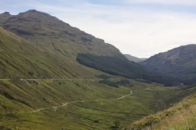
Inveruglas
In or near Tarbet.
Inveruglas in Scotland Islands, United Kingdom.

Alec MacKinnon — CC BY-SA 2.0 via Wikimedia Commons licence
Plan your visit
- Typical visit
- 4 h–8 h
- Best time of year
- Spring – autumn (Apr–Oct)
- Nearest railway station
- Arrochar and Tarbet · 4.9 km
- Free entry
- Family-friendly
- Dog-friendly
Getting there & planning your visit
To visit Inveruglas in the Scottish Highlands, the nearest railway station is Arrochar and Tarbet, located 4.9 km away. The postcode for navigation is G83 7DP. Entry to the park is free.
About
Inveruglas is a place of interest in Scotland Islands, United Kingdom — drawn from open-data sources for visitor reference. See the linked Wikipedia article for the full description.
Photo gallery
See it from the streetimagery from 2025
Imagery © Mapillary contributors, CC BY-SA 4.0
From the Wikipedia article
Inveruglas (Scottish Gaelic: Inbhir Dhubhghlais) is a hamlet on the west shore of Loch Lomond, fairly near the north end of the loch and is within the Loch Lomond and The Trossachs National Park. It is situated on the A82 trunk road, connecting Glasgow to Inverness. It is within the historic county of Dunbartonshire, and since 1996 it has been part of the Argyll and Bute council area. Nearby isles include Inveruglas Isle and Wallace's Isle. Inversnaid is roughly opposite on the east shore, there is a pedestrian ferry. The Inveruglas Water flows into the loch at the hamlet, flowing down from Loch Sloy. The name of this watercourse is a curious back-formation, since Inveruglas means "the mouth of the Douglas". It may have acquired this name to differentiate it from the Douglas Water a few miles further south. Inveruglas Isle lies in Inveruglas Bay, an inlet of Loch Lomond.
Excerpt from Wikipedia under CC BY-SA 4.0. See the source article linked in Sources below.
- Coordinates
- 56.2470, -4.7140
- District
- Argyll and Bute
- Postcode
- G83 7DP
- Parliamentary constituency
- Argyll, Bute and South Lochaber
- Nearest railway station
- Arrochar and Tarbet — 4.9 km
Sources
- wikidata: Q16892730 (CC0)
- wikipedia: Inveruglas (CC BY-SA 4.0)
Other places nearby
Inveruglas railway station
Historic bridges · 0.2 km

Wallace's Isle
Islands · 0.3 km

Inveruglas Isle
Islands · 0.4 km

Inveruglas Isle Castle
Castles · 0.4 km

Bridge, Sloy Power Station, Inveruglas
Historic bridges · 0.5 km

An Ceann Mòr - Inveruglas Pyramid
Viewpoints · 0.6 km

Inveruglas camping permit area March-September
Campsites · 0.7 km

Creag-an-Arnain Viaduct
Historic bridges · 1.3 km

Kenmore Hill
Mountains & hills · 1.4 km

Dubh Chnoc
Mountains & hills · 1.8 km
Dubh Chnoc
Mountains & hills · 1.8 km

Inversnaid Hotel
Hotels · 1.9 km
Nearby
📷 3Historic bridges · Central Scotland
Inveruglas railway station
Inveruglas railway station in Scotland Islands, United Kingdom.
📷 4Islands · Central Scotland
Wallace's Isle
Wallace's Isle — island in Loch Lomond, Argyll and Bute, Scotland, UK.
📷 4Islands · Central Scotland
Inveruglas Isle
Inveruglas Isle — island in Argyll and Bute, Scotland, UK.
📷 5Castles · Central Scotland
Inveruglas Isle Castle
Inveruglas Isle Castle — scheduled monument-listed castle in scotland-highlands, United Kingdom.
📷 5Historic bridges · Central Scotland
Bridge, Sloy Power Station, Inveruglas
Bridge, Sloy Power Station, Inveruglas — category C listed building-listed bridge in scotland-highlands, United Kingdom.
📷 3Viewpoints · Central Scotland
An Ceann Mòr - Inveruglas Pyramid
An Ceann Mòr - Inveruglas Pyramid is a viewpoint in the United Kingdom.
Where to eat & stay near Inveruglas
Places to stay
📷 5Campsites · Central Scotland
Inveruglas camping permit area March-September
Inveruglas camping permit area March-September — a campsite in scotland highlands.
📷 7 📷 7
📷 7Hotels · Central Scotland
Inversnaid Bunkhouse
Inversnaid Bunkhouse — a hotel in scotland highlands.
 📷 5
📷 5Campsites · Central Scotland
Tarbet isle camping permit area March-September
Tarbet isle camping permit area March-September — a campsite in scotland highlands.
 📷 7
📷 7Hotels · Central Scotland
Tarbet Hotel
Tarbet Hotel — a hotel in scotland highlands.
 📷 5
📷 5Campsites · Central Scotland
MacTavish Campsite
MacTavish Campsite — a campsite in scotland highlands.
Places to eat & drink
 📷 5
📷 5Historic pubs · Central Scotland
The Drovers Inn
The Drovers Inn — Historic pub — listed building or notable heritage status.
More national parks in this region
 Flagship📷 5
National parks · Central Scotland
Loch Lomond and The Trossachs National Park
Loch Lomond and The Trossachs National Park is a National park in Scotland.
 📷 5
📷 5National parks · Central Scotland
Whistlefield
Whistlefield in Scotland Islands, United Kingdom.
 📷 4
📷 4 📷 3
📷 3Frequently asked questions
- Where is Inveruglas?
- Inveruglas is in the Scottish Highlands, United Kingdom (postcode G83 7DP).
- What is Inveruglas?
- Inveruglas in Scotland Islands, United Kingdom.
- How do I get to Inveruglas?
- The nearest railway station is Arrochar and Tarbet, about 4.9 km away. Drivers can use postcode G83 7DP.
- Is Inveruglas free to visit?
- Yes, Inveruglas is free to enter.
- How do I get to Inveruglas?
- The nearest railway station is Arrochar and Tarbet, about 4.9 km away. Drivers can navigate to postcode G83 7DP.