
Islands · Scottish Highlands
Innis Mhòr
In or near Tain.
Innis Mhòr — island in Highland, Scotland, UK.

Wikimedia Commons licence
Plan your visit
- Typical visit
- 4 h–12 h
- Nearest railway station
- Tain · 7.8 km
- Free entry
- Dog-friendly
Getting there & planning your visit
To visit Innis Mhòr in the Scottish Highlands, the nearest railway station is Tain, which is 7.8 km away. Entry to the island is free.
About
Innis Mhòr is a island in the United Kingdom. Wikidata describes it as: "island in Highland, Scotland, UK". Coordinates: 57.8508°, -3.9400°.
Photo gallery
From the Wikipedia article
Innis Mhòr is a tidal island in the Dornoch Firth of Easter Ross off the east coast of Scotland. It is about 26 hectares (64 acres) in extent and is largely, if not exclusively, made up of moving sand dunes. No point on the island is greater than 5 metres (16 ft) above sea level. It has almost certainly never been permanently inhabited. The nearest settlement is Inver to the south (which is 5 kilometres (3.1 mi) west of Portmahomack). The town of Tain is 8 kilometres (5.0 mi) to the east. Scotland's north and west coasts have over 700 islands all told. Innis Mhòr is one of the few east coast islands, only 4 of which exceed 20 hectares (49 acres) in size. The extensive tidal Whiteness Sands lie between Innis Mhòr and the Easter Ross coast, with the headland of Rubh' na h-Innse Moire lying to the west of the island. Inland there is the Morrich More, an extensive area of dune grassland with wetland communities, and a grade 1 SSSI, and RAF Tain, a bombing range on an alluvial plain known as the Fendom. The area includes the most extensive area (260 hectares (1.0 sq mi)) of salt marsh in the Highlands. The island is part of the Dornoch Firth National Scenic Area, one of 40 in Scotland. Local birdlife includes important populations of osprey (10 pairs representing about 10% of the UK breeding population), bar-tailed godwit, greylag goose and wigeon and numerous more common species such as curlew, dunlin, oystercatcher and teal. There are no other islands nearby, although a sandy spit to the south is marked as Innis Bheag (meaning "small island") on some maps and is also referred to as Paterson Island.
Excerpt from Wikipedia under CC BY-SA 4.0. See the source article linked in Sources below.
- Coordinates
- 57.8508, -3.9400
- Nearest railway station
- Tain — 7.8 km
Sources
- wikidata: Q6035820 (CC0)
- wikipedia: Innis Mhòr (CC BY-SA 4.0)
Other places nearby

Whiteness Sands
Beaches · 1.7 km

Inver Bay
Natural landmarks · 3.3 km

CSM John Skinner VC Memorial
Memorials & monuments · 3.8 km
Inver Evacuation Memorial Tablet
Memorials & monuments · 3.9 km

Inver
Villages · 4.0 km

Tain Airfield Memorial
Memorials & monuments · 5.3 km

Roy's Bay
Natural landmarks · 5.4 km

Dornoch camping and caravaning site
Campsites · 5.5 km
.png?width=1200)
Loch Slin Castle
Literary houses · 5.6 km

Dornoch Sands
Beaches · 5.7 km

Janet Horne Memorial Stone
Memorials & monuments · 5.8 km

Dornoch Station
Hotels · 6.0 km
Nearby
📷 3📷 5Natural landmarks · Scottish Highlands
Inver Bay
Inver Bay — a natural feature in scotland highlands.
📷 3Memorials & monuments · Scottish Highlands
CSM John Skinner VC Memorial
CSM John Skinner VC Memorial — a memorial in scotland-highlands, United Kingdom.
📷 3Memorials & monuments · Scottish Highlands
Inver Evacuation Memorial Tablet
Inver Evacuation Memorial Tablet — a memorial in scotland-highlands, United Kingdom.
📷 5📷 3Memorials & monuments · Scottish Highlands
Tain Airfield Memorial
Tain Airfield Memorial — a memorial in scotland-highlands, United Kingdom.
Where to eat & stay near Innis Mhòr
Places to stay
📷 5Campsites · Scottish Highlands
Dornoch camping and caravaning site
Dornoch camping and caravaning site — a campsite in scotland highlands.
📷 5Hotels · Scottish Highlands
Dornoch Station
Dornoch Station — a hotel in scotland highlands. 5-star. Brand: Marine & Lawn Hotels & Resorts.
 📷 5
📷 5Campsites · Scottish Highlands
Portmahomack Caravan Site
Portmahomack Caravan Site — a campsite in scotland highlands.
 📷 5
📷 5Caravan parks · Scottish Highlands
Granny's Heilan' Hame Holiday Park
Granny's Heilan' Hame Holiday Park — a caravan park in scotland highlands. Brand: Parkdean Resorts.
 📷 5
📷 5Campsites · Scottish Highlands
Dornoch Firth Caravan Park
Dornoch Firth Caravan Park — a campsite in scotland highlands.
 📷 5
📷 5Caravan parks · Scottish Highlands
Golspie Links Caravan Park
Golspie Links Caravan Park — a caravan park in scotland highlands.
Places to eat & drink
 📷 7
📷 7Historic pubs · Scottish Highlands
Commercial Bar, 84 High Street, Invergordon
Commercial Bar, 84 High Street, Invergordon in Scotland Highlands, United Kingdom.
More places in this region
 Flagship📷 5
Islands · Scottish Highlands
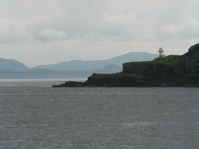
Eigg
Eigg — one of the Small Isles in the Inner Hebrides, Scotland, UK.
 Flagship📷 5
Islands · Scottish Highlands
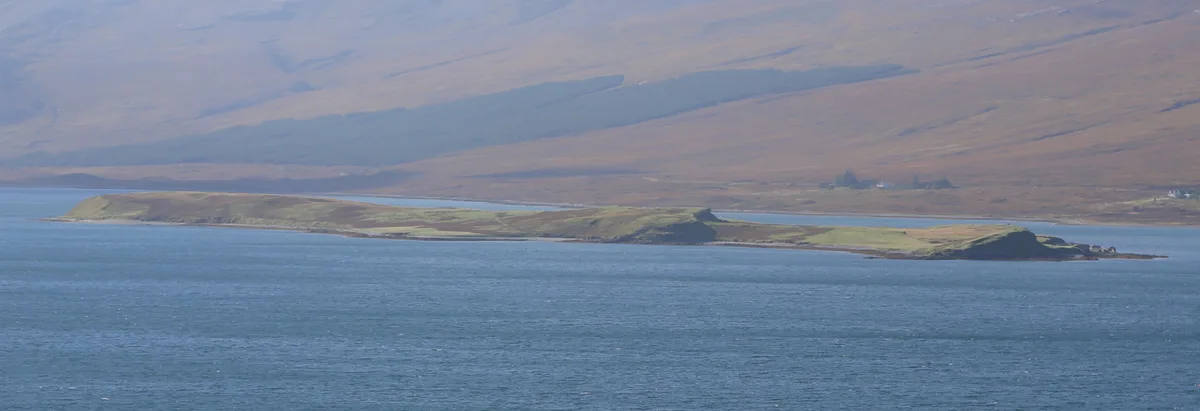
Eilean Choraidh
Eilean Choraidh — island in Loch Eriboll, Sutherland, Highland, Scotland, UK.
 Flagship📷 3
 Flagship📷 5
Frequently asked questions
- Where is Innis Mhòr?
- Innis Mhòr is in the Scottish Highlands, United Kingdom.
- What is Innis Mhòr?
- Innis Mhòr — island in Highland, Scotland, UK.
- How do I get to Innis Mhòr?
- The nearest railway station is Tain, about 7.8 km away. The nearest town is Tain. Its coordinates are 57.8508°, -3.9400°.
- Is Innis Mhòr free to visit?
- Yes, Innis Mhòr is free to enter.
- How do I get to Innis Mhòr?
- The nearest railway station is Tain, about 7.8 km away.