
Historic bridges · Central Scotland
Inner Tay Estuary
In or near Inchture.
Inner Tay Estuary in Scotland Islands, United Kingdom.

William Starkey — CC BY-SA 2.0 via Wikimedia Commons licence

Plan your visit
- Typical visit
- 15 min–30 min
- Nearest railway station
- Invergowrie · 9.7 km
- Free entry
- Dog-friendly
Getting there & planning your visit
To visit the Inner Tay Estuary, the nearest railway station is Invergowrie, which is approximately 9.7 km away. Entry is free, and there are no specific accessibility details provided. The postcode for the area is KY14 6HL.
About
Inner Tay Estuary is a place of interest in Scotland Islands, United Kingdom — drawn from open-data sources for visitor reference. See the linked Wikipedia article for the full description.
Photo gallery
From the Wikipedia article
The Inner Tay Estuary is the inner, western part of the Firth of Tay, from the Tay Railway Bridge in the east to the Queen's Bridge over the River Tay in Perth and the bridge in Bridge of Earn on the River Earn. It is one of the largest estuaries in eastern Scotland, and is up to 2.5 km wide. It consists primarily of intertidal sand and mud flats extending seaward to the main channel, most of which are on the northern shore. Landward of these are salt marsh and Phragmites reedbeds. The estuary contains two large islands: Mugdrum Island, opposite Newburgh; and Moncreiffe Island, immediately below Perth. The estuary's narrow form, and the large volume of freshwater from the Rivers Tay and Earn, restrict the influence of saltwater west of the Tayport narrows. Much of the tidal water is freshwater or mildly brackish.
Excerpt from Wikipedia under CC BY-SA 4.0. See the source article linked in Sources below.
Background
Visiting
Public roads run within a few hundred metres of the north and south shores, providing easy access to view the estuary and its wildlife, though parking is limited in many places. South shore: Wormit, Balmerino, Newburgh, Elcho Castle North bank: Riverside Drive in Dundee (by the railway bridge); Invergowrie, Kingoodie, Port Allen, Powgavie, Cairnie Pier Perth: From both banks, the bridges, Moncreiffe Island Bridge of Earn: The bridge. The minor road from Newburgh to Balmerino also offers excellent panoramic views northwards over the inner estuary.
Sourced from Wikipedia under CC BY-SA 4.0.
- Coordinates
- 56.3900, -3.1600
- District
- Fife
- Postcode
- KY14 6HL
- Parliamentary constituency
- North East Fife
- Nearest railway station
- Invergowrie — 9.7 km
Sources
- wikidata: Q6035590 (CC0)
- wikipedia: Inner Tay Estuary (CC BY-SA 4.0)
Other places nearby

Errol Airfield
Other places · 2.1 km

Flisk
Other places · 2.2 km
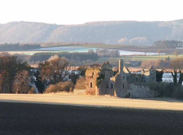
Ballinbreich Castle
Castles · 2.4 km

Carse of Gowrie
Vineyards · 2.5 km

Fliskmillan Hill
Mountains & hills · 2.6 km

RAF Errol Memorial
Memorials & monuments · 2.7 km

Fernlea CL Caravan Site
Caravan parks · 2.8 km

Aithmuir
Archaeological sites · 2.8 km

Bogmill
Archaeological sites · 3.0 km
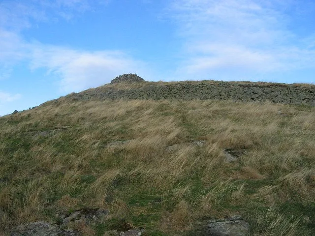
Norman's Law
Mountains & hills · 3.1 km

Norman's Law Hillfort
Hill forts · 3.1 km

Cistern Green viewpoint to the estuary
Viewpoints · 3.1 km
Nearby
📷 3📷 4📷 3Castles · Central Scotland
Ballinbreich Castle
Ballinbreich Castle — castle in Fife, Scotland, UK.
📷 2Vineyards · Central Scotland
Carse of Gowrie
Carse of Gowrie in Scotland Islands, United Kingdom.
📷 5Mountains & hills · Central Scotland
Fliskmillan Hill
Fliskmillan Hill — mountain in scotland central. Elevation: 167 m.
📷 3Memorials & monuments · Central Scotland
RAF Errol Memorial
RAF Errol Memorial — a memorial in scotland-central, United Kingdom.
Where to eat & stay near Inner Tay Estuary
Places to stay
📷 5Caravan parks · Central Scotland
Fernlea CL Caravan Site
Fernlea CL Caravan Site — a caravan park in scotland central.
 📷 5
📷 5Caravan parks · Central Scotland
Inchmartine Caravan Park
Inchmartine Caravan Park — a caravan park in scotland central.
 📷 5
📷 5Caravan parks · Central Scotland
South Valleyfield
South Valleyfield — a caravan park in scotland central.
 📷 5
📷 5 📷 4
📷 4Caravan parks · Central Scotland
Annsmuir Caravan Park
Annsmuir Caravan Park — a caravan park in scotland central.
 📷 7
📷 7Hotels · Central Scotland
Hampton by Hilton Dundee City Centre
Hampton by Hilton Dundee City Centre — a hotel in scotland central. Brand: Hampton.
Places to eat & drink
 📷 5
📷 5Historic pubs · Central Scotland
57, 59, 61 West Port, Dundee
57, 59, 61 West Port, Dundee in Scotland Central, United Kingdom.
 📷 5
📷 5 📷 7
📷 7Historic pubs · Central Scotland
The Pillars Bar, 9, 11 Crichton Street, Dundee
The Pillars Bar, 9, 11 Crichton Street, Dundee in Scotland Central, United Kingdom.
 📷 5
📷 5Historic pubs · Central Scotland
Public House, 15 Dock Street, Dundee
Public House, 15 Dock Street, Dundee in Scotland Central, United Kingdom.
 📷 7
📷 7Historic pubs · Central Scotland
The Counting House
The Counting House in Scotland Central, United Kingdom.
 📷 7
📷 7Historic pubs · Central Scotland
The Stance and Drum Public House, 16 Dock Street, Dundee
The Stance and Drum Public House, 16 Dock Street, Dundee in Scotland Central, United Kingdom.
More bridges in this region
 📷 3
📷 3Historic bridges · Central Scotland
Kelloe House
Kelloe House in England North East, United Kingdom.
 📷 4
📷 4Historic bridges · Central Scotland
Chirnsidebridge
Chirnsidebridge in England North East, United Kingdom.
 📷 3
📷 3.jpg?width=1200) 📷 3
📷 3Historic bridges · Central Scotland
Achnamara Clapper Bridge
Achnamara Clapper Bridge is a historic bridge in the United Kingdom.
Frequently asked questions
- Where is Inner Tay Estuary?
- Inner Tay Estuary is in the Scottish Highlands, United Kingdom (postcode KY14 6HL).
- What is Inner Tay Estuary?
- Inner Tay Estuary in Scotland Islands, United Kingdom.
- How do I get to Inner Tay Estuary?
- The nearest railway station is Invergowrie, about 9.7 km away. Drivers can use postcode KY14 6HL.
- Is Inner Tay Estuary free to visit?
- Yes, Inner Tay Estuary is free to enter.
- How do I get to Inner Tay Estuary?
- Drivers can navigate to postcode KY14 6HL. It sits within the North East Fife parliamentary constituency.