
Islands · Central Scotland
Inner Hebrides
Also known as: Ynysoedd Mewnol Heledd, Na h-Eileanan a-staigh
Inner Hebrides in Scotland Islands, United Kingdom.

Richard Webb — CC BY-SA 2.0 via Wikimedia Commons licence

Plan your visit
- Typical visit
- 4 h–12 h
- Free entry
- Dog-friendly
About
Inner Hebrides is a place of interest in Scotland Islands, United Kingdom — drawn from open-data sources for visitor reference. See the linked Wikipedia article for the full description.
Photo gallery
From the Wikipedia article
The Inner Hebrides is an archipelago off the west coast of mainland Scotland, to the south east of the Outer Hebrides. Together these two island chains form the Hebrides, which experience a mild oceanic climate. The Inner Hebrides comprise 35 inhabited islands as well as 44 uninhabited islands with an area greater than 30 hectares (74 acres). Skye, Mull, and Islay are the three largest, and also have the highest populations. The main commercial activities are tourism, crofting, fishing and whisky distilling. In modern times the Inner Hebrides have formed part of two separate local government jurisdictions, one to the north and the other to the south. Together, the islands have an area of about 4,130 km2 (1,594 sq mi), and had a population of 18,948 in 2011. The population density is therefore about 4.6 inhabitants per square kilometre (12 inhabitants per square mile). There are various important prehistoric structures, many of which pre-date the first written references to the islands by Roman and Greek authors. In the historic period the earliest known settlers were Picts to the north and Gaels in the southern kingdom of Dál Riada prior to the islands becoming part of the Suðreyjar kingdom of the Norse, who ruled for over 400 years until sovereignty was transferred to Scotland by the Treaty of Perth in 1266. Control of the islands was then held by various clan chiefs, principally the MacLeans, MacLeods and MacDonalds. The Highland Clearances of the 19th century had a devastating effect on many communities and it is only in recent years that population levels have ceased to decline. Sea transport is crucial and a variety of ferry services operate to mainland Scotland and between the islands. The Gaelic language remains strong in some areas; the landscapes have inspired a variety of artists; and there is a diversity of wildlife.
Excerpt from Wikipedia under CC BY-SA 4.0. See the source article linked in Sources below.
Background
Description
, Staffa]] Hebridean landscapes have inspired a variety of musicians, writers and artists. The Hebrides, also known as Fingal's Cave, is a famous overture written by Felix Mendelssohn inspired by his visit to Staffa. Marie Dare's Hebridean Suite for cello and piano was composed in 1947. Contemporary musicians associated with the islands include Ian Anderson, Donovan, Chris Rainbow and Runrig. Enya's song "Ebudæ" from Shepherd Moons is based on a traditional waulking song. The poet Sorley MacLean was born on Raasay, the setting for his best known poem, Hallaig. George Orwell wrote much of the novel 1984 whilst living at Barnhill on Jura and J.M. Barrie wrote a screenplay for the 1924 film…
Sourced from Wikipedia under CC BY-SA 4.0.
- Coordinates
- 56.5000, -6.0000
- District
- Argyll and Bute
- Postcode
- PA72 6JU
- Parliamentary constituency
- Argyll, Bute and South Lochaber
Sources
- wikidata: Q81052 (CC0)
- wikipedia: Inner Hebrides (CC BY-SA 4.0)
Other places nearby
Torr Nam Fiann, dun
Archaeological sites · 0.2 km

Killichronan
Villages · 0.2 km
Killiechronan Campsite
Campsites · 0.3 km

standing stone 540m NNE of Killiechronan Farm
Windmills · 0.5 km

Easan Labhar
Waterfalls · 1.0 km

Easan Labhar
Beaches · 1.0 km

Kellan Wood, dun site
Archaeological sites · 1.0 km

Gruline
Mountains & hills · 1.1 km

Faisg Air An Oir, standing stone 305m SSW of Clachaig
Windmills · 1.7 km

Macquarie Mausoleum
Follies · 1.8 km

standing stone 665m WNW of Gruline House
Windmills · 1.9 km

Gruline House Crannog
Archaeological sites · 2.5 km
Nearby
📷 3Archaeological sites · Central Scotland
Torr Nam Fiann, dun
Torr Nam Fiann, dun — a archaeological in scotland-highlands, United Kingdom.
📷 5📷 5Campsites · Central Scotland
Killiechronan Campsite
Killiechronan Campsite — a campsite in scotland highlands.
📷 5Windmills · Central Scotland
standing stone 540m NNE of Killiechronan Farm
standing stone 540m NNE of Killiechronan Farm — a post mill in scotland-highlands, United Kingdom.
📷 3Where to eat & stay near Inner Hebrides
Places to stay
📷 5Campsites · Central Scotland
Killiechronan Campsite
Killiechronan Campsite — a campsite in scotland highlands.
 📷 5
📷 5Campsites · Central Scotland
Salen Bay Campsite
Salen Bay Campsite — a campsite in scotland highlands.
 📷 5
📷 5Hostels · Central Scotland
Ulva Hostel
Ulva Hostel — a hostel in scotland highlands.
 📷 5
📷 5Campsites · Scottish Highlands
Tobermory Campsite
Tobermory Campsite — a campsite in scotland highlands.
 📷 5
📷 5Hostels · Central Scotland
Highland Basecamp
Highland Basecamp — a hostel in scotland highlands.
 📷 5
📷 5Hostels · Scottish Highlands
Tobermory Youth Hostel
Tobermory Youth Hostel — a hostel in scotland highlands.
Places to eat & drink
 📷 5
📷 5Restaurants · Central Scotland
The Boathouse
The Boathouse — a restaurant in scotland highlands.
More places in this region
 Flagship📷 5
Islands · Central Scotland
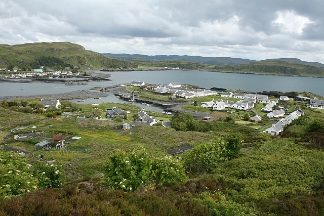
Easdale
Easdale — one of the Slate Islands, in the Firth of Lorn, Scotland.
 Flagship📷 5
Islands · Central Scotland
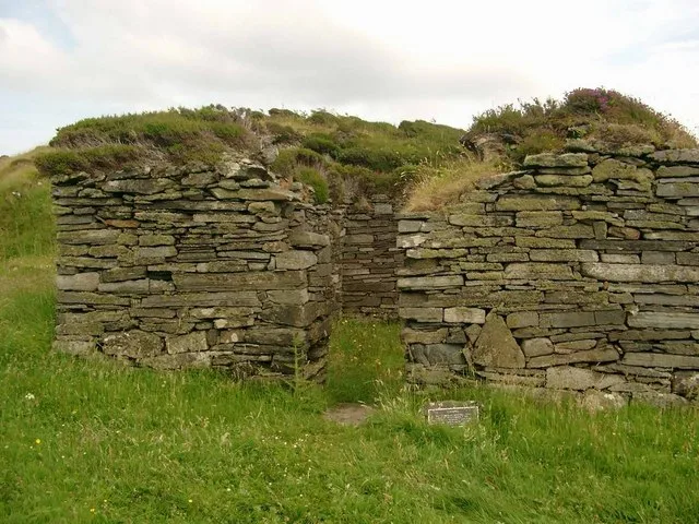
Eileach an Naoimh
Eileach an Naoimh — uninhabited island, Garvellachs, Scotland.
 Flagship📷 3
Islands · Central Scotland
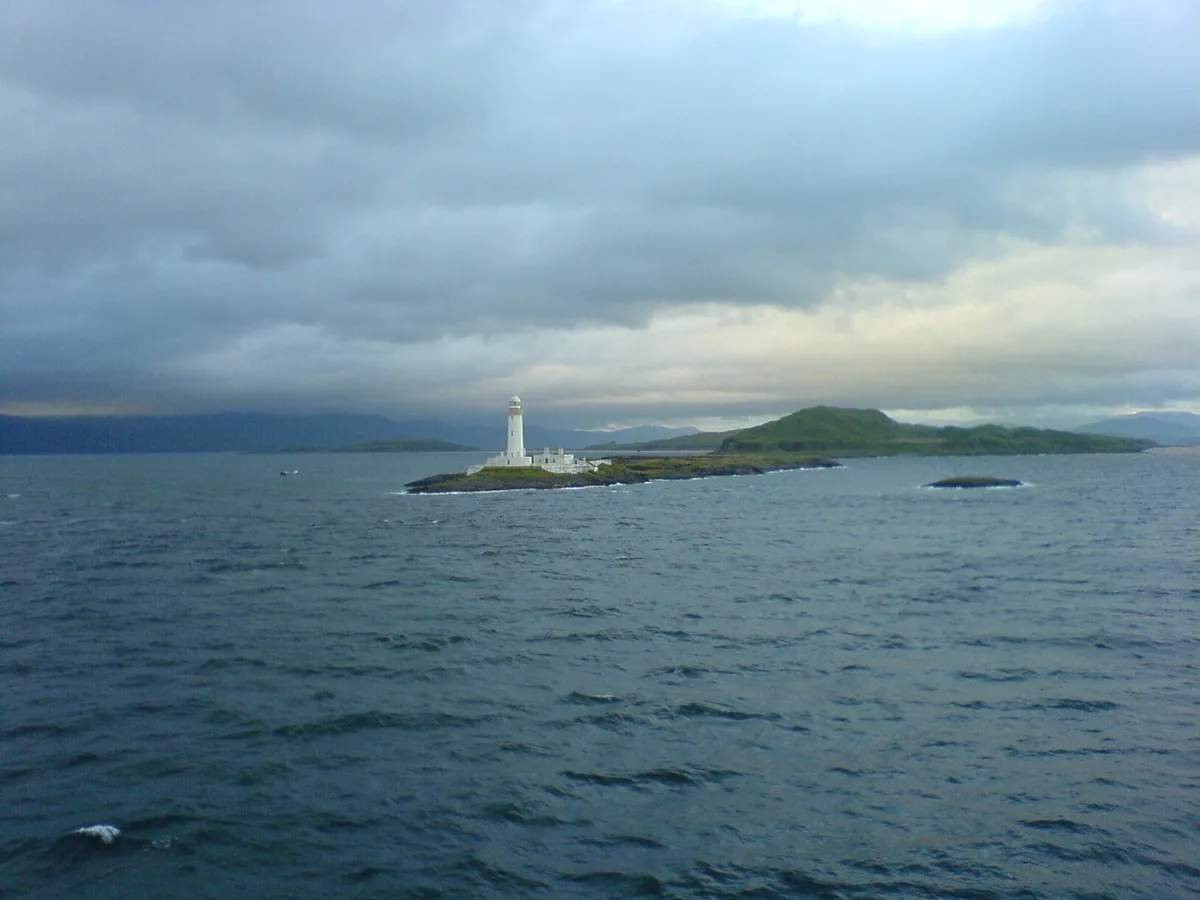
Eilean Musdile
Eilean Musdile — an islet to the south west of Lismore in the Inner Hebrides.
 📷 5
📷 5Islands · Central Scotland
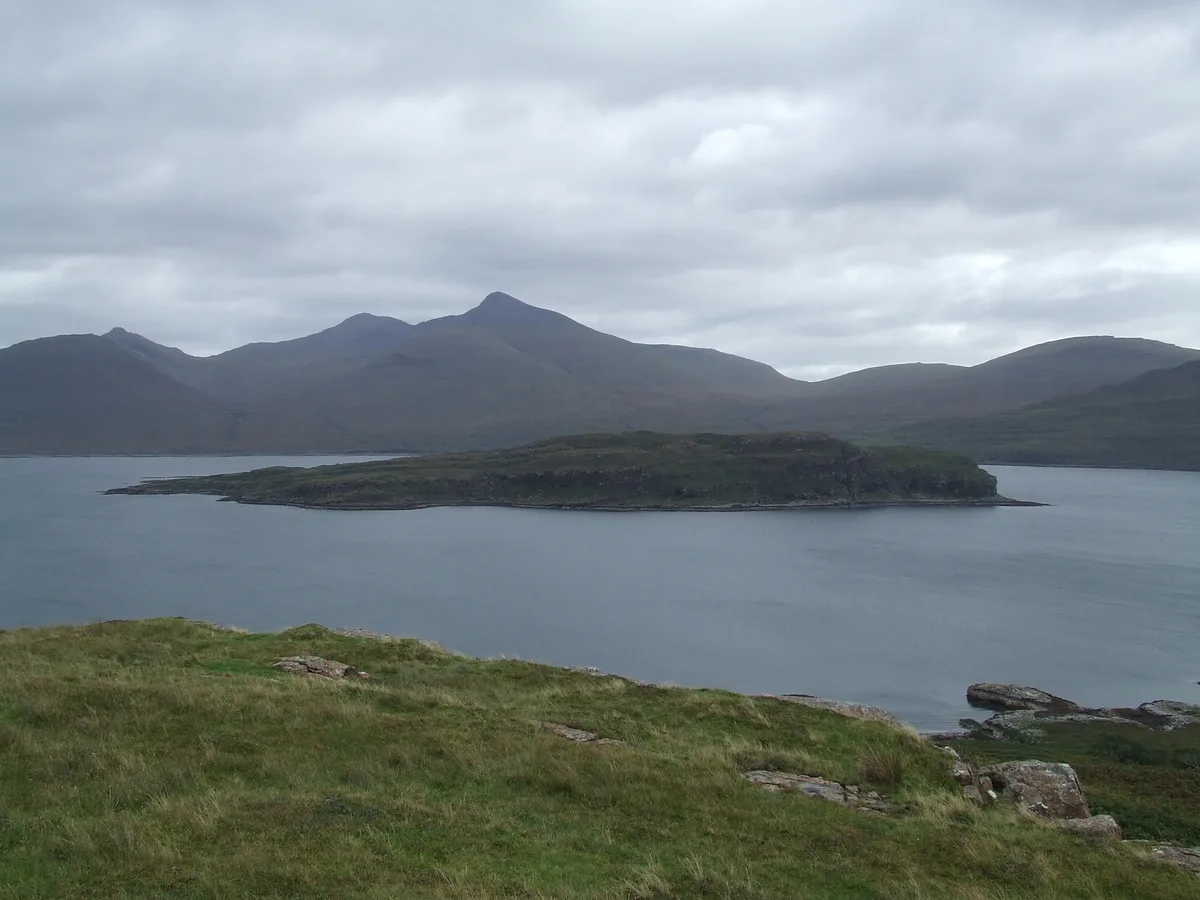
Eorsa
Eorsa — island. Off the coast of Mull, Scotland, in United Kingdom.
Frequently asked questions
- Where is Inner Hebrides?
- Inner Hebrides is in the Scottish Islands, United Kingdom (postcode PA72 6JU).
- What is Inner Hebrides?
- Inner Hebrides in Scotland Islands, United Kingdom.
- How do I get to Inner Hebrides?
- Drivers can use postcode PA72 6JU.
- Is Inner Hebrides free to visit?
- Yes, Inner Hebrides is free to enter.
- How do I get to Inner Hebrides?
- Drivers can navigate to postcode PA72 6JU. It sits within the Argyll, Bute and South Lochaber parliamentary constituency.