
Historic bridges · South East England
Inglis Pipe Bridge
In or near Crondall.
Inglis Pipe Bridge — Grade II listed building-listed bridge in england-south-east, United Kingdom.

Stuart Logan — CC BY-SA 2.0 via Wikimedia Commons licence

Plan your visit
- Typical visit
- 15 min–30 min
- Nearest railway station
- Aldershot · 1.9 km
- Free entry
- Dog-friendly
Getting there & planning your visit
To visit Inglis Pipe Bridge, the nearest railway station is Aldershot, located 1.9 km away. The postcode for navigation is GU11 2HJ. Entry to the bridge is free.
About
Inglis Pipe Bridge is a Grade II listed building-listed bridge in england-south-east, United Kingdom, registered on the National Heritage List for England (NHLE entry 1489910). Listed status protects buildings and structures of special architectural or historic interest. See the linked Wikipedia article for further details.
Photo gallery
360° viewimagery from 2020
Imagery © Mapillary contributors, CC BY-SA 4.0
Heritage listing
The Inglis Bridge near Aldershot in Hampshire, carries a sewer pipe across the Basingstoke Canal. Also known as the Inglis Pyramid Bridge, or the Inglis Pipe Bridge, it is an early form of military portable prefabricated steel bridge, manufactured in 1916. It is a unique survivor of this type in England, after a similar bridge in Lincolnshire was removed after 2017. The Aldershot bridge is located near Laffan's Road and Aldershot Wharf car park. It is owned by the Ministry of Defence, and was listed at Grade II in 2024. The Inglis Portable Military Bridge (Light Type) was designed by the engineer Charles Inglis, in the First World War as a lightweight, portable and reusable bridge that could be assembled or disassembled by a team of soldiers in the field within a matter of minutes.
From the Historic England List Entry under OGL v3.
Protected designations
- Site of Special Scientific Interest: Basingstoke Canal SSSI
- Area of Outstanding Natural Beauty: Surrey Hills
Designations sourced from Natural England open data under OGL v3.
From the Wikipedia article
The Inglis Bridge near Aldershot in Hampshire, carries a sewer pipe across the Basingstoke Canal. Also known as the Inglis Pyramid Bridge, or the Inglis Pipe Bridge, it is an early form of military portable prefabricated steel bridge, manufactured in 1916. It is a unique survivor of this type in England, after a similar bridge in Lincolnshire was removed after 2017. The Aldershot bridge is located near Laffan's Road and Aldershot Wharf car park. It is owned by the Ministry of Defence, and was listed at Grade II in 2024. The Inglis Portable Military Bridge (Light Type) was designed by the engineer Charles Inglis, in the First World War as a lightweight, portable and reusable bridge that could be assembled or disassembled by a team of soldiers in the field within a matter of minutes. The original design used modular units built from 8 ft (2.4 m) lengths of steel pipe, joined by pre-cast junctions to heavy steel transoms, with four pipes meeting at the apex to form pyramids which would be linked longitudinally. Ten of this first design, the light type, were constructed during the war, designed as a footbridge allowing passage by soldiers in single file. A similar "heavy" type of Inglis bridge was developed to bear vehicles, and later models used steel pipes joining rectangular and then square frames, known as Type I and Type II respectively, capable of carrying tanks across wider gaps. Developments of the Inglis bridge continue in use until the Second World War, until it was replaced by the Bailey bridge. The Aldershot bridge comprises six pyramids forming three W-shaped Warren trusses on each side, sloped to meet at the apex. It is believed to have been brought back to England from France after the First World War, and constructed by military engineers as a training exercise. It has been in place since at least 1963 and possibly before 1944.
Excerpt from Wikipedia under CC BY-SA 4.0. See the source article linked in Sources below.
- Coordinates
- 51.2630, -0.7682
- County
- Hampshire
- District
- Rushmoor
- Parish
- Rushmoor, unparished area
- Postcode
- GU11 2HJ
- Parliamentary constituency
- Aldershot
- Nearest railway station
- Aldershot — 1.9 km
Sources
- wikidata: Q130475147 (CC0)
- wikipedia: Inglis Bridge, Aldershot (CC BY-SA 4.0)
Other places nearby

Runways End Outdoor Centre
Campsites · 0.2 km

Aldershot Observatory
Observatories · 0.7 km

Cathedral of St Michael and St George, Aldershot
Cathedrals · 0.7 km
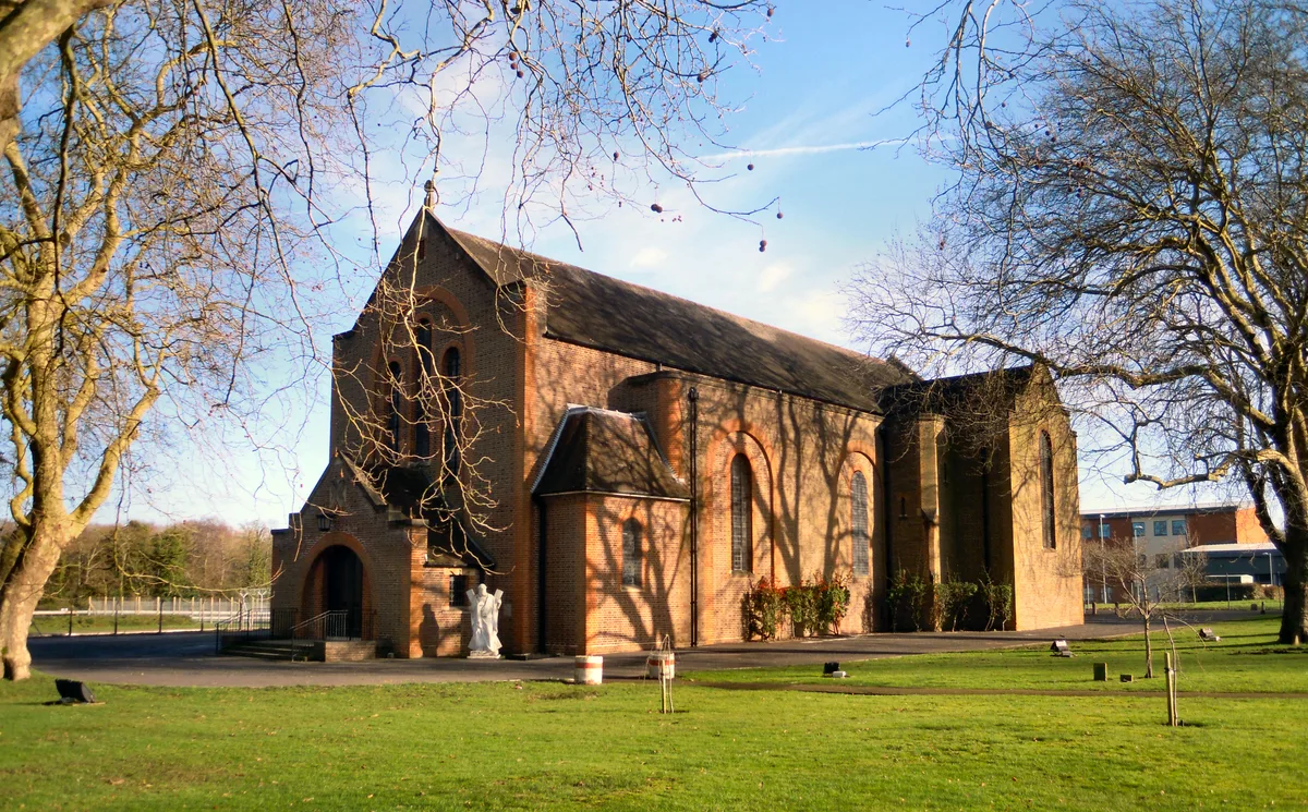
St Andrew's Garrison Church
Historic churches · 0.7 km
British Army 8th Division World War I Memorial
Memorials & monuments · 0.7 km
South East District Headquarters Building Of General Officers Commanding
Gardens · 0.7 km

Fox Lines
Memorials & monuments · 0.8 km
Royal Army Physical Training Corps Museum
Museums · 0.9 km

Aldershot Military Stadium
Stadiums · 0.9 km

Memorial Square
Memorials & monuments · 0.9 km
British Army 2nd Division World War I Memorial
Memorials & monuments · 1.0 km

Prince Consort's Library
Historic libraries · 1.0 km
Nearby
📷 5Campsites · South East England
Runways End Outdoor Centre
Runways End Outdoor Centre — a campsite in england south east.
📷 5Observatories · South East England
Aldershot Observatory
Aldershot Observatory — a Grade II*-listed observatory in england-south-east, United Kingdom.
📷 5Cathedrals · South East England
Cathedral of St Michael and St George, Aldershot
Cathedral of St Michael and St George, Aldershot — a Grade II*-listed cathedral in england-south-east, United Kingdom.
📷 5Historic churches · South East England
St Andrew's Garrison Church
St Andrew's Garrison Church — grade II listed church in Rushmoor, Hampshire, England, UK.
📷 5Memorials & monuments · South East England
British Army 8th Division World War I Memorial
British Army 8th Division World War I Memorial — Grade II listed building-listed memorial in england-south-east, United Kingdom.
📷 5Gardens · South East England
South East District Headquarters Building Of General Officers Commanding
South East District Headquarters Building Of General Officers Commanding — a garden in england-south-east, United Kingdom.
Where to eat & stay near Inglis Pipe Bridge
Places to stay
📷 5Campsites · South East England
Runways End Outdoor Centre
Runways End Outdoor Centre — a campsite in england south east.
 📷 5
📷 5Caravan parks · South East England
Grove Farm Park Mobile Home Park
Grove Farm Park Mobile Home Park — a caravan park in england south east.
 📷 5
📷 5Caravan parks · South East England
Mytchett Farm (Mobile Home Park)
Mytchett Farm (Mobile Home Park) — a caravan park in england south east.
 📷 5
📷 5Caravan parks · South East England
Basingstoke Canal Caravan and Camp Site
Basingstoke Canal Caravan and Camp Site — a caravan park in england south east.
 📷 6
📷 6Hotels · South East England
Lakeside Leisure Complex
The Lakeside Leisure Complex is a hotel, conferencing, entertainment and associated leisure complex in Frimley Green in west Surrey, England. It hosted the open/men's and women's BDO World Darts Champ
 📷 5
📷 5Places to eat & drink
 📷 5
📷 5Historic pubs · South East England
The Tumble Down Dick Pub
The Tumble Down Dick Pub in England South East, United Kingdom.
 📷 7
📷 7Historic pubs · South East England
8 And 9 (The Queens Head), The Borough
8 And 9 (The Queens Head), The Borough in England South East, United Kingdom.
 📷 7
📷 7Historic pubs · South East England
William Cobbett Public House
William Cobbett Public House in England South East, United Kingdom.
 📷 7
📷 7Historic pubs · South East England
The Fox Public House
The Fox Public House in England South East, United Kingdom.
 📷 7
📷 7Restaurants · South East England
The Bengal Lounge
The Bengal Lounge — a restaurant in england south east.
 📷 7
📷 7More bridges in this region
 📷 5
📷 5Historic bridges · South East England
Briary Hill Bridge east
Briary Hill Bridge east is a historic bridge in the United Kingdom.
 📷 5
📷 5Historic bridges · South East England
Briary Hill Bridge west
Briary Hill Bridge west is a historic bridge in the United Kingdom.
 📷 5
📷 5Historic bridges · South East England
Bridge 157 VIR (Bath Hard Road)
Bridge 157 VIR (Bath Hard Road) is a historic bridge in the United Kingdom.
 📷 5
📷 5Historic bridges · South East England
Dorking Arch Bridge
Dorking Arch Bridge is a historic bridge in the United Kingdom.
Frequently asked questions
- Where is Inglis Pipe Bridge?
- Inglis Pipe Bridge is in Hampshire, South-East England, United Kingdom (postcode GU11 2HJ), in the parish of Rushmoor, unparished area.
- What is Inglis Pipe Bridge?
- Inglis Pipe Bridge — Grade II listed building-listed bridge in england-south-east, United Kingdom.
- How do I get to Inglis Pipe Bridge?
- The nearest railway station is Aldershot, about 1.9 km away. Drivers can use postcode GU11 2HJ.
- Is Inglis Pipe Bridge a listed building?
- Inglis Pipe Bridge is officially recognised as Grade II listed building listed.
- Is Inglis Pipe Bridge a protected site?
- Yes — Inglis Pipe Bridge is part of the Basingstoke Canal SSSI Site of Special Scientific Interest and the Surrey Hills National Landscape (AONB).
- Is Inglis Pipe Bridge free to visit?
- Yes, Inglis Pipe Bridge is free to enter.
- How do I get to Inglis Pipe Bridge?
- The nearest railway station is Aldershot, about 1.9 km away. Drivers can navigate to postcode GU11 2HJ.