
Historic bridges · South Wales
Inglis Bridge
In or near Dixton.
Inglis Bridge is a historic bridge in the United Kingdom.

Wikimedia Commons contributors — see linked file page for photographer and licence licence

Plan your visit
- Typical visit
- 15 min–30 min
- Nearest railway station
- Rookwood · 7.9 km
- Free entry
- Dog-friendly
Getting there & planning your visit
Inglis Bridge is located in Monmouthshire, South Wales, with the postcode NP25 3AX. The nearest railway station is Rookwood, which is 7.9 km away. Entry to the bridge is free.
About
Inglis Bridge is a named historic bridge in the United Kingdom. Coordinates: 51.8169°, -2.7158°. This entry is part of The Great Britain Guide, a free, ad-free, open-data tourist directory.
Photo gallery
Heritage listing
The Inglis Bridge, Monmouth, Wales crosses the River Monnow linking Vauxhall Fields and the suburb of Osbaston. Designed by, and named after, Charles Inglis, the bridge was constructed in 1931 and refurbished in 1988. It is a Mark II model of an Inglis bridge, and the only known example in Britain of such a bridge still in public use. Access was limited to pedestrians in 2018, vehicular use being prohibited on safety grounds. In September 2024 the bridge was also closed to pedestrians due to safety concerns. Following a sustained local campaign, supported by Monmouth's member of parliament, the Ministry of Defence announced £1M in funding to repair the bridge and restore pedestrian access in 2026.
From Cadw under OGL v3.
Official information
The Savoy Theatre in Monmouth is a historic grade 2 listed building and one of the oldest working theatres in Wales. It offers a diverse program of feature films, live performances, and special cinema events.
Protected designations
- Site of Special Scientific Interest: River Wye SSSI
- Area of Outstanding Natural Beauty: Wye Valley
Designations sourced from Natural England open data under OGL v3.
From the Wikipedia article
The Inglis Bridge, Monmouth, Wales crosses the River Monnow linking Vauxhall Fields and the suburb of Osbaston. Designed by, and named after, Charles Inglis, the bridge was constructed in 1931 and refurbished in 1988. It is a Mark II model of an Inglis bridge, and the only known example in Britain of such a bridge still in public use. Access was limited to pedestrians in 2018, vehicular use being prohibited on safety grounds. In September 2024 the bridge was also closed to pedestrians due to safety concerns. Following a sustained local campaign, supported by Monmouth's member of parliament, the Ministry of Defence announced £1M in funding to repair the bridge and restore pedestrian access in 2026. The bridge is a Grade II listed structure.
Excerpt from Wikipedia under CC BY-SA 4.0. See the source article linked in Sources below.
Background
History
Sir Charles Inglis (31 July 1875 – 19 April 1952) was a British civil engineer. While a lecturer in mechanical engineering at King's College, Cambridge, Inglis joined the Cambridge University Officers' Training Corps and on the outbreak of World War 1 was commissioned into the Royal Engineers. Appointed director of the bridging department, he designed a transportable steel bridge that could be erected in a day. Named the Inglis bridge in his honour, the design remained in use by the British Army throughout the First World War and the inter-war period, until being superseded by the higher capacity Bailey bridge in 1940–1941. The Inglis Bridge at Monmouth was built by the Royal Monmouthshire…
Description
The bridge is constructed of tubular steel and comprises a 27.4 m single span with a 2.9 m deck. It is supported by longitudinal stringers and two spans of lateral bracing. The design is of the Warren truss type. The Inglis bridges were constructed using prefabricated components, allowing for rapid deployment and reuse in combat conditions. The Mark I design comprised steel tubes of differing lengths, which led to errors during assembly. The Mark II model standardised the steel tubes used to a single length. Inglis Bridge is a Grade II listed structure.
Sourced from Wikipedia under CC BY-SA 4.0.
- Coordinates
- 51.8169, -2.7158
- District
- Monmouthshire
- Parish
- Monmouth
- Postcode
- NP25 3AX
- Parliamentary constituency
- Monmouthshire
- Phone
- 01600 772467
- Nearest railway station
- Rookwood — 7.9 km
- Opening
- |closed =
Sources
- osm: w169458166 (ODbL)
- wikipedia: Inglis Bridge, Monmouth (CC BY-SA 4.0)
- commons: Monmouth Vauxhall Fields Inglis Bridge.JPG (CC BY-SA 4.0)
Other places nearby

Monnow Mill
Mills · 0.1 km

Monmouth County Gaol
Chapels · 0.2 km

North Parade House
Historic houses · 0.2 km

Monmouth Cemetery
Cemeteries · 0.3 km
.jpg?width=1200)
Parade House, Monmouth
Historic houses · 0.3 km

Masonic Hall
Open-air theatres · 0.3 km

Oak House
Historic houses · 0.4 km
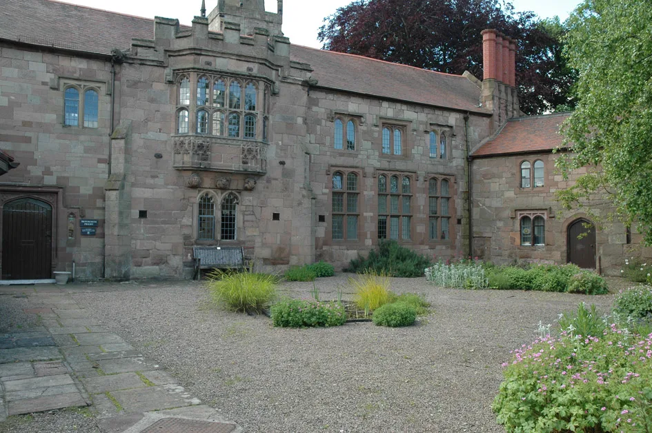
Monmouth Priory
Abbeys & priories · 0.4 km

Market Hall, Monmouth
Abbeys & priories · 0.4 km
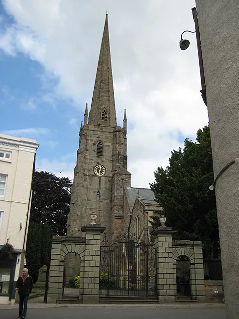
St Mary's Priory Church
Historic churches · 0.4 km

1 Monk Street
Gardens · 0.4 km

Savoy Theatre, Monmouth
Open-air theatres · 0.5 km
Nearby
📷 3Mills · South Wales
Monnow Mill
Monnow Mill — Grade II listed building in Monmouth. About 500m north of Monmouth Castle between the road and the river Monnow.
📷 4Chapels · South Wales
Monmouth County Gaol
The County Gaol, situated in North Parade, Monmouth, Wales, was Monmouthshire's main prison when it was opened in 1790. It served as the county jail of Monmouthshire and criminals or those who fell fo
📷 3📷 4Cemeteries · South Wales
Monmouth Cemetery
Monmouth Cemetery is a cemetery located at Osbaston Road, Monmouth, Wales. It was available for burials between 1852 and 2012.
📷 3Historic houses · South Wales
Parade House, Monmouth
Parade House, Monmouth — Grade II listed building in Monmouth. On the principal road leading north from Monmouth centre set between Monk Street and Hereford Road.
📷 5Where to eat & stay near Inglis Bridge
Places to stay
 📷 5
📷 5Campsites · South Wales
Monnow Bridge Caravan Site
Monnow Bridge Caravan Site — a campsite in wales south.
 📷 5
📷 5Hotels · South Wales
The Riverside Hotel
The Riverside Hotel — a hotel in wales south.
 📷 5
📷 5Campsites · South Wales
Broadstone Park Camping and Fishery
Broadstone Park Camping and Fishery — a campsite in wales south.
 📷 5
📷 5Campsites · South Wales
Glen Trothy C. & C. Park
Glen Trothy C. & C. Park — a campsite in wales south.
 📷 5
📷 5 📷 5
📷 5Campsites · South Wales
Biblins Youth Campsite
Biblins Youth Campsite — a campsite in wales south.
Places to eat & drink
 📷 5
📷 5 📷 5
📷 5Historic pubs · South Wales
The Punch House
The Punch House — Historic pub — listed building or notable heritage status.
 📷 5
📷 5 📷 6
📷 6Historic pubs · South Wales
Queens Head
Queens Head in Wales South, United Kingdom.
 📷 6
📷 6 📷 5
📷 5More bridges in this region
.jpg?width=1200) 📷 3
📷 3Historic bridges · South Wales
Afon Taff Viaduct
Afon Taff Viaduct is a historic bridge in the United Kingdom.
 📷 3
📷 3Historic bridges · South Wales
Avonmouth Bridge
Avonmouth Bridge is a historic bridge in the United Kingdom.
 📷 5
📷 5Historic bridges · South Wales
Biblins Bridge
Biblins Bridge is a historic bridge in the United Kingdom.
 📷 3
📷 3Historic bridges · South Wales
Blackweir Bridge
Blackweir Bridge is a historic bridge in the United Kingdom.
Frequently asked questions
- Where is Inglis Bridge?
- Inglis Bridge is in South Wales, United Kingdom (postcode NP25 3AX), in the parish of Monmouth.
- What is Inglis Bridge?
- Inglis Bridge is a historic bridge in the United Kingdom.
- How do I get to Inglis Bridge?
- The nearest railway station is Rookwood, about 7.9 km away. The nearest town is Dixton. Drivers can use postcode NP25 3AX.
- Is Inglis Bridge a listed building?
- Inglis Bridge is officially recognised as Grade II listed building listed.
- Is Inglis Bridge a protected site?
- Yes — Inglis Bridge is part of the River Wye SSSI Site of Special Scientific Interest and the Wye Valley National Landscape (AONB).
- Is Inglis Bridge free to visit?
- Yes, Inglis Bridge is free to enter.
- How do I get to Inglis Bridge?
- The nearest railway station is Rookwood, about 7.9 km away. Drivers can navigate to postcode NP25 3AX.