Forests & woodlands · Central Scotland
Inchmickery
Also known as: Innis nam Bhiocaire
In or near Cramond.
Inchmickery is a forest or woodland in the United Kingdom.

Wikimedia Commons contributors — see linked file page for photographer and licence licence
Plan your visit
- Typical visit
- 1 h–3 h
- Nearest railway station
- Aberdour · 5.1 km
- Free entry
- Family-friendly
- Dog-friendly
Getting there & planning your visit
To visit Inchmickery, the nearest railway station is Aberdour, located 5.1 km away. Entry to the site is free.
About
Inchmickery is a named forest, woodland or nature reserve in the United Kingdom. Also known as: Innis nam Bhiocaire. Coordinates: 56.0112°, -3.2738°.
Photo gallery
From the Wikipedia article
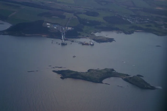
Inchmickery is a small island in the Firth of Forth in Scotland. It is about two miles (3.2 km) north of Edinburgh. Its name comes from the Scottish Gaelic, Innis nam Biocaire, meaning Isle of the Vicars, implying that there may have been an old ecclesiastical or Culdee settlement here, as in nearby Inchcolm. It features occasionally in a riddle, "How many inches is the Forth?", playing on a pun on 'Inch' (Innis), the Gaelic word for island, and inch, the imperial measurement. Inchmickery is tiny, only 100 metres by 200 metres. During both World War I and World War II the island was used as a gun emplacement. The concrete buildings make the island look (from a distance) like a battleship. Although the island is now uninhabited much of this concrete superstructure remains largely intact. The conclusion of Iain Banks's 1993 novel Complicity was set here and the film adaptation used it as a location. The island is now an RSPB reserve, and is home to breeding pairs of common eider, Sandwich terns and various gulls. It used to be a nesting site for the very rare roseate tern, but the roseate terns have now moved elsewhere in the Firth of Forth. There are exposed rocks off Inchmickery, known as the Cow & Calves. Inchmickery was formerly known for its oyster-beds, and used to be covered in moss and lichen.
Excerpt from Wikipedia under CC BY-SA 4.0. See the source article linked in Sources below.
- Coordinates
- 56.0112, -3.2738
- Nearest railway station
- Aberdour — 5.1 km
Sources
- osm: w3468125 (ODbL)
- wikipedia: Inchmickery (CC BY-SA 4.0)
- commons: Inchmickery Island.jpg (CC BY-SA 4.0)
Other places nearby
Inchmickery
Islands · 0.0 km
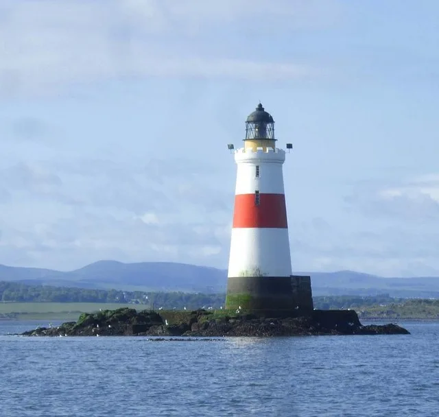
Oxcars Lighthouse
Lighthouses · 1.3 km
Inchcolm
Islands · 2.6 km

Inchcolm Museum
Museums · 2.6 km

Carcraig
Islands · 2.6 km
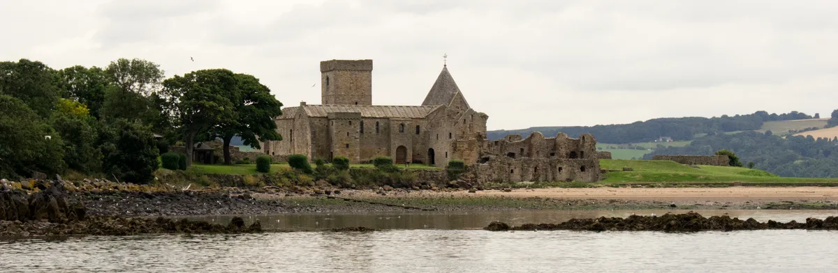
Inchcolm Abbey
Abbeys & priories · 2.7 km

Inchcolm Abbey
Cathedrals · 2.7 km

Blessing of Burntisland
Other places · 3.6 km

Hound Point
Historic bridges · 3.7 km

The Pitt
Farmers’ markets · 3.7 km

Muirhouse, Marine Drive, Edinburgh
Historic houses · 3.7 km

Cramond Fish
Public art & sculpture · 3.7 km
Nearby
📷 3📷 3Lighthouses · Central Scotland
Oxcars Lighthouse
Oxcars Lighthouse — lighthouse in Fife, Scotland, UK.
Flagship📷 3Islands · Central Scotland
Inchcolm
Inchcolm — island in the Firth of Forth in Scotland.
📷 3Museums · Central Scotland
Inchcolm Museum
Inchcolm Museum — a museum in scotland-central, United Kingdom.
📷 3★ Iconic📷 5Where to eat & stay near Inchmickery
Places to stay
 📷 5
📷 5Campsites · Central Scotland
Edinburgh Caravan Club
Edinburgh Caravan Club — a campsite in scotland central.
 📷 5
📷 5Hotels · Central Scotland
Premier Inn Leith Waterfront
Premier Inn Leith Waterfront — a hotel in scotland central. 3-star. Brand: Premier Inn.
 📷 5
📷 5B&Bs · Central Scotland
Links Guest House
Links Guest House — a bed-and-breakfast in scotland central.
 📷 5
📷 5Hostels · Central Scotland
Just Sleep Hostel
Just Sleep Hostel — a hostel in scotland central.
 📷 7
📷 7 📷 5
📷 5Hotels · Central Scotland
The Edinburgh Residence
The Edinburgh Residence — a hotel in scotland central.
Places to eat & drink
 📷 7
📷 7Historic pubs · Central Scotland
Granton Tavern, 160 Lower Granton Road, Edinburgh
Granton Tavern, 160 Lower Granton Road, Edinburgh in Scotland Central, United Kingdom.
 📷 6
📷 6Historic pubs · Central Scotland
Starbank Arms, 62-64 Laverockbank Road, Edinburgh
Starbank Arms, 62-64 Laverockbank Road, Edinburgh in Scotland Central, United Kingdom.
 📷 5
📷 5Historic pubs · Central Scotland
The Star Tavern, 71-73 High Street, Burntisland
The Star Tavern, 71-73 High Street, Burntisland in Scotland Central, United Kingdom.
 📷 7
📷 7Historic pubs · Central Scotland
Hamilton's Bar & Kitchen
Hamilton's Bar & Kitchen in Scotland Central, United Kingdom.
 📷 7
📷 7Historic pubs · Central Scotland
Kay's Bar
Kay's Bar in Scotland Central, United Kingdom.
 📷 5
📷 5Historic pubs · Central Scotland
Public House and Restaurant, 3 The Shore, Leith, Edinburgh
Public House and Restaurant, 3 The Shore, Leith, Edinburgh in Scotland Central, United Kingdom.
More forests in this region
 📷 5
📷 5Forests & woodlands · Central Scotland
Clyde Muirshiel Regional Park
Clyde Muirshiel Regional Park is a forest or woodland in the United Kingdom.
 📷 3
📷 3Forests & woodlands · Central Scotland
Glasdrum Wood National Nature Reserve
Glasdrum Wood National Nature Reserve is a forest or woodland in the United Kingdom.
 📷 5
📷 5Forests & woodlands · Central Scotland
Taynish National Nature Reserve
Taynish National Nature Reserve is a forest or woodland in the United Kingdom.
 📷 5
📷 5Forests & woodlands · Central Scotland
Birnam Oak
The Birnam Oak is an example of Sessile oak (Quercus petraea) at Birnam, Perth and Kinross, Scotland (grid reference NO032421). Sometimes known as Macbeth's Oak, as it is a relic of Birnam Wood, menti
Frequently asked questions
- Where is Inchmickery?
- Inchmickery is in central Scotland, United Kingdom.
- What is Inchmickery?
- Inchmickery is a forest or woodland in the United Kingdom.
- How do I get to Inchmickery?
- The nearest railway station is Aberdour, about 5.1 km away. Its coordinates are 56.0112°, -3.2738°.
- Is Inchmickery free to visit?
- Yes, Inchmickery is free to enter.
- How do I get to Inchmickery?
- The nearest railway station is Aberdour, about 5.1 km away.