
Canals · Yorkshire & the Humber
Huddersfield Broad Canal
In or near Roberttown.
Huddersfield Broad Canal — canal in Northern England.

Wikimedia Commons contributors — see linked file page for photographer and licence licence

Plan your visit
- Typical visit
- 1 h–2 h
- Nearest railway station
- Deighton · 2.0 km
- Free entry
- Dog-friendly
Getting there & planning your visit
To visit the Huddersfield Broad Canal, the nearest railway station is Deighton, located 2 km away. The postcode for sat-nav is HD5 0RX, and entry to the canal is free.
About
Huddersfield Broad Canal is a canal in the United Kingdom. Wikidata describes it as: "canal in Northern England". Coordinates: 53.6840°, -1.7360°.
Photo gallery
From the Wikipedia article
The Huddersfield Broad Canal or Sir John Ramsden's Canal, is a wide-locked navigable canal in West Yorkshire in northern England. The waterway is 3.75 miles (6 km) long and has 9 wide locks. It follows the valley of the River Colne and connects the Calder and Hebble Navigation at Cooper Bridge junction with the Huddersfield Narrow Canal near Aspley Basin in Huddersfield. Construction was authorised in 1774, and the canal opened two years later. It became part of a trans-Pennine route in 1811 when the Huddersfield Narrow Canal joined it at Aspley Basin. Traffic was hampered by the long narrowboats used on the narrow canal that could not use Ramsden's Canal's shorter locks. Goods were transhipped at Aspley Basin, and although shorter narrowboats were built, its success as a trans-Pennine route was overshadowed by the Rochdale Canal which had wide locks throughout and joined the Calder and Hebble Navigation at Sowerby Bridge. The canal passed into railway ownership in 1845, but prospered into the 20th century. Railway ownership ceased in 1945, when it was bought by the Calder and Hebble Navigation, at which point the narrow canal across the Pennines was abandoned. The broad canal carried commercial traffic, particularly coal for power stations, until 1953. After the formation of British Waterways in 1962, the canal was designated a cruiseway in 1968, which meant that it was mainly for leisure traffic. Use of the canal has increased significantly since the Huddersfield Narrow Canal re-opened in 2001, as it is no longer a dead end. Many of its structures have been given listed building status, in recognition of their historic importance.
Excerpt from Wikipedia under CC BY-SA 4.0. See the source article linked in Sources below.
Background
History
The canal appears to have been planned for some time before it was authorised, as the Calder and Hebble Navigation obtained an act of Parliament, the Calder and Hebble Navigation Act 1757 (31 Geo. 2. c. 72), for its canal in 1758, which included a clause to prevent interference with any future navigation "from the Mouth of the River Coln to the town of Huddersfield". In 1766, Robert Whitworth surveyed a route for such a canal, and the Calder and Hebble Navigation Act 1769 (9 Geo. 3. c. 71) contained a similar clause. A second survey was carried out in 1773 by Luke Holt and Joseph Atkinson for the Ramsden family, who owned the whole of Huddersfield at the time and keen to develop the canal.…
Architecture
| repeal_date = | amendments = | repealing_legislation = | related_legislation = | status = Amended | original_text = https://books.google.co.uk/books?id=WrmXQpgmfMAC&pg=PA333 | collapsed = yes }} The canal was authorised by an act of Parliament, the (14 Geo. 3. c. 13), obtained on 9 March 1774, which enabled "Sir John Ramsden, Baronet, to make and maintain a navigable Canal from the River Calder, between a Bridge called Cooper's Bridge, and the Mouth of the River Colne to the King's Mill, near the town of Huddersfleld, in the West Riding of the county of York". Sir John was Lord of the Manor of Huddersfield, and proprietor of the Ramsden Estate that owned much of the town. Although a…
Description
The Calder and Hebble Canal company bought Ramsden's Canal on 1 January 1945, in an agreement with the London, Midland and Scottish Railway company. They paid £4,000 which included a short length of the Narrow Canal, and the rest of that canal was abandoned. The canal was used to carry coal to a power station, and was used by some 80 barges each month. Along with most of the operating British canals, it was nationalised on 1 January 1948. The coal traffic ended in October 1953, and was the last commercial traffic to use the canal. With the passing of the Transport Act 1962 responsibility passed from the British Transport Commission to British Waterways. Under the terms of the Transport Act…
Sourced from Wikipedia under CC BY-SA 4.0.
- Coordinates
- 53.6840, -1.7360
- District
- Kirklees
- Parish
- Kirklees, unparished area
- Postcode
- HD5 0RX
- Parliamentary constituency
- Huddersfield
- Established
- 1776
- Nearest railway station
- Deighton — 2 km
Sources
- wikidata: Q16247812 (CC0)
- wikipedia: Huddersfield Broad Canal (CC BY-SA 4.0)
- commons: Aspley Basin RLH.jpg (CC BY-SA 4.0)
Other places nearby

Dumb Steeple
Memorials & monuments · 0.4 km

Calder And Hebble Navigation Cooper Bridge Lock And Gantry To Foot Bridge
Historic bridges · 0.4 km

Caldervale Line
Historic bridges · 0.6 km
Robin Hood's Grave
Memorials & monuments · 0.6 km

Calder And Hebble Navigation Bridge Taking Colne Bridge Road Sir John Ramsdens Canal Bridge Taking Colne Bridge Road
Historic bridges · 0.7 km

Colne Bridge
Historic bridges · 0.7 km

Calder And Hebble Navigation Brearley Bridge Kirklees Cut Brearley Bridge
Historic bridges · 1.1 km

The Old Mill
Historic pubs · 1.2 km
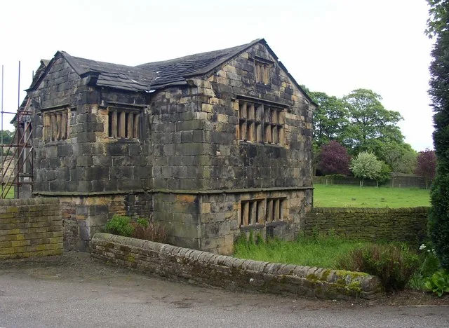
Kirklees Priory
Hill forts · 1.2 km

Kirklees Hall
Historic houses · 1.4 km
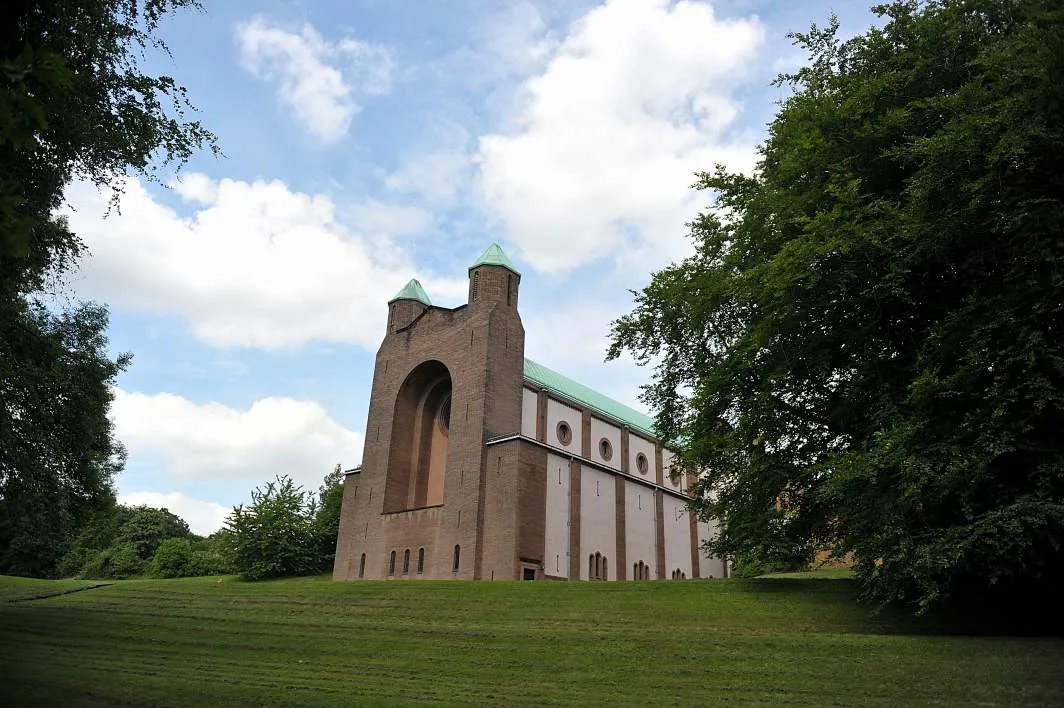
Community of the Resurrection
Historic churches · 1.5 km

Calder And Hebble Navigation Bridge Taking Leeds Road Sir John Ramsdens Canal Bridge Taking Leeds Road
Historic bridges · 2.0 km
Nearby
📷 3Memorials & monuments · Yorkshire & the Humber
Dumb Steeple
Dumb Steeple — a memorial in Yorkshire & the Humber, United Kingdom.
📷 3Historic bridges · Yorkshire & the Humber
Calder And Hebble Navigation Cooper Bridge Lock And Gantry To Foot Bridge
Calder And Hebble Navigation Cooper Bridge Lock And Gantry To Foot Bridge — Grade II listed building-listed bridge in england-yorkshire, United Kingdom.
📷 3Historic bridges · Yorkshire & the Humber
Caldervale Line
Caldervale Line is a historic bridge in the United Kingdom.
Memorials & monuments · Yorkshire & the Humber
Robin Hood's Grave
Robin Hood's Grave — a memorial in england yorkshire.
📷 3Historic bridges · Yorkshire & the Humber
Calder And Hebble Navigation Bridge Taking Colne Bridge Road Sir John Ramsdens Canal Bridge Taking Colne Bridge Road
Calder And Hebble Navigation Bridge Taking Colne Bridge Road Sir John Ramsdens Canal Bridge Taking Colne Bridge Road — Grade II listed building-listed bridge in england-yorkshire, United Kingdom.
📷 3Historic bridges · Yorkshire & the Humber
Colne Bridge
Colne Bridge is a historic bridge in the United Kingdom.
Where to eat & stay near Huddersfield Broad Canal
Places to stay
 📷 5
📷 5Campsites · Yorkshire & the Humber
Bradley Wood Scout Campsite & Activity Centre
Bradley Wood Scout Campsite & Activity Centre — a campsite in england yorkshire.
 📷 5
📷 5Caravan parks · Yorkshire & the Humber
Ashdene Naturist Club
Ashdene Naturist Club — a caravan park in england yorkshire.
 📷 5
📷 5Hotels · Yorkshire & the Humber
315 Bar and Restaurant
315 Bar and Restaurant — a hotel in england yorkshire.
 📷 5
📷 5Caravan parks · Yorkshire & the Humber
Elland Hall Farm Caravan Park
Elland Hall Farm Caravan Park — a caravan park in england yorkshire.
 📷 5
📷 5 📷 7
📷 7Hotels · Yorkshire & the Humber
Heath Cottage Hotel
Heath Cottage Hotel — a hotel in england yorkshire.
Places to eat & drink
📷 5Historic pubs · Yorkshire & the Humber
The Old Mill
The Old Mill in England Yorkshire, United Kingdom.
 📷 5
📷 5Historic pubs · Yorkshire & the Humber
The Beaumont Arms Public House And Adjoining Barns To East
The Beaumont Arms Public House And Adjoining Barns To East in England Yorkshire, United Kingdom.
 📷 5
📷 5Historic pubs · Yorkshire & the Humber
The Vulcan Public House
The Vulcan Public House in England Yorkshire, United Kingdom.
 📷 7
📷 7Historic pubs · Yorkshire & the Humber
Old Hall Public House
Old Hall Public House in England Yorkshire, United Kingdom.
 📷 7
📷 7Historic pubs · Yorkshire & the Humber
The White Swan Public House
The White Swan Public House in England Yorkshire, United Kingdom.
 📷 5
📷 5Historic pubs · Yorkshire & the Humber
The College Arms
The College Arms in England Yorkshire, United Kingdom.
More places in this region
 📷 3
📷 3 📷 5
📷 5Canals · Yorkshire & the Humber
Hollinwood Branch Canal
Hollinwood Branch Canal is a canal in the United Kingdom.
 📷 3
📷 3Canals · Yorkshire & the Humber
Macclesfield Canal
Macclesfield Canal — canal in north west England.
 📷 5
📷 5Canals · Yorkshire & the Humber
Peak Forest Canal
Peak Forest Canal — canal in Derbyshire/Cheshire/Greater Manchester, England, UK.
Frequently asked questions
- Where is Huddersfield Broad Canal?
- Huddersfield Broad Canal is in Yorkshire, United Kingdom (postcode HD5 0RX), in the parish of Kirklees, unparished area.
- What is Huddersfield Broad Canal?
- Huddersfield Broad Canal — canal in Northern England.
- How do I get to Huddersfield Broad Canal?
- The nearest railway station is Deighton, about 2.0 km away. The nearest town is Roberttown. Drivers can use postcode HD5 0RX.
- When was Huddersfield Broad Canal built?
- Built or established in 1776.
- Is Huddersfield Broad Canal free to visit?
- Yes, Huddersfield Broad Canal is free to enter.
- How do I get to Huddersfield Broad Canal?
- The nearest railway station is Deighton, about 2.0 km away. Drivers can navigate to postcode HD5 0RX.